Fishing in Walker County, Georgia
Seat: LaFayette. Population 67,654 (2020).
- 2lake pages
- 1launch site
- 27trout streams
 Pick for troutPiscifun Carbon X ultralight spinning reel28% OFFSale $57.99
Photo of Conasauga River: Thomson200, CC0 1.0
First things to know about Walker County
County offices for Walker County sit in LaFayette; for shop listings the site places it in Northwest Georgia. Its land area is 446 square miles and its water area 0.6; the 2020 count was 67,654 people.
Lake pages exist for 2 waters in the county, 273 acres in all, led by Queen City Lake. WRD maps 1 public launch site in the county, 1 lane counted where the layer gives lanes. Most are run by City of LaFayette. About 190.9 miles of designated trout water run through 27 county streams. The DNR lists 2 piers and bank sites here for fishing from shore.
 For the trout herePiscifun Carbon XT ultralight spinning reel25% OFFSale $59.99
Lakes and launches across Walker County, plotted
Georgia DNR WRD Water Access Points, CRD coastal layers and WRD waterbodies, checked October 2026.
Walker County lakes
| Lake | Acres | Type | Ramps | Fish listed |
|---|---|---|---|---|
| Queen City Lake | 270 | lake | 1 | largemouth bass, yellow bass |
| Sawmill Lake | 3 | lake | 0 | largemouth bass, bluegill |
Anglers in LaFayette also drive to these lakes beyond Walker County, the closest with pages.
| Lake | From LaFayette | Acres | Type | Ramps | Fish listed |
|---|---|---|---|---|---|
| Lake Marvin | 15 miles southeast | 90 | lake | 1 | largemouth bass, bluegill |
| James H Floyd SP – Lower | 19 miles south | 22 | lake | 1 | largemouth bass, channel catfish |
| James H Floyd SP – Upper | 19 miles south | 29 | lake | 1 | largemouth bass, channel catfish |
| Lower Arrowhead Lake | 20 miles southeast | 14 | lake | 0 | largemouth bass, channel catfish |
| Antioch Lake East | 24 miles south | 165 | PFA lake | 1 | largemouth bass, yellow bass |
| Antioch Lake West | 24 miles south | 213 | PFA lake | 1 | largemouth bass, yellow bass |
WRD waterbodies and reservoirs layers, NHD areas, WRD access point species flags and WRD fishing forecasts.
Creeks and rivers through Walker County
- Chattooga River, Chattooga Countyriver, 2 ramps
- West Chickamauga Creekstream, 2.3 trout miles
- Little Chickamauga Creekstream, 13 trout miles
- West Armuchee Creekstream, 11.8 trout miles
- Chattanooga Creekstream, 8.7 trout miles
- Johns Creekstream, 10.9 trout miles
- Duck Creekstream, 15.3 trout miles
- Snake Creekstream, 13.4 trout miles
- Rock Creek, Walker Countystream, 11.6 trout miles
- Gulf Creekstream, 10 trout miles
- Chappel Creekstream, 8.7 trout miles
- Hogjowl Creekstream, 8.6 trout miles
- Mud Creek, Walker Countystream, 8.1 trout miles
- Dry Creek near LaFayette, Walker Countystream, 7.4 trout miles
- Gilreath Creekstream, 6.7 trout miles
- Ruff Creekstream, 7.3 trout miles
- Dick Creekstream, 5.8 trout miles
- Dry Creek near Resaca, Walker Countystream, 5.3 trout miles
- Concord Creekstream, 5.5 trout miles
- Allen Creekstream, 5.1 trout miles
- Bailey Creek, Walker Countystream, 4.6 trout miles
- Furnace Creekstream, 4.3 trout miles
- Coulter Creekstream, 4.4 trout miles
- Mill Creek, Walker Countystream, 4.1 trout miles
- Dickson Creekstream, 3.5 trout miles
Cold trout creeks running through Walker County
Trout miles in the county: 190.9, on 27 streams, 1 of which get heavy stocking on some segment.
- Mill Creek2.3 trout mi, near Chickamauga
- Shop Creek2.2 trout mi, near LaFayette
- Harrisburg Creek0.1 trout mi, near Trion
Gauged streams in Walker County
| USGS gauge | Latest reading | Time (ET) |
|---|---|---|
| Chattanooga Creek At Ga193, Near Flintstone, Ga | 9 cfs, 3.07 ft gage height | Nov 10 11:30 pm |
US Geological Survey provisional data, retrieved Nov 11, 2026 12:32 am ET. Provisional readings can be revised.
WRD Trout Fishing layer (designated trout streams), checked October 2026.
Walker County in the trout destinations table
In the guide trout table the county has 17 entries, and the trout license applies to every one.
- Chappel Cr. watershed
- Chattanooga Cr. watershed upstream from Walker Co Rd. 235
- Concord Cr. watershed
- Duck Cr. watershed
- East Fork Little R. watershed, which flows into Dade County
- East Fork Little R. watershed, which flows into Chattooga County, including Gilreath Cr
- Furnace Cr. watershed
- Gulf Cr. watershed
- Harrisburg Cr. watershed, including Dougherty Cr. watershed, upstream from Dougherty Cr
- Johns Cr. watershed
- Left Fork Coulter Branch watershed
- Little Chickamauga Cr. watershed
- Rock Cr. watershed, including Sawmill Branch, upstream from Sawmill Branch
- Ruff Cr. watershed
- Snake Cr. watershed
- West Armuchee Cr. watershed
- West Chickamauga Cr. watershed upstream from Walker Co Rd. 107
2026-2027 Georgia Hunting and Fishing Regulations, trout streams and destinations by county.
Ramps and put-ins found in Walker County
- Queen City Lake Boat RampQueen City Lake, 1 lane
Fishing piers the DNR maps in Walker County (2)
- Crockford-Pigeon Mountain WMAbank fishing area, Sawmill Lake
- West Armuchee Creekbank fishing area, West Armuchee Creek
Georgia DNR WRD Water Access Points.
What WRD stocks and the records from Walker County
In 2026 the WRD trout lists carry 1 rows for the county.
Walker County on the WRD stocking schedule
| Water | Schedule or date |
|---|---|
| West Armurchee Creek** | Stocked weekly from April-July 31st, then twice before Labor Day, and once in |
WRD 2026 Trout Stocking Frequencies and Weekly Stocking Report; WRD freshwater and CRD saltwater record lists.
Where Walker County anglers stock up on bait
- Boats & Motors Of Dalton Incbait and tackle shop, Tunnel Hill, 16 miles
- Water 2 Woods Outdoorsbait and tackle shop, Ringgold, 16 miles
- Academy Sports + Outdoors, 865 Shugart Rdsporting goods store, Dalton, 17 miles
- Brown's Ferry Marinamarina, Rossville, 19 miles
- Discount Sporting Goods & Tackbait and tackle shop, Dalton, 21 miles
Listed waters of Walker County
| Species | Limit | Season |
|---|---|---|
| Black bass (all species combined) | 10 in total, only 5 of which may be Altamaha, Bartrams, Chattahoochee, Coosa, Shoal, Smallmouth, Suwannee, Tallapoosa | Open all year |
| Largemouth bass | Counts toward 10 black bass total; minimum length 12 inches statewide (exceptions on listed lakes and PFAs) | Open all year |
| Spotted bass | Counts toward 10 black bass total; no statewide minimum length (14 inches on Lake Lanier) | Open all year |
| Shoal bass | Counts toward 10 black bass total (only 5 may be shoal and other listed bass); minimum length 15 inches statewide (Flint River below Warwick Dam slot) | Open all year |
| Smallmouth bass | Counts toward 10 black bass total; only 5 of the 10 may be smallmouth and other listed bass; no minimum length | Open all year |
| Striped, white and hybrid bass | 15 in total, only two of which can be 22 inches or longer | Open all year |
| Crappie | 30 | Open all year |
| Bream (sunfish) | 50 in total | Open all year |
| Catfish | No limit | Open all year |
No zones split Georgia freshwater, so Walker County uses the statewide rows unless a water is listed.
Listed waters touching Walker County (2)
| Water | Rule |
|---|---|
| Chattooga River | Section: from GA Hwy 28 bridge upstream to the mouth of Reed Creek. Delayed harvest: from Nov. 1 – May 14 annually all trout must be released immediately and only artificial lures with one single hook per lure may be used and possessed (droppers allowed if each lure has one single hook). Restriction |
| Rock Creek Lake | Trout impoundment: fishing hours 30 minutes before sunrise until 30 minutes after sunset (no night fishing). Anglers may fish for species other than trout without a trout license. |
2026-2027 Georgia Hunting and Fishing Regulations (effective July 1, 2026 to June 30, 2027), statewide limits and listed exceptions.
Within reach of Walker County
Walker County communities
- LaFayettepop. 6,888
- Fairviewpop. 6,409
- Rossvillepop. 3,980
- Chattanooga Valleypop. 3,962
- Chickamaugapop. 2,917
- Lookout Mountainpop. 1,641
- Rock Springpop. 891
Counties beside Walker County
- Dade County14 miles northwest
- Catoosa County15 miles northeast
- Chattooga County18 miles south
- Whitfield County20 miles east
- Gordon County29 miles southeast
Piscifun reels to rig up for Walker County


Piscifun and Amazon links are affiliate links; the site earns a commission on qualifying purchases.
Pictures of the fish at Walker County
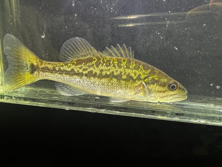
Photo: Nick Tobler (Cowturtle), CC BY 4.0

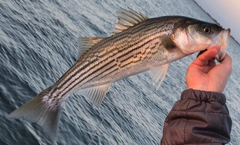
Photo: SFOfishing, CC BY-SA 4.0

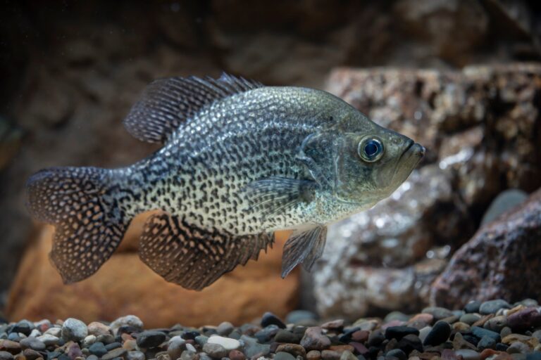
Photo: USFWS Mountain-Prairie, Public domain

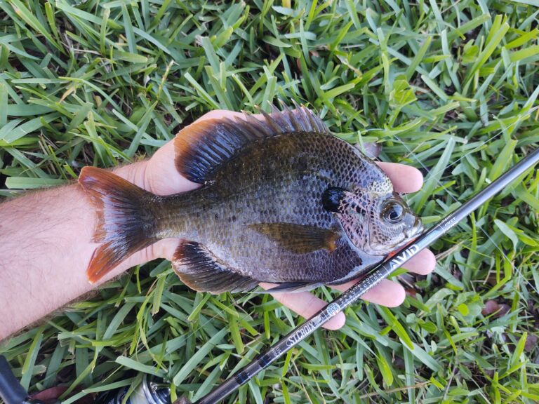
Photo: Thefishingnomad youtube, CC BY-SA 4.0

What visiting anglers wonder about Walker County
Which ramps serve Walker County boaters?
1 public launch site in all, 1 lane recorded.
Which lake covers the most acres in Walker County?
Queen City Lake, at 270 acres.
Does Walker County have designated trout streams?
190.9 miles on 27 streams, all needing a trout license.
How many black bass can I keep in Walker County?
Georgia allows 10 black bass a day, largemouth 12 inches or longer, barring listed exceptions.
Which stores in Walker County carry fishing gear?
Our list has none in the county.
Which guide services call Walker County home?
None list the county; the statewide guides page has the rest.
Can I fish a state PFA in Walker County?
No Public Fishing Area is in the county.
Which city hosts the government of Walker County?
LaFayette hosts the courthouse.
What does a fishing license cost for Walker County?
Georgia asks anglers 16 and older for a fishing license: $15 for residents and $50 for nonresidents, each good for 365 days from purchase. Designated trout water needs the $10 resident trout license (nonresidents $25) on top of the Georgia fishing license ($15 resident, $50 nonresident).
Tow the boat to Walker County
Open a ramp for lanes, operator and directions.