Gunnison River Fishing
42.5 Gold Medal miles in Delta County, Gunnison County and Montrose County.
 Pick for troutPiscifun Carbon X ultralight spinning reel28% OFFSale $57.99
Photo: Jeffrey Beall, CC BY 4.0
The Gunnison River at a glance
Through Delta County, Gunnison County and Montrose County runs the Gunnison River, a river CPW manages for anglers. Orchard City lies near 5 miles from the channel. CPW lists about 42.5 miles as Gold Medal.
About 123.3 miles in 8 reaches fall under special regulations. Anglers reach it on Black Canyon of the Gunnison National Park, Delta SWA and Gunnison Gorge Wilderness Area & Gunnison Gorge NCA. Flow is measured at 3 active gauges.
CPW Fishing Atlas 2025 layers (special-regulation, Gold Medal and fishing location layers), NHD flowlines, Census places, retrieved October 25, 2026.
the Gunnison River as Gold Medal water
| Gold Medal reach | Miles |
|---|---|
| 200 yds. below Crystal Res. dam to North Fork | 29.9 |
| Almont to US 50 bridge | 12.6 |
Gold Medal means CPW has measured trophy-grade trout numbers on the Gunnison River reaches listed.
CPW Gold Medal Streams layer (reach miles computed from the line geometry) and the Gold Medal list in the 2026 Colorado Fishing brochure (CPW, season March 1, 2026 to March 31, 2027), p. 3, retrieved October 25, 2026.
 For the trout herePiscifun Carbon XT ultralight spinning reel25% OFFSale $59.99
Reaches of the Gunnison River with their own rules
| Reach | Miles | Rule as printed |
|---|---|---|
| US 50 bridge / Confluence of the East and Taylor Rivers | 12.63 | see the brochure entry |
| Standing water line of Blue Mesa Reservoir / US 50 bridge | 5.7 | rule text in the brochure |
| Blue Mesa Dam / 225 yards downstream of Blue Mesa Dam | 0.13 | printed in the brochure only |
| 130 yards downstream of Morrow Point Reservoir dam / Morrow Point Reservoir dam | 0.08 | brochure lists the rule |
| Crystal Reservoir dam / 200 yards downstream of Crystal Reservoir dam | 0.11 | rule in the CPW brochure |
| Confluence with the Smith Fork / 200 yards downstream of Crystal Reservoir dam | 26.32 | see CPW brochure |
| Relief Ditch diversion (five miles above Austin Bridge) / Confluence with the Smith Fork | 7.54 | see the brochure entry |
| Relief Ditch diversion (five miles above Austin Bridge) / Confluence with the Colorado River | 70.78 | rule text in the brochure |
Each regulated stretch of the Gunnison River has the tackle or harvest rule shown, or the one printed in the brochure.
Brochure entries for the Gunnison River
| Water as printed | Rule | Brochure |
|---|---|---|
| From Almont to the U.S. 50 bridge. From 200 yards downstream of Crystal Dam to the north fork of the Gunnison. From the confluence of the East and Taylor rivers downstream to the U.S. 50 bridge: | Artificial flies and lures only. Bag, possession and min. size for brown trout is 2, 16 inches long. Rainbow trout must be returned to water immediately. | p. 23 |
| From the confluence of the East and Taylor Rivers downstream to the standing water line of Blue Mesa Reservoir, including all tributary canals and diversions: | Taking kokanee prohibited Aug. 1–Oct 31. Snagging kokanee permitted Nov. 1–Dec. 31. | p. 23 |
| From Blue Mesa Dam downstream for 225 yards: | Fishing prohibited as posted. | p. 23 |
| continued on page 24 From the closure signs below Blue Mesa Dam downstream to Morrow Point Dam: | Snagging kokanee permitted Sept. 1–Dec. 31. | p. 23 |
| From Morrow Point Dam downstream for 130 yards: | Fishing prohibited as posted. | p. 23 |
| From the closure sign below Morrow Point Dam downstream to Crystal Dam: | Snagging kokanee permitted Sept. 1–Dec. 31. | p. 23 |
| From Crystal Dam downstream for 200 yards: | Fishing prohibited as posted. | p. 23 |
| From 200 yards downstream of the Crystal Dam downstream to the Relief Ditch diversion (5 miles above Austin Bridge): | Artificial flies and lures only. Rainbow trout must be returned to water immediately. | p. 23 |
| From the confluence with the Smith Fork downstream to the confluence with the Colorado River: | No bag or possession limit for channel catfish, largemouth bass, smallmouth bass, northern pike, walleye, green sunfish, bluegill, bullhead, yellow perch or crappie. | p. 23 |
Special regulations as printed in the 2026 Colorado Fishing brochure (CPW, season March 1, 2026 to March 31, 2027), pp. 11 to 39, checked against CPW Chapter W-1 (as approved 13 November 2025); retrieved October 2026.
CPW special fishing regulation and Quality Waters layers, retrieved October 25, 2026.
Walk-in water on the Gunnison River
- Black Canyon of the Gunnison National Parkpublic property
- Delta SWAFishing Access, 2 acres
- Gunnison Gorge Wilderness Area & Gunnison Gorge NCAWilderness
- Gunnison River SWASWA, 80.6 acres
Much Colorado stream frontage is private; on the Gunnison River, fish from the properties listed and respect posted boundaries.
CPW Fishing Atlas fishing location property names and Quality Waters access notes, retrieved October 25, 2026.
The fishery in the Gunnison River
CPW ties these fish to the Gunnison River; others likely live there.
CPW Quality Waters species, state records and stocking report, retrieved October 25, 2026.
Flow stations along the Gunnison River
| USGS gauge | Latest reading | Time (ET) |
|---|---|---|
| Gunnison River Near Gunnison, Co. | 296 cfs, 1.14 ft gage height | Nov 12 11:15 pm |
| Gunnison River Below Gunnison Tunnel, Co | 205 cfs, 1.40 ft gage height | Nov 12 11:15 pm |
| Gunnison River At Delta, Co | 491 cfs, 1.46 ft gage height | Nov 12 11:15 pm |
US Geological Survey provisional data, retrieved Nov 12, 2026 11:32 pm ET. Provisional readings can be revised.
Reservoir releases upstream can lift the Gunnison River without warning.
USGS instantaneous values, provisional; Gunnison River Near Gunnison, CO, Gunnison River Below Gunnison Tunnel, CO and Gunnison River At Delta, CO.
Reaching the banks of the Gunnison River
The atlas lists no access for the Gunnison River.
When the Gunnison River ramp is crowded
- Boat Ramp on Sweitzer LakeSweitzer Lake, 9 miles
- Peninsula Day-Use boat ramp on Crawford ReservoirCrawford Reservoir, 17 miles
- Iron Creek boat ramp on Crawford ReservoirCrawford Reservoir, 17 miles
CPW boat ramp and Fishing Atlas fishing location layers, USGS gauges, retrieved October 25, 2026.
Limits a warden checks on the Gunnison River
| Species | Bag and possession | Season |
|---|---|---|
| Trout, arctic char, grayling, salmon and whitefish (not kokanee) | Daily bag 4, possession 8, in aggregate | Open all year, day and night, unless a special regulation says otherwise |
| Brook trout 8 inches or less (bonus) | Daily bag 10, possession 10 | Open all year, day and night, unless a special regulation says otherwise |
| Kokanee salmon | Daily bag 10, possession 10 | Open all year, day and night, unless a special regulation says otherwise |
| Walleye, saugeye and sauger | Daily bag 5, possession 5, in aggregate | Open all year, day and night, unless a special regulation says otherwise |
| Largemouth, smallmouth and spotted bass | Daily bag 5, possession 5, in aggregate | Open all year, day and night, unless a special regulation says otherwise |
| Smallmouth bass | No bag or possession limit | Open all year, day and night, unless a special regulation says otherwise |
| Channel, flathead and blue catfish | Daily bag 10, possession 10, in aggregate | Open all year, day and night, unless a special regulation says otherwise |
| Yellow perch | No bag or possession limit | Open all year, day and night, unless a special regulation says otherwise |
| Northern pike and bullhead | No bag or possession limit | Open all year, day and night, unless a special regulation says otherwise |
Drainage matters for walleye, wiper and perch limits; the Gunnison River sits west of the Continental Divide. The chart is the baseline on the Gunnison River; brochure entries can tighten it.
Colorado sells no separate trout stamp; a CPW fishing license covers trout ($44.87 for adult residents, $124.01 for nonresidents), and anglers 16 and older need one.
Statewide bag and possession chart, 2026 Colorado Fishing brochure (CPW, season March 1, 2026 to March 31, 2027), p. 10, retrieved October 25, 2026. All Colorado limits.
Colorado record fish pulled from the Gunnison River
| Species | Category | Weight or length | Angler | Year |
|---|---|---|---|---|
| Cutbow | heritage length (to 2019) | 33 1/2 inches in | Patrick Duke | |
| Brook Trout | heritage length (to 2019) | 26 inches in | Mark Armstrong |
CPW state records, 2026 Colorado Fishing brochure (CPW, season March 1, 2026 to March 31, 2027), retrieved October 25, 2026.
The ground surrounding the Gunnison River
Other reservoirs within a drive of the Gunnison River
- Sweitzer Lake9 miles
- Confluence Lake10 miles
- Davies Reservoir Little15 miles
- Pitcairn Reservoir15 miles
Where to buy line and lures near the Gunnison River
- Ed's Fly Shopfly shop, Montrose, 20 miles
- Cj's Fly Shopfly shop, Montrose, 21 miles
- Sportsman's Warehouse Montrosesporting goods store, Montrose, 23 miles
- Walker's Bait & Tacklebait and tackle shop, Whitewater, 26 miles
Outfitters who fish the Gunnison River
- Crested Butte Angler LLCfishing guide, Crested Butte
- Gunnison Valley Anglers Cofishing guide, Gunnison River, Gunnison
- High Mountain Drifters Guide Service, LLCfishing guide, Gunnison
- Dragonfly Anglers, LLCfly fishing guide, Crested Butte
Beds and gas close to the Gunnison River
- Orchard City5 miles
- Cedaredge8 miles
- Delta10 miles
- Olathe13 miles
Colorado rivers close to the Gunnison River
- Dirty George Creek17 miles
- Kiser Creek18 miles
- Ward Creek18 miles
- Bonita Creek19 miles
County guides that cover the Gunnison River
Piscifun tackle sized for the Gunnison River


Piscifun and Amazon links are affiliate links; the site earns a commission on qualifying purchases.
Photo views of fishing water near Gunnison River

Photo: Jeffrey Beall, CC BY-SA 3.0

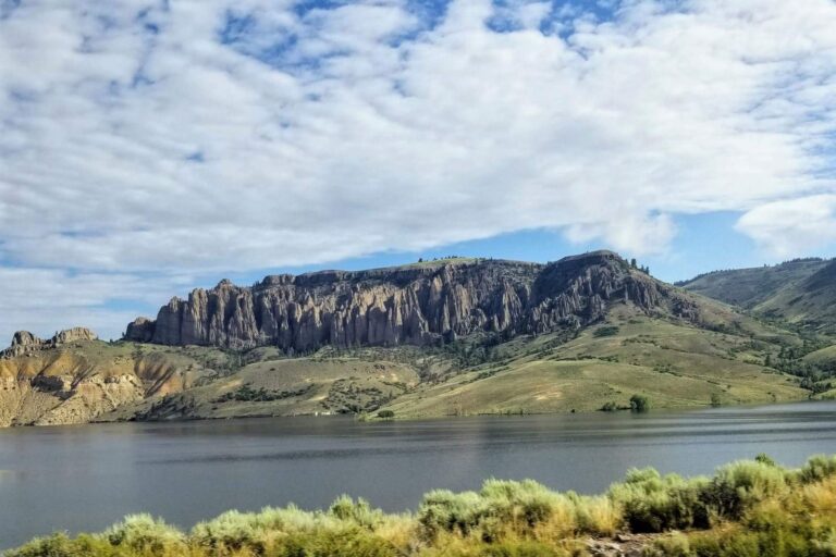
Photo: NPS Natural Resources, Public domain

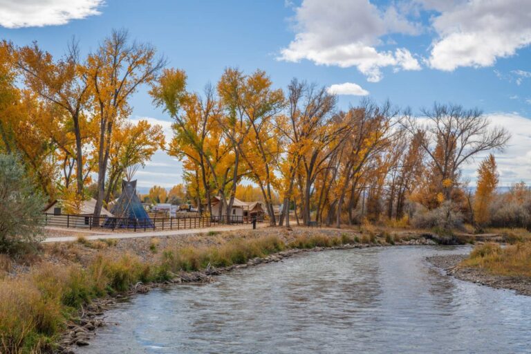
Photo: Nexus65, CC BY-SA 4.0


Photo: Unknown, CC BY-SA 4.0

Before you drive to the Gunnison River, read these
Where does the Gunnison River run?
Look in Delta County, Gunnison County and Montrose County.
Does CPW treat the Gunnison River as trout water worth the drive?
CPW rates some 42.5 miles Gold Medal.
What did the newest USGS reading on the Gunnison River say?
The 3 USGS gauges report above.
Where can I wade the Gunnison River legally?
CPW lists Black Canyon of the Gunnison National Park, Delta SWA, Gunnison Gorge Wilderness Area & Gunnison Gorge NCA and Gunnison River SWA.
Is the Gunnison River catch and release?
Reach rules cover 8 reaches. From the brochure: Artificial flies and lures only. Bag, possession and min. size for brown trout is 2, 16 inches long. Rainbow trout must be returned to water immediately.
Does Colorado sell a trout stamp for the Gunnison River?
Colorado sells no separate trout stamp; a CPW fishing license covers trout ($44.87 for adult residents, $124.01 for nonresidents), and anglers 16 and older need one.
Which tackle counter on our Colorado list is nearest the Gunnison River?
Ed's Fly Shop sits about 20 miles away.
Which fish does CPW place in the Gunnison River?
CPW records mention brook trout and cutbow.
What town sits by the Gunnison River?
Orchard City is nearest, some 5 miles off.
Fish a few runs of the Gunnison River
Look at the flow band and limits, then go.