Dolores River Fishing
Quality Water in Dolores County and Montezuma County.
 Pick for troutPiscifun Carbon X ultralight spinning reel28% OFFSale $57.99
Photo: Jeffrey Beall, CC BY 4.0
Getting to know the Dolores River
The Dolores River cuts its river channel across Dolores County and Montezuma County. Dolores is the closest Census place to the channel, under a mile away.
The atlas marks 4 reaches as regulated water, near 182.8 miles. Open ground along it includes Joe Rowell Park and Lone Dome SWA. Readings come in from 1 active gauge. The Fishing Atlas lists 1 mapped fishing location on it.
CPW Quality Waters: The Dolores River below McPhee Dam is remote, hard to get to, and the tailwater trout fishery can “ebb and flow” upstream and downstream depending on the water supply but it consistently produces quality rainbow and brown trout, particularly in the spring when most flowing rivers are turbid and blown out from high runoff.
CPW Fishing Atlas 2025 layers (special-regulation, Gold Medal and fishing location layers), NHD flowlines, Census places, retrieved October 25, 2026.
 For the trout herePiscifun Carbon XT ultralight spinning reel25% OFFSale $59.99
Gold Medal and regulated reaches of the Dolores River
| Reach | Miles | Rule as printed |
|---|---|---|
| From McPhee Reservoir dam downstream to Ferris Campground | 5.5 | 1. Fishing is by artificial flies and lures only. 2. All trout must be returned to the water immediately upon catch. 3. There is no bag or possession limit for channel catfish, largemouth bass, smallmouth bass, northern pike, walleye, green sunfish, bluegill, |
| Standing water line of McPhee Reservoir / Confluence with the West Fork of the Dolores River | 14.56 | printed in the brochure only |
| Bradfield Bridge / McPhee Dam | 12.53 | brochure lists the rule |
| Bradfield Bridge / Utah state line | 150.21 | rule in the CPW brochure |
Fish a regulated Dolores River reach by its own rule, not the statewide chart.
The Dolores River in the special regulations
| Water as printed | Rule | Brochure |
|---|---|---|
| San Miguel From the confluence with West Fork of the Dolores River downstream to the standing water line of McPhee Reservoir: | Taking kokanee prohibited except Nov. 15– Dec. 31 when snagging permitted. | p. 20 |
| From McPhee Dam downstream approximately 11 miles to the Bradfield Bridge: | Artificial flies and lures only. Trout must be returned to water immediately. | p. 20 |
| From McPhee Dam downstream to the state line: | No bag or possession limit for channel catfish, largemouth bass, smallmouth bass, northern pike, walleye, green sunfish, bluegill, bullhead, yellow perch or crappie. | p. 20 |
| From Bradfield Bridge downstream to the state line: | No bag or possession limit for brown trout. | p. 20 |
Special regulations as printed in the 2026 Colorado Fishing brochure (CPW, season March 1, 2026 to March 31, 2027), pp. 11 to 39, checked against CPW Chapter W-1 (as approved 13 November 2025); retrieved October 2026.
CPW special fishing regulation and Quality Waters layers, retrieved October 25, 2026.
Public access on the Dolores River
- Joe Rowell Parkpublic property
- Lone Dome SWASWA, 1,735.3 acres
Colorado law gives no right to wade through private land, so stay on public parcels of the Dolores River.
CPW Fishing Atlas fishing location property names and Quality Waters access notes, retrieved October 25, 2026.
Which fish the Dolores River holds
Each chip for the Dolores River rests on a CPW record.
CPW Quality Waters species, state records and stocking report, retrieved October 25, 2026.
Streamflow on the Dolores River
| USGS gauge | Latest reading | Time (ET) |
|---|---|---|
| Dolores River At Dolores, Co. | 673 cfs, 4.02 ft gage height | Nov 11 10:45 pm |
US Geological Survey provisional data, retrieved Nov 11, 2026 11:33 pm ET. Provisional readings can be revised.
Compare today with the median line before wading the Dolores River.
USGS instantaneous values, provisional; Dolores River At Dolores, CO.
Finding the Dolores River
Fishing locations, Dolores River
- Dolores River fishing access near Doloresmedium access, stocked: catchable trout and sub-catchables, 6,927 ft
Ramps a short tow from the Dolores River
- McPhee Ramp on Narraguinnep ReservoirNarraguinnep Reservoir, 3 miles
- House Creek Ramp on Narraguinnep ReservoirNarraguinnep Reservoir, 4 miles
- Puett Reservoir SWAPuett Reservoir, 6 miles
- Narraguinnep Reservoir SWANarraguinnep Reservoir, 6 miles
CPW boat ramp and Fishing Atlas fishing location layers, USGS gauges, retrieved October 25, 2026.
Bag limits on the Dolores River
| Species | Bag and possession | Season |
|---|---|---|
| Trout, arctic char, grayling, salmon and whitefish (not kokanee) | Daily bag 4, possession 8, in aggregate | Open all year, day and night, unless a special regulation says otherwise |
| Brook trout 8 inches or less (bonus) | Daily bag 10, possession 10 | Open all year, day and night, unless a special regulation says otherwise |
| Kokanee salmon | Daily bag 10, possession 10 | Open all year, day and night, unless a special regulation says otherwise |
| Walleye, saugeye and sauger | Daily bag 5, possession 5, in aggregate | Open all year, day and night, unless a special regulation says otherwise |
| Largemouth, smallmouth and spotted bass | Daily bag 5, possession 5, in aggregate | Open all year, day and night, unless a special regulation says otherwise |
| Smallmouth bass | No bag or possession limit | Open all year, day and night, unless a special regulation says otherwise |
| Channel, flathead and blue catfish | Daily bag 10, possession 10, in aggregate | Open all year, day and night, unless a special regulation says otherwise |
| Yellow perch | No bag or possession limit | Open all year, day and night, unless a special regulation says otherwise |
| Northern pike and bullhead | No bag or possession limit | Open all year, day and night, unless a special regulation says otherwise |
On the CPW drainage map, the Dolores River lies west of the Continental Divide. Colorado streams stay open all year; on the Dolores River the bag is the variable.
Colorado sells no separate trout stamp; a CPW fishing license covers trout ($44.87 for adult residents, $124.01 for nonresidents), and anglers 16 and older need one.
Statewide bag and possession chart, 2026 Colorado Fishing brochure (CPW, season March 1, 2026 to March 31, 2027), p. 10, retrieved October 25, 2026. All Colorado limits.
Catchable trout for the Dolores River
For the Dolores River, CPW shows 4 listings on the CPW catchable trout report (2 in 2026, 1 in 2025, 1 in 2024); latest August 7, 2026.
| Report date | What CPW lists |
|---|---|
| August 7, 2026 | catchable trout, CPW Southwest Region |
| June 26, 2026 | catchable trout, CPW Southwest Region |
| November 7, 2025 | catchable trout, CPW Southwest Region |
| September 19, 2024 | catchable trout, CPW Southwest Region |
CPW Fish Stocking Report (catchable trout of about 10 inches; the date is when CPW added the water to its weekly list), 2024 to October 2026, retrieved October 25, 2026.
Neighbors of the Dolores River
Colorado lakes in the Dolores River neighborhood
- McPhee Reservoir5 miles
- Narraguinnep Reservoir6 miles
- Puett Reservoir7 miles
- Totten Reservoir7 miles
Fly shops and bait stores around the Dolores River
- Doc's Marina McPheemarina, Dolores, 5 miles
- On the Hook Bait & Tackle Shopbait and tackle shop, Cortez, 9 miles
Paid guides within reach of the Dolores River
- Duranglers, Inc.fishing guide, Durango
- Cole Glenn Fly Fishing LLCfly fishing guide, Durango
- Durango Fly Fishing LLC.fly fishing guide, Durango, (970) 799-5246
Communities within reach of the Dolores River
- Cortez9 miles
- Mancos15 miles
Creeks around the Dolores River
- McElmo Creek14 miles
- Stoner Creek17 miles
- Bear Creek, Montezuma County21 miles
- Spring Creek, Dolores County23 miles
the Dolores River and the counties around it
- Dolores County
- Montezuma County
A Piscifun kit for days on the Dolores River


Piscifun and Amazon links are affiliate links; the site earns a commission on qualifying purchases.
Telling the species of Dolores River apart by photo
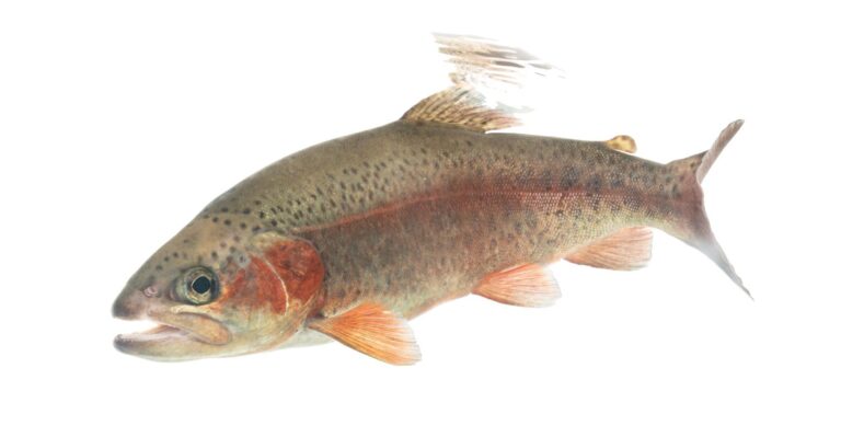
Photo: USFWS Mountain Prairie, Public domain

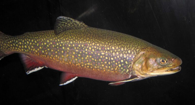
Photo: James St. John, CC BY 2.0

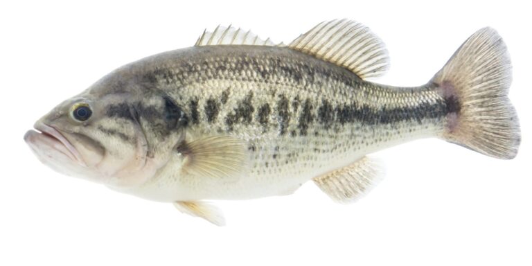
Photo: USFWS Mountain Prairie, Public domain

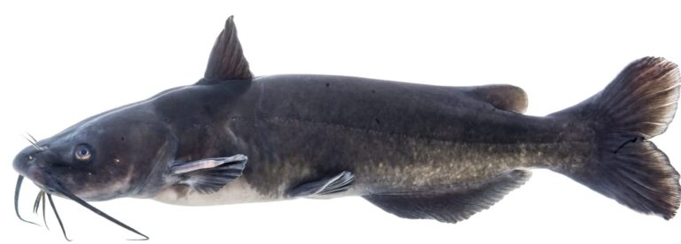
Photo: USFWS Mountain Prairie, Public domain

Planning notes for the Dolores River
Where would I look for the Dolores River on a Colorado map?
Its Colorado basin takes in Dolores County and Montezuma County.
Is the Dolores River Gold Medal?
Yes, a CPW Quality Water.
Does a USGS station report flows on the Dolores River?
USGS keeps 1 USGS gauge here; see the flow band.
Is the Dolores River mostly private?
Public access: Joe Rowell Park and Lone Dome SWA.
Is the Dolores River flies and lures only?
4 reaches carry special rules; read the reach table and brochure entry. The brochure entry reads: Taking kokanee prohibited except Nov. 15– Dec. 31 when snagging permitted.
Can an out-of-state visitor buy a license for the Dolores River?
Colorado sells no separate trout stamp; a CPW fishing license covers trout ($44.87 for adult residents, $124.01 for nonresidents), and anglers 16 and older need one.
Is there a fly shop near the Dolores River?
Drive 5 miles to Doc's Marina McPhee.
Which species does CPW list for the Dolores River?
Expect rainbow trout, brown trout and trout.
Which Colorado town sits nearest the Dolores River?
Base yourself in Dolores, under a mile away.
Is the Dolores River on the trout report?
4 listings on the CPW catchable trout report (2 in 2026, 1 in 2025, 1 in 2024); latest August 7, 2026.
Put the Dolores River on this season's list
Flows and rules are on this page; check both.