Fishing in Pulaski County, Arkansas
County seat: Little Rock. Population 399,125 (2020).
- 23lake pages
- 46launches
- 7river pages
 Pick for catfishPiscifun LumiCat II catfish rod48% OFFSale $114.99
Photo of Lake Maumelle: Jason Ronza, CC BY-SA 4.0
Opening notes on fishing Pulaski County
The courthouse for Pulaski County stands in Little Rock; 399,125 people lived in the county at the 2020 count. 23 lakes with a full page sit inside the county, and Lake Maumelle is the largest of them.
There are 46 boat or paddle launches and 29 pier or bank sites on AGFC maps of the county. The county's river pages cover Arkansas River, Little Maumelle River and Palarm Creek. Navigation pools on the Arkansas River here include Pool 5, Pool 6 and Pool 7. Boyle Park Pond is one of 12 program ponds that AGFC stocks for family fishing in the county.
U.S. Census Bureau, 2020 Census counts (TIGERweb) and the 2023 Gazetteer, read November 8, 2026. AGFC access layer (ArcGIS service), read November 8, 2026.
Every mapped ramp and pond in Pulaski County
AGFC boat-and-kayak and fishing access layers and AGFC fishing-area lake points, checked November 8, 2026.
Still-water pages for Pulaski County
| Lake | Size | Ramps | Kind | AGFC target fish |
|---|---|---|---|---|
| Lake Maumelle | 8,900 acres | 9 | lake | black bass, bream, catfish |
| Plum Bayou | about 171 acres of mapped outline | 2 | oxbow or natural lake | black bass, bream, catfish |
| Willastein Lake | about 40 acres of mapped outline | 0 | lake | black bass, bream, catfish |
| Hunter Lake | about 22 acres of mapped outline | 1 | Corps lake | not listed |
| Willow Beach Park Pond | about 18 acres of mapped outline | 0 | FCFP pond | black bass, bream, catfish |
| Lander’s Lake Pond | about 16 acres of mapped outline | 0 | mapped pond | black bass, bream, catfish |
| Cherrywood Lake | about 10 acres of mapped outline | 2 | FCFP pond | black bass, bream, catfish |
| Dupree Park Pond | about 7 acres of mapped outline | 1 | mapped pond | black bass, bream, catfish |
| Paradise Park Pond | about 5 acres of mapped outline | 1 | FCFP pond | bream, catfish, trout (seasonal stocking) |
| Lake Valencia | about 5 acres of mapped outline | 0 | FCFP pond | bream, catfish, trout (seasonal stocking) |
| Western Hills Lake | about 4 acres of mapped outline | 0 | FCFP pond | bream, catfish, trout (seasonal stocking) |
| Boyle Park Pond | about 4 acres of mapped outline | 0 | FCFP pond | bream, catfish, trout (seasonal stocking) |
| Rock Creek in Boyle Park | about 2 acres of mapped outline | 1 | FCFP pond | bream, trout (seasonal stocking), channel catfish |
| Pinnacle Mountain State Park Pond | about 2 acres of mapped outline | 1 | FCFP pond | bream, catfish, channel catfish |
| Kiwanis Park Pond | about 1 acres of mapped outline | 0 | mapped pond | black bass, bream, catfish |
| Hindman Park | about 1 acres of mapped outline | 0 | FCFP pond | bream, catfish, channel catfish |
| MacArthur Park Pond | about 1 acres of mapped outline | 0 | FCFP pond | black bass, bream, catfish |
| Conner Park Pond | about 1 acres of mapped outline | 0 | FCFP pond | bream, catfish, channel catfish |
| Pinnacle Mountain Pond | not stated | 0 | mapped pond | bream, catfish |
| Sherwood City Pond | not stated | 0 | FCFP pond | bream, catfish, trout (seasonal stocking) |
| Burns Park Covered Bridge Pond | not stated | 0 | mapped pond | black bass, bream, catfish |
| Jacksonville Shooting Sports Complex Pond | not stated | 0 | mapped pond | black bass, bream, catfish |
| Lake Willistein | not stated | 1 | lake | black bass, bream, catfish |
Acreage and depth as AGFC states them in its description of this water (AGFC page), read November 8, 2026. Sizes AGFC does not state print as mapped outline area. Target fish as AGFC lists them.
 For the catfish herePiscifun Chaos XS round baitcaster36% OFFSale $57.99
The Pulaski County target-fish tally
Around Little Rock, to 50 miles out, bream appears on the most AGFC target lists.
AGFC public fishing area target species, counted per lake page within 50 miles; a listing, not a catch survey.
Smaller Pulaski County ponds and lakes without a full page
40 further named lakes in Pulaski County appear here as a list until more is published about them.
| Water | Size | Kind | Nearest town |
|---|---|---|---|
| Murray Lake | about 5,216 acres of mapped outline | reservoir | Natural Steps |
| Old River Lake | about 849 acres of mapped outline | lake | Scott |
| Willow Beach Lake | about 344 acres of mapped outline | reservoir | Scott |
| Georgetown Lake | about 220 acres of mapped outline | lake | Wrightsville |
| Bredlow Reservoir | about 206 acres of mapped outline | reservoir | Hensley |
| Indianhead Lake | about 175 acres of mapped outline | lake | Sherwood |
| Hills Lake | about 156 acres of mapped outline | lake | McAlmont |
| Horseshoe Lake – Pulaski County | about 129 acres of mapped outline | lake | Scott |
| Big Rock Settling Pond | about 114 acres of mapped outline | mapped pond | Sweet Home |
| Thomas Lake | about 38 acres of mapped outline | lake | Jacksonville |
| C&C by the Lake | about 16 acres of mapped outline | mapped pond | Cabot |
| Jewett Lake | about 13 acres of mapped outline | lake | North Little Rock |
| Ott Park Pond 1 | about 11 acres of mapped outline | mapped pond | College Station |
| LRPD Training Academy | about 7 acres of mapped outline | mapped pond | Landmark |
| Camp Hope Pond | about 6 acres of mapped outline | mapped pond | Gibson |
| Twin Lakes “”A”” | about 5 acres of mapped outline | mapped pond | Little Rock |
| Twin Lakes “”B”” | about 4 acres of mapped outline | mapped pond | Little Rock |
| Jacksonville Shooting Range Pond | about 3 acres of mapped outline | mapped pond | Jacksonville |
| Links Pond | about 3 acres of mapped outline | mapped pond | Sherwood |
| Fort Roots Lake | about 3 acres of mapped outline | mapped pond | Cammack Village |
| Little Rock AFB Lake | about 2 acres of mapped outline | mapped pond | Jacksonville |
| Otter Creek Pond | about 2 acres of mapped outline | mapped pond | Alexander |
| Crystal Hill Pond | about 1 acres of mapped outline | mapped pond | Little Rock |
| Ark. Veterans Cemetary | about 1 acres of mapped outline | mapped pond | Sherwood |
| Air Force Base Hagar 1080 Pond | not stated | mapped pond | Jacksonville |
| Westwood Pond | not stated | mapped pond | Alexander |
| Camp Robinson SUA Community Fishing Pond | not stated | mapped pond | Gibson |
| Community Center Pond | not stated | mapped pond | Jacksonville |
| War Memorial Park Pond | not stated | mapped pond | Cammack Village |
| Heifer Project International – Little Rock | not stated | mapped pond | North Little Rock |
| Rattlesnake Ridge Pond | not stated | mapped pond | Natural Steps |
| Burns Park Golf Lakes/Covered Bridge | not stated | mapped pond | Cammack Village |
| Camp JT Robinson Golf Course Pond | not stated | mapped pond | North Little Rock |
| Ottenheimer Park | not stated | mapped pond | Little Rock |
| Sherwood Community Pond | not stated | mapped pond | Sherwood |
| Floyd May Pond | not stated | mapped pond | Wrightsville |
| NLR Community Center Pond | not stated | mapped pond | North Little Rock |
| Camp Ferncliff | not stated | mapped pond | Avilla |
| Quarry Pond | not stated | mapped pond | Natural Steps |
| Wildwood Lake | not stated | lake | Natural Steps |
Outline area from the USGS National Hydrography Dataset outline (GIS polygon area, not an AGFC surface-acre figure), read November 8, 2026. AGFC public fishing areas map (agfc.com), read November 8, 2026.
Moving water across Pulaski County
- Arkansas River43 AGFC accesses, 9 USGS gauges
- Little Maumelle RiverAGFC water trail, 6 AGFC accesses
- Palarm Creek4 AGFC accesses
- Fourche Creek3 AGFC accesses, 2 USGS gauges
- Maumelle River3 AGFC accesses, 4 USGS gauges
- Rock Creek1 AGFC access, 1 USGS gauge
- White Oak Bayou1 AGFC access
USGS stations inside Pulaski County
| USGS gauge | Latest reading | Time (ET) |
|---|---|---|
| Arkansas River At Murray Dam Near Little Rock, Ar | 27,300 cfs, 249.08 ft gage height | Apr 28 12:00 am Not updated since Apr 28, 2010. |
| Lake Maumelle At State Hwy 10 Near Wye, Ar | 11,000 cfs, 3.13 ft gage height | Nov 1 2:45 am Not updated since Nov 1, 2018. |
| Rock Creek At 36th Street At Little Rock, Ar | 1 cfs, 1.95 ft gage height | Nov 13 6:45 pm |
| Fourche Creek At Univ. Avenue At Little Rock, Ar | 0 cfs, 1.99 ft gage height | Nov 13 6:45 pm |
| Maumelle River West Of Wye, Ar | 17.50 ft gage height | Nov 13 6:45 pm |
| Maumelle River Near Wye, Ar | 0 cfs, 4.80 ft gage height | Nov 13 6:45 pm |
US Geological Survey provisional data, retrieved Nov 13, 2026 7:33 pm ET. Provisional readings can be revised.
AGFC public fishing areas map (agfc.com), read November 8, 2026. USGS Water Data for the Nation, live through the site, retrieved on page view.
Arkansas River water inside Pulaski County
- Arkansas River Pool 5pool on the McClellan-Kerr system
- Arkansas River Pool 6lock-and-dam pool
- Arkansas River Pool 7navigation pool
AGFC public fishing areas map (agfc.com), read November 8, 2026.
Kid-friendly stocked ponds in Pulaski County
| Pond | City | Stocked with | Last stocking |
|---|---|---|---|
| Boyle Park Pond | Little Rock | Catfish and Trout | catfish last stocked June 25, 2026; trout last stocked December 17, 2025 |
| Cherrywood Lake | Sherwood | Catfish and Trout | catfish last stocked September 21, 2026 |
| Conner Park Pond | Little Rock | Catfish and Trout | catfish last stocked September 21, 2026 |
| Hindman Park | Little Rock | Catfish | catfish last stocked March 27, 2026 |
| Lake Valencia | Maumelle | Catfish and Trout | catfish last stocked October 1, 2026; trout last stocked December 17, 2025 |
| MacArthur Park Pond | Little Rock | Catfish and Trout | catfish last stocked October 2, 2026; trout last stocked December 17, 2025 |
| Paradise Park Pond | Jacksonville | Catfish and Trout | catfish last stocked September 21, 2026; trout last stocked December 15, 2025 |
| Pinnacle Mountain State Park Pond | Little Rock | Catfish | catfish last stocked September 21, 2026 |
| Rock Creek in Boyle Park | Little Rock | Catfish | trout last stocked December 18, 2024 |
| Sherwood City Pond | Sherwood | Catfish and Trout | no date printed |
| Western Hills Lake | Little Rock | Catfish and Trout | catfish last stocked September 23, 2026 |
| Willow Beach Park Pond | Scott | Catfish | no date printed |
Family and Community Fishing Program ponds
Last-stocked dates as printed on the AGFC Family and Community Fishing Program page (agfc.com; AGFC prints no numbers per pond), read November 8, 2026.
AGFC and Corps launches across Pulaski County
- AHTD Parking Boat Ramp on Lake MaumelleLake Maumelle, boat ramp, picnic tables, recreational area, restrooms
- Alltel Boat Ramp on Arkansas River Pool 6Arkansas River Pool 6, boat ramp, concrete surface, fishing pier, mobility-impaired
- Bringle Creek Parking Access on Lake MaumelleLake Maumelle, boat ramp, picnic tables, recreational area, restrooms
- Bufflehead Bay Trail Access on Lake MaumelleLake Maumelle, boat ramp, picnic tables, recreational area, restrooms
- Burns Park Boat Ramp on Arkansas River Pool 6Arkansas River Pool 6, boat ramp, concrete surface, fishing pier, mobility-impaired
- Cherrywood Lake AccessCherrywood Lake, boat ramp, fishing pier, mobility-impaired, picnic tables
- Cooks Landing on Arkansas River Pool 7Arkansas River Pool 7, boat ramp, concrete surface, restrooms
- David D. Terry Lock & Dam Boat Ramp on Arkansas River Pool 5Arkansas River Pool 5, boat ramp, concrete surface
- David D. Terry Park East Boat Ramp on Arkansas River Pool 6Arkansas River Pool 6, boat ramp, concrete plank surface
- David D. Terry Park West Boat Ramp on Arkansas River Pool 6Arkansas River Pool 6, boat ramp, concrete plank surface
- Dupree Park Boat RampDupree Park Pond, boat ramp, paved surface
- Grand Maumelle Sailing Club Boat RampLake Maumelle, boat ramp, gravel surface, picnic tables, recreational area, restrooms
- Hunter Lake Boat RampHunter Lake, boat ramp, concrete surface
- Hwy 300 Parking Access on Lake MaumelleLake Maumelle, boat ramp, picnic tables, recreational area, restrooms
- Interstate Park Fourche Creek AccessFourche Creek, canoe/kayak access, stationary access surface, recreational area
- Jewett Lake Boating AccessJewett Lake, boat ramp, gravel surface
- Loon Point/Farkleberry Trail Access on Lake MaumelleLake Maumelle, boat ramp, picnic tables, recreational area, restrooms
- Maumelle Harbor Boat RampLake Maumelle, boat ramp, concrete surface, picnic tables, recreational area, restrooms
- Maumelle Park Boat Ramp on Arkansas River Pool 7Arkansas River Pool 7, boat ramp, concrete surface, camping, picnic tables, recreational area
- Murray Park #1 Boat Ramp on Arkansas River Pool 6Arkansas River Pool 6, boat ramp, concrete surface, mobility-impaired, picnic tables, recreational area
- Murray Park #2 Boat Ramp on Arkansas River Pool 6Arkansas River Pool 6, boat ramp, concrete surface, mobility-impaired, picnic tables, recreational area
- PMSP – Little Maumelle Boat RampMaumelle River, boat ramp, concrete surface, fishing pier, recreational area
- PMSP Boat Rampwater not named, boat ramp, gravel surface
- Paradise Park Boat RampParadise Park Pond, boat ramp, paved surface, fishing pier, mobility-impaired
- Park on the River boating access on Arkansas River Pool 7Arkansas River Pool 7, boat ramp, concrete surface, fishing pier, mobility-impaired
- Pinnacle Mountain State Park Pond Boat RampPinnacle Mountain State Park Pond , boat ramp
- Remmell Park Boat Ramp on Fourche CreekFourche Creek, boat ramp, concrete surface, picnic tables, recreational area, restrooms
- Riverview Boat Ramp on Arkansas River Pool 6Arkansas River Pool 6, boat ramp, concrete surface
- Rock Creek in Boyle Park Boat RampRock Creek in Boyle Park, boat ramp
- Sleepy Hollow#1 Boat Rampwater not named, boat ramp, concrete surface
- Sleepy Hollow#2 Boat Rampwater not named, boat ramp, concrete surface
- Vista Park Boat Ramp on Lake MaumelleLake Maumelle, boat ramp, picnic tables, recreational area, restrooms
- West Rock Boat Ramp on Lake MaumelleLake Maumelle, boat ramp, concrete surface, picnic tables, recreational area, restrooms
- White Oak Bayou AccessWhite Oak Bayou, canoe/kayak access, floating access surface
- 2 Rivers Park Carry-in Access on Maumelle RiverMaumelle River, boat ramp
- Cherrywood Lake Boat RampCherrywood Lake, boat ramp, paved surface
- Pinnacle Mountain State Park Access on Maumelle RiverMaumelle River, boat ramp
- Public boat ramp (north), Pulaski Countywater not named, boat ramp, concrete surface
- Public boat ramp (north), Pulaski Countywater not named, boat ramp, concrete surface
- Public boat ramp (north), Pulaski Countywater not named, boat ramp, concrete surface
- Public boat ramp on Arkansas River Pool 5Arkansas River Pool 5, boat ramp, concrete surface
- Public boat ramp on Arkansas River Pool 6 (east)Arkansas River Pool 6, boat ramp, concrete surface, camping, mobility-impaired, picnic tables
- Public boat ramp on Arkansas River Pool 6 (west)Arkansas River Pool 6, boat ramp, concrete surface
- Public boat ramp on Fourche CreekFourche Creek, boat ramp, paved surface, recreational area
- Public boat ramp on Lake WillisteinLake Willistein, boat ramp, concrete surface
- Public boat ramp on Plum BayouPlum Bayou, boat ramp, concrete surface
AGFC fishing access in Pulaski County
- Boyle Park Pier on Rock CreekRock Creek, fishing pier
- Boyle Park PondBoyle Park Pond, bank fishing
- Conner Park PondConner Park Pond, bank fishing
- Hindman ParkHindman Park, bank fishing
- Kiwanis Park PierKiwanis Park Pond, fishing pier, mobility-impaired
- Lake Valencia Fishing AccessLake Valencia , bank fishing
- MacArthur Park PierMacArthur Park Pond, fishing pier
- PMSP Courtesy Dock on Quarry PondQuarry Pond, fishing area, restrooms
- Palarm Creek/Arkansas River AccessPalarm Creek, bank fishing
- Paradise Pond East Pier on Paradise Park PondParadise Park Pond, fishing pier, mobility-impaired
- Sherwood City PondSherwood City Pond, bank fishing
- Western Hills Fishing AccessWestern Hills Lake, fishing pier, mobility-impaired, picnic tables
- Burns Park Covered Bridge PondBurns Park Covered Bridge Pond, fishing area
- Camp Ferncliff Fishing AccessCamp Ferncliff, fishing area
- Camp Robinson SUA Community Fishing PondCamp Robinson SUA Community Fishing Pond, fishing area
- I-430 Access Maumelle/Arkansas Rivers on Little Maumelle RiverLittle Maumelle River, fishing area
- Jacksonville Shooting Sports Complex PondJacksonville Shooting Sports Complex Pond, fishing area
- Landers' Lake PierLander’s Lake Pond, fishing pier
- Little Maumelle River Floating Campsite Fishing AccessLittle Maumelle River, fishing area, camping
- Little Rock AFB Lake Fishing AccessLittle Rock AFB Lake, fishing area
- Ottenheimer ParkOttenheimer Park, fishing area
- Otter Creek PondOtter Creek Pond, fishing area
- Thomas Lake Fishing AccessThomas Lake, fishing area
- Twin Lakes “”A”” Fishing AccessTwin Lakes “”A””, fishing area
- Twin Lakes “”B”” Fishing AccessTwin Lakes “”B””, fishing area
- West Summit Parking Fishing Access on Little Maumelle RiverLittle Maumelle River, fishing area
- Wildwood Lake Fishing AccessWildwood Lake, fishing area
- Willastein Lake Fishing AccessWillastein Lake, fishing area
- Willow Beach Park PondWillow Beach Park Pond, fishing area
AGFC access layer (ArcGIS service), read November 8, 2026. Lanes, fees and hours are not fields in the AGFC layers.
Keeping fish across Pulaski County
Unless a water carries its own Code line, these statewide AGFC limits apply everywhere in Pulaski County. Anyone 16 or older needs a license: $10.50 for Arkansans, $60 for a nonresident year.
| Species | Statewide rule as printed | Code |
|---|---|---|
| Alligator Gar | daily limit of 1 with 36-inch maximum length. | N1.01(C) |
| American Eel | daily limit of 2 fish with no length restrictions. | N1.01(D) |
| Black Bass (Largemouth, Spotted, And Smallmouth) | daily limit of 10 black bass (all species combined) with no length restrictions. Reservoir Smallmouth Bass, daily limit of 6, 12-inch minimum; Flowing Waters Smallmouth Bass, daily limit of 2, 12-inch minimum. | N1.01(E) |
| Bream | Daily limit is 50 fish over 4 inches, no limit on bream 4 inches or shorter. | N1.01(F) |
| Catfish (Except Bullhead) | daily limit of 10 catfish (all species combined) with no length restrictions. | N1.01(G) |
| Crappie | daily limit of 30 crappie (all species combined) with no length restrictions. | N1.01(H) |
| Paddlefish | daily limit of 2 Paddlefish with no length restrictions. | N1.01(I) |
| Rock Bass | daily limit of 10 Rock Bass with no length restrictions. | N1.01(J) |
| Sauger | daily limit of 6 Sauger with no length restrictions. | N1.01(K) |
| Saugeye | daily limit of 6 Saugeye with no length restrictions. | N1.01(L) |
Where statewide limits change in Pulaski County
- Arkansas RiverBlack Bass (Largemouth, Spotted, And Smallmouth): Largemouth Bass 14-inch minimum.
Every Arkansas water-specific limit
AGFC Code of Regulations (regulation library), read November 8, 2026. Fishing license prices as printed on the AGFC license descriptions and fees page (agfc.com), matching Code Addendum D1.01, read November 8, 2026.
AGFC record fish caught near Pulaski County
| Species | Weight | Division | Water | Date |
|---|---|---|---|---|
| Black Buffalo | 92 lbs., 8 oz. | rod and reel | Lake Maumelle | Feb. 26, 2001 |
| Flathead Catfish | 80 lbs., 0 oz. | rod and reel | Arkansas River | Oct. 28, 1989 |
| Alligator Gar | 215 lbs., 0 oz. | rod and reel | Arkansas River | July 31, 1964 |
| Sauger | 6 lbs., 12 oz. | rod and reel | Arkansas River | Dec. 15, 1976 |
| Highfin Carpsucker | 1 lbs., 12 oz. | unrestricted tackle | Arkansas River | June 19, 2017 |
| River Carpsucker | 3 lbs., 2 oz. | unrestricted tackle | Arkansas River | June 19, 2017 |
| Longnose Gar | 54 lbs., 0 oz. | unrestricted tackle | Arkansas River | Aug. 4, 2011 |
Arkansas state record fish as listed by AGFC (record list), read November 8, 2026.
Weigh-ins and team events on Pulaski County water
Organizer pages tie 1 event or results to Pulaski County water; 0 still lie ahead.
| Date | Event | Water | Organizer |
|---|---|---|---|
| June 20, 2026 | Fishers of Men Arkansas Central Classic, Arkansas River 2026-06 | Arkansas River | Fishers of Men National Team Trail |
Organizer schedule and results pages, checked November 2026.
Bait shops around Pulaski County
Marinas and tackle in Pulaski County
- Academy Sports + Outdoors, 11400 W Markham Stbait and tackle shop, Little Rock
- Academy Sports + Outdoors, 6100 Warden Rdbait and tackle shop, Sherwood
- BCW Wholesalebait and tackle shop, Jacksonville
- Bass Pro Shops, 1 Bass Pro Drbait and tackle shop, Little Rock
- Craw Paws Bait & Tacklebait and tackle shop, Jacksonville
- Dick's Sporting Goods, 4188 E Mccain Blvdbait and tackle shop, North Little Rock
- Fishn Stuffbait and tackle shop, Sherwood
- Gander Mountainbait and tackle shop, North Little Rock
- Hatchet Jack's Sports Shopbait and tackle shop, North Little Rock
- McSwain's Sports Centerbait and tackle shop, North Little Rock
- Ozark Angler, 12305 Chenal Pkwy ST Bbait and tackle shop, Little Rock
- Ozark Angler, 400 N Bowman Rdbait and tackle shop, Little Rock
- Southern Reelbait and tackle shop, Little Rock
- Stone Fly Netsfly shop, Little Rock
- River Valley Marinamarina, Little Rock
- Rockwater Marinamarina, North Little Rock
Yellow Pages and tourism guide listings (city of business), read November 8, 2026.
Minutes past Pulaski County
Communities across Pulaski County
- Little Rockpop. 202,591
- North Little Rockpop. 64,591
- Sherwoodpop. 32,731
- Jacksonvillepop. 29,477
- Maumellepop. 19,251
- Gibsonpop. 4,111
- Landmarkpop. 3,585
- Wrightsvillepop. 1,542
Over the line from Pulaski County
- Saline County22 miles west
- Lonoke County24 miles east
- Faulkner County26 miles north
- Grant County34 miles south
Piscifun gear a Natural State angler might bring to Pulaski County


Piscifun and Amazon links are affiliate links; the site earns a commission on qualifying purchases.
Telling the Pulaski County fish apart at a glance
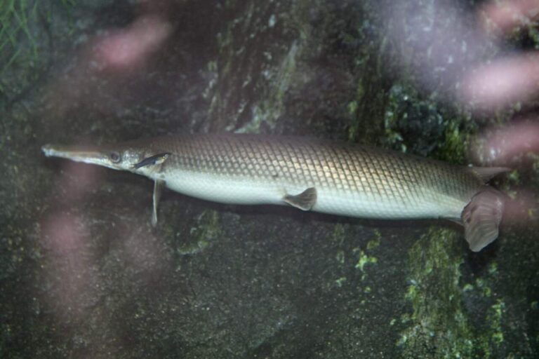
Photo: Cliff, CC BY 2.0


Photo: USFWS Fish and Aquatic Conservation, Public domain

Photo: USFWS Mountain-Prairie, Public domain
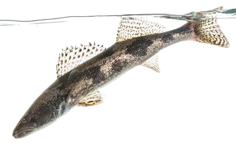
Photo: USFWS Mountain-Prairie, Public domain
Getting the facts straight on Pulaski County fishing
Where can a johnboat go in the water in Pulaski County?
AGFC maps 46 launches here.
Which Pulaski County lake spreads out the farthest?
Lake Maumelle, measuring 8,900 acres.
What fish are on AGFC lists around Pulaski County?
AGFC lists bream on the most lake pages within 50 miles, then catfish, black bass and crappie.
Where do Pulaski County anglers pick up minnows?
16 listings, including Academy Sports + Outdoors, 11400 W Markham St.
Where does Pulaski County keep its county courthouse in Arkansas?
Little Rock is the seat.
Which AGFC license covers fishing in Pulaski County?
Expect to pay $10.50 (Arkansas resident) or $60 (out of state) for a year of fishing.
What Arkansas counties sit beside Pulaski County?
By distance: Saline County, Lonoke County and Faulkner County.
What daily limit applies to crappie in Pulaski County?
Statewide: daily limit of 30 crappie (all species combined) with no length restrictions. Waters with their own Code line differ.
Are there special rules on Pulaski County lakes?
1 water with a page here carry their own Code line, starting with Arkansas River.
Does AGFC stock a town pond in Pulaski County?
Boyle Park Pond, Cherrywood Lake and Conner Park Pond: Catfish and Trout, catfish last stocked June 25, 2026; trout last stocked December 17, 2025.
When is the next Arkansas weigh-in on Pulaski County water?
1 organizer entry on file, none with a date still ahead.
Which records were caught in Pulaski County?
Black Buffalo, 92 lbs., 8 oz. (rod and reel), from Lake Maumelle.
Spend a Natural State morning on Pulaski County water
Ramp pages carry AGFC surface notes and directions.