Fishing in Gila County, Arizona
County seat: Globe. Census 2020 residents: 53,272.
- 3lake pages
- 10ramps
- 17river pages
 Pick for smallmouth bassPiscifun Chaos Pro CNC baitcasting reel25% OFFSale $97.99
Photo of Roosevelt Lake: Alan Stark, CC BY-SA 2.0
An overview of the desert and high-country water in Gila County
53,272 residents were tallied across Gila County in 2020, and Globe is its seat of government. Gazetteer totals put it at 4,758 square miles of land and 37.2 square miles of water. 3 lakes, ponds and reservoirs are covered in the county, with Roosevelt Lake biggest. Moving water with a page of its own here includes Bonita Creek, Canyon Creek (Headwaters to O.W. Bridge) and Canyon Creek (O.W. Bridge to the Fort Apache Indian Reservation).
Inside the line sit 10 launch ramps and 5 other fishing points additional mapped points without a ramp. County waters carry these AZGFD region labels: Region 2 – Flagstaff and Region 6 – Mesa. Per AZGFD's water-by-water text, 9 waters in the county are stocked and 11 are not; the layer carries no release dates. The regulation book lists special entries for 10 waters in the county.
U.S. Census Bureau, 2020 Census counts (TIGERweb) and the 2023 Gazetteer, read November 16, 2026. AZGFD Fish & Boat reference layers (ArcGIS service), read November 16, 2026.
Every mapped lake, launch and shore point across Gila County
AZGFD Fish & Boat reference layers (ArcGIS service), read November 16, 2026. Lake pins sit at the AZGFD point for each water.
Arizona still water inside Gila County
| Lake | Size | Access points | Kind | AZGFD flags |
|---|---|---|---|---|
| Roosevelt Lake | 20,300 acres | 11 | lake | largemouth bass, smallmouth bass, channel catfish |
| Granite Dells Lake | no size printed | 0 | lake | rainbow trout, Gila trout, bluegill |
| Green Valley Park Lakes | no size printed | 0 | lake, Community Fishing water | rainbow trout, Gila trout, largemouth bass |
From Globe, a drive past the Gila County line reaches these lakes.
| Lake | From Globe | Size | Access points | Kind | AZGFD flags |
|---|---|---|---|---|---|
| Apache Lake | 33 miles out, heading northwest | 2,656 acres | 4 | lake | rainbow trout, largemouth bass, smallmouth bass |
| Canyon Lake | 41 miles out, heading west | 950 acres | 10 | lake | rainbow trout, largemouth bass, smallmouth bass |
| Saguaro Lake | 47 miles out, heading west | 1,264 acres | 8 | lake | rainbow trout, largemouth bass, smallmouth bass |
| Painted Sky Park at Blossom Rock | 47 miles out, heading west | no size printed | 0 | lake | largemouth bass, channel catfish, bluegill |
| Frontier Family Park | 50 miles out, heading west | 5 acres | 0 | lake | rainbow trout, largemouth bass, channel catfish |
| Red Mountain Lake | 54 miles out, heading west | 8 acres | 0 | lake, Community Fishing water | rainbow trout, largemouth bass, channel catfish |
Size as AZGFD’s description of this water states it (Fish & Boat layer), read November 16, 2026. Waters with no acreage in AZGFD’s text show their mapped outline instead. Arizona Game and Fish Department Fish & Boat Arizona fishing-waters layer (ArcGIS service) record for this water, read November 16, 2026.
 For the smallmouth bass herePiscifun AlinoX 300 low profile baitcaster34% OFFSale $104.99
What the Fish & Boat flags name most often by Gila County
Bars count lake pages within 60 miles of Globe where AZGFD flags the fish as present; bluegill leads.
AZGFD species-present flags, counted per lake page within 60 miles; a flag is presence in the layer, not a catch survey. AZGFD fishing-waters layer species fields (ArcGIS service), read November 16, 2026. A Yes means AZGFD lists the species for the water, not that anglers are catching it.
Moving Arizona water in Gila County
- Bonita CreekAZGFD stream record
- Canyon Creek (Headwaters to O.W. Bridge)booklet entry, 1 USGS gauge candidate
- Canyon Creek (O.W. Bridge to the Fort Apache Indian Reservation)booklet entry, 1 USGS gauge candidate
- Christopher CreekAZGFD stream record
- Dude Creekbooklet entry
- East Verde River (From the Pumphouse downstream)booklet entry, 2 USGS gauge candidates
- East Verde River (From the creek source to the SRP Pumphouse)booklet entry, 4 USGS gauge candidates
- Ellison CreekAZGFD stream record
- Fossil Creekbooklet entry, 1 USGS gauge candidate
- Haigler CreekAZGFD stream record
- Horton Creekbooklet entry
- Mule CreekAZGFD stream record
- Pine Creek1 USGS gauge candidate
- Tonto CreekAZGFD stream record
- Upper Salt Riverbooklet entry, 2 USGS gauge candidates
- Webber CreekAZGFD stream record
- Workman CreekAZGFD stream record
Water-level stations in Gila County
USGS has no current reading for these gauges.
AZGFD Fish & Boat fishing-waters layer (ArcGIS service) record for this river, read November 16, 2026. USGS Water Data for the Nation, live through the site, retrieved on page view.
Arizona launch ramps across Gila County
- Cholla Boat Ramp on Roosevelt Lakeboat ramp, SRP ramp depth 67 ft on November 16, 2026; Gila County
- Grapevine Boat Ramp on Roosevelt Lakeboat ramp, SRP ramp depth 26 ft on November 16, 2026; Gila County
- Green Valley Lake Boat Rampboat ramp; Gila County
- Indian Point Boat Ramp on Roosevelt Lakeboat ramp, SRP ramp depth 15 ft on November 16, 2026; Gila County
- Roosevelt Lake Marina Boat Rampboat ramp; Gila County
- Schoolhouse Boat Ramp on Roosevelt Lakeboat ramp, SRP ramp depth 11 ft on November 16, 2026; Gila County
- Windy Hill Boat Ramp – Badger on Roosevelt Lakeboat ramp, SRP ramp depth 75 ft on November 16, 2026; Gila County
- Windy Hill Boat Ramp – Bobcat on Roosevelt Lakeboat ramp, SRP ramp depth -1 ft on November 16, 2026; Gila County
- Windy Hill Boat Ramp – Coyote on Roosevelt Lakeboat ramp, SRP ramp depth 11 ft on November 16, 2026; Gila County
- Windy Hill Boat Ramp – Ringtail on Roosevelt Lakeboat ramp, SRP ramp depth 44 ft on November 16, 2026; Gila County
Arizona docks and piers in Gila County
- Cholla Bay Shoreline Areaforest service site: boating – motorized, Tonto National Forest; Gila County
- Fishing Dock on Green Valley Lakefishing dock; Gila County
- Roosevelt Lake Marinamarina; Gila County
- Roosevelt Marinaforest service site: boating – motorized, Tonto National Forest; Gila County
- Windy Hill Boating Siteforest service site: boating – motorized, Tonto National Forest; Gila County
AZGFD Fish & Boat reference layers (ArcGIS service), read November 16, 2026.
Mapped Gila County waters that carry only a name and outline
- San Carlos Reservoirabout 13,059 acres of mapped outline
- Theodore Roosevelt Lakeabout 9,075 acres of mapped outline
- Theodore Roosevelt Lakeabout 712 acres of mapped outline
- Tailings Pond Number Threeabout 546 acres of mapped outline
- Cottonwood Tailings Pondabout 192 acres of mapped outline
- Solitude Tailings Pondabout 143 acres of mapped outline
- Georges Basinabout 81 acres of mapped outline
- Tufa Stone Tankabout 45 acres of mapped outline
- Phillips Park Tankabout 32 acres of mapped outline
- Gimme Tankabout 24 acres of mapped outline
- Halfway Tankabout 13 acres of mapped outline
- Sawmill Tankabout 13 acres of mapped outline
- Glade Tankabout 12 acres of mapped outline
Outline area from the USGS National Hydrography Dataset waterbody layer (NHD service; mapped polygon area, not an AZGFD surface-acre figure), read November 16, 2026. Names come from the USGS National Hydrography Dataset and the AZGFD layer; no page and no fish list for these waters.
Special lines for Gila County lakes and streams
The rules here are from the 2025 & 2026 Arizona Fishing Regulations, open January 1, 2025 through December 31, 2026 and amended January 30, 2026; AZGFD had approved no 2027 booklet that this site could find when it was checked.
- Canyon Creek (Headwaters to O.W. Bridge)From the O.W. Bridge to the Fort Apache Indian Reservation. Catch-and-release only for trout; trout must be immediately released unharmed; no trout may be kept; artificial fly and lure only; single-pointed barbless hooks only. (Canyon Creek)
- Canyon Creek (O.W. Bridge to the Fort Apache Indian Reservation)From the O.W. Bridge to the Fort Apache Indian Reservation. Catch-and-release only for trout; trout must be immediately released unharmed; no trout may be kept; artificial fly and lure only; single-pointed barbless hooks only. (Canyon Creek)
- Dude CreekIn Gila County is closed to fishing from Jan. 1 to April 30. Catch-and-release only for trout; trout must be immediately released unharmed; no trout may be kept; artificial fly and lure only; single-pointed barbless hooks only from May 1 to Dec. 31. (Dude Creek)
- East Verde River (From the Pumphouse downstream)• From the creek source to the SRP Pumphouse. Catch-and-release only for trout; trout must be immediately released unharmed; no trout may be kept; artificial fly and lure only; single-pointed barbless hooks only. Unlimited smallmouth and largemouth bass; unlimited channel and flathead catfish. • From the Pumphouse downstream. Statewide daily bag limits apply for trout. Unlimited smallmouth and largemouth bass; unlimited channel and flathead catfish. (East Verde River)
- East Verde River (From the creek source to the SRP Pumphouse)• From the creek source to the SRP Pumphouse. Catch-and-release only for trout; trout must be immediately released unharmed; no trout may be kept; artificial fly and lure only; single-pointed barbless hooks only. Unlimited smallmouth and largemouth bass; unlimited channel and flathead catfish. • From the Pumphouse downstream. Statewide daily bag limits apply for trout. Unlimited smallmouth and largemouth bass; unlimited channel and flathead catfish. (East Verde River)
- Fossil CreekSeasonally, from the first Saturday in October through April 30, fishing is allowed between the waterfall located approximately 1 mile above the Flume Trailhead parking lot along FS 708 and the downstream-most power line crossing (immediately below Sally May Wash). Catch-and-release only for roundtail chub. Roundtail chub must be immediately released unharmed; no chub may be kept; artificial fly and lure only; single-pointed barbless hooks only. (Fossil Creek)
- Granite Dells LakeThe limit is 2 trout any combination rainbow trout or Gila trout; 5 bluegill. (Granite Dells Lake)
- Horton CreekCatch and release only for trout, trout must be immediately released unharmed; no trout may be kept; artificial fly and lure only; single-pointed barbless hooks only. (Horton Creek)
- Roosevelt LakeThe limit is 15 crappie. (Roosevelt Lake)
- Upper Salt RiverFrom Roosevelt Diversion Dam upstream to the boundary junction of the San Carlos and Fort Apache Indian Reservations. Unlimited smallmouth and largemouth bass; unlimited channel and flathead catfish. (Upper Salt River)
2025 & 2026 Arizona Fishing Regulations (open January 1, 2025 through December 31, 2026; AZGFD PDF), read November 16, 2026.
AZGFD stocking text for Gila County waters
- Canyon Creek (Headwaters to O.W. Bridge)The Arizona Game and Fish Department stocks rainbow trout during the spring and summer months.
- Christopher CreekThe Arizona Game and Fish Department stocks rainbow trout and/or gila trout into Christopher Creek in the spring and summer.
- East Verde River (From the Pumphouse downstream)The Arizona Game and Fish Department stocks rainbow and/or Gila trout in the spring and summer months.
- Granite Dells LakeOnce the lake opens, it will be stocked up to three times a year with rainbow trout, Gila trout, and/or bluegill.
- Green Valley Park LakesGreen Valley Park lakes are stocked as part of the Arizona Game and Fish Department Community Fishing Program.
- Haigler CreekThe creek is stocked during early spring through the summer as water quality allows.
- Roosevelt LakeThe Arizona Game and Fish Department occasionally stocks fish into Roosevelt Lake as needed.
- Tonto CreekUpper Tonto Creek is stocked in the spring and summer months with rainbow trout and/or Gila trout.
- Workman CreekThe Arizona Game and Fish Department stocks rainbow and Gila trout in the summer months.
AZGFD Fish & Boat fishing-waters layer stocking fields (ArcGIS service) and AZGFD bulletins, read November 16, 2026. The layer says whether a water is stocked, not when or how many.
Record-book water in Gila County
| Species | Size as listed | Water | Year | Category |
|---|---|---|---|---|
| Smallmouth bass | 7 lb. 0.96 oz. 22.75 in. | Roosevelt Lake | 1988 | Inland Waters – Hook and Line |
| Bigmouth buffalo | 36 lb. 6 oz. 38.5 in. | Roosevelt Lake | 1995 | Inland Waters – Hook and Line |
| Smallmouth bass | 23 in. | Roosevelt Lake | 2006 | Inland Waters – Catch-and-Release |
| Yellow bass | 13 in. | Roosevelt Lake | 2008 | Inland Waters – Catch-and-Release |
| Flathead catfish | 53 in. | Roosevelt Lake | 2006 | Inland Waters – Catch-and-Release |
| Gila trout | 16 in. | Green Valley Park Lakes | 2021 | Inland Waters – Catch-and-Release |
Arizona state record fish as printed on pp. 40-41 of the 2025 & 2026 Arizona Fishing Regulations, updated Oct. 24, 2024 (AZGFD PDF; AZGFD’s fishing challenges page is behind a bot check), read November 16, 2026.
Events tied to Gila County lakes
| Date | Event | Water | Organizer |
|---|---|---|---|
| April 11, 2027 | AZ BASS Nation Qualifier #5 (2027) | Theodore Roosevelt Lake | Arizona B.A.S.S. Nation |
| Oct. 24, 2026 | Bob Hirsch Crappie Classic (2026) | Theodore Roosevelt Lake | not named (listed by Lake.com) |
| May 31, 2026 | AZ BASS Nation Open (2026) | Theodore Roosevelt Lake | Arizona B.A.S.S. Nation |
Event as listed by the organizer (source), read November 16, 2026.
Arizona gear stores in Gila County
Desert shops the Gila County regulars swear by
- Highway 188 Tackle & Suppliesbait and tackle shop, Tonto Basin
- Apache Lake Marina & Resortmarina, Roosevelt
- Roosevelt Lake Marinamarina, Roosevelt
Yellow Pages and operator listings (city of business), read November 16, 2026. Guides appear as businesses; no license or permit status is implied.
In Arizona close to Gila County
Arizona places in Gila County with town pages
- Payson2020 count 16,351
- Globe2020 count 7,249
- San Carlos2020 count 3,987
- Star Valley2020 count 2,484
- Miami2020 count 1,541
Arizona neighbors of Gila County
- Pinal County68 miles out, heading southwest
- Graham County80 miles out, heading southeast
- Greenlee County98 miles out, heading east
- Maricopa County102 miles out, heading west
Finding bait around Gila County
This site files the county in its southeast Arizona grouping, a map quadrant of our own and not an AZGFD region.
Piscifun reels and line to pack for the drive to Gila County


Piscifun and Amazon links are affiliate links; the site earns a commission on qualifying purchases.
Red-rock creeks, mesa reservoirs and river reaches around Gila County, pictured

Photo: mirage1210, CC BY 2.0

Photo: Geoff Livingston, CC BY-SA 2.0
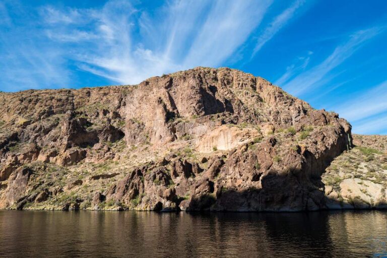
Photo: Kevin Dooley, CC BY 2.0
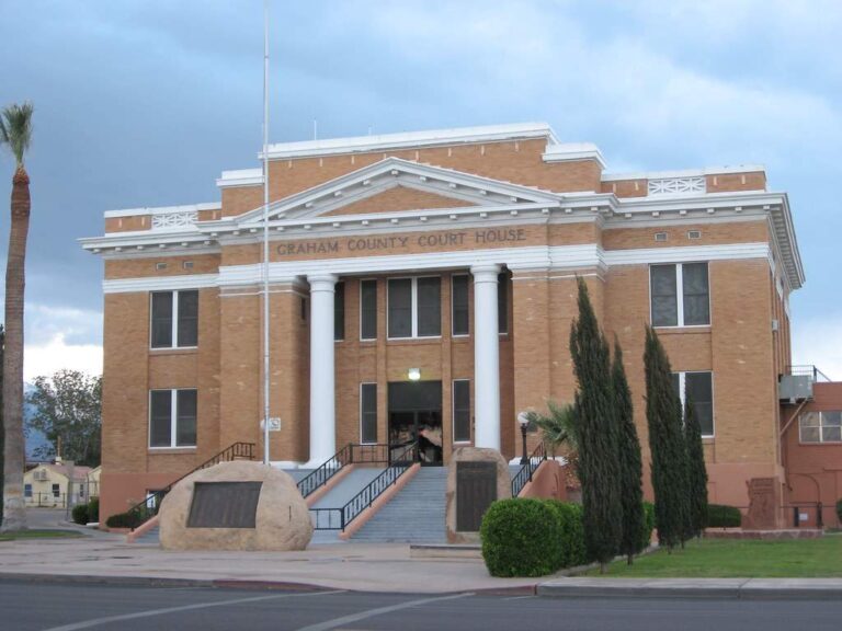
Photo: Ken Lund, CC BY-SA 2.0
Fishing inside Gila County, Arizona: the common asks
Where can I put a boat in the water in Arizona's Gila County?
10 ramps, each in the access list above.
Which lake is the biggest in Arizona's Gila County?
Roosevelt Lake leads with 20,300 acres.
What fish turn up on Arizona lake pages near Gila County?
The layer flags bluegill on the most lake pages within 60 miles, then channel catfish, largemouth bass and rainbow trout; a flag shows presence, not a catch.
Where do anglers in Gila County pick up lures and line?
3 listings, Highway 188 Tackle & Supplies among them.
What Arizona town serves Gila County as its seat?
It is Globe.
What does an Arizona fishing license cost for Gila County?
Anglers 10 and older need a valid Arizona fishing or combination license on publicly accessible water; the 2025 & 2026 Arizona Fishing Regulations prints $37 for a resident General Fishing license and $55 for a nonresident, each good for one year from the date of purchase.
What Arizona counties are closest to Gila County?
Nearest first: Pinal County, Graham County and Greenlee County.
What booklet limits cover Gila County water?
Limits come from the booklet's statewide rows unless the water has its own entry, and an entry replaces the statewide limit for the fish it names; the six AZGFD region pages on this site list the entries. The rules here are from the 2025 & 2026 Arizona Fishing Regulations, open January 1, 2025 through December 31, 2026 and amended January 30, 2026; AZGFD had approved no 2027 booklet that this site could find when it was checked.
Does the regulation book list entries for Gila County water?
10 waters with a page here carry their own entry in the booklet, beginning with Canyon Creek (Headwaters to O.W. Bridge).
Is stocking noted for waters in Arizona's Gila County?
AZGFD's per-water text flags 9 waters in the county as stocked and 11 as not stocked; it prints no dates or counts, so none appear here.
Do organizers run Arizona derbies on Gila County water?
3 entries on file; the next is AZ BASS Nation Qualifier #5 (2027) on Theodore Roosevelt Lake, April 11, 2027.
Which records trace to Gila County?
Smallmouth bass, 7 lb. 0.96 oz. 22.75 in., from Roosevelt Lake (1988).
A saguaro-shade morning in Gila County
River pages list access points and nearby USGS gauges.