Fishing in Coconino County, Arizona
County seat: Flagstaff. Census 2020 residents: 145,101.
- 27lake pages
- 27ramps
- 7river pages
 Pick for troutPiscifun Carbon X ultralight spinning reel28% OFFSale $57.99
Photo of Lake Powell: Esther Lee, CC BY 2.0
Fishing Coconino County, Arizona, in brief
The courthouse for Coconino County stands in Flagstaff; the county held 145,101 residents at the 2020 count. The county line encloses 18,616 square miles of land and 45 square miles of water, per the Gazetteer. Measured by acres or outline, Long Lake tops the 27 lakes, ponds and reservoirs covered here. The stream list for Coconino County starts with Bright Angel Creek, Chevelon Creek and East Clear Creek.
AZGFD, the Park Service and the Forest Service map 27 launch ramps here, alongside 20 other fishing points other points. On AZGFD's own region map, waters here fall in Region 1 – Pinetop and Region 2 – Flagstaff. AZGFD's per-water text marks 27 county waters as stocked and 7 as not stocked; no dated schedule is printed with it. 26 waters here carry their own entry in the 2025 and 2026 booklet.
U.S. Census Bureau, 2020 Census counts (TIGERweb) and the 2023 Gazetteer, read November 16, 2026. AZGFD Fish & Boat reference layers (ArcGIS service), read November 16, 2026.
Charting the waters and ramps of Coconino County
AZGFD Fish & Boat reference layers (ArcGIS service), read November 16, 2026. Lake pins sit at the AZGFD point for each water.
Choosing among the Arizona lakes of Coconino County
| Lake | Size | Access points | Kind | AZGFD flags |
|---|---|---|---|---|
| Long Lake | about 338 acres of mapped outline | 3 | lake | rainbow trout, largemouth bass, walleye |
| C.C. Cragin Reservoir (Blue Ridge Reservoir) | 275 acres | 2 | reservoir | rainbow trout, green sunfish, suckers |
| Ashurst Lake | 229 acres | 2 | lake | rainbow trout, brown trout, tiger trout |
| Chevelon Canyon Lake | 208 acres | 1 | lake | rainbow trout, brown trout, suckers |
| Willow Springs Lake | 158 acres | 2 | lake | rainbow trout, tiger trout |
| Marshall Lake | 150 acres | 2 | lake | rainbow trout, brook trout, tiger trout |
| Kinnikinick Lake | 126 acres | 2 | lake | rainbow trout, brown trout, brook trout |
| Dogtown Reservoir | about 80 acres of mapped outline | 1 | reservoir | rainbow trout, brown trout, largemouth bass |
| Knoll Lake | 77 acres | 2 | lake | rainbow trout, green sunfish, suckers |
| Bear Canyon Lake | 60 acres | 0 | lake | rainbow trout, Arctic grayling, green sunfish |
| Cataract Lake | 55 acres | 1 | lake | rainbow trout, brown trout, tiger trout |
| Woods Canyon Lake | 55 acres | 2 | lake | rainbow trout, brown trout, tiger trout |
| Kaibab Lake | 45 acres | 3 | lake | rainbow trout, brown trout, largemouth bass |
| White Horse Lake | about 42 acres of mapped outline | 0 | lake | largemouth bass, channel catfish, black crappie |
| Santa Fe Reservoir | about 13 acres of mapped outline | 0 | reservoir | rainbow trout, brown trout, channel catfish |
| Stone Dam Lake | 10 acres | 0 | lake, Community Fishing water | largemouth bass, channel catfish, black crappie |
| Russel Tank | 4.5 acres | 1 | lake | rainbow trout |
| Perkins Tank | 3.5 acres | 0 | lake | rainbow trout, brown trout, brook trout |
| Long Tom Tank | 3 acres | 0 | lake | rainbow trout |
| City Reservoir (Buckskinner Park) | no size printed | 0 | reservoir | rainbow trout, brown trout, largemouth bass |
| Elk Tank | no size printed | 0 | lake | rainbow trout, brown trout |
| Frances Short Pond | no size printed | 0 | pond | rainbow trout, channel catfish, bluegill |
| J.D. Dam | no size printed | 1 | lake | rainbow trout, brown trout, tiger trout |
| Lake Mary, Lower | no size printed | 1 | lake | rainbow trout, largemouth bass, walleye |
| Lake Mary, Upper | no size printed | 1 | lake | largemouth bass, walleye, northern pike |
| Lake Powell | no size printed | 6 | lake | largemouth bass, smallmouth bass, striped bass |
| Middle Tank | no size printed | 0 | lake | brown trout |
Size as AZGFD’s description of this water states it (Fish & Boat layer), read November 16, 2026. Waters with no acreage in AZGFD’s text show their mapped outline instead. Arizona Game and Fish Department Fish & Boat Arizona fishing-waters layer (ArcGIS service) record for this water, read November 16, 2026.
 For the trout herePiscifun Carbon XT ultralight spinning reel25% OFFSale $59.99
The presence tally for Coconino County lakes
The count covers species flags on lakes within 60 miles of Flagstaff, with rainbow trout ahead.
AZGFD species-present flags, counted per lake page within 60 miles; a flag is presence in the layer, not a catch survey. AZGFD fishing-waters layer species fields (ArcGIS service), read November 16, 2026. A Yes means AZGFD lists the species for the water, not that anglers are catching it.
Arizona rivers and creeks running through Coconino County
- Bright Angel Creekbooklet entry, 3 USGS gauge candidates
- Chevelon Creekbooklet entry
- East Clear CreekAZGFD stream record
- Lees Ferry on Colorado Riverbooklet entry, 2 USGS gauge candidates
- Oak Creekbooklet entry, 3 USGS gauge candidates
- Oak Creek, West Forkbooklet entry, 2 USGS gauge candidates
- Willow Springs CreekAZGFD stream record
How the Coconino County washes and rivers read, by gauge
USGS has no current reading for these gauges.
AZGFD Fish & Boat fishing-waters layer (ArcGIS service) record for this river, read November 16, 2026. USGS Water Data for the Nation, live through the site, retrieved on page view.
Arizona boat launches inside Coconino County
- Antelope Point Boat Ramp on Lake Powell / Colorado River (Glen Canyon National Recreation Area) (east)boat ramp, Glen Canyon National Recreation Area; Coconino County
- Antelope Point Boat Ramp on Lake Powell / Colorado River (Glen Canyon National Recreation Area) (west)boat ramp, Glen Canyon National Recreation Area; Coconino County
- Antelope Point Marina Boat Ramp on Lake Powellboat ramp; Coconino County
- Ashurst Lake Boat Rampboat ramp; Coconino County
- Boat Ramp #1 on Upper Lake Maryboat ramp; Coconino County
- Boat Ramp #2 on Upper Lake Maryboat ramp; Coconino County
- C.C. Cragin Reservoir (Blue Ridge Reservoir) Boat Rampboat ramp; Coconino County
- Cataract Lake Boat Rampboat ramp; Coconino County
- Chevelon Canyon Lake Boat Rampboat ramp; Coconino County
- Dogtown Reservoir Boat Rampboat ramp; Coconino County
- Kaibab Lake Boat Rampboat ramp; Coconino County
- Kinnikinick Lake Boat Rampboat ramp; Coconino County
- Knoll Lake Boat Rampboat ramp; Coconino County
- Lee's Ferry Landing on Colorado River (Grand Canyon National Park)boat ramp, Glen Canyon National Recreation Area; Coconino County
- Lees Ferry Boat Launch on Lake Powell / Colorado River (Glen Canyon National Recreation Area)boat ramp, Glen Canyon National Recreation Area; Coconino County
- Lees Ferry Boat Ramp on Colorado River – Imperial Divisionboat ramp; Coconino County
- Lower Lake Mary Boat Rampboat ramp; Coconino County
- Marshall Lake Boat Rampboat ramp; Coconino County
- Narrows Boat Ramp on Upper Lake Maryboat ramp; Coconino County
- North Boat Ramp on Long Lakeboat ramp; Coconino County
- South Boat Ramp on Long Lakeboat ramp; Coconino County
- Stateline Auxilary Boat Ramp on Lake Powellboat ramp; Coconino County
- Wahweap Boat Ramp on Lake Powellboat ramp, Glen Canyon National Recreation Area; Coconino County
- Wahweap Marina Boat Ramp on Lake Powellboat ramp; Coconino County
Arizona bank spots within Coconino County
- Lower Lake Mary Fishing Areaforest service site: lake and pond fishing, Coconino National Forest; Coconino County
- Upper Lake Mary Fishing Areaforest service site: boating – motorized, Coconino National Forest; Coconino County
- Antelope Point Marina on Lake Powell / Colorado River (Glen Canyon National Recreation Area)marina, Glen Canyon National Recreation Area; Coconino County
- Ashurst Lake Fishing Areaforest service site: lake and pond fishing, Coconino National Forest; Coconino County
- C.C. Cragin (Blue Ridge) Reservoir Fishing Areaforest service site: boating – non-motorized, Coconino National Forest; Coconino County
- JD Dam Fishing Areaforest service site: lake and pond fishing, Kaibab National Forest; Coconino County
- Kaibab Lake Fishing Dockfishing dock; Coconino County
- Kinnikinick Lake Fishing Areaforest service site: boating – non-motorized, Coconino National Forest; Coconino County
- Knoll Lake Fishing Areaforest service site: boating – non-motorized, Coconino National Forest; Coconino County
- Lake Mary Recreation Corridor Fishing Areaforest service site: boating – motorized, Coconino National Forest; Coconino County
- Marshall Lake Fishing Areaforest service site: lake and pond fishing, Coconino National Forest; Coconino County
- Oak Creek Fishing Areaforest service site: river and stream fishing, Coconino National Forest; Coconino County
- Russell Tank Fishing Areaforest service site: lake and pond fishing, Kaibab National Forest; Coconino County
- Soldier / Long Lakes Fishing Areaforest service site: lake and pond fishing, Coconino National Forest; Coconino County
- Southwest shore Fishing Area on Kaibab Lakeada accessible fishing location; Coconino County
- Stoneman Lake Fishing Areaforest service site: lake and pond fishing, Coconino National Forest; Coconino County
- Wahweap Marina on Lake Powellada accessible fishing location; Coconino County
- Wahweap Marina on Lake Powellmarina, Glen Canyon National Recreation Area; Coconino County
- Willow Springs Lake Fishing and Boating Siteforest service site: boating – motorized, Apache-Sitgreaves National Forest; Coconino County
- Woods Canyon Lake Area Boating Siteforest service site: boating – motorized, Apache-Sitgreaves National Forest; Coconino County
AZGFD Fish & Boat reference layers (ArcGIS service), read November 16, 2026.
Short list: stock tanks and small basins in Coconino County
- Mormon Lakeabout 4,904 acres of mapped outline
- Rogers Lakeabout 1,198 acres of mapped outline
- Upper Lake Maryabout 827 acres of mapped outline
- Tremaine Lakeabout 666 acres of mapped outline
- Red Lakeabout 501 acres of mapped outline
- Hay Lakeabout 458 acres of mapped outline
- Long Lakeabout 280 acres of mapped outline
- Lower Lake Maryabout 257 acres of mapped outline
- Davenport Lakeabout 151 acres of mapped outline
- Stone Lakeabout 148 acres of mapped outline
- Red Lakeabout 144 acres of mapped outline
- Stoneman Lakeabout 141 acres of mapped outline
- Boot Lakeabout 113 acres of mapped outline
- Deep Lakeabout 107 acres of mapped outline
- Grass Flat Tankabout 106 acres of mapped outline
- Breezy Lakeabout 105 acres of mapped outline
- Mud Lakeabout 103 acres of mapped outline
- Soldier Annex Lakeabout 95 acres of mapped outline
- Potato Lakeabout 95 acres of mapped outline
- Vail Lakeabout 94 acres of mapped outline
- Laguna Lakeabout 89 acres of mapped outline
- Little Red Lakeabout 86 acres of mapped outline
- Coleman Lakeabout 79 acres of mapped outline
- Scholz Lakeabout 73 acres of mapped outline
- Ducksnest Lakeabout 63 acres of mapped outline
- Post Lakeabout 59 acres of mapped outline
- Horse Lakeabout 57 acres of mapped outline
- Red Lake Tankabout 56 acres of mapped outline
- Pine Lakeabout 55 acres of mapped outline
- To Kla Daa Aakee Pondabout 54 acres of mapped outline
- Moonlight Bay Reservoirabout 51 acres of mapped outline
- McDermit Lakeabout 50 acres of mapped outline
- Smoot Lakeabout 48 acres of mapped outline
- White Water Tankabout 48 acres of mapped outline
- Daze Lakeabout 46 acres of mapped outline
- Fry Lakeabout 44 acres of mapped outline
- Corner Lakeabout 40 acres of mapped outline
- Cow Lakeabout 39 acres of mapped outline
- Howard Lakeabout 32 acres of mapped outline
- Odell Lakeabout 32 acres of mapped outline
Outline area from the USGS National Hydrography Dataset waterbody layer (NHD service; mapped polygon area, not an AZGFD surface-acre figure), read November 16, 2026. Names come from the USGS National Hydrography Dataset and the AZGFD layer; no page and no fish list for these waters.
Limits the booklet prints by name for Coconino County
The rules here are from the 2025 & 2026 Arizona Fishing Regulations, open January 1, 2025 through December 31, 2026 and amended January 30, 2026; AZGFD had approved no 2027 booklet that this site could find when it was checked.
- Bear Canyon LakeUnlimited smallmouth and largemouth bass; unlimited channel and flathead catfish. (Bear Canyon Lake)
- Bright Angel CreekUnlimited trout; unlimited striped bass; unlimited catfish. Trout taken at Bright Angel Creek shall be killed and retained as part of the bag limit or immediately released. (Bright Angel Creek)
- C.C. Cragin Reservoir (Blue Ridge Reservoir)Unlimited smallmouth and largemouth bass; unlimited channel and flathead catfish. (C.C. Cragin Reservoir (Blue Ridge Reservoir))
- Cataract LakeThe limit is 2 bass, minimum size 13 inches; the limit is 4 channel catfish. (Cataract Lake)
- Chevelon Canyon LakeThe limit is 2 trout; artificial fly and lure only. Unlimited smallmouth and largemouth bass; unlimited channel and flathead catfish. (Chevelon Canyon Lake)
- Chevelon Creek• From the confluence with Willow Springs Creek to Chevelon Crossing including Chevelon Canyon Lake. The limit is 2 trout; artificial fly and lure only. • From Chevelon Crossing to the Little Colorado River. Unlimited rainbow and brown trout from Sept. 1 through March 31. Statewide daily bag limits apply for trout. (Chevelon Creek)
- City Reservoir (Buckskinner Park)The limit is 2 bass, minimum size 13 inches; the limit is 4 channel catfish; the limit is 5 sunfish. (City Reservoir)
- Dogtown ReservoirThe limit is 2 bass, minimum size 13 inches; the limit is 4 channel catfish. (Dogtown Reservoir)
- Elk TankCatch-and-release only for trout. Trout must be immediately released unharmed; no trout may be kept; artificial fly and lure only; single-pointed barbless hooks only. (Elk Tank)
- Frances Short PondThe limit is 2 bass, minimum size 13 inches; the limit is 4 catfish; the limit is 5 sunfish. (Frances Short Pond)
- J.D. DamCatch-and-release only for trout. Trout must be immediately released unharmed; no trout may be kept; artificial fly and lure only; single-pointed barbless hooks only. (J.D. Dam Lake)
- Kaibab LakeThe limit is 2 bass, minimum size 13 inches; the limit is 4 channel catfish. (Kaibab Lake)
2025 & 2026 Arizona Fishing Regulations (open January 1, 2025 through December 31, 2026; AZGFD PDF), read November 16, 2026.
The hatchery question across Coconino County
- Ashurst LakeThe Arizona Game and Fish Department stocks rainbow trout, tiger trout, and brown trout.
- Bear Canyon LakeThe Arizona Game and Fish Department stocks Bear Canyon Lake with rainbow trout during summer months and arctic grayling in the spring when available.
- C.C. Cragin Reservoir (Blue Ridge Reservoir)The Arizona Game and Fish Department stocks rainbow trout.
- Cataract LakeThe Arizona Game and Fish Department stocks rainbow trout, tiger trout, brown trout, and channel catfish into Cataract Lake.
- Chevelon Canyon LakeThe Arizona Game and Fish Department stocks rainbow trout into Chevelon Canyon Lake in the spring and fall.
- City Reservoir (Buckskinner Park)The Arizona Game and Fish Department stocks rainbow trout, brown trout, and channel catfish.
- Dogtown ReservoirCowpuncher Pond will be managed primarily under a warmwater management plan with general opportunity for largemouth bass, channel catfish, redear sunfish, bluegill, black crappie, and channel catfish.
- Elk TankThe Arizona Game and Fish Department stocks rainbow trout and brown trout into Elk Tank.
- Frances Short PondThe Arizona Game and Fish Department stocks Frances Short Pond with rainbow trout, bluegill, and channel catfish.
- J.D. DamThe Arizona Game and Fish Department stocks J.D.
AZGFD Fish & Boat fishing-waters layer stocking fields (ArcGIS service) and AZGFD bulletins, read November 16, 2026. The layer says whether a water is stocked, not when or how many.
Where Coconino County shows up in the record list
| Species | Size as listed | Water | Year | Category |
|---|---|---|---|---|
| Northern pike | 32 lb. 5.6 oz. 49 in. | Ashurst Lake | 2004 | Inland Waters – Hook and Line |
| Rainbow trout | 15 lb. 9.12 oz. 32.5 in. | Willow Springs Lake | 2006 | Inland Waters – Hook and Line |
| Tiger trout | 5 lb 15.36 oz 23.5 in. | Woods Canyon Lake | 2023 | Inland Waters – Hook and Line |
| Brook trout | 15 in. | Perkins Tank | 2015 | Inland Waters – Catch-and-Release |
| Brook trout | 5 lb. 4.0 oz. 19.0 in. | Lees Ferry on Colorado River | 1982 | Colorado River Waters – Hook and Line |
| Walleye | 8 lb. 1.0 oz. 29.0 in. | Lake Powell | 1977 | Colorado River Waters – Hook and Line |
Arizona state record fish as printed on pp. 40-41 of the 2025 & 2026 Arizona Fishing Regulations, updated Oct. 24, 2024 (AZGFD PDF; AZGFD’s fishing challenges page is behind a bot check), read November 16, 2026.
Buying tackle inside Coconino County, Arizona
Restocking line and hooks for Coconino County
- Gary Yamamoto Custom Baitsbait and tackle shop, Page
- Lake Mary Fishing Boat Rentalsbait and tackle shop, Flagstaff
- Lees Ferry Anglers Fly Shopfly shop, Marble Canyon
- Lees Ferry Lodge Fly Shopfly shop, Marble Canyon
- Stix Liquor & Sporting Goodsbait and tackle shop, Page
- Antelope Point Marina & RV Parkmarina, Page
- Wahweap Marina (Lake Powell Resorts & Marinas)marina, Page
Arizona outfitters who run trips to Coconino County
- Bubba's Guide Servicefishing guide, Page, (928) 645-3506
- GO Fish Charterscharter, Page, (435) 648-2416
- Lake Powell Guide Servicesfishing guide, Page, (801) 631-0158
- Lees Ferry Anglers Guide Servicefly fishing guide, Marble Canyon, (928) 355-2261
- Lees Ferry On The Flyfly fishing guide, Marble Canyon, (928) 522-4124
- McNabb Fishing Guide Servicefishing guide, Page, (928) 660-1020
Yellow Pages and operator listings (city of business), read November 16, 2026. Guides appear as businesses; no license or permit status is implied.
Grouped near Coconino County on the Arizona map
Arizona lodging towns across Coconino County
- Flagstaff2020 count 76,831
- Tuba City2020 count 8,072
- Page2020 count 7,440
- Doney Park2020 count 5,910
- Williams2020 count 3,202
- Timberline-Fernwood2020 count 2,572
- Kachina Village2020 count 2,502
- Fredonia2020 count 1,323
Arizona counties next to Coconino County
- Navajo County87 miles out, heading east
- Yavapai County94 miles out, heading southwest
- Mohave County111 miles out, heading west
- Apache County132 miles out, heading east
Where Coconino County anglers shop, by area
Coconino County is in the northeast Arizona grouping here, which is a map quadrant and has nothing to do with AZGFD regions.
Piscifun kit to stow in the truck for time at Coconino County


Piscifun and Amazon links are affiliate links; the site earns a commission on qualifying purchases.
Early light on the water near Coconino County, Sonoran style

Photo: Gunther Hagleitner, CC BY 2.0
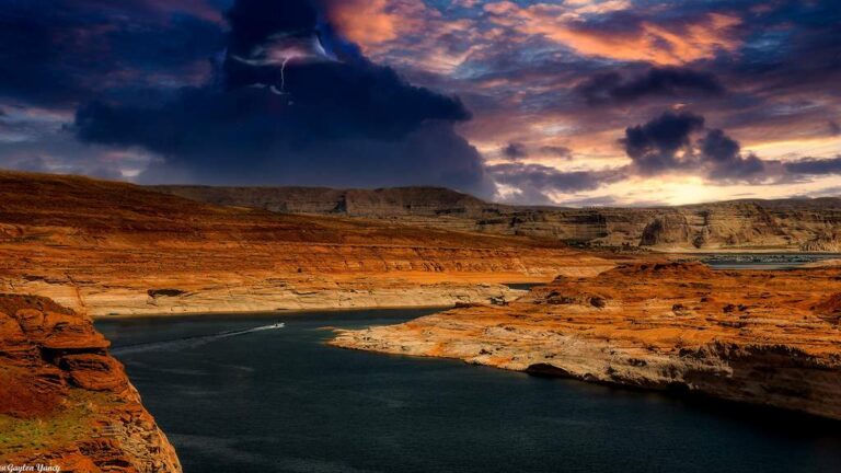
Photo: G. Yancy, CC BY 2.0
Photo: Mobilus In Mobili, CC BY-SA 2.0

Photo: Alan Levine, CC BY 2.0
The questions Coconino County anglers trade at the bait counter
How many launch ramps does Coconino County have in the mapped data?
The mapped layers list 27 ramps.
Which Arizona water has the biggest size figure in Coconino County?
That is Long Lake, listed at about 338 acres of mapped outline.
Which fish lead the AZGFD flags near Coconino County?
The layer flags rainbow trout on the most lake pages within 60 miles, then bluegill, channel catfish and brown trout; a flag shows presence, not a catch.
Does Coconino County have an Arizona marina or bait counter?
There are 7; Gary Yamamoto Custom Baits comes first.
From which Arizona town does Coconino County govern?
Flagstaff.
Which licenses do Coconino County anglers carry?
Anglers 10 and older need a valid Arizona fishing or combination license on publicly accessible water; the 2025 & 2026 Arizona Fishing Regulations prints $37 for a resident General Fishing license and $55 for a nonresident, each good for one year from the date of purchase.
Which Arizona counties lie closest to Coconino County?
Navajo County, Yavapai County and Mohave County sit nearest.
How many fish may I keep from Arizona water in Coconino County?
Limits come from the booklet's statewide rows unless the water has its own entry, and an entry replaces the statewide limit for the fish it names; the six AZGFD region pages on this site list the entries. The rules here are from the 2025 & 2026 Arizona Fishing Regulations, open January 1, 2025 through December 31, 2026 and amended January 30, 2026; AZGFD had approved no 2027 booklet that this site could find when it was checked.
Where do Arizona limits change in Coconino County?
26 waters with a page here carry their own entry in the booklet, beginning with Bear Canyon Lake.
Are Coconino County lakes on the hatchery list?
AZGFD's per-water text flags 27 waters in the county as stocked and 7 as not stocked; it prints no dates or counts, so none appear here.
Has an Arizona state record fish come from Coconino County?
Northern pike, 32 lb. 5.6 oz. 49 in., from Ashurst Lake (2004).
Hitch the boat for Sonoran water in Coconino County
Check a water's booklet entry before keeping fish.