Fishing in Prince of Wales-Hyder Census Area, Alaska
Administrative center: Craig. Census 2020 residents: 5,753.
- 11lake pages
- 11ramps
- 32river pages
 Pick for rainbow troutPiscifun Carbon X ultralight spinning reel28% OFFSale $57.99
Photo of Sitka: Игор Миновски, CC BY 2.0
First things to know about fishing Alaska's Prince of Wales-Hyder Census Area
A headcount of 5,753 in 2020 makes up Prince of Wales-Hyder Census Area, with Craig as the administrative center. As a census area it is counted by the Bureau but has no assembly. Within its boundary the Census counts 5,268 square miles of land and 5,642 square miles of water. This site writes up 11 lakes here, and Klawock Lake is the largest by size. The river pages of Prince of Wales-Hyder Census Area cover Gunnuk Creek, Halfmile Creek and Hamilton Creek.
The access layers hold 11 ramps in Prince of Wales-Hyder Census Area, plus 17 other fishing sites harbor or trail sites. For salt water, this site has 3 area pages tied to Prince of Wales-Hyder Census Area. Special regulation lines apply to 13 waters here.
Population from the 2020 Census (TIGERweb), places and boroughs from the Census 2023 Gazetteer, read November 14, 2026. Launch or access details as published in the ADF&G goFishAK layer (ADF&G titles it a draft), read November 14, 2026.
A frontier water map of Prince of Wales-Hyder Census Area
Launch or access details as published in the ADF&G goFishAK layer (ADF&G titles it a draft), read November 14, 2026. Lake pins are the ADF&G reference point for each lake.
Alaska lake pages for Prince of Wales-Hyder Census Area
| Lake | Size | Access sites | ADF&G lists |
|---|---|---|---|
| Klawock Lake | about 2,797 acres of mapped outline | 0 | Dolly Varden, rainbow trout, cutthroat trout |
| Neck Lake | about 970 acres of mapped outline | 0 | Dolly Varden, kokanee, cutthroat trout |
| Sarkar Lakes | about 718 acres of mapped outline | 0 | Dolly Varden, cutthroat trout, rainbow trout |
| Kegan Lake | about 624 acres of mapped outline | 0 | Dolly Varden, cutthroat trout, rainbow trout |
| Luck Lake | about 509 acres of mapped outline | 0 | Dolly Varden, cutthroat trout, rainbow trout |
| Red Lake | about 413 acres of mapped outline | 0 | Dolly Varden, cutthroat trout, rainbow trout |
| Twin Island Lake | about 316 acres of mapped outline | 0 | Dolly Varden, cutthroat trout |
| Black Bear Lake | about 187 acres of mapped outline | 0 | rainbow trout |
| Angel Lake | about 152 acres of mapped outline | 0 | rainbow trout, cutthroat trout, Dolly Varden |
| Trumpeter Lake | about 52 acres of mapped outline | 0 | rainbow trout, cutthroat trout, Dolly Varden |
| Cavern Lake | about 26 acres of mapped outline | 0 | Dolly Varden, cutthroat trout, rainbow trout |
Acres as the ADF&G lake layer lists them, read November 14, 2026. Lakes with no ADF&G acreage print their USGS mapped outline instead. Record from the ADF&G Sport Fish Lakes Database (SF_Lakes), read November 14, 2026.
 For the rainbow trout herePiscifun Carbon XT ultralight spinning reel25% OFFSale $59.99
Counting ADF&G species lists near Prince of Wales-Hyder Census Area
Summing ADF&G lists for lakes within 80 miles of Craig, cutthroat trout comes first.
ADF&G species lists, counted per lake page within 80 miles; presence in a layer, not a catch survey. Record from the ADF&G Sport Fish Lakes Database (SF_Lakes), read November 14, 2026.
Alaska rivers to wade in Prince of Wales-Hyder Census Area
- Gunnuk Creek1 USGS gauge
- Halfmile Creek1 USGS gauge
- Hamilton Creekregulation heading, 1 USGS gauge, goFishAK entry
- Hatchery Creekregulation heading, 1 USGS gauge, goFishAK entry
- Maybeso Creek1 USGS gauge, goFishAK entry
- Old Tom Creek1 USGS gauge
- Reynolds Creek1 USGS gauge
- Salmon River1 USGS gauge
- Staney Creekregulation heading, 1 USGS gauge, goFishAK entry
- Threemile Creekregulation heading, 1 USGS gauge
- *Black Bear CreekgoFishAK entry
- *Bohemian RiverAWC stream record
- *Luck Creekregulation heading, goFishAK entry
- *Natzuhini RiverAWC stream record
- Cathedral Falls CreekgoFishAK entry
- Coffman CreekgoFishAK entry
- Eagle Creekregulation heading, goFishAK entry
- Harris RivergoFishAK entry
- Hydaburg RiverAWC stream record
- Karta RivergoFishAK entry
- Kegan Creekregulation heading, goFishAK entry
- Klawock RivergoFishAK entry
- Logjam CreekgoFishAK entry
- Luck Creekregulation heading, goFishAK entry
- Natzuhini RiverAWC stream record
- North Fork Soule RiverAWC stream record
- Ratz CreekgoFishAK entry
- Red Bay Creekregulation heading, goFishAK entry
- Sarkar CreekgoFishAK entry
- Shinaku Creekregulation heading, goFishAK entry
USGS gauges reporting across Prince of Wales-Hyder Census Area
| USGS gauge | Latest reading | Time (ET) |
|---|---|---|
| Salmon R Nr Hyder Ak | 422 cfs, 16.63 ft gage height | Nov 16 11:45 am |
| Staney C Nr Klawock Ak | 2,160 cfs, 10.87 ft gage height | Nov 16 11:30 am |
| Harris R 1.2 Mi Ab Mouth Nr Hollis Ak | 1,290 cfs, 22.35 ft gage height | Nov 16 12:15 pm |
US Geological Survey provisional data, retrieved Nov 16, 2026 12:33 pm ET. Provisional readings can be revised.
Stream record from the ADF&G Anadromous Waters Catalog (2026 layer), read November 14, 2026. A catalog entry is a use record, not a fishing-quality claim. Streamflow and level from USGS National Water Information System; many Alaska gauges report only in the open-water season.
Saltwater ADF&G management areas tied to Prince of Wales-Hyder Census Area
- Petersburg-WrangellADF&G management area
- Prince of Wales IslandADF&G management area
- SitkaADF&G management area
Record from the ADF&G Sport Fish Lakes Database (SF_Lakes), read November 14, 2026.
Alaska trailer launches around Prince of Wales-Hyder Census Area
- Coffman Cove Launch Ramplaunch ramp; Prince of Wales-Hyder Census Area
- Craig False Island Launch Ramplaunch ramp; Prince of Wales-Hyder Census Area
- Craig North Cove Launch Ramplaunch ramp; Prince of Wales-Hyder Census Area
- Hollis Launch Ramplaunch ramp; Prince of Wales-Hyder Census Area
- Hydaburg Launch Ramplaunch ramp; Prince of Wales-Hyder Census Area
- Hyder Boat Launchlaunch ramp; Prince of Wales-Hyder Census Area
- Kake Harbor Launch Ramplaunch ramp; Prince of Wales-Hyder Census Area
- Klawock Launch Ramplaunch ramp; Prince of Wales-Hyder Census Area
- Labouchere Bay Launch Ramplaunch ramp; Prince of Wales-Hyder Census Area
- Naukati Bay Launch Ramplaunch ramp; Prince of Wales-Hyder Census Area
- Whale Pass Launch Ramplaunch ramp; Prince of Wales-Hyder Census Area
ADF&G fishing access sites in Prince of Wales-Hyder Census Area
- Cathedral Falls Trailangler access trail; Prince of Wales-Hyder Census Area
- Coffman Cove Harborharbor, launch ramp, fish cleaning tables, float plane dock, restrooms; Prince of Wales-Hyder Census Area
- Craig North and South Cove Harborharbor, launch ramp, restrooms, fish cleaning tables, showers, trash disposal; Prince of Wales-Hyder Census Area
- Hatchery Creek Trailangler access trail; Prince of Wales-Hyder Census Area
- Hydaburg Harborharbor, launch ramp, fuel dock, float plane dock; Prince of Wales-Hyder Census Area
- Kake Harborharbor; Prince of Wales-Hyder Census Area
- Klawock Harborharbor, fish cleaning, trash disposal, launch ramp, restrooms, fuel, grid facilities; Prince of Wales-Hyder Census Area
- Naukati Bay Harborharbor, launch ramp, float plane dock, fish cleaning tables, fuel, restrooms, laundry; Prince of Wales-Hyder Census Area
- Neck Creek Trailangler access trail; Prince of Wales-Hyder Census Area
- Point Bakerharbor, fuel dock, float plane dock; Prince of Wales-Hyder Census Area
- Port Protectionharbor, fuel dock, float plane dock; Prince of Wales-Hyder Census Area
- Sarkar Canoe Routeangler access trail; Prince of Wales-Hyder Census Area
- Thorne Bay Harborharbor, launch ramp, float plane moorage, trash disposal, restrooms; Prince of Wales-Hyder Census Area
- Whale Pass Harborharbor, launch ramp, float plane moorage; Prince of Wales-Hyder Census Area
- Dog Salmon Fish Pass Wildlife Viewing SiteUSFS recreation area (Lake and Pond Fishing); Prince of Wales-Hyder Census Area
- Neck Lake Access Boating SiteUSFS recreation area (Boating – Motorized); Prince of Wales-Hyder Census Area
- Sarkar Lake Access Boating SiteUSFS recreation area (Boating – Motorized); Prince of Wales-Hyder Census Area
Launch or access details as published in the ADF&G goFishAK layer (ADF&G titles it a draft), read November 14, 2026.
Named lakes on the Alaska map of Prince of Wales-Hyder Census Area
- Sweetwater Lakeabout 1,981 acres of mapped outline
- Salmon Lakeabout 1,376 acres of mapped outline
- Nutkwa Lagoonabout 1,011 acres of mapped outline
- Salmon Bay Lakeabout 989 acres of mapped outline
- Essowah Lakesabout 840 acres of mapped outline
- Purple Lakeabout 793 acres of mapped outline
- Hetta Lakeabout 612 acres of mapped outline
- Devil Lakeabout 549 acres of mapped outline
- Tamgas Lakeabout 524 acres of mapped outline
- Trout Lakeabout 476 acres of mapped outline
- Shipley Lakeabout 452 acres of mapped outline
- Klakas Lakeabout 446 acres of mapped outline
- Hassler Lakeabout 431 acres of mapped outline
- Niblack Lakeabout 401 acres of mapped outline
- Old Franks Lakeabout 386 acres of mapped outline
- Nichols Lakeabout 379 acres of mapped outline
- Paul Lakeabout 373 acres of mapped outline
- Lake Josephineabout 360 acres of mapped outline
- Miller Lakeabout 347 acres of mapped outline
- Kugel Lakeabout 342 acres of mapped outline
- Summit Lakeabout 337 acres of mapped outline
- Thorne Lakeabout 326 acres of mapped outline
- Lake Lueliaabout 314 acres of mapped outline
- Lake Galeaabout 304 acres of mapped outline
- No Name Lakeabout 290 acres of mapped outline
- Lake Welcomeabout 276 acres of mapped outline
- Karta Lakeabout 250 acres of mapped outline
- Little Devil Lakeabout 247 acres of mapped outline
- Lake Saint Nicholasabout 234 acres of mapped outline
- Big Lakeabout 219 acres of mapped outline
- Parrot Lakeabout 195 acres of mapped outline
- Aiken Lakeabout 190 acres of mapped outline
- Clover Lakeabout 189 acres of mapped outline
- Johnson Lakeabout 189 acres of mapped outline
- Melanson Lakeabout 186 acres of mapped outline
- Kutlaku Lakeabout 180 acres of mapped outline
- Chuck Lakeabout 155 acres of mapped outline
- Dora Lakeabout 145 acres of mapped outline
- Hessa Lakeabout 138 acres of mapped outline
- Alecks Lakeabout 136 acres of mapped outline
Mapped outline area computed from the USGS National Hydrography Dataset waterbody polygon, read November 14, 2026: outline area is not a surface-acre figure from ADF&G. Names come from ADF&G lake lists and the USGS names layer; no page and no fish list for these lakes.
Regulation headings in the booklets that touch Prince of Wales-Hyder Census Area waters
Rules and fees are the 2026 edition: ADF&G prints "Effective until the 2027 summary is issued" on every 2026 booklet, and no 2027 booklet exists. Emergency orders supersede the booklet.
- *Luck CreekLUCK LAKE – including Eagle Creek, Prince of Wales Island Area: Only unbaited, artificial lures or flies may be used year-round. The use of bait is prohibited.
- Eagle CreekEAGLE LAKE, Petersburg-Wrangell Area: Only unbaited, artificial lures or flies may be used year-round. The use of bait is prohibited.
- Hamilton CreekHAMILTON CREEK, Petersburg-Wrangell Area: Only unbaited, artificial lures or flies may be used year-round. The use of bait is prohibited.
- Hatchery CreekHATCHERY CREEK, Prince of Wales Island Area: 100 feet upstream of the upper falls to 100 feet downstream of the lower falls:
- Kegan CreekKEGAN LAKE, Prince of Wales Island Area: Only unbaited, artificial lures or flies may be used year-round. The use of bait is prohibited.
- Kegan LakeKEGAN LAKE, Prince of Wales Island Area: Only unbaited, artificial lures or flies may be used year-round. The use of bait is prohibited.
- Luck CreekLUCK LAKE – including Eagle Creek, Prince of Wales Island Area: Only unbaited, artificial lures or flies may be used year-round. The use of bait is prohibited.
- Luck LakeLUCK LAKE – including Eagle Creek, Prince of Wales Island Area: Only unbaited, artificial lures or flies may be used year-round. The use of bait is prohibited.
- Neck LakeNECK LAKE, Prince of Wales Island Area: Only unbaited, artificial lures or flies may be used year-round. The use of bait is prohibited.
- Red Bay CreekRED BAY LAKE, Prince of Wales Island Area: Only unbaited, artificial lures or flies may be used year-round. The use of bait is prohibited.
- Shinaku CreekSHINAKU LAKE, Prince of Wales Island Area: Bait is allowed year-round. Rick Cottrell, halibut, Sunshine Cove Salmon Bay PrinceL.of Wales Island Area Red Bay L. Eagle Cr. Luck L. C rne Riv Control L. Karta Lake Hollis Kasaan Craig Meyers Chuck Salmon Lake Klawock Thorne Bay Noname Lake AIT Tho Luc y Cr cher Hat gja Shinaku Lake Noyes Coffman Cove Sweetwater Sarkar Edna Bay Closed to sport fishing for shrimp by nonresidents and personal use shrimping by residents in 2026 by EO. Whale Pass Kosciusko Closed to sport fishing for Dungeness crab by nonresident anglers. (Big) Creek Scowl Arm ran Baker Salt Water Special regulations Prince of Wales Island Area
- Staney CreekSTANEY CREEK, Prince of Wales Island Area: Only unbaited, artificial lures or flies may be used year-round. The use of bait is prohibited.
Rules as printed in the 2026 ADF&G Sport Fishing Regulations Summary (booklet). Effective until the 2027 summary is issued; emergency orders supersede the booklet (ADF&G emergency orders). Read November 14, 2026.
Where Alaska anglers in Prince of Wales-Hyder Census Area shop
Tackle counters on the road to Prince of Wales-Hyder Census Area, Alaska
- Craig North Cove Small Boat Harbormarina, Craig
- Craig South Cove Small Boat Harbormarina, Craig
- Hydaburg Small Boat Harbormarina, Hydaburg
- Hyder Harbormarina, Hyder
- Kake Portage Cove Small Boat Harbormarina, Kake
- Klawock Small Boat Harbormarina, Klawock
- Metlakatla Small Boat Harbor – Newmarina, Metlakatla
- Metlakatla Tamgass Harbormarina, Metlakatla
- Thorne Bay Small Boat Harbormarina, Thorne Bay
Alaska guide businesses close to Prince of Wales-Hyder Census Area
- Catch-A-Kingfishing guide, Craig, (907) 826-2938
- King Fisher Charters & Lodgecharter, Craig, (907) 826-3350
- Slammin' Sams Fishing Charterscharter, Klawock, (907) 755-2443
Yellow Pages, chamber and DOT&PF harbor listings (city of business), read November 14, 2026. Guides are listed as businesses; no licence or registration status is implied.
A short stretch past Prince of Wales-Hyder Census Area, Alaska
Town pages within Prince of Wales-Hyder Census Area, Alaska
- Craig2020 count 1,036
Across the Alaska borough line from Prince of Wales-Hyder Census Area
- Wrangell City and Borough56 miles northeast
- Ketchikan Gateway Borough82 miles east
- Petersburg Borough99 miles north
- Sitka City and Borough134 miles northwest
Piscifun gear an angler could bring north to Prince of Wales-Hyder Census Area


Piscifun and Amazon links are affiliate links; the site earns a commission on qualifying purchases.
A look at the shoreline near Prince of Wales-Hyder Census Area
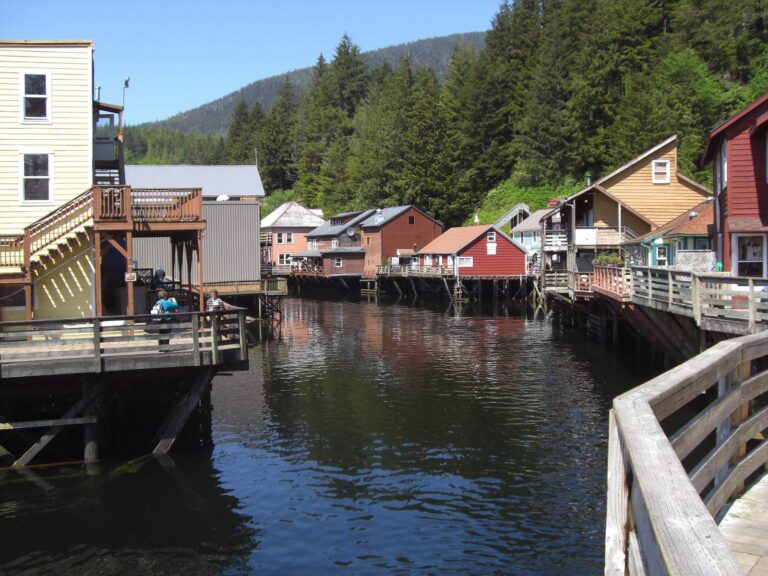
Photo: Larry Koester, CC BY 2.0
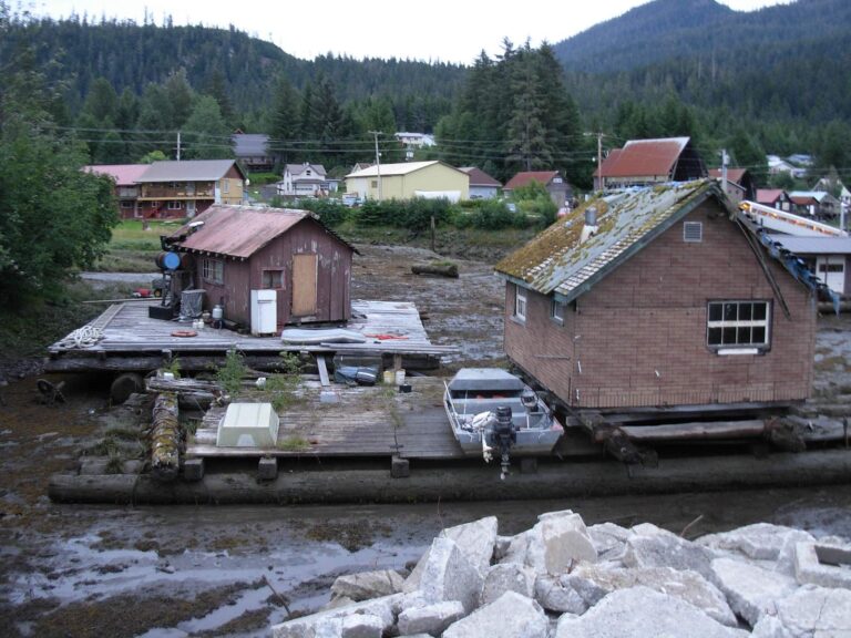
Photo: brewbooks, CC BY-SA 2.0
Lakes, forks and harbors of Prince of Wales-Hyder Census Area, explained
How many goFishAK ramps are listed for Prince of Wales-Hyder Census Area?
There are 11 ramps in the access data.
Where is the widest lake in Prince of Wales-Hyder Census Area?
Klawock Lake, with about 2,797 acres of mapped outline.
What fish does ADF&G name near Prince of Wales-Hyder Census Area?
The layers name cutthroat trout on the most lake pages within 80 miles, then rainbow trout, Dolly Varden and silver salmon; they show presence, not a catch.
Where can I buy bait in Prince of Wales-Hyder Census Area, Alaska?
Try Craig North Cove Small Boat Harbor; the listing has 9.
Where does Prince of Wales-Hyder Census Area keep its administrative center?
Craig has it.
Which Alaska licenses cover fishing in Prince of Wales-Hyder Census Area?
A resident annual sport fishing license is $20 and a nonresident annual license $100
What lies next to Prince of Wales-Hyder Census Area?
Begin with Wrangell City and Borough, Ketchikan Gateway Borough and Petersburg Borough.
How many Dolly Varden or trout may I take home from Prince of Wales-Hyder Census Area?
Limits depend on the booklet area, the species heading and any heading printed for the water; the four booklet pages on this site give the headings, and king salmon rows lean on emergency orders. Rules and fees are the 2026 edition: ADF&G prints "Effective until the 2027 summary is issued" on every 2026 booklet, and no 2027 booklet exists. Emergency orders supersede the booklet.
Do the 2026 booklets print a lake heading in Prince of Wales-Hyder Census Area?
13 waters with a page here carry their own heading, beginning with *Luck Creek.
Where do halibut and salmon anglers read up for Prince of Wales-Hyder Census Area?
3 saltwater area pages here, starting with Petersburg-Wrangell.
Set up an Alaska fishing week in Prince of Wales-Hyder Census Area
Lake pages carry access sites, ADF&G species lists and booklet headings.