Prince of Wales Island Saltwater Fishing
An ADF&G saltwater fishing area in Prince of Wales-Hyder Census Area and Wrangell City and Borough.
 Pick for salmonPiscifun Viper X spinning reel50% OFFSale $39.99
Photo of Ketchikan: Larry Koester, CC BY 2.0
A Alaska profile of Prince of Wales Island
The Prince of Wales Island management area has 14 goFishAK marine points and 114 atlas areas in the agency’s saltwater data. The area reaches into Prince of Wales-Hyder Census Area and Wrangell City and Borough. Region on the record: Southeast.
None of the rows measures fishing success: one source is a draft layer, the other a 1989 atlas.
Description, access and tackle text as published in the ADF&G goFishAK Sport Fishing Opportunities and Access layer (ADF&G titles it a draft), read November 14, 2026.
goFishAK saltwater points in Prince of Wales Island
| Point as published | Species text as published | Access type as published | Borough or census area |
|---|---|---|---|
| Noyes Island | King salmon, lingcod, rockfish, halibut, coho salmon | marine boat | Prince of Wales-Hyder Census Area |
| Noyes Island, East Addington | King salmon, halibut, coho salmon | marine boat | Prince of Wales-Hyder Census Area |
| Port Saint Nicholas | Dungeness crab, king salmon, pink salmon, chum salmon, coho salmon | marine boat, walk-in, canoe/kayak | Prince of Wales-Hyder Census Area |
| Thorne Bay | Dungeness crab, king salmon, pink salmon, coho salmon | marine boat, roadside, canoe/kayak | Prince of Wales-Hyder Census Area |
| Kegan Bay/Creek | Dolly Varden, cutthroat trout, rainbow trout, steelhead trout, sockeye salmon, pink salmon, chum salmon, coho salmon | marine boat, float plane | Prince of Wales-Hyder Census Area |
| San Alberto Bay | King salmon, halibut, rockfish, coho salmon, pink salmon | marine boat | Prince of Wales-Hyder Census Area |
| Baker Island | King salmon, rockfish, halibut, lingcod, coho salmon, pink salmon | marine boat | Prince of Wales-Hyder Census Area |
| Cape Chacon | King salmon, rockfish, halibut, lingcod, coho salmon, pink salmon, shrimp | marine boat | Prince of Wales-Hyder Census Area |
| Klawock Inlet | Dungeness crab, coho salmon, king salmon | marine boat, canoe/kayak, roadside | Prince of Wales-Hyder Census Area |
| Port Asumcion | Chum salmon | marine boat | Prince of Wales-Hyder Census Area |
| Sea Otter Sound | King salmon, rockfish, halibut, lingcod, coho salmon, pink salmon, shrimp | marine boat | Prince of Wales-Hyder Census Area |
| Suemez Island | King salmon, rockfish, halibut, lingcod, coho salmon, pink salmon | marine boat | Prince of Wales-Hyder Census Area |
| Whale Pass | Dungeness crab, coho salmon, pink salmon | marine boat, roadside, canoe/kayak | Prince of Wales-Hyder Census Area |
| Coffman Cove | King salmon, bottomfish, dungeness crab, pink salmon, coho salmon | marine boat, roadside, canoe/kayak | Prince of Wales-Hyder Census Area |
Noyes Island
Outside (west) of Noyes Island is popular location with many productive locations for bottom fish, Chinook and coho salmon. Locations include: Cape Ulitka, Roller Bay, Rockpile and Pineapple.
For reaching it the layer says: Approximately 30 miles by boat from Craig. Gear text, quoted: For Chinook salmon the most effective techniques are mooching, jigging and trolling.
Noyes Island, East Addington
Southern Noyes Island east of Cape Addington is a popular locaton for Chinook and coho salmon.
Directions text, quoted: Approximately 25 miles by boat from Craig. Tackle text as printed: For Chinook salmon the most effective techniques are mooching, jigging and trolling.
Port Saint Nicholas
Chinook salmon are stocked in the estuary and return to the creek from May through July. A weir is in place to prevent Chinook salmon from spawning in the creek.
The route note says: Approximately 7 miles from Craig by boat or vehicle on Port Saint Nicholas Rd. The layer's tackle text: Chinook salmon may be caught casting/trolling spinners or by snagging.
Thorne Bay
At the town of Thorne Bay and a staging area for salmon entering the Thorne River. Good numbers of Dungeness crab and provides access to Clarence Strait.
The route note says: Boat ramp and harbor at Thorne Bay. The layer's tackle text: For salmon the most effective techniques are casting lures, jigging and trolling.
Kegan Bay/Creek
Kegan Creek is a short stream at the outlet of Kegan Lake. The creek is located on the south end of Prince of Walesin Moira Sound and offers a remote get away with 2 USFS cabins nearby and lots of angler opportunities.
The route note says: Accessible by air or boat, ~30 air miles from Ketchikan or 51 air miles east of Craig. The layer's tackle text: Bait prohibited, only unbaited, artifical lures or flies may be used year-round.
San Alberto Bay
A popular and close location to Craig/Klawock for bottomfish, including halibut and Chinook, coho and pink salmon. A productive area for returning Klawock River hatchery coho salmon.
Access text as printed: San Alberto Bay is directly west of Craig (< 5 miles) and Klawock Inlet accessible by boat if leaving out of Klawock and Craig. Tackle note, as published: For king salmon the most effective techniques are mooching, jigging and trolling.
The Prince of Wales Island entries between them name coho salmon, king salmon, pink salmon, halibut, rockfish, lingcod, dungeness crab, chum salmon, shrimp and dolly varden.
Many 2026 king salmon rows say the fishery was closed in 2026 by emergency order; the text is as printed, so check the current emergency orders.
Description, access and tackle text as published in the ADF&G goFishAK Sport Fishing Opportunities and Access layer (ADF&G titles it a draft), read November 14, 2026.
 For the salmon herePiscifun AlumiX spinning reel46% OFFSale $64.99
Salmon Holes and Halibut Hills areas in Prince of Wales Island
The printed atlas contributes 114 rows for Prince of Wales Island, each a named saltwater area.
| Atlas area | Atlas map area | Atlas label | Borough or census area |
|---|---|---|---|
| Ratz Pt -Ratz Harbor | Prince of Wales, Clarence Strait | Salmon | Prince of Wales-Hyder Census Area |
| Narrow Pt. | Prince of Wales, Clarence Strait | Salmon | Prince of Wales-Hyder Census Area |
| Tolstoi Bay-Tolstoi Pt. | Prince of Wales, Clarence Strait | Salmon | Prince of Wales-Hyder Census Area |
| Kasaan Peninsula- Grindall Island | Prince of Wales, Clarence Strait | Salmon | Prince of Wales-Hyder Census Area |
| Kasaan Peninusla – Grindall I. | Prince of Wales, Clarence Strait | Halibut | Prince of Wales-Hyder Census Area |
| Kasaan Bay-Baker Point | Prince of Wales, Clarence Strait | Salmon | Prince of Wales-Hyder Census Area |
| Kasaan Bay-Outer Pt. | Prince of Wales – Clarence Strait | Salmon | Prince of Wales-Hyder Census Area |
| Twelvemile Arm-Twelvemile Bay-Kasaan Bay | Prince of Wales- Clarence Strait | Salmon | Prince of Wales-Hyder Census Area |
| Twelvemile Arm | Prince of Wales | Salmon | Prince of Wales-Hyder Census Area |
| Kasaan Bay-Poor Man Bay-Sunny Hat Pt. | Prince of Wales-Clarence Strait | Salmon | Prince of Wales-Hyder Census Area |
| Karta Bay-Kasaan Bay | Prince of Wales-Clarence Strait | Halibut | Prince of Wales-Hyder Census Area |
| Skowl Arm-Saltery Cove-Thumb Pt. | Prince of Wales-Clarence Strait | Salmon | Prince of Wales-Hyder Census Area |
| Skowl Arm | Prince of Wales-Clarence Strait | Salmon | Prince of Wales-Hyder Census Area |
| Skowl Island-Skowl Pt. | Prince of Wales-Clarence Strait | Salmon | Prince of Wales-Hyder Census Area |
| Patterson Island-High Island | Prince of Wales-Clarence Strait | Salmon | Prince of Wales-Hyder Census Area |
| Island Pt. | Prince of Wales-Clarence Strait | Salmon | Prince of Wales-Hyder Census Area |
| Twenty Fathom Bank-Island Point | Prince of Wales-Clarence Strait | Halibut | Prince of Wales-Hyder Census Area |
| Docotr Pt.-Clover Pt. | Prince of Wales-Clarence Strait | Halibut | Prince of Wales-Hyder Census Area |
| Cholmondeley Sound-Skin Island | Prince of Wales-Clarence Strait | Salmon | Prince of Wales-Hyder Census Area |
| Cholmondeley Sound-Skin Island | Prince of Wales-Clarence Strait | Salmon | Prince of Wales-Hyder Census Area |
| Chasina Island-Chasina Pt.-Windy Pt. | Prince of Wales-Clarence Strait | Salmon | Prince of Wales-Hyder Census Area |
| Cape Chacon | Clarence Strait-Prince of Wales Is. | Salmon | Prince of Wales-Hyder Census Area |
| McLean Arm-McLean Pt.-Island Pt. | Clarence Strait-Prince of Wales Is. | Salmon | Prince of Wales-Hyder Census Area |
| Kendrick Bay-Kendrick Is. | Clarence Strait-Prince of Wales Is. | Salmon | Prince of Wales-Hyder Census Area |
| Chichagof Bay-Rip Pt.-Moira Rock | Moira Sound-Clarence Strait-Prince of Wales Is. | Salmon | Prince of Wales-Hyder Census Area |
| Wedge Is.-Port Johnson | Clarence Strait-Prince of Wales Is. | Salmon | Prince of Wales-Hyder Census Area |
| Sukwan Strait-Eek Pt. | Cordova Sound-Prince of Wales Is. | Salmon | Prince of Wales-Hyder Census Area |
| Mud Bay-Lime Pt.-Nutkwa Inlet | Cordova Sound-Prince of Wales Is. | Salmon | Prince of Wales-Hyder Census Area |
| Hassiah Inlet-Nutkwa Inlet | Cordova Sound-Prince of Wales Is. | Salmon | Prince of Wales-Hyder Census Area |
| South Arm-Cholmondeley Sound | Cholmondeley Sound-Prince of Wales Is. | Salmon | Prince of Wales-Hyder Census Area |
| West Arm-Cholmondeley Sound | Cholmondeley Sound-Prince of Wales Is. | Salmon | Prince of Wales-Hyder Census Area |
| Cordova Sound-Abalone Is. | Cordova Sound-Prince of Wales Is. | Salmon | Prince of Wales-Hyder Census Area |
| Tah Bay-Cordova Sound | Tah Bay-Cordova Sound-Prince of Wales Is. | Salmon | Prince of Wales-Hyder Census Area |
| Datzkoo Harbor-Cordova Sound | Cordova Sound-Prince of Wales Is. | Salmon | Prince of Wales-Hyder Census Area |
| Wolk Pt.-Cape Muzon-McLeod Bay | Cordova Sound-Prince of Wales Is. | Salmon | Prince of Wales-Hyder Census Area |
| Dewey Rocks-Cordova Sound | Cordova Sound-Prince of Wales Is. | Salmon | Prince of Wales-Hyder Census Area |
| Pt. Bazan-Parrot Rock-Security Pt. | Port Bazan-Prince of Wales Is. | Salmon | Prince of Wales-Hyder Census Area |
| Halibut Nose-Tlevak Strait | Tlevak Strait-Prince of Wales Is. | Salmon | Prince of Wales-Hyder Census Area |
| South Pass-Turn Rock-Goat Is. | Tlevak Strait-Prince of Wales Is. | Salmon | Prince of Wales-Hyder Census Area |
| San Antonio Pt.-Ridge Is.-Ulloa Channel | Ulloa Channel-Prince of Wales Is. | Salmon | Prince of Wales-Hyder Census Area |
| Ulloa Channel-San Antonio Pt. | Ulloa Channel-Prince of Wales Is. | Halibut | Prince of Wales-Hyder Census Area |
| Iphigenia Pt.-Perlas Pt.-Trocadero Bay | Trocadero Bay-Prince of Wales Is. | Salmon | Prince of Wales-Hyder Census Area |
| Big Bay-Trocadero Bay | Trocadero Bay-Prince of Wales Is. | Halibut | Prince of Wales-Hyder Census Area |
| Port Caldera-Lomas Pt. | Trocadero Bay-Prince of Wales Is. | Halibut | Prince of Wales-Hyder Census Area |
| Lomas Pt.-Tranquil Pt.-Trocadero Bay | Trocadero Bay-Prince of Wales Is. | Salmon | Prince of Wales-Hyder Census Area |
| Culebrina Is.-Doyle Bay-Trocadero Bay | Trocadero Bay-Prince of Wales Is. | Salmon | Prince of Wales-Hyder Census Area |
| Miraballes Pt.-Rancheria Is. | Port Saint Nicholas-Prince of Wales Is. | Salmon | Prince of Wales-Hyder Census Area |
| Coronados Islands | Trocadero Bay-Prince of Wales Is. | Salmon | Prince of Wales-Hyder Census Area |
| Port Saint Nicholas | Port Saint Nicholas-Prince of Wales Is. | Salmon | Prince of Wales-Hyder Census Area |
| Cape Suspiro- | Port Saint Nicholas-Prince of Wales Is. | Salmon | Prince of Wales-Hyder Census Area |
| Ballena Is. Shoal-Bucarelli Bay | Ursua Channel-San Juan Bautista Is.-Craig | Halibut | Prince of Wales-Hyder Census Area |
| Agueda Pt.-San Juanito Is.-Cape Cambon | Ursua Channel-San Juan Bautista Is. | Salmon | Prince of Wales-Hyder Census Area |
| Balandra Is.-San Alberto Bay | Trocadero Bay-Prince of Wales Is. | Salmon | Prince of Wales-Hyder Census Area |
| Cape Felix-Pt. Rosary-Port Santa Cruz | Bucareli Bay-Suemez Is. | Salmon | Prince of Wales-Hyder Census Area |
| Cape Chrikof-Bartolome-Port Asuncion | Bucareli Bay-Baker Is. | Salmon | Prince of Wales-Hyder Census Area |
| Pt. Fula-Port Delores-Pt. Cangrejo | Bucareli Bay-Suemez Is. | Salmon | Prince of Wales-Hyder Census Area |
| Adrian Cove-San Adrian Is.-Pt. Verde | Ulloa Channel-Suemez Is. | Salmon | Prince of Wales-Hyder Census Area |
| Port Estrella-Cape Flores-Pt. Providence | Bucareli Bay-Prince of Wales Is. | Halibut | Prince of Wales-Hyder Census Area |
| Cabras Is.-Pt. Cangrejo-Bucareli Bay | Bucareli Bay-Suemez Is. | Halibut | Prince of Wales-Hyder Census Area |
| Pt. Cocos-Silvester Pt.-Bibora Is. | Bucareli Bay-St. Ignace Is. | Salmon | Prince of Wales-Hyder Census Area |
| Sword Pt.-Pt. Amargura-Pt. Cuerbo | Lulu Is.-Ursua Channel-Prince of Wales Is. | Salmon | Prince of Wales-Hyder Census Area |
| Port Real Marina-Muerta Is.-Triste Pt. | Port Real Marina-Baker Isl.-Lulu Is. | Salmon | Prince of Wales-Hyder Census Area |
| Cape Addington-St. Nicholas Pt. | St. Nicholas Channel-Noyes Is. | Salmon | Prince of Wales-Hyder Census Area |
| Veta Bay-Granite Pt.-Arcada Rock | Veta Bay-Baker Is. | Halibut | Prince of Wales-Hyder Census Area |
| Cape Addington-Cape Ulitka-Noyes Is. | Cape Addington-Noyes Is.-Prince of Wales | Halibut | Prince of Wales-Hyder Census Area |
| Steamboat Bay/Pt.-Arriaga Passage | Steamboat Bay-Arriaga Passage-Noyes Is. | Salmon | Prince of Wales-Hyder Census Area |
| Pt. San Francisco-St. Nicholas Channel | St. Nicholas Channel-Noyes Is.-Prince of Wales Is. | Salmon | Prince of Wales-Hyder Census Area |
| Pt. Marabilla/Marabilla Is. | St. Nicholas Channel-Lulu Is.-Prince of Wales Is. | Salmon | Prince of Wales-Hyder Census Area |
| Pt. Santa Gertrudis-Pt. St. Thomas | Portillo Channel-Lulu Is.-Prince of Wales Is. | Salmon | Prince of Wales-Hyder Census Area |
| Abrejo Rocks-Snail Pt.-Portillo Channel | Portillo Channel-San Fernando Is. | Salmon | Prince of Wales-Hyder Census Area |
| Klawock Inlet-Fish Egg Is. | Klawock Inlet-Prince of Wales Is. | Salmon | Prince of Wales-Hyder Census Area |
| Entrance Pt.-Klawock Inlet-Wadleigh Isl. | Klawock Inlet-Wadleight Isl.-Prince of Wales Isl. | Salmon | Prince of Wales-Hyder Census Area |
| Pt. Polocano-San Alberto Bay | San Alberto Bay-San Fernando Isl. | Salmon | Prince of Wales-Hyder Census Area |
| Catalina Is.-San Christobal Channel | San Christobal Channel-Prince of Wales Is. | Salmon | Prince of Wales-Hyder Census Area |
| Cruz Pass-Pt. Santa Lucia- | Cruz Pass-San Christoval Ch.-San Fernando Is. | Salmon | Prince of Wales-Hyder Census Area |
| Palisade Pt.-San Christoval Channel | San Christoval Channel-Prince of Wales Is. | Salmon | Prince of Wales-Hyder Census Area |
| Hermagos Is.-Pt. Santa Rosalia | San Christoval Channel-Prince of Wales Is. | Salmon | Prince of Wales-Hyder Census Area |
| Hermagos Is.-San Christoval Channel | San Christoval Channel-Prince of Wales Is. | Halibut | Prince of Wales-Hyder Census Area |
| Larzatita Is. Reef-San Christoval Ch. | San Christoval Channel-Prince of Wales Is. | Salmon | Prince of Wales-Hyder Census Area |
| Tonowek Bay-St. Philip Is. | Tonowek Bay-St. Philip Is.-Prince of Wales Is. | Salmon | Prince of Wales-Hyder Census Area |
The table shows the first 80 of 114 rows in the atlas data for this area.
Names and labels from Salmon Holes and Halibut Hills, an ADF&G sport fishing atlas of southeast Alaska (1989), read November 14, 2026.
Saltwater rules that cover Prince of Wales Island
Saltwater limits for Prince of Wales Island sit in the regional booklet that covers it, and this page prints none because they are not attached to a single point here.
Rules and fees are the 2026 edition: ADF&G prints "Effective until the 2027 summary is issued" on every 2026 booklet, and no 2027 booklet exists. Emergency orders supersede the booklet. Emergency orders supersede the printed regulations, so check the ADF&G emergency order page before fishing.
A resident annual sport fishing license is $20 and a nonresident annual license $100.
Rules as printed in the 2026 ADF&G Sport Fishing Regulations Summary (booklet). Effective until the 2027 summary is issued; emergency orders supersede the booklet (ADF&G emergency orders). Read November 14, 2026.
Along the same valley as Prince of Wales Island, Alaska
Alternate Alaska ramps beside Prince of Wales Island
- Craig False Island Launch Ramp3 miles
- Craig North Cove Launch Ramp3 miles
- Klawock Launch Ramp4 miles
- Hollis Launch Ramp17 miles
- Hydaburg Launch Ramp22 miles
- Naukati Bay Launch Ramp26 miles
Walk-in and bank options around Prince of Wales Island, Alaska
- Craig North and South Cove Harbor3 miles
- Klawock Harbor4 miles
- Hydaburg Harbor22 miles
- Thorne Bay Harbor25 miles
- Naukati Bay Harbor26 miles
Bait and fly shops worth a detour before Prince of Wales Island, Alaska
- Craig North Cove Small Boat Harbormarina, Craig, 3 miles
- Craig South Cove Small Boat Harbormarina, Craig, 3 miles
- Klawock Small Boat Harbormarina, Klawock, 4 miles
- Hydaburg Small Boat Harbormarina, Hydaburg, 22 miles
- Thorne Bay Small Boat Harbormarina, Thorne Bay, 25 miles
- Ketchikan Knudsen Cove Harbormarina, Ketchikan, 50 miles
Hiring a Alaska guide for Prince of Wales Island
- King Fisher Charters & Lodgecharter, Craig, (907) 826-3350
- Slammin' Sams Fishing Charterscharter, Klawock, (907) 755-2443
- Catch-A-Kingfishing guide, Craig, (907) 826-2938
Alaska towns a highway drive from Prince of Wales Island
- Craig2 miles
- Ketchikan56 miles
- Wrangell62 miles
- Petersburg87 miles
Alaska borough pages that cover Prince of Wales Island
- Prince of Wales-Hyder Census Areaadministrative center: Craig
- Wrangell City and Boroughborough seat: Wrangell
Piscifun tackle chosen for a day at Prince of Wales Island


Piscifun and Amazon links are affiliate links; the site earns a commission on qualifying purchases.
Photographs of the water around Prince of Wales Island
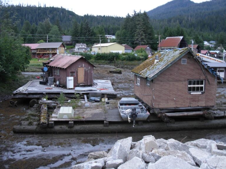
Photo: brewbooks, CC BY-SA 2.0
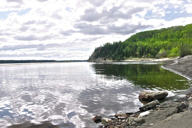
Photo: Ron Reiring, CC BY 2.0
Alaska: getting Prince of Wales Island sorted before you hit the road
How does ADF&G define Prince of Wales Island?
The agency uses it as a management area, and its coast falls in Prince of Wales-Hyder Census Area and Wrangell City and Borough.
What saltwater points does ADF&G list for Prince of Wales Island?
There are 14 marine points on file, such as Noyes Island.
What are the Salmon Holes and Halibut Hills rows for Prince of Wales Island?
The atlas is from 1989 and marks areas on the water, not access.
What can I target in Prince of Wales Island?
The point text lists coho salmon, king salmon, pink salmon, halibut, rockfish and lingcod.
Does Alaska set size limits in Prince of Wales Island?
No limits are shown here because point listings do not carry them.
Do I need my own license in Prince of Wales Island?
A resident annual sport fishing license is $20 and a nonresident annual license $100. Every fee ADF&G prints is on the license page.
What ADF&G put-ins serve Prince of Wales Island?
Start with Craig False Island Launch Ramp, Craig North Cove Launch Ramp and Klawock Launch Ramp; the nearby band lists more.
Who sells Alaska tackle near Prince of Wales Island?
Nearest listed: Craig North Cove Small Boat Harbor, about 3 miles away.
Are king salmon rules different in Prince of Wales Island?
King salmon rules are the ones most often changed by emergency order, so confirm before you go.
Check the tide book for Prince of Wales Island
Buy the license before you leave the dock.