Fishing in Crawford County, Missouri
Courthouse in Steelville. MDC manages its fish from the MDC St. Louis Region.
- 0docks and jetties
- 11ramps
- 5river pages
 Pick for troutPiscifun Carbon X ultralight spinning reel28% OFFSale $57.99
Photo of Meramec River: JDMcGreg, CC BY-SA 3.0
Sizing up Crawford County before a fishing trip
23,056 Missourians called Crawford County home in 2020; the county seat is Steelville. Land runs to 742 square miles and water to 1.3, per the Census Gazetteer. Lake and stream management here falls to the MDC St. Louis Region.
Count 11 public ramps on the public lists, including 0 with an accessible flag. The trout list for this area takes in Blue Springs Creek and Meramec River.
Census 2020 population and 2023 Gazetteer areas; MDC Managed Public Waterbody outlines, boat ramp/access, dock, jetty and fish attractor layers; USACE ramp layers; retrieved October 2026.
 For the trout herePiscifun Carbon XT ultralight spinning reel25% OFFSale $59.99
A map of where to wet a line in Crawford County
MDC boat ramp/access and dock layers, USACE ramps, MDC lake label points and MDC stream access areas. Checked October 2026.
Which Crawford County lakes have full pages
Crawford County anglers in Steelville reach these outside lakes first.
| Lake | From Steelville | Acres | Ramps | Motor note | Fish MDC names |
|---|---|---|---|---|---|
| Scioto Lake | 14 miles west | 5 | 0 | ||
| Blackwell Lake | 17 miles south | 26 | 1 | ||
| Towell Lake | 19 miles west | 97 | 1 | largemouth bass, crappie, redear sunfish | |
| Schuman Park Lake | 23 miles west | 5 | 0 | ||
| Macs Lake | 24 miles south | 26 | 1 | ||
| Shawnee Lake | 24 miles south | 16 | 1 |
MDC Managed Public Waterbody outlines (GIS acres), MDC 2026 Fishing Prospects species and boating notes; retrieved October 2026.
Fish named in MDC reports near Crawford County
Each bar is the number of lake pages within 50 miles of Steelville that list the fish, led by channel catfish.
Species named in MDC 2026 Fishing Prospects text, the MDC state record list and MDC trout program waters, counted per lake page within 50 miles; not a full survey.
Ponds in Crawford County listed without a page
A further 5 ponds and small lakes in Crawford County carry MDC outlines but little else.
| Water | Acres | Attractors | Nearest place |
|---|---|---|---|
| Gravel Pit 1 | 3 | 0 | St. James |
| Gravel Pit 2 | 1 | 0 | St. James |
| Gravel Pit 5 | 1 | 0 | St. James |
| Gravel Pit 4 | 1 | 0 | St. James |
| Gravel Pit 3 | 1 | 0 | St. James |
MDC Managed Public Waterbody outlines and fish attractor layer, retrieved October 2026.
Moving water to fish in Crawford County
- Meramec RiverRed Ribbon trout area, smallmouth and goggle-eye management water, 13 MDC ramps, 12 access areas, 229 mi in Missouri
- Blue Springs CreekBlue Ribbon trout area, 6 mi in Missouri
- Bourbeuse River6 MDC ramps, 8 access areas, 154 mi in Missouri
- Courtois Creekgoggle-eye management water, 1 MDC ramp, 1 access area, 40 mi in Missouri
- Huzzah Creekgoggle-eye management water, 1 MDC ramp, 1 access area, 36 mi in Missouri
How Crawford County creeks are flowing on USGS gauges
| USGS gauge | Latest reading | Time (ET) |
|---|---|---|
| Meramec River Near Sullivan, Mo | 318 cfs, 3.07 ft gage height | Nov 13 12:30 am |
| Meramec River Near Steelville, Mo | 174 cfs, 1.32 ft gage height | Nov 13 1:15 am |
| Huzzah Creek Near Steelville, Mo | 56 cfs, 2.67 ft gage height | Nov 13 12:30 am |
| Meramec River At Cook Station, Mo | 19 cfs, 2.07 ft gage height | Nov 13 1:00 am |
US Geological Survey provisional data, retrieved Nov 13, 2026 1:33 am ET. Provisional readings can be revised.
MDC stream access areas and boat ramps, MDC trout and smallmouth management layers, USGS NHD lengths and USGS gauges; retrieved October 2026.
Where Crawford County anglers go for stocked rainbows
Keeping trout takes a Missouri trout permit on top of the fishing permit: $12 for residents and $24 for nonresidents 16 and older.
Ribbon trout areas in Crawford County
| Area | Water and segment | Length | Daily | Lures |
|---|---|---|---|---|
| Blue Ribbon | Blue Springs Creek: From Blue Springs to its junction with Meramec River — 4 miles | At least 18" | 1 | Artificial lures and flies |
| Red Ribbon | Meramec River: From Highway 8 bridge to Scott’s Ford and in Dry Fork Creek from the elevated cable crossing to its confluence with the Meramec River — 8.2 | At least 15" | 2 | Artificial lures and flies |
- Meramec River (From Highway 8 bridge to Scott’s Ford and in Dry Fork Creek from the elevated cable crossing to its confluence with the Meramec River — 8.2 miles)Brown Trout (primarily), Red Ribbon Trout Areas are stocked primarily with browns. (Red Ribbon Trout Area)
MDC trout program statements (2026 regulations booklet, MDC news releases and area pages); MDC publishes no per-water stocking table; trout areas and trout parks as printed in the 2026 regulations booklet pp. 24 to 27.
Public ramps and fishing docks across Crawford County
- Blue Springs Creek Conservation Area on Meramec RiverMeramec River, boat ramp, parking
- Campbell Bridge Access on Meramec RiverMeramec River, boat ramp, parking, privy nearby
- Huzzah Conservation Area on Courtois CreekCourtois Creek, boat ramp, parking, privy nearby
- Huzzah Conservation Area on Huzzah CreekHuzzah Creek, boat ramp, parking
- Mint Spring Access on Bourbeuse RiverBourbeuse River, boat ramp, parking
- Riverview Access on Meramec RiverMeramec River, boat ramp
- Sappington Bridge Access on Meramec RiverMeramec River, boat ramp, parking, privy nearby
- Scotts Ford Access on Meramec River SMB SMAMeramec River SMB SMA, boat ramp, parking, privy nearby
- Woodson K. Woods Memorial Conservation Area on Meramec River Red Ribbon Trout AreaMeramec River Red Ribbon Trout Area, boat ramp, parking, privy nearby
- Campbell Bridge Access on Meramec RiverMeramec River, boat ramp, parking, privy nearby
- Sappington Bridge Access on Meramec RiverMeramec River, boat ramp, parking, privy nearby
MDC boat ramp/access, fishing dock, jetty and cleaning station layers; USACE Little Rock District ramp layers; retrieved October 2026.
Missouri limits anglers follow in Crawford County
For Crawford County, the statewide table is the default and the named waters below differ.
| Species | Limit | Season |
|---|---|---|
| Black bass (largemouth, smallmouth, spotted/Kentucky) | 6 a day | All year |
| Black bass (largemouth, smallmouth, spotted/Kentucky) (Ozark streams) | 6 a day; 12" minimum | May 23, 2026–Feb. 28, 2027 |
| Channel catfish | 10 a day | All year |
| Blue catfish | 5 a day | All year |
| Flathead catfish | 5 a day | All year |
| Crappie (black and white) | 30 a day | All year |
| Goggle-eye (Ozark, rock, and shadow bass) and warmouth | 15 a day; 7" minimum | All year |
| Muskellunge | 1 (daily limit is 1 muskellunge or 1 northern pike); 36" minimum | All year |
| Northern pike | 1 (daily limit is 1 muskellunge or 1 northern pike) | All year |
| Paddlefish (spoonbill) | 2 a day; 32" minimum (eye to fork of tail) | March 15–April 30 |
| Pickerel (chain and grass) | 6 a day | All year |
| Shovelnose sturgeon | 10 a day; 30" maximum (snout to fork of tail) | All year |
| Trout (rainbow and brown) | 4 a day; Rainbow: none; Brown: 15" minimum in streams | All year |
| Walleye and sauger | 4 a day; 15" minimum | All year |
| White, yellow, and striped bass and their hybrids | 15 a day; No more than 4 longer than 18" | All year |
Lakes and streams of Crawford County with extra rules (17)
| Water | Where | Rule |
|---|---|---|
| Blue Springs Creek | In Crawford County | The use of porous-soled waders is prohibited. See Page 24. |
| Blue Springs Creek | In Crawford County from Blue Springs to the Meramec River | ▶ Blue Ribbon Trout Area — See Page 26 for special regulations. |
| Blue Springs Creek | In Crawford County from Blue Springs to the Meramec River | Only flies and artificial lures may be used, and soft plastic baits and natural and scented baits are prohibited when fishing for any species. |
| Blue Springs Creek | In Crawford County from Blue Springs to the Meramec River | Gigging, bowfishing, and using an atlatl are prohibited, and fish taken by these methods may not be possessed on these waters or their banks. |
| Courtois Creek | From Highway 8 bridge in Crawford County to Huzzah Creek | Goggle-eye and warmouth — 8" minimum length limit |
| Dry Fork Creek | In Crawford and Phelps counties | The use of porous-soled waders is prohibited. See Page 24. |
| Dry Fork Creek | In Crawford and Phelps counties from the elevated cable crossing to the Meramec River | ▶ Part of the Meramec River Red Ribbon Trout Area — See Page 27 for special regulations. |
| Dry Fork Creek | In Crawford and Phelps counties from the elevated cable crossing to the Meramec River | Only flies and artificial lures may be used, and soft plastic baits and natural and scented baits are prohibited when fishing for any species. |
| Huzzah Creek | Mainstem and its tributaries | Black bass — The daily and possession limit is 12 fish and may include no more than 6 largemouth bass and smallmouth bass, combined total of both species. |
| Huzzah Creek | Mainstem and its tributaries | Spotted bass — No minimum length limit |
| Huzzah Creek | From Willhite Road in Crawford County to the Meramec River | Goggle-eye and warmouth — 8" minimum length limit |
| Meramec River | Mainstem and its tributaries, except as noted below | Black bass — Daily and possession limit is 12 fish and may include no more than 6 largemouth bass and smallmouth bass, combined total of both species. |
| Meramec River | Mainstem and its tributaries, except as noted below | Spotted bass — No minimum length limit |
| Meramec River | In Crawford and Phelps counties | The use of porous-soled waders is prohibited. See Page 24. |
| Meramec River | From Highway 8 bridge to Scotts Ford | ▶ Red Ribbon Trout Area — See Page 27 for special regulations. |
| Meramec River | From Highway 8 bridge to Scotts Ford | Only flies and artificial lures may be used, and soft plastic baits and natural and scented baits are prohibited when fishing for any species. |
| Meramec River | From Highway 8 bridge to the railroad crossing at Bird’s Nest | Smallmouth bass — 15" minimum length limit. Daily and possession limit of 12 black bass, which may include no more than 6 largemouth bass and smallmouth bass, combined total of both species, may include only 1 smallmouth bass. |
Limits and seasons as printed in A Summary of Missouri Fishing Regulations 2026 (MDC, effective March 1, 2026), page 20 (booklet PDF); retrieved October 27, 2026. Rules as printed in A Summary of Missouri Fishing Regulations 2026 (MDC, effective March 1, 2026) (booklet PDF, Special Regulations on Large Lakes and on Rivers and Streams); checked against the current Wildlife Code October 27, 2026.
Missouri record weights from Crawford County water
No record on the readable MDC list comes from Crawford County water, so the closest record waters within 70 miles appear here.
| Species | Weight | Method | Water | Date | Source |
|---|---|---|---|---|---|
| River Redhorse | 10 lbs. 3 oz. | pole and line | Osage Fork Gasconade River | May 16, 2026 | MDC news release |
MDC State Record Fish list (first page of 135 records readable) and MDC news releases, retrieved October 2026.
Who sells bait and runs trips in Crawford County
Crawford County bait, tackle and boat slips
- The Lakeshore Marinamarina, Cuba
Yellow Pages and chain store listings, guide listings (county of business); retrieved October 2026.
Around Crawford County
Where to stay while fishing Crawford County
- Cubapop. 3,181
- Bourbonpop. 1,567
- Steelvillepop. 1,472
County pages around Crawford County
- Washington County23 miles east
- Phelps County27 miles west
- Dent County27 miles south
- Franklin County34 miles northeast
Ozark-ready Piscifun reels for a day on Crawford County


Piscifun and Amazon links are affiliate links; the site earns a commission on qualifying purchases.
Hollows, bluffs and lakes by Crawford County, in photos

Photo: Ajay Suresh, CC BY 2.0

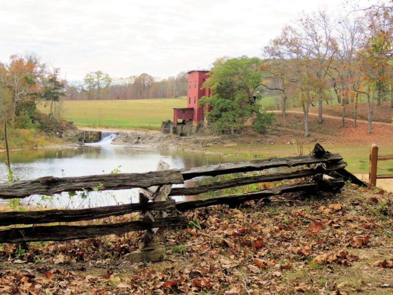
Photo: John Foehner, CC BY 2.0
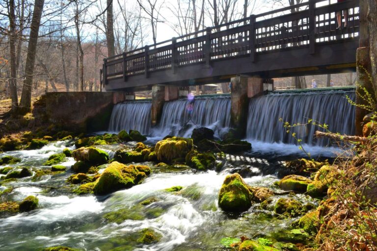
Photo: Kbh3rd, CC BY 3.0

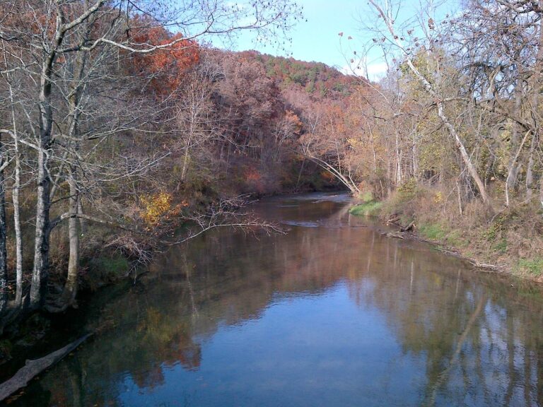
Photo: mostateparks, Public domain
Hunting in Crawford County
Public hunting land, seasons and processors for Crawford County are on State Hunting Spots, our sister site.
Questions that come up about water in Crawford County
Which Crawford County ramps take a trailer?
The MDC and Corps lists hold 11 public ramps; 0 are accessible.
Which lake in Crawford County tops the acreage list?
No lake page sits inside; Scioto Lake, 14 miles away, is the closest.
Which fish should a Crawford County visitor plan to chase?
Channel catfish lead the count of lake pages within 50 miles that MDC reports name, followed by crappie, largemouth bass and redear sunfish.
Can a visitor buy live bait inside Crawford County?
The Lakeshore Marina heads a list of 1.
Do any guides run trips from a Crawford County address?
No guide listing carries a local address.
Which town serves as seat for Crawford County?
It is Steelville.
Is a single MDC permit enough for Crawford County?
Between ages 16 and 64 a Missouri angler needs a fishing permit, $14 a year for residents and $57 for nonresidents, or $9 for a daily permit. A trout permit, $12 for residents, is needed to possess trout.
Which county page lies closest to Crawford County?
Closest by centre point: Washington County, Phelps County and Dent County.
Which MDC region handles Crawford County?
MDC counts it as part of the MDC St. Louis Region.
Which MDC special rules apply in Crawford County?
The 2026 booklet prints 17 special-regulation bullets naming this area, starting with Blue Springs Creek; the table above shows each.
Which Crawford County streams or lakes get trout?
Blue Springs Creek and Meramec River; MDC trout rules for each are on the linked pages.
Plan a Show-Me day on Crawford County water
Lake pages carry ramps, docks and MDC prospects.