East Cote Blanche Bay Fishing
A bay of the Louisiana coast in Iberia Parish, inside the LDWF saltwater line.
 Pick for redfishPiscifun Alloy S inshore spinning reelCheck price at Piscifun
Photo of Atchafalaya Bay: NOAA Restoration Center, Erik Zobrist, Public domain
What the gazetteer and LDWF record about East Cote Blanche Bay
East Cote Blanche Bay, a bay, sits in Iberia Parish on the USGS names map. It falls on the salt side of the LDWF line, where saltwater rules apply. The closest Census place is Franklin, roughly 17 miles away.
Boaters reach it from 1 launch. LDWF maps 1 pier or bank site for fishing from land. Offshore and inshore crews have built 6 reef sites within 25 miles. There are 2 water-level stations in range. The gazetteer maps 1 named pass close by.
USGS Geographic Names Information System (feature class and point), LDWF saltwater line, LDWF launch and Banks and Piers layers; retrieved October 28, 2026.
Where boats go in for East Cote Blanche Bay
- Burns Point Recreational Area on East Cote Blanche Bay2-lane concrete ramp, public, fee, Public; $1 fee
Nearby launches when East Cote Blanche Bay is busy
- Cabot Boat Launch on Atchafalaya BasinAtchafalaya Basin, 13 miles northeast
- Big D's Boat Launch on West Cote Blanche BayWest Cote Blanche Bay, 16 miles northwest
- St. Mary Seafood and Marina on West Cote Blanche BayWest Cote Blanche Bay, 16 miles northwest
- Quintana Public Launch on West Cote Blanche BayWest Cote Blanche Bay, 17 miles northwest
- Fairfax Foster Bailey Boat Launch on Franklin CanalFranklin Canal, 17 miles northeast
- Cypremort Point State Park on Vermilion BayVermilion Bay, 18 miles northwest
LDWF boat launch inventory (saltwater, brackish and freshwater launches), retrieved October 28, 2026.
Fishing East Cote Blanche Bay on foot
- Burns Point Recreation Area on East Cote Blanche Baybank fishing, salt or brackish, Bank access to East Cote Blanche Bay, restrooms, 24-hour access – 337-836-9784
Shore fishing a short drive from East Cote Blanche Bay
- Cypremort Point State Park on Vermilion Bayfishing pier, salt or brackish, 17 miles
LDWF Banks and Piers layer, retrieved October 28, 2026.
Where LDWF built reefs by East Cote Blanche Bay
Near East Cote Blanche Bay: 6 reef program sites, 3 inshore.
| Reef | Program | Depth | Size | Distance |
|---|---|---|---|---|
| Rabbit Island Reef | inshore | 10-ft | 50 acres | 6 miles southeast |
| Rabbit Island Pass Reef | nearshore | 4-ft | 4 acres | 10 miles south |
| Nickel Reef | nearshore | 7-ft | 4 acres | 11 miles south |
| Cypremort Point Reef | inshore | 6-ft | 1 acres | 18 miles northwest |
| Cypremort Point II Reef | inshore | 7-ft | 40 acres | 19 miles northwest |
| Eugene Island 51 Reef | nearshore | 22 miles south |
LDWF Artificial Reef Program saltwater reef layer and site PDFs (depth and acres as printed), retrieved October 28, 2026.
Tide and water level at East Cote Blanche Bay
NOAA CO-OPS water level, preliminary reading at retrieval (October 28, 2026); station page for live data.
- Point Chevreuiltide predictions, 6 miles
- South Point, Marsh Islandtide predictions, 9 miles
- Rabbit Island, 5 miles south oftide predictions, 10 miles
- Cote Blanche Island, West Cote Blanche Baytide predictions, 13 miles
On East Cote Blanche Bay a north wind can drain the flats; watch the gauge, not just the tide table.
NOAA CO-OPS water level and tide prediction stations within 25 and 15 miles, retrieved October 28, 2026.
Where current runs near East Cote Blanche Bay
- East Pass4 miles west
USGS GNIS passes and guts within 12 miles; retrieved October 28, 2026.
Harbour towns near East Cote Blanche Bay
- Cypremort PointSt. Mary Parish, 18 miles
USGS GNIS coastal towns and fishing ports within 20 miles; retrieved October 28, 2026.
Legal keepers on East Cote Blanche Bay
| Species | Daily limit and size | Season |
|---|---|---|
| Cobia (ling or lemonfish) | 1 daily per person; no more than 2 per vessel; 36" min fork length | Open year-round in state waters |
| Black drum | 5 daily per person – bag and possession; no more than one over 27" max total length; 16" min total length; 27" max total length | Open year-round in state waters |
| Red drum (redfish) | 4 daily per person – bag; none over 27" max total length; 18" min total length; 27" max total length | Open year-round in state waters |
| Southern flounder | 10 daily per person | Open year-round except no possession allowed from Oct. 15 – Nov. 30 |
| Spanish mackerel | 15 daily per person; 12" min fork length | Open year-round in state waters |
| Striped mullet | 100 lbs. daily | Open year-round in state waters |
| Spotted seatrout (speckled trout) | 15 daily per person with no more than 2 over 20" max total length; 13" min total length; 20" max total length | Open year-round in state waters |
| Sheepshead | No daily limit | Open year-round in state waters |
| Tripletail | 5 daily per person; 18" min total length | Open year-round in state waters |
| Black bass (largemouth and spotted) | 10 daily | Open year-round |
| Striped or hybrid striped bass (or any combination thereof) | 5 daily; no more than two over 30" total length | Open year-round |
| White bass | 50 daily | Open year-round |
| Yellow bass | 50 daily | Open year-round |
| Sunfish (bream) | No daily limit | Open year-round |
| Crappie (black and white) | 50 daily; 100 fish possession limit | Open year-round |
| Bowfin (choupique) | No daily limit; 16" MLL | Open year-round |
The table puts the inshore rules for East Cote Blanche Bay on top and freshwater rows below.
South of the LDWF saltwater line an angler 18 or older carries a Basic Fishing License plus a Saltwater License: $17 and $15 for residents, $68 and $60 for nonresidents.
Limits and seasons as printed in the 2026 Louisiana Recreational Fishing Regulations (LDWF pamphlet, updated September 21, 2026), page 19 (pamphlet PDF); confirmed on the LDWF saltwater finfish page October 28, 2026.
 For the redfish herePiscifun NautiX saltwater spinning reel14% OFFSale $94.99
Neighbouring bays measured against East Cote Blanche Bay
For more launch choices, West Cote Blanche Bay offers 4 in the LDWF inventory.
| Water | Distance | Type | Launches | Piers and banks | Reefs within 25 mi | NOAA stations |
|---|---|---|---|---|---|---|
| East Cote Blanche Bay | bay | 1 | 1 | 6 | 2 | |
| West Cote Blanche Bay | 10 miles northwest | bay | 4 | 0 | 7 | 0 |
| Vermilion Bay | 23 miles northwest | bay | 3 | 1 | 4 | 1 |
| Atchafalaya Bay | 25 miles southeast | bay | 0 | 0 | 3 | 3 |
| Fourleague Bay | 32 miles southeast | bay | 0 | 0 | 1 | 3 |
| Lake Mechant | 44 miles southeast | coastal lake | 1 | 0 | 4 | 1 |
LDWF launch, Banks and Piers and reef layers, NOAA CO-OPS stations, USGS GNIS; retrieved October 28, 2026.
The country behind East Cote Blanche Bay
Neighbouring lakes to East Cote Blanche Bay
- Lake Verret, Grassy Lake and Lake Palourde32 miles
- Fausse Point, Dauterive and Catahoula Complex36 miles
- Spanish Lake37 miles
- Atchafalaya Basin47 miles
Bayous and rivers feeding toward East Cote Blanche Bay
- Franklin Canal17 miles
- Hayes Coulee29 miles
Bait and ice near East Cote Blanche Bay
- Atchafalaya Baits Manufacturerbait and tackle shop, Patterson, 23 miles
- Uncle Danny's Huntin 'n' Fishinbait and tackle shop, New Iberia, 26 miles
- Al Has Baitbait and tackle shop, Berwick, 27 miles
- Ivys Tackle Boxbait and tackle shop, Morgan City, 29 miles
- Chase's Fishing & Hunting Suppliesbait and tackle shop, Lydia
- Iberia Marinemarina, New Iberia
Booked trips to East Cote Blanche Bay
- Bayou Bowfishing Charters & Airboat Servicescharter, New Iberia, (504) 234-7436
- Romero Fishing and Rentalcharter, New Iberia, (337) 367-8344
Louisiana overnight bases for East Cote Blanche Bay
- Franklin17 miles
- Baldwin20 miles
- Patterson22 miles
- Bayou Vista24 miles
Parish pages that list East Cote Blanche Bay
- Iberia Parishseat: New Iberia
Reels and line from Piscifun ahead of East Cote Blanche Bay


Piscifun and Amazon links are affiliate links; the site earns a commission on qualifying purchases.
Fish to recognise before a trip to East Cote Blanche Bay
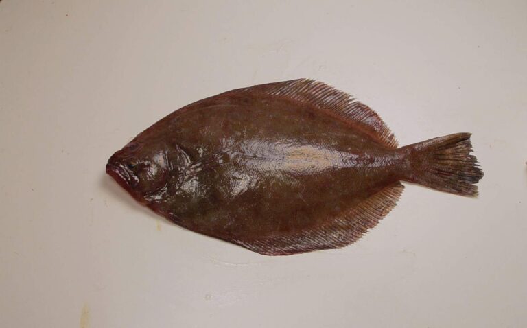
Photo: SEFSC Pascagoula Laboratory; Collection of Brandi Noble, NOAA/NMFS/SEFSC, Public domain

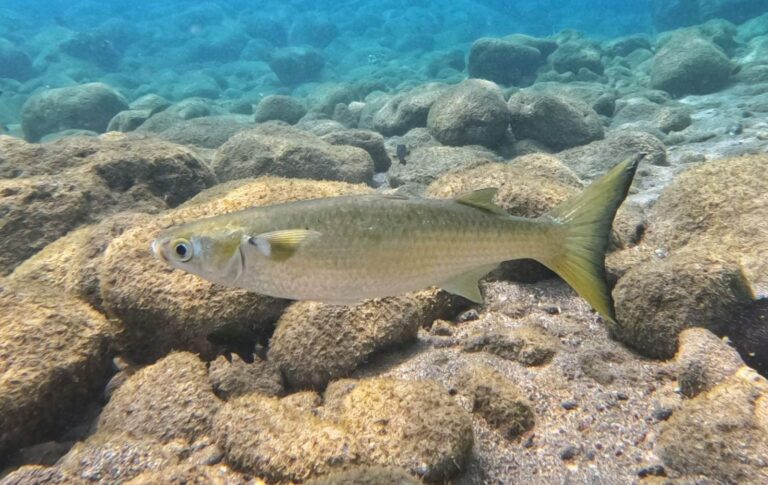
Photo: albertoalcala, CC BY 4.0

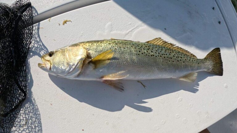
Photo: Rennair, CC BY-SA 4.0

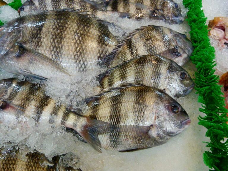
Photo: Rusty Clark ~ 100K Photos, CC BY 2.0
What first-timers on East Cote Blanche Bay want to know
Which parish holds East Cote Blanche Bay?
The gazetteer point is in Iberia Parish, about 17 miles from Franklin.
Do I need a saltwater license for East Cote Blanche Bay?
South of the LDWF saltwater line an angler 18 or older carries a Basic Fishing License plus a Saltwater License: $17 and $15 for residents, $68 and $60 for nonresidents.
Where do bay boats put in for East Cote Blanche Bay?
LDWF lists 1 launch, Burns Point Recreational Area on East Cote Blanche Bay among them.
Which creel limits cover East Cote Blanche Bay?
Cobia (ling or lemonfish): 1 daily per person; no more than 2 per vessel; 36" min fork length; Open year-round in state waters.
How many reefs lie near East Cote Blanche Bay?
Rabbit Island Reef is nearest of 6 sites.
How high is the water on East Cote Blanche Bay?
Use LAWMA, Amerada Pass, shown in the tide band.
Does LDWF map a pier on East Cote Blanche Bay?
1 pier or bank site on the LDWF list; Burns Point Recreation Area on East Cote Blanche Bay is one of them.
Where can I pick up shiners near East Cote Blanche Bay?
Closest on our Louisiana list: Atchafalaya Baits Manufacturer, about 23 miles away.
Which cuts are near East Cote Blanche Bay?
Within 12 miles: East Pass.
Put East Cote Blanche Bay on the inshore list
Check the wind and tide, then pick the launch nearest your target.