Ketchikan Saltwater Fishing
An ADF&G saltwater fishing area in Ketchikan Gateway Borough.
 Pick for salmonPiscifun Viper X spinning reel50% OFFSale $39.99
Photo of Ketchikan: Larry Koester, CC BY 2.0
Sizing up Ketchikan before the Alaska drive
Ketchikan is an ADF&G management area with 6 goFishAK marine points and 46 atlas areas recorded on the coast. It spans Ketchikan Gateway Borough. ADF&G lists it in its Southeast region.
The rows here are published names from a draft agency layer and a 1989 atlas, and they make no catch claim.
Description, access and tackle text as published in the ADF&G goFishAK Sport Fishing Opportunities and Access layer (ADF&G titles it a draft), read November 14, 2026.
goFishAK saltwater points in Ketchikan
| Point as published | Species text as published | Access type as published | Borough or census area |
|---|---|---|---|
| North Point Higgins | Pink salmon, coho salmon | roadside, marine shore | Ketchikan Gateway Borough |
| Thomas Basin | King salmon, pink salmon, chum salmon, coho salmon | roadside | Ketchikan Gateway Borough |
| Herring Cove | King salmon, coho salmon | roadside, marine boat, marine shore | Ketchikan Gateway Borough |
| Coast Guard Beach | Pink salmon, coho salmon | walk-in | Ketchikan Gateway Borough |
| Mountain Point Shoreline | Pink salmon, coho salmon | marine shore | Ketchikan Gateway Borough |
| Southend Marine Salmon Fishery | King salmon, coho salmon, pink salmon, chum salmon | marine boat | Ketchikan Gateway Borough |
North Point Higgins
Directions text, quoted: Approximately 15 road miles north of Ketchikan at the end of North Pt Higgins Road. Tackle text as printed: Anglers commonly use spinners, spoons, herring, cured eggs, and flies for salmon.
Thomas Basin
Very popular urban fishing for salmon returning to Ketchikan Creek.
The route note says: Located in downtown Ketchikan seaward of the Steadman Street Bridge.
Herring Cove
Very popular fishing location for enhanced king and coho salmon.
The route note says: Located at approximately mile 8 S.Tongass Highway.
Coast Guard Beach
Access text as printed: Approximately 15 road miles north of Ketchikan at the end of N. Tackle note, as published: Anglers commonly use spinners, spoons, herring, cured eggs, and flies for salmon.
Mountain Point Shoreline
Mountain Point is a popular spot for anglers to cast for salmon from the shoreline.
Access text as printed: Located ~5.5 miles south of Ketchikan along the S. Tackle note, as published: Anglers commonly use spinners, spoons, herring, cured eggs, and flies for salmon.
Southend Marine Salmon Fishery
South of Ketchikan there are numerous popular drags for king, coho, pink, and chum salmon including Mountain Point, Herring Cove, Cone Island, Alava Point, and Nicholas Pass.
Getting there, as published: Approximately 0.5 – 20 miles by boat from Ketchikan. On tackle the layer says: For salmon the most effective technique is trolling.
Across Ketchikan the layer text mentions coho salmon, pink salmon, king salmon and chum salmon.
Many 2026 king salmon rows say the fishery was closed in 2026 by emergency order; the text is as printed, so check the current emergency orders.
Description, access and tackle text as published in the ADF&G goFishAK Sport Fishing Opportunities and Access layer (ADF&G titles it a draft), read November 14, 2026.
 For the salmon herePiscifun AlumiX spinning reel46% OFFSale $64.99
Salmon Holes and Halibut Hills areas in Ketchikan
The ADF&G Southeast atlas names 46 rows in Ketchikan; each row is a map area with a salmon or halibut label, not a launch or an access point.
| Atlas area | Atlas map area | Atlas label | Borough or census area |
|---|---|---|---|
| Grant Cove-Vallenar Bay-Vallenar Pt. | Gravina Island-Clarence Strait-Behm Canal | Salmon | Ketchikan Gateway Borough |
| Vallenar Bay | Gravina Island-Clarence Strait-Behm Canal | Halibut | Ketchikan Gateway Borough |
| Ship Is.-Niblack/Caamano Pt.-Bond Bay | Cleveland Peninsula-Clarence Strait-Behm Canal | Salmon | Ketchikan Gateway Borough |
| Bond Bay-Helm Bay | Clarence Strait-Behm Canal | Salmon | Ketchikan Gateway Borough |
| Helm Bay-Helm Pt.-Port Stewart | Clarence Strait-Behm Canal | Salmon | Ketchikan Gateway Borough |
| Clover Passage-Grant Is.-Betton Island | Clarence Strait-Behm Canal | Salmon | Ketchikan Gateway Borough |
| Helm Bay-Helm Point-Forss Island | Clarence Strait-Behm Canal | Halibut | Ketchikan Gateway Borough |
| Snail Pt-Spacious Bay | Behm Canal | Salmon | Ketchikan Gateway Borough |
| Dall Head-Bronaugh Is.-Nichols Passage | Clarence Strait-Nichols Passage | Salmon | Ketchikan Gateway Borough |
| Bostwick Pt.-Blank Pt.-Blank Inlet | Clarence Strait-Nichols Passage | Salmon | Ketchikan Gateway Borough |
| Tongass Narrows-Mountain Pt. | Nichols Passage-Tongass Narrows | Salmon | Ketchikan Gateway Borough |
| Mountain Pt.-Cutter Rocks-Herring Bay | Nichols Passage-Revillagigdeo Channel | Salmon | Ketchikan Gateway Borough |
| California Head-Carroll Inlet | George Inlet-Carroll Inlet | Salmon | Ketchikan Gateway Borough |
| Revillagigedo Channel-Carroll Pt. | Revillagigedo Channel-Carroll Inlet | Salmon | Ketchikan Gateway Borough |
| Rock Pt.-Carroll Inlet | Carroll Inlet | Salmon | Ketchikan Gateway Borough |
| Washington Monument Rock-Cone Is. | Revillagigedo Channel-Thorne Arm | Salmon | Ketchikan Gateway Borough |
| Lucky Cove-Pt. Alava | Revillagigedo Channel | Salmon | Ketchikan Gateway Borough |
| Pt. Alava-Revillagigdeo Channel | Revillagigdeo Channel-Behm Canal | Halibut | Ketchikan Gateway Borough |
| Alava Bay-Behm Canal | Revillagigdeo Channel-Behm Canal | Halibut | Ketchikan Gateway Borough |
| Behm Canal | Behm Canal | Halibut | Ketchikan Gateway Borough |
| Pt. Skykes-Skyes Cove-Behm Canal | Revillagigedo Channel-Behm Canal | Salmon | Ketchikan Gateway Borough |
| Black Is.-Slate Is.-Quadra Pt. | Revillagigedo Channel | Salmon | Ketchikan Gateway Borough |
| Kah Shakes Pt.-Revillagigedo Channel | Revillagigedo Channel | Salmon | Ketchikan Gateway Borough |
| Kah Shakes Pt.-White Reef-Snail Rk | Revillagigedo Channel | Halibut | Ketchikan Gateway Borough |
| Foggy Bay-DeLong Is. | Revillagigedo Channel | Halibut | Ketchikan Gateway Borough |
| Foggy Pt.-Laketa Pt.-Cape Fox | Revillagigedo Channel | Salmon | Ketchikan Gateway Borough |
| Duke Pt.-Revillagigedo Channel | Revillagigedo Channel-Dixon Entrance | Salmon | Ketchikan Gateway Borough |
| Kelp Is.-East Is.-Duke Island | Revillagigedo Channel-Dixon Entrance | Salmon | Ketchikan Gateway Borough |
| Club Rocks-Duke Island | Dixon Entrance-Clarence Strait | Salmon | Ketchikan Gateway Borough |
| West Rock-Duke Island | Dixon Entrance-Clarence Strait | Salmon | Ketchikan Gateway Borough |
| Hassler Reef-Duke Island | Dixon Entrance-Clarence Strait | Salmon | Ketchikan Gateway Borough |
| Sealing Reef-Pt. Percy | Clarence Strait-Dixon Entrance | Salmon | Ketchikan Gateway Borough |
| Ward Cove-Tongass Narrows | Ward Cove-Revillagigedo Is. | Salmon | Ketchikan Gateway Borough |
| Betton Is.-Back Is.-Naha Bay | Naha Bay-Behm Canal-Revillagigedo Is. | Halibut | Ketchikan Gateway Borough |
| Bushy Pt. Cove-Bushy Pt.-Behm Canal | Behm Canal-Revillagigedo Is. | Salmon | Ketchikan Gateway Borough |
| Chin Pt.-Nose Pt.-Brow Pt.-Behm Canal | Behm Canal-Revillagigedo Is. | Salmon | Ketchikan Gateway Borough |
| Gedney Is.-Behm Canal | Behm Canal-Revillagigedo Is. | Salmon | Ketchikan Gateway Borough |
| Hassler Is.-Black Is.-Behm Canal | Behm Canal Revillagigedo Is. | Salmon | Ketchikan Gateway Borough |
| Dress Pt.-Hassler Pass | Hassler Pass-Behm Canal-Revillagigedo Is. | Salmon | Ketchikan Gateway Borough |
| Curlew Pt.-Behm Narrows | Behm Narrows-Bell Is.-Revillagigedo Is. | Salmon | Ketchikan Gateway Borough |
| Curlew Pt.-Behm Narrows | Behm Narrows-Bell Is.-Revillagigedo Is. | Halibut | Ketchikan Gateway Borough |
| Syble Pt-Yes Bay-Behm Canal | Yes Bay-Behm Canal-Cleveland Peninsula | Salmon | Ketchikan Gateway Borough |
| Spacious Bay-Behm Canal | Spacious Bay-Behm Canal-Cleveland Peninsula | Salmon | Ketchikan Gateway Borough |
| Princess Bay-Behm Canal | Princes Bay-Behm Canal-Revillagigedo Is. | Halibut | Ketchikan Gateway Borough |
| Short Pass-Smeaton Is.-Behm Canal | Short Pass-Behm Canal | Halibut | Ketchikan Gateway Borough |
| Gravina Pt.-Blank Inlet-Nichols Passage | Blank Inlet-Nichols Passage-Gravina Is. | Salmon | Ketchikan Gateway Borough |
Names and labels from Salmon Holes and Halibut Hills, an ADF&G sport fishing atlas of southeast Alaska (1989), read November 14, 2026.
Saltwater rules that cover Ketchikan
This page leaves limits to the booklet for Ketchikan and to the emergency orders.
Rules and fees are the 2026 edition: ADF&G prints "Effective until the 2027 summary is issued" on every 2026 booklet, and no 2027 booklet exists. Emergency orders supersede the booklet. Emergency orders supersede the printed regulations, so check the ADF&G emergency order page before fishing.
A resident annual sport fishing license is $20 and a nonresident annual license $100.
Rules as printed in the 2026 ADF&G Sport Fishing Regulations Summary (booklet). Effective until the 2027 summary is issued; emergency orders supersede the booklet (ADF&G emergency orders). Read November 14, 2026.
A short stretch past Ketchikan, Alaska
Alaska ramps a short tow past Ketchikan
- Mountain Point Boat Launch5 miles
- Bar Harbor Launch Ramp7 miles
- Knudson Cove Boat Launch13 miles
- Hollis Launch Ramp45 miles
- Hydaburg Launch Ramp53 miles
- Klawock Launch Ramp64 miles
Angler access sites by Ketchikan
- Silvis Lakes Trail2 miles
- Hole-In-The-Wall Harbor3 miles
- Thomas Basin Harbor5 miles
- Bar Harbor7 miles
- Carlanna Lake Trail7 miles
Tackle counters on the road to Ketchikan, Alaska
- Ketchikan Hole in the Wall Harbormarina, Ketchikan, 3 miles
- Ketchikan Thomas Basin Boat Harbormarina, Ketchikan, 5 miles
- Ketchikan Bar Harbor Southmarina, Ketchikan, 7 miles
- Air Marine Harbormarina, Ketchikan, 10 miles
- Refuge Cove Marinamarina, Ketchikan, 10 miles
- Knudson Cove Marinamarina, Ketchikan, 13 miles
Alaska guide businesses close to Ketchikan
- AAA Sportfishing Co.charter, Ketchikan, (907) 617-9585
- Alaska King Fishing Chartercharter, Ketchikan, (907) 821-3399
- Alaska Sportfishing Adventures, LLCcharter, Ketchikan, (907) 723-4811
- Alaska Wilderness Charterscharter, Ketchikan, (907) 247-4868
- Alie-Bob Charterscharter, Ketchikan, (907) 225-8511
- Aurora Sportfishingcharter, Ketchikan, (907) 617-3474
- Campbell's Fishing Charterscharter, Ketchikan, (907) 247-2315
- Carsons Catch Custom Charterscharter, Ketchikan, (907) 254-7675
Finding a bunk close to Ketchikan, Alaska
- Ketchikan6 miles
- Wrangell60 miles
- Craig63 miles
- Petersburg110 miles
Alaska borough and census-area write-ups naming Ketchikan
- Ketchikan Gateway Boroughborough seat: Ketchikan
Piscifun gear an angler could bring north to Ketchikan


Piscifun and Amazon links are affiliate links; the site earns a commission on qualifying purchases.
Early light on the water near Ketchikan, northern style
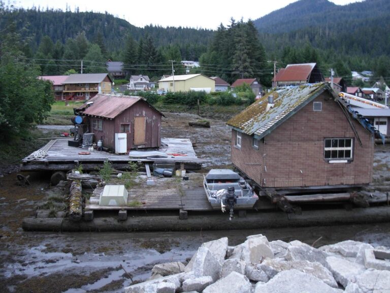
Photo: brewbooks, CC BY-SA 2.0
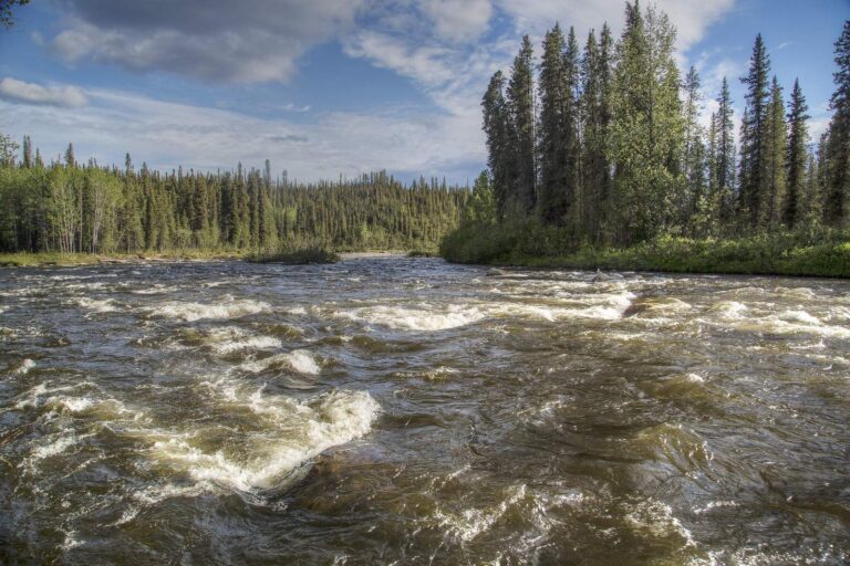
Photo: Bureau of Land Management, CC BY 2.0
The usual puzzlers about Ketchikan, Alaska
Which waters does Ketchikan cover?
The agency draws it as an area; its saltwater data fall in Ketchikan Gateway Borough.
Which named places are listed for Ketchikan?
The draft layer holds 6 marine points, such as North Point Higgins.
How should I read the atlas rows for Ketchikan?
They are labeled areas on a printed 1989 atlas, so a row does not mean a ramp or a shore site.
Which fish are named in Ketchikan?
Across the points the names are coho salmon, pink salmon, king salmon and chum salmon.
What bag limits apply in Ketchikan?
The booklet for the area holds the rules; emergency orders change them.
Which Alaska paperwork should I carry for Ketchikan?
A resident annual sport fishing license is $20 and a nonresident annual license $100. See the license and regulations page for each type.
Does Ketchikan have launch ramps nearby?
ADF&G launch pages near it include Mountain Point Boat Launch, Bar Harbor Launch Ramp and Knudson Cove Boat Launch.
Where do people buy supplies for Ketchikan?
Ketchikan Hole in the Wall Harbor, about 3 miles away tops the list.
Is king salmon fishing open in Ketchikan?
Read the ADF&G emergency orders; king salmon rules change by order.
Pack rain gear for Ketchikan
License prices and the 2026 booklet notes are on the Alaska license page.