Fishing in Hoonah-Angoon Census Area, Alaska
Administrative center: Hoonah. Census 2020 residents: 2,365.
- 1lake pages
- 4ramps
- 27river pages
 Pick for salmonPiscifun Viper X spinning reel50% OFFSale $39.99
Photo of Chilkoot River: mike, CC BY-SA 2.0
First things to know about fishing Alaska's Hoonah-Angoon Census Area
A headcount of 2,365 in 2020 makes up Hoonah-Angoon Census Area, with Hoonah as the administrative center. As a census area it is counted by the Bureau but has no assembly. Within its boundary the Census counts 6,560 square miles of land and 3,013 square miles of water. This site writes up 1 lake here, and Florence Lake is the largest by size. The river pages of Hoonah-Angoon Census Area cover *Kahtaheena River, Salmon River and *Berg River.
The access layers hold 4 ramps in Hoonah-Angoon Census Area, plus 5 other fishing sites harbor or trail sites. For salt water, this site has 2 area pages tied to Hoonah-Angoon Census Area. Special regulation lines apply to 3 waters here.
Population from the 2020 Census (TIGERweb), places and boroughs from the Census 2023 Gazetteer, read November 14, 2026. Launch or access details as published in the ADF&G goFishAK layer (ADF&G titles it a draft), read November 14, 2026.
 For the salmon herePiscifun AlumiX spinning reel46% OFFSale $64.99
A frontier water map of Hoonah-Angoon Census Area
Launch or access details as published in the ADF&G goFishAK layer (ADF&G titles it a draft), read November 14, 2026. Lake pins are the ADF&G reference point for each lake.
Alaska lake pages for Hoonah-Angoon Census Area
| Lake | Size | Access sites | ADF&G lists |
|---|---|---|---|
| Florence Lake | about 874 acres of mapped outline | 0 | cutthroat trout, rainbow trout, Dolly Varden |
Beyond Hoonah-Angoon Census Area sit more lakes; miles run from Hoonah.
| Lake | From Hoonah | Size | Access sites | ADF&G lists |
|---|---|---|---|---|
| Fish Creek Pond | 34 miles northeast | no size printed | 0 | Dolly Varden, cutthroat trout, steelhead trout |
| Auke Lake | 34 miles northeast | about 178 acres of mapped outline | 0 | cutthroat trout, pink salmon, silver salmon |
| Windfall Lake Outlet Stream | 37 miles northeast | no size printed | 0 | Dolly Varden, cutthroat trout, steelhead trout |
| Moose Lake | 37 miles northeast | no size printed | 0 | cutthroat trout, Dolly Varden |
| Dredge Lake | 37 miles northeast | no size printed | 0 | Dolly Varden, cutthroat trout, silver salmon |
| Windfall Lake | 37 miles northeast | about 109 acres of mapped outline | 0 | Dolly Varden, cutthroat trout, silver salmon |
Acres as the ADF&G lake layer lists them, read November 14, 2026. Lakes with no ADF&G acreage print their USGS mapped outline instead. Record from the ADF&G Sport Fish Lakes Database (SF_Lakes), read November 14, 2026.
Counting ADF&G species lists near Hoonah-Angoon Census Area
Summing ADF&G lists for lakes within 80 miles of Hoonah, cutthroat trout comes first.
ADF&G species lists, counted per lake page within 80 miles; presence in a layer, not a catch survey. Record from the ADF&G Sport Fish Lakes Database (SF_Lakes), read November 14, 2026.
Alaska rivers to wade in Hoonah-Angoon Census Area
- *Kahtaheena River2 USGS gauges
- Salmon River1 USGS gauge
- *Berg RiverAWC stream record
- *Carolus RiverAWC stream record
- *East Kahtaheena RiverAWC stream record
- *East Mole RiverAWC stream record
- *Good RiverAWC stream record
- Bartlett RivergoFishAK entry
- Beartrack RiverAWC stream record
- Dixon RiverAWC stream record
- Dundas RiverAWC stream record
- Excursion RiverAWC stream record
- Game CreekgoFishAK entry
- Indian RiverAWC stream record
- Kennel CreekgoFishAK entry
- King Salmon RiverAWC stream record
- Lisianski RiverAWC stream record
- Mole RiverAWC stream record
- Mud Bay RiverAWC stream record
- Neka RiverAWC stream record
- Pavlof RiverAWC stream record
- Saltery RiverAWC stream record
- Spasski CreekgoFishAK entry
- Stag RiverAWC stream record
- Steelhead Riverregulation heading
- Stranger RiverAWC stream record
- Trail Riverregulation heading
USGS gauges reporting across Hoonah-Angoon Census Area
| USGS gauge | Latest reading | Time (ET) |
|---|---|---|
| Salmon R At Gustavus Ak | 127 cfs, 9.71 ft gage height | Nov 14 9:00 pm |
| Kahtaheena R Ab Upper Falls Nr Gustavus Ak | 179 cfs | Oct 1 3:45 am Not updated since Oct 1, 2004. |
| Kahtaheena R Nr Gustavus Ak | 8 cfs | Apr 3 3:45 am Not updated since Apr 3, 2001. |
US Geological Survey provisional data, retrieved Nov 16, 2026 12:33 pm ET. Provisional readings can be revised.
Stream record from the ADF&G Anadromous Waters Catalog (2026 layer), read November 14, 2026. A catalog entry is a use record, not a fishing-quality claim. Streamflow and level from USGS National Water Information System; many Alaska gauges report only in the open-water season.
Saltwater ADF&G management areas tied to Hoonah-Angoon Census Area
- Juneau-Glacier BayADF&G management area
- SitkaADF&G management area
Record from the ADF&G Sport Fish Lakes Database (SF_Lakes), read November 14, 2026.
Alaska trailer launches around Hoonah-Angoon Census Area
- Angoon Boat Launchlaunch ramp; Hoonah-Angoon Census Area
- Freshwater Bay Boat Launchlaunch ramp; Hoonah-Angoon Census Area
- Hoonah Boat Launch/Harborlaunch ramp; Hoonah-Angoon Census Area
- Salmon River Boat Launchlaunch ramp; Hoonah-Angoon Census Area
ADF&G fishing access sites in Hoonah-Angoon Census Area
- Angoon Harborharbor; Hoonah-Angoon Census Area
- Bohemia Basin Dock/Floatharbor; Hoonah-Angoon Census Area
- Elfin Cove Inner Harborharbor; Hoonah-Angoon Census Area
- Hoonah Harborharbor; Hoonah-Angoon Census Area
- Tenakee Springs Harborharbor; Hoonah-Angoon Census Area
Launch or access details as published in the ADF&G goFishAK layer (ADF&G titles it a draft), read November 14, 2026.
Named lakes on the Alaska map of Hoonah-Angoon Census Area
- Thayer Lakeabout 2,849 acres of mapped outline
- Crillon Lakeabout 1,289 acres of mapped outline
- Lake Elfendahlabout 890 acres of mapped outline
- Distin Lakeabout 799 acres of mapped outline
- North Deception Lakeabout 794 acres of mapped outline
- Davidson Lakeabout 619 acres of mapped outline
- Abyss Lakeabout 576 acres of mapped outline
- North Trick Lakeabout 553 acres of mapped outline
- Lake Kathleenabout 456 acres of mapped outline
- Surge Lakeabout 433 acres of mapped outline
- Lake Guerinabout 413 acres of mapped outline
- Lake Alexanderabout 400 acres of mapped outline
- South Deception Lakeabout 352 acres of mapped outline
- Wood Lakeabout 343 acres of mapped outline
- McKinney Lakeabout 319 acres of mapped outline
- Lake Morrisabout 300 acres of mapped outline
- Jims Lakeabout 299 acres of mapped outline
- Icefall Lakeabout 292 acres of mapped outline
- Kanalku Lakeabout 251 acres of mapped outline
- Eliza Lakeabout 224 acres of mapped outline
- Fresh Water Lakeabout 208 acres of mapped outline
- Peanut Lakeabout 190 acres of mapped outline
- Slide Lakeabout 178 acres of mapped outline
- Beaver Lakeabout 178 acres of mapped outline
- Bartlett Lakeabout 165 acres of mapped outline
- Lake Seclusionabout 156 acres of mapped outline
- Fish Lakeabout 156 acres of mapped outline
- Goose Lakeabout 135 acres of mapped outline
- Hoktaheen Lakeabout 121 acres of mapped outline
- Pleasant Bay Lakeabout 119 acres of mapped outline
- Takanis Lakeabout 100 acres of mapped outline
- Pavlof Lakeabout 100 acres of mapped outline
- Sikady Lakeabout 91 acres of mapped outline
- Vivid Lakeabout 76 acres of mapped outline
- Otter Lakeabout 66 acres of mapped outline
- South Trick Lakeabout 53 acres of mapped outline
- Coo Lakeabout 43 acres of mapped outline
- Pine Lakeabout 30 acres of mapped outline
- Islet Lakeabout 29 acres of mapped outline
- Pybus Lakeabout 29 acres of mapped outline
Mapped outline area computed from the USGS National Hydrography Dataset waterbody polygon, read November 14, 2026: outline area is not a surface-acre figure from ADF&G. Names come from ADF&G lake lists and the USGS names layer; no page and no fish list for these lakes.
Regulation headings in the booklets that touch Hoonah-Angoon Census Area waters
Rules and fees are the 2026 edition: ADF&G prints "Effective until the 2027 summary is issued" on every 2026 booklet, and no 2027 booklet exists. Emergency orders supersede the booklet.
- Florence LakeFLORENCE LAKE (Admiralty Island), Juneau-Glacier Bay Area: Bait is allowed year-round.
- Steelhead RiverSTEELHEAD CREEK, Ketchikan Area: Only unbaited, artificial lures or flies may be used year-round. The use of bait is prohibited.
- Trail RiverTRAIL LAKE, Kenai River: Open year-round to sport fishing for species other than salmon.
Rules as printed in the 2026 ADF&G Sport Fishing Regulations Summary (booklet). Effective until the 2027 summary is issued; emergency orders supersede the booklet (ADF&G emergency orders). Read November 14, 2026.
Where Alaska anglers in Hoonah-Angoon Census Area shop
Tackle counters on the road to Hoonah-Angoon Census Area, Alaska
- Angoon Small Boat Harbormarina, Angoon
- Hoonah Small Boat Harbormarina, Hoonah
- Pelican Small Boat Harbormarina, Pelican
- Tenakee Springs Harbormarina, Tenakee Springs
Alaska guide businesses close to Hoonah-Angoon Census Area
- Campbell Custom Fly Fishingfly fishing guide, Hoonah, (907) 321-8004
- Eagle Charters & Lodgescharter, Elfin Cove, (907) 239-2259
- Fishing Bear Charterscharter, Tenakee Springs, (907) 736-2350
- Glacier Bay Sportfishingcharter, Gustavus, (800) 445-2112
- Glacier Bay Tours & Charterscharter, Gustavus, (907) 697-2255
Yellow Pages, chamber and DOT&PF harbor listings (city of business), read November 14, 2026. Guides are listed as businesses; no licence or registration status is implied.
A short stretch past Hoonah-Angoon Census Area, Alaska
Across the Alaska borough line from Hoonah-Angoon Census Area
- Haines Borough49 miles north
- Juneau City and Borough62 miles east
- Skagway Municipality82 miles north
- Sitka City and Borough86 miles south
Piscifun gear an angler could bring north to Hoonah-Angoon Census Area


Piscifun and Amazon links are affiliate links; the site earns a commission on qualifying purchases.
Fjords, lakes and tidewater by Hoonah-Angoon Census Area through a lens
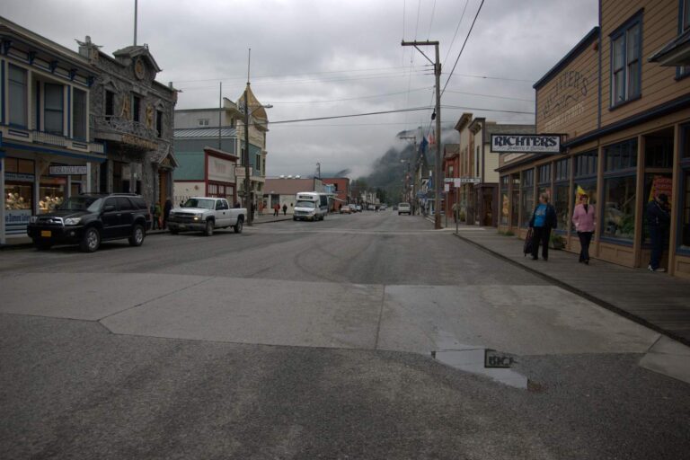
Photo: Kevin, CC BY 2.0
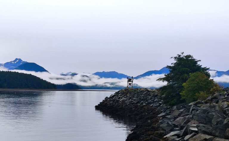
Photo: Игор Миновски, CC BY 2.0
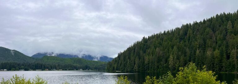
Photo: Ken Lund, CC BY-SA 2.0
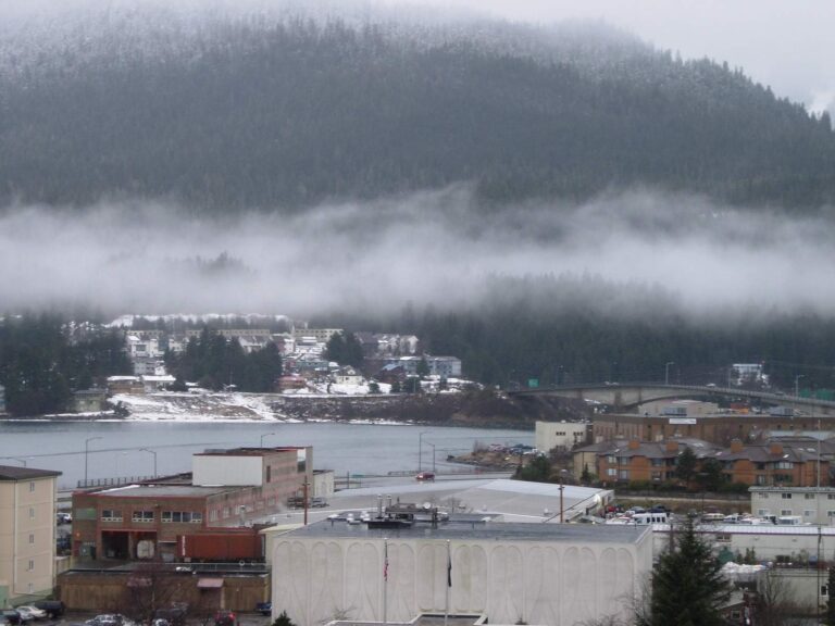
Photo: Mark Brennan, CC BY-SA 2.0
Lakes, forks and harbors of Hoonah-Angoon Census Area, explained
How many goFishAK ramps are listed for Hoonah-Angoon Census Area?
There are 4 ramps in the access data.
Where is the widest lake in Hoonah-Angoon Census Area?
Florence Lake, with about 874 acres of mapped outline.
What fish does ADF&G name near Hoonah-Angoon Census Area?
The layers name cutthroat trout on the most lake pages within 80 miles, then Dolly Varden, silver salmon and rainbow trout; they show presence, not a catch.
Where can I buy bait in Hoonah-Angoon Census Area, Alaska?
Try Angoon Small Boat Harbor; the listing has 4.
Where does Hoonah-Angoon Census Area keep its administrative center?
Hoonah has it.
Which Alaska licenses cover fishing in Hoonah-Angoon Census Area?
A resident annual sport fishing license is $20 and a nonresident annual license $100
What lies next to Hoonah-Angoon Census Area?
Begin with Haines Borough, Juneau City and Borough and Skagway Municipality.
How many Dolly Varden or trout may I take home from Hoonah-Angoon Census Area?
Limits depend on the booklet area, the species heading and any heading printed for the water; the four booklet pages on this site give the headings, and king salmon rows lean on emergency orders. Rules and fees are the 2026 edition: ADF&G prints "Effective until the 2027 summary is issued" on every 2026 booklet, and no 2027 booklet exists. Emergency orders supersede the booklet.
Do the 2026 booklets print a lake heading in Hoonah-Angoon Census Area?
3 waters with a page here carry their own heading, beginning with Florence Lake.
Where do halibut and salmon anglers read up for Hoonah-Angoon Census Area?
2 saltwater area pages here, starting with Juneau-Glacier Bay.
Set up an Alaska fishing week in Hoonah-Angoon Census Area
Lake pages carry access sites, ADF&G species lists and booklet headings.