Green Bay Fishing
Launches, bay fishing, charters and the perch and walleye rules for Green Bay.
 Pick for walleyePiscifun Viper X spinning reel50% OFFSale $39.99
Photo: Giorgio Galeotti, CC BY-SA 4.0

Green Bay from Marinette to the Fox River mouth
Green Bay is the long arm of Lake Michigan between the Door Peninsula and the Marinette and Oconto shore. Regulations treat it as part of Lake Michigan, and its walleye, yellow perch, smallmouth bass, musky and northern pike draw boats from the Fox River mouth to Sturgeon Bay.
The Green Bay directory lists 9 harbors and bays, 30 landings, 0 shore spots, 22 river mouths and 18 charter services.
 For the walleye herePiscifun AlumiX spinning reel46% OFFSale $64.99
WDNR words on Green Bay fishing
“Lake Michigan, or the big pond as many Wisconsinites know it, is the No. 1 most frequently visited water in Wisconsin, and it's easy to see why. Whether by boat or onshore, a fishing pole will bring you some of the state's best and most diverse fishing, not to mention picturesque views.”
“And with millions of fish stocked annually to keep populations healthy, there's a good chance there will be a bite on your line.”
“Plan your trip, get information about charter fishing and learn more about how the department works to protect and enhance the Lake Michigan fishery through the links below.”
Quoted from WDNR Lake Michigan pages, checked October 2026.
Where to launch and fish on Green Bay, mapped
WDNR Boat Access and Shore Fishing layers and assessment units.
Public launches serving Green Bay
- Sister Bay MarinaDoor County, 4 lanes
- Tennison Bay Carry-in RampDoor County, 1 lane
- Ephraim Boat RampDoor County, 2 lanes
- Green Bay AccessDoor County, 1 lane
- Fish Creek RampDoor County, 2 lanes
- Red Arrow Park Boat RampMarinette County, 2 lanes
- Egg Harbor Municipal MarinaDoor County, 2 lanes
- Little River Boat LandingMarinette County, 2 lanes
- Park & Boat LandingMarinette County, 1 lane
- Frank E. Murphy County Park Boat RampDoor County, 2 lanes
- Lake Michigan AccessMarinette County
- Peshtigo Harbor Access – End of Harbor RoadMarinette County, 1 lane
- North Bay Shore Recreation Area Boat RampOconto County, 4 lanes
- D.E. Hall ParkOconto County, 1 lane
- Olde Stone Quarry Park Boat RampDoor County, 4 lanes
- Breakwater Park Boat RampOconto County, 5 lanes
- Lily Bay Park Boat RampDoor County, 2 lanes
- Ern-JoysDoor County, 1 lane
- Pensaukee WAOconto County, 1 lane
- Pensaukee Wildlife Area AccessOconto County, 1 lane
- SUGAR CREEK PARK BOAT RAMPDoor County, 2 lanes
- Roadside off of S. Lake Michigan DriveDoor County
- S. Lake Michigan Drive Carry-inDoor County
- Chaudiors Dock Park Boat RampDoor County, 3 lanes
- Roadside off of S. Lake Michigan DriveDoor County, 1 lane
- Beauty View Road AccessDoor County, 1 lane
- Cecil Depeau Bay Shore Park Boat RampBrown County, 4 lanes
- Harbor Lights RoadBrown County, 1 lane
- Peter's LandingBrown County, 1 lane
- Green Bay Metropoltan Boat LaunchBrown County, 5 lanes
WDNR Boat Access layer, checked October 2026.
Protected water and piers along Green Bay
- Egg HarborEgg Harbor, 337 acres
- Little HarborSturgeon Bay, 148 acres
- Bay Beach LagoonsGreen Bay, 50 acres
- Sturgeon BaySturgeon Bay, 4,945 acres
- Little Sturgeon BaySturgeon Bay, 1,068 acres
- Juddville BayEgg Harbor, 238 acres
- Horse Shoe BayEgg Harbor, 445 acres
- Sand BaySturgeon Bay, 351 acres
- Rileys BaySturgeon Bay, 139 acres
Streams emptying into Green Bay
- Oconto RiverOconto, classified trout stream
- Menominee RiverMarinette
- Pensaukee RiverOconto
- Duck CreekHoward
- Little Suamico RiverSuamico
- Suamico RiverSuamico
- Sugar CreekForestville
- Little RiverMarinette
- Lilly Bay CreekSturgeon Bay, classified trout stream
- Thomas SloughOconto
- Tibbett CreekSuamico
- Renard CreekLuxemburg
- Larson CreekSturgeon Bay
- Kirchner CreekSuamico
- Woodard CreekSturgeon Bay
- Bear CreekForestville
- Schuyler CreekForestville
- Turtle CreekOconto
- Gilson CreekLuxemburg, classified trout stream
- May Swamp CreekSturgeon Bay
- Mahone CreekGreen Bay
- University CreekMarinette
What creel clerks saw lately on Green Bay
Duck Creek, Oct. 12, 2026. “Low fishing pressure was seen at Duck Creek this week with many pleasure boaters out enjoying the weather this weekend. Successful anglers reported catches of yellow perch, largemouth bass and a few panfish. Yellow perch were smaller in size within Duck Creek, but a few keepers were harvested using live bait. Largemouth bass were smaller in size, ranging between 5 to 11 inches and were caught on a variety of lures and live bait. Water temperatures were around 63 degrees this week.”
Fox River, Oct. 12, 2026. “Moderate fishing activity was seen this week on the Fox River. Anglers targeted a variety of species including yellow perch, muskellunge, walleye, largemouth bass and smallmouth bass. Successful anglers reported catches of yellow perch, muskellunge, walleye, largemouth bass, smallmouth bass, freshwater drum, gizzard shad and northern pike. Yellow perch that were caught ranged in size between 4 to 10 inches and were caught on live bait by anglers fishing on Green Bay proper. Very few muskellunge were reported as being caught this week with the few muskies caught ranging from 38 to 52 inches long. Walleyes were caught just below the De Pere Dam this week by anglers jigging in 3-8 feet of water”
Suamico River, Oct. 12, 2026. “Moderate fishing activity was seen out of the Suamico River boat launch. Many recreational duck hunters and pleasure boaters were seen at this location. Anglers targeted yellow perch, muskellunge and walleye. Successful anglers reported catches of yellow perch, northern pike, muskellunge, largemouth bass and gizzard shad. Yellow perch were found near the bait balls up and down the west shoreline in waters of 4 to 8 feet deep. Fishing with live bait near the bait balls was the most productive tactic with perch between 6 to 13 inches being caught. Northern pike were few and far between and ranged in size between 27 to 38 inches. Muskellunge were difficult to land this week with only a few succ”
Marinette, Oct. 12, 2026. “There was not much for fishing pressure this week. Many days had high winds which kept boaters off the water. The pink salmon run was winding up this week with only a few fish left hanging around the dams. A few more Chinook salmon showed up this week in the Peshtigo and Menominee rivers. With cooler temperatures coming up there should be some brown trout coming into the rivers as well. Water temperatures were around the 60 degree mark.”
Oconto, Oct. 12, 2026. “A few yellow perch anglers were out on the bay out of Oconto when the winds would allow it. Best action was in deeper waters of 30 to 40 feet on minnows. Some days there were also white perch mixed in as well. The pink salmon run was coming to an end this week with very few fish left by the Stiles dam. A few Chinook salmon started to show up near the dam. Areas downstream from the dam were hard to fish with the extremely low water levels. Water temperature was around 60 degrees or slightly warmer.”
Quoted from the WDNR Lake Michigan outdoor report, retrieved 2026-10-21.
How high Green Bay stands now
US Army Corps of Engineers, Detroit District (CWMS) reading for NOAA Green Bay East Stage, recorded October 21, 2026; retrieved October 21, 2026. Values are provisional.
US Army Corps of Engineers, Detroit District (CWMS) reading for NOAA Sturgeon Bay Canal Stage, recorded October 21, 2026; retrieved October 21, 2026. Values are provisional.
NOAA CO-OPS Great Lakes water levels reading for Sturgeon Bay Canal (IGLD85), recorded October 21, 2026; retrieved October 21, 2026. Values are provisional.
NOAA CO-OPS Great Lakes water levels reading for Green Bay East (IGLD85), recorded October 21, 2026; retrieved October 21, 2026. Values are provisional.
What anglers may keep from Green Bay
| Species | Where | Limit | Season |
|---|---|---|---|
| Largemouth and smallmouth bass | Other Lake Michigan waters | 5 in total; minimum length 14 inches | May 2, 2026 – March 7, 2027 |
| Largemouth and smallmouth bass (catch and release) | Other Lake Michigan waters | 0 (catch and release only) | At all other times of year |
| Smallmouth bass (harvest) | Green Bay and waters within 5 miles of the Door County shoreline in Lake Michigan | 5 in total; minimum length 14 inches | July 1, 2026 – March 7, 2027 |
| Smallmouth bass (catch and release) | Green Bay and waters within 5 miles of the Door County shoreline in Lake Michigan | 0 (catch and release only) | At all other times of year |
| Bluegill, pumpkinseed, sunfish, yellow perch and crappie | Lake Michigan and Green Bay | 25 in total; includes yellow perch limit; no minimum length | Open all year for bluegill, sunfish and crappie |
| Yellow perch | Green Bay and the Fox River | 15; no minimum length | Open May 20, 2026 – March 15, 2027 |
| Yellow perch | Lake Michigan | 5; no minimum length | Closed May 1, 2026 – June 15, 2026 |
| Lake sturgeon | Lake Michigan | 0 | Closed all year |
| Walleye and sauger (includes hybrids) | Fox River from its mouth upstream to the dam at De Pere | 1 in total; minimum length 28 inches | March 2, 2026 – May 1, 2026 |
| Walleye and sauger (includes hybrids) | Fox River from its mouth upstream to the dam at De Pere | 3 in total; no minimum length | May 2, 2026 – March 7, 2027 |
| Walleye and sauger (includes hybrids) | Fox River from its mouth upstream to the dam at De Pere | 1 in total; minimum length 28 inches | March 8, 2027 – April 30, 2027 |
| Ruffe and gobies | Lake Michigan | 0 | Closed all year – one may be killed and possessed for transport to a DNR Service Center or Regional Office |
| White perch | Lake Michigan | No bag limit; no minimum length | Open all year |
| Cisco and whitefish | Lake Michigan | 10 in total; no minimum length | Open all year |
| Lake trout | Other Lake Michigan waters | 5 in total with other trout and salmon; minimum length 10 inches | Open all year |
| Other trout and salmon | Lake Michigan | 5 in total with lake trout; minimum length 10 inches | Open all year |
- Lake Michigan (outlying waters)Includes the Bay of Green Bay, the Fox River upstream to the DePere dam, Sturgeon Bay, other bays to Lake Michigan and Green Bay.
- Major Green Bay tributariesMAJOR GREEN BAY TRIBUTARIES – Brown County: Duck Creek upstream to the first dam located on the Oneida Golf and Riding Club property excluding its tributaries; Suamico River upstream to County Highway HS; East River upstream to Hoffman Rd (County Highway XX) excluding its tributaries. Marinette Coun
- Lake Michigan tributaries north and south of US Hwy 10Lake Michigan tributaries north of Hwy 10 (located in the counties of Marinette, Oconto, Brown, Door, Kewaunee and Manitowoc).
- Wisconsin-Michigan boundary watersIncludes the Brule, Menominee and Montreal rivers and their sloughs and flowages; that portion of Green Bay at the mouth of the Menominee River between the “government pier” or break wall on the south and the “lighthouse pier” or breakwall on the north and a line connecting the eastern-most points o
- Lake trout may not be possessed while fishing within the Mid Lake Reef Complex area indicated on the map.rule
- Goldfish may not be possessed or used for bait. Alewife and live native crayfish may be used for bait on Lake Michigan. Non-native crayfish may only be possessed and used if dead.rule
- All ice fishing shelters must be removed daily and when not in use after the first Sunday following March 12 on Green Bay and Lake Michigan.rule
- Motor trolling is permitted on Lake Michigan with three hooks, baits or lures per person.rule
- Anglers must carry a paper copy of their license/stamps while fishing on Lake Michigan.rule
You must have a fishing license and a Great Lakes trout and salmon stamp privilege or a valid two-day Sports Fishing License to fish for trout and salmon in Lake Michigan.
2026-2027 Guide to Wisconsin Hook and Line Fishing Regulations. All Wisconsin limits.
Hiring a boat and captain for Green Bay
- River Guide, AGreen Bay charter, Door County, Appleton, (920) 841-2118
- Door County ChartersGreen Bay charter, Door County, Baileys Harbor, (920) 559-2665
- First Choice Charter FishingGreen Bay charter, Door County, Baileys Harbor, (920) 839-2055
- Big Country ChartersGreen Bay charter, Green Bay, Brussels, (720) 273-7527
- Fish Anytime ChartersGreen Bay charter, Green Bay, DePere, (920) 241-0543
- Pike Pole Fishing Guide ServiceGreen Bay charter, Green Bay, Edgerton, (608) 290-3929
- SimpleSail ChartersGreen Bay charter, Door County, Marinette, (715) 732-6422
- Weekend Warrior Guide ServiceGreen Bay charter, Green Bay, Marinette, (920) 362-1978
- Angler's Edge Sportfishing ChartersGreen Bay charter, Sturgeon Bay, (906) 630-1492
- Hitman ChartersGreen Bay charter, Sturgeon Bay, (920) 609-7788
- Hook Em & Cook EmGreen Bay charter, Sturgeon Bay, (920) 495-5912
- J-E Fishing EnterprisesGreen Bay charter, Green Bay, Sturgeon Bay, (920) 743-7877
- JJs Guide ServiceGreen Bay charter, Door County, Sturgeon Bay, (920) 493-2953
- Leprechaun Fishing Charters, LLCGreen Bay charter, Door County, Sturgeon Bay, (612) 799-1453
- S/V Talisman Sailing ChartersGreen Bay charter, Door County, Sturgeon Bay, (920) 559-9124
- Salmon Depot Charter FishingGreen Bay charter, Sturgeon Bay, (715) 340-8509
- Tite Line FishingGreen Bay charter, Green Bay, Sturgeon Bay, (920) 495-7522
- Wacky Walleye Guide ServiceGreen Bay charter, Green Bay, Sturgeon Bay, (920) 743-5731
What the shore looks like near Green Bay
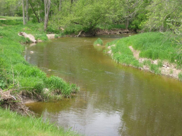
Photo: Dan Perry, CC BY 2.0

Photo: William Alden, CC BY-SA 2.0
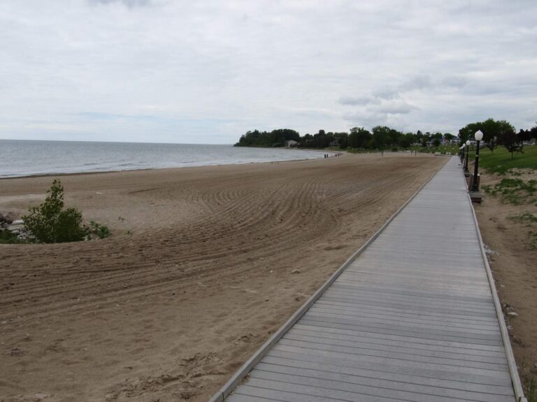
Photo: Ken Lund, CC BY-SA 2.0

Photo: Dan Perry, CC BY 2.0
Before you fish Green Bay: quick answers
What license do I need for the bay waters of Green Bay?
Green Bay counts as Lake Michigan water, so trout and salmon need a Wisconsin license plus the $10 Great Lakes stamp; other fish need only the license ($20 resident, $55 nonresident).
How many launches reach Green Bay?
The WDNR layer lists 30 launches on the bay; harbor polygons number 9.
Must I carry a printed license on Green Bay?
Yes, bay anglers carry a paper copy of the license and stamps, as the guide requires on Lake Michigan waters.
Which rivers empty into Green Bay?
22 river mouths are listed, including Oconto River, Menominee River and Pensaukee River.
Are there guides for Green Bay walleye and perch?
18 charter listings, mostly out of Sturgeon Bay, Brussels and Baileys Harbor.
Can I troll with a motor on Green Bay?
Motor trolling is legal on the bay with up to three hooks, baits or lures each.
Is there a recent fishing report for Green Bay?
Yes, WDNR creel notes from the bay are quoted above with dates.
Is there a water level gauge on Green Bay?
NOAA and Corps gauges on the bay are listed above with dated readings.
What is the Green Bay yellow perch limit?
15; no minimum length, Open May 20, 2026 – March 15, 2027
Run the bay shore of Green Bay
Pack a paper license and the Great Lakes stamp before launching on the bay.