Lake Michigan Fishing
Wisconsin landings, harbors, river mouths, charters and limits on Lake Michigan.
 Pick for coho salmonPiscifun Viper X spinning reel50% OFFSale $39.99
Photo: Ken Lund, CC BY-SA 2.0
Lake Michigan from Kenosha to Door County
Wisconsin owns the western shore of Lake Michigan from the Illinois line at Kenosha north past Milwaukee, Sheboygan, Manitowoc and Algoma to the tip of Door County. The DNR manages chinook and coho salmon, brown, rainbow and lake trout here, plus yellow perch and smallmouth bass near shore.
This page gathers 29 harbors and bays, 6 WDNR shore sites, 49 river mouths and 32 boat access sites on Lake Michigan, with the limits and 62 charter listings.
 For the coho salmon herePiscifun AlumiX spinning reel46% OFFSale $64.99
How the DNR describes Lake Michigan fishing
“Lake Michigan, or the big pond as many Wisconsinites know it, is the No. 1 most frequently visited water in Wisconsin, and it's easy to see why. Whether by boat or onshore, a fishing pole will bring you some of the state's best and most diverse fishing, not to mention picturesque views.”
“And with millions of fish stocked annually to keep populations healthy, there's a good chance there will be a bite on your line.”
“Plan your trip, get information about charter fishing and learn more about how the department works to protect and enhance the Lake Michigan fishery through the links below.”
Quoted from WDNR Lake Michigan pages, checked October 2026.
Landings, harbors and river mouths on Lake Michigan
WDNR Boat Access and Shore Fishing layers and assessment units.
Boat access sites on Lake Michigan
- Dock Road Public AccessDoor County
- Jackson Harbor AccessDoor County, 2 lanes
- Old Camp Road Carry-in AccessDoor County
- Wickman Road Carry-inDoor County
- Michigan Road Carry-inDoor County
- Percy Johnson County Park Carry-in AccessDoor County
- Homestead Road Carry-inDoor County, 1 lane
- Garrett Bay Road Boat LaunchDoor County, 1 lane
- Liberty Grove Boat RampDoor County, 2 lanes
- Lake Michigan – Rowleys Bay AccessDoor County, 1 lane
- Nicolet Bay AccessDoor County, 2 lanes
- North Bay/Lake Michigan Boat RampDoor County, 1 lane
- Blues Point RampDoor County, 1 lane
- Baileys Harbor AccessDoor County, 4 lanes
- Shauer Park RampDoor County, 1 lane
- Whitefish Bay RampDoor County, 1 lane
- Red River ParkKewaunee County, 1 lane
- Steele Street Point LaunchKewaunee County, 4 lanes
- Algoma MarinaKewaunee County, 4 lanes
- Two Creeks AccessManitowoc County, 1 lane
- Thiede Road Canoe AccessManitowoc County, 2 lanes
- S. Lakeview Drive Carry-inManitowoc County
- Red Arrow Park Boat RampManitowoc County, 1 lane
- Hika Park AccessManitowoc County, 2 lanes
- Lake Michigan AccessSheboygan County
- Deland Park Boat RampSheboygan County, 5 lanes
- Port Washington – Lake MichiganOzaukee County, 5 lanes
- McKinley Park MarinaMilwaukee County, 5 lanes
- South Shore Park Boat RampMilwaukee County, 4 lanes
- Bender Park Boat LaunchMilwaukee County, 5 lanes
- Lake Michigan Access (Pershing Park)Racine County, 5 lanes
- Simmon's Island Boat HarborKenosha County, 5 lanes
WDNR Boat Access layer, checked October 2026.
Harbors, bays and shore fishing on Lake Michigan
- Kenosha HarborKenosha, 27 acres
- Milwaukee HarborWest Milwaukee, 0 acres
- Racine HarborRacine, 84 acres
- Two Rivers HarborTwo Rivers, 11 acres
- Kewaunee Inner HarborKewaunee, 36 acres
- Milwaukee HarborSt. Francis, 18 acres
- Port Washington HarborPort Washington, 25 acres
- Sheboygan HarborSheboygan, 4 acres
- Manitowoc HarborManitowoc, 20 acres
- Kewaunee Outer HarborKewaunee, 17 acres
- Algoma HarborAlgoma, 3 acres
- Baileys HarborEphraim, 25 acres
- Detroit HarborSister Bay, 64 acres
- Washington HarborSister Bay, 130 acres
- West HarborSister Bay, 57 acres
- Detroit HarborSister Bay, 156 acres
- Eagle HarborEphraim, 587 acres
- Hedgehog HarborSister Bay, 149 acres
- Juneau Park LagoonShorewood, 14 acres
- Rowley BaySister Bay, 13 acres
- Wisconsin BaySister Bay, 114 acres
- Garretts BaySister Bay, 151 acres
- Ellison BaySister Bay, 265 acres
- Sister BaySister Bay, 87 acres
- Little Sister BaySister Bay, 47 acres
- Nicolet BayEphraim, 109 acres
- Tennison BayEphraim, 73 acres
- Fish Creek BayEphraim, 113 acres
- Runway BayPleasant Prairie, 129 acres
- Summerfest Shore FishingDeveloped Shore Fishing Site, West Milwaukee
- Fishing Pier At Potawatomi Park Picnic AreaDeveloped Shore Fishing Site, Genoa City
- Weborg Pier/Peninsula State ParkFishing Pier, Ephraim
- Cupertino Pier (Russell Avenue Pier)Fishing Pier, St. Francis
- Racine Harbor Fishing PierDeveloped Shore Fishing Site, Racine
- Quarry Lake Fishing PierDeveloped Shore Fishing Site, Belgium
River mouths along Lake Michigan
- Marinette
- Green Bay
- Door County – North
- Door County – Middle
- Door County – South
- Ahnapee RiverAlgoma
- East Twin RiverTwo Rivers, classified trout stream
- West Twin RiverTwo Rivers, classified trout stream
- Manitowoc RiverManitowoc
- Fischer Creek near Cleveland, Manitowoc CountyCleveland
- Pigeon RiverSheboygan
- Sheboygan RiverSheboygan, classified trout stream
- Sauk CreekPort Washington
- Milwaukee RiverWest Milwaukee
- Root RiverRacine
- Pike River, Kenosha CountyKenosha
- Silver Creek, Manitowoc CountyManitowoc
- Stony CreekForestville
- Point CreekCleveland
- Oak CreekSouth Milwaukee
- Black RiverSheboygan
- Sucker CreekPort Washington
- Kinnickinnic River, Milwaukee CountyWest Milwaukee
- Red RiverLuxemburg
- Hibbards CreekEgg Harbor, classified trout stream
- Molash CreekTwo Rivers
- Sandy Bay CreekKewaunee
- Pine CreekCleveland
- Little Manitowoc RiverManitowoc
- Fourmile CreekSheboygan
- Calvin CreekManitowoc
- Centerville CreekCleveland
- Mashek CreekKewaunee
- Silver Creek, 25n, 26e, 1 NwnwAlgoma
- Sevenmile Creek, Sheboygan CountyCleveland
- Three Springs CreekSister Bay
- Barnes Creek, Kenosha CountyPleasant Prairie
- Barr CreekCedar Grove
- Fish CreekBayside
- Three Mile CreekAlgoma, classified trout stream
- Ephraim CreekEphraim, classified trout stream
- Fish CreekEphraim
- Shivering SandsSturgeon Bay
- Whitefish Bay CreekSturgeon Bay, classified trout stream
- Macco CreekLuxemburg
- Dominican CreekWind Point
- Heins CreekEgg Harbor, classified trout stream
- Hidden SpringsEphraim, classified trout stream
- Pickerel Pond CreekEphraim
Recent WDNR fishing reports from Lake Michigan
Northern Door County, Oct. 5, 2026. “Anglers continue to target smallmouth bass, yellow perch, walleye, and Chinook salmon. At Egg Harbor Pier anglers targeting Chinook salmon had success with crankbaits, spawn and skein, catching fish around 10 pounds. Anglers also targeted smallmouth bass and yellow perch, with minnows producing fish. Perch measured approximately 7.5–8 inches. In Sister Bay, boaters targeting smallmouth bass had success using Ned rigs with 2-inch plastics in 8–9 feet of water. Water temperatures were around 63 degrees Fahrenheit.”
Sturgeon Bay, Oct. 5, 2026. “This week most anglers fishing the shorelines were going after smallmouth bass and yellow perch. Both species were recorded caught along with freshwater drum. A mix of worms, minnows and artificial worms were used as bait by those with fish. Throughout the week, boaters fishing in the canal were targeted many different species. Smallmouth bass groups were mostly in 16 feet of water using bright soft plastics. Yellow perch boaters fished 12 to 20 feet of water and preferred using minnows over worms. Walleye were caught in 20 feet of water and northern pike were caught in 18 feet of water. Surface temperature in the canal was around 63 degrees Fahrenheit.”
Algoma, Oct. 5, 2026. “The pier saw anglers come out early and late fishing for Chinook and coho salmon. Down the Ahnapee River, anglers were split evenly either targeting salmon or northern pike. Water clarity on the river was murky again this week being around a foot of visibility. Boaters were similarly going after Chinook and Coho salmon and reported catching Chinook salmon; however, they were split when it came to the depth of water they were in. Some groups were shallow, fishing in 12 feet of water. Other groups were in as deep as 300 feet of water reporting bites between 50 to 80 feet down. Orange and green flasher flies and j-plugs were mostly used. The average surface temperature rose this week being arou”
Kewaunee, Oct. 5, 2026. “Anglers were lined up along the pier and harbor shorelines again this week targeting primarily Chinook and coho salmon. Both of these species were recorded caught with green and blue spoons being the typical lure of choice for those with fish. The majority of boaters were fishing within the harbor area. Chinook salmon were caught in 10 to 12 feet of water by these groups. Surface temperatures climbed as the days went on. The harbor was anywhere from 63 to 67 degrees Fahrenheit throughout the week.”
Quoted from the WDNR Lake Michigan outdoor report, retrieved 2026-10-21.
Water level readings on Lake Michigan
US Army Corps of Engineers, Detroit District (CWMS) reading for NOAA Kewaunee Stage, recorded October 21, 2026; retrieved October 21, 2026. Values are provisional.
US Army Corps of Engineers, Detroit District (CWMS) reading for NOAA Milwaukee Stage and Weather, recorded October 21, 2026; retrieved October 21, 2026. Values are provisional.
NOAA CO-OPS Great Lakes water levels reading for Milwaukee (IGLD85), recorded October 21, 2026; retrieved October 21, 2026. Values are provisional.
NOAA CO-OPS Great Lakes water levels reading for Kewaunee, Lake Michigan (IGLD85), recorded October 21, 2026; retrieved October 21, 2026. Values are provisional.
Seasons and bag limits on Lake Michigan
| Species | Where | Limit | Season |
|---|---|---|---|
| Largemouth and smallmouth bass (harvest) | Within one-fourth mile of all islands in the Town of Washington Island | 5 in total; minimum length 12 inches | July 1, 2026 – March 7, 2027 (no catch and release fishing prior to July 1 opener) |
| Largemouth and smallmouth bass | Other Lake Michigan waters | 5 in total; minimum length 14 inches | May 2, 2026 – March 7, 2027 |
| Largemouth and smallmouth bass (catch and release) | Other Lake Michigan waters | 0 (catch and release only) | At all other times of year |
| Smallmouth bass (harvest) | Green Bay and waters within 5 miles of the Door County shoreline in Lake Michigan | 5 in total; minimum length 14 inches | July 1, 2026 – March 7, 2027 |
| Smallmouth bass (catch and release) | Green Bay and waters within 5 miles of the Door County shoreline in Lake Michigan | 0 (catch and release only) | At all other times of year |
| Muskellunge (includes hybrids) | North of Waldo Boulevard, Manitowoc | 1; minimum length 54 inches | May 23, 2026 – Dec. 31, 2026 (open water only) |
| Muskellunge (includes hybrids) | South of Waldo Boulevard, Manitowoc | 1; minimum length 40 inches | May 2, 2026 – Dec. 31, 2026 |
| Northern pike | North of Waldo Boulevard, Manitowoc | 5; no minimum length | Open all year |
| Northern pike | South of Waldo Boulevard, Manitowoc | 2; minimum length 26 inches | Open all year |
| Bluegill, pumpkinseed, sunfish, yellow perch and crappie | Lake Michigan and Green Bay | 25 in total; includes yellow perch limit; no minimum length | Open all year for bluegill, sunfish and crappie |
| Yellow perch | Green Bay and the Fox River | 15; no minimum length | Open May 20, 2026 – March 15, 2027 |
| Yellow perch | Lake Michigan | 5; no minimum length | Closed May 1, 2026 – June 15, 2026 |
| Lake sturgeon | Lake Michigan | 0 | Closed all year |
| Walleye and sauger (includes hybrids) | Fox River from its mouth upstream to the dam at De Pere | 1 in total; minimum length 28 inches | March 2, 2026 – May 1, 2026 |
| Walleye and sauger (includes hybrids) | Fox River from its mouth upstream to the dam at De Pere | 3 in total; no minimum length | May 2, 2026 – March 7, 2027 |
| Walleye and sauger (includes hybrids) | Fox River from its mouth upstream to the dam at De Pere | 1 in total; minimum length 28 inches | March 8, 2027 – April 30, 2027 |
| Walleye and sauger (includes hybrids) | Lake Michigan waters north of Waldo Boulevard, Manitowoc | 1 in total; minimum length 15 inches | March 2, 2026 – May 1, 2026 |
| Walleye and sauger (includes hybrids) | Lake Michigan waters north of Waldo Boulevard, Manitowoc | 5 in total; minimum length 15 inches | May 2, 2026 – March 7, 2027 |
| Walleye and sauger (includes hybrids) | Lake Michigan waters north of Waldo Boulevard, Manitowoc | 1 in total; minimum length 15 inches | March 8, 2027 – April 30, 2027 |
| Walleye and sauger (includes hybrids) | Lake Michigan waters south of Waldo Boulevard, Manitowoc | 5 in total; minimum length 15 inches | Open all year |
| Ruffe and gobies | Lake Michigan | 0 | Closed all year – one may be killed and possessed for transport to a DNR Service Center or Regional Office |
| White perch | Lake Michigan | No bag limit; no minimum length | Open all year |
| Cisco and whitefish | Lake Michigan | 10 in total; no minimum length | Open all year |
| Lake trout | Mid Lake Reef Complex | 0 | No open season |
- Lake Michigan (outlying waters)Includes the Bay of Green Bay, the Fox River upstream to the DePere dam, Sturgeon Bay, other bays to Lake Michigan and Green Bay.
- Lake Michigan tributaries north and south of US Hwy 10Lake Michigan tributaries north of Hwy 10 (located in the counties of Marinette, Oconto, Brown, Door, Kewaunee and Manitowoc).
- Wisconsin-Michigan boundary watersIncludes the Brule, Menominee and Montreal rivers and their sloughs and flowages; that portion of Green Bay at the mouth of the Menominee River between the “government pier” or break wall on the south and the “lighthouse pier” or breakwall on the north and a line connecting the eastern-most points o
- Lake trout may not be possessed while fishing within the Mid Lake Reef Complex area indicated on the map.rule
- Goldfish may not be possessed or used for bait. Alewife and live native crayfish may be used for bait on Lake Michigan. Non-native crayfish may only be possessed and used if dead.rule
- All ice fishing shelters must be removed daily and when not in use after the first Sunday following March 12 on Green Bay and Lake Michigan.rule
- Motor trolling is permitted on Lake Michigan with three hooks, baits or lures per person.rule
- Anglers must carry a paper copy of their license/stamps while fishing on Lake Michigan.rule
You must have a fishing license and a Great Lakes trout and salmon stamp privilege or a valid two-day Sports Fishing License to fish for trout and salmon in Lake Michigan.
2026-2027 Guide to Wisconsin Hook and Line Fishing Regulations. All Wisconsin limits.
Charter captains on Lake Michigan
- Bay Lake ChartersLake Michigan charter, Lake Michigan, Algoma, (920) 594-0910
- Fishin' Magician ChartersLake Michigan charter, Algoma, (920) 304-3474
- Gail Force SportfishingLake Michigan charter, Lake Michigan, Algoma, (920) 304-1999
- Haasch Guide ServiceLake Michigan charter, Algoma, (888) 966-3474
- Hakuna Matata ChartersLake Michigan charter, Lake Michigan, Algoma, (715) 451-1697
- Kinn's Sport FishingLake Michigan charter, Lake Michigan, Algoma, (800) 446-8605
- RV ChartersLake Michigan charter, Lake Michigan, Algoma, (920) 487-0022
- Trik Sea Charters, LLCLake Michigan charter, Algoma, (920) 866-9006
- Halcyon Fishing AdventuresLake Michigan charter, Lake Michigan, Baileys Harbor, (920) 857-6302
- Silver Strike Charter FishingLake Michigan charter, Baileys Harbor, (920) 421-3888
- Finseekers Guide ServiceLake Michigan charter, Lake Michigan, Delavan, (847) 707-1827
- Northshore Salmon ChartersLake Michigan charter, Ellison Bay, (920) 399-4326
- Mariner Charter FishingLake Michigan charter, Gills Rock, (920) 421-1578
- Wolf Pack AdventuresLake Michigan charter, Howards Grove, (920) 207-1212
- Josh Teigen's Guide ServiceLake Michigan charter, Iron River, (715) 813-0575
- Hunter Charters/JEDI SportfishingLake Michigan charter, Kenosha, (262) 914-9100
- Kenosha Charter Boat AssociationLake Michigan charter, Lake Michigan, Kenosha, (262) 945-8560
- Stellar ChartersLake Michigan charter, Kenosha, (262) 620-1611
- JAWS II CharterLake Michigan charter, Lake Michigan, Kewaunee, (920) 819-6883
- Tigger II ChartersLake Michigan charter, Lake Michigan, Kewaunee, (920) 493-6748
- Blue Max ChartersLake Michigan charter, Milwaukee, (414) 828-1094
- Brew City Charters Lake Michigan Fishing MilwaukeeLake Michigan charter, Lake Michigan, Milwaukee, (414) 899-5959
- Reel Sensation ChartersLake Michigan charter, Lake Michigan, Milwaukee, (414) 384-8096
- Angry Fin Charter FishingLake Michigan charter, Lake Michigan, Port Washington, (262) 689-5294
- C&D ChartersLake Michigan charter, Lake Michigan, Port Washington, (414) 840-1429
- Cracker Jack ChartersLake Michigan charter, Lake Michigan, Port Washington, (414) 852-2963
- Fin N Fly SportfishingLake Michigan charter, Lake Michigan, Port Washington, (262) 339-8799
- Fish On Guide Services of WisconsinLake Michigan charter, Lake Michigan, Port Washington, (262) 844-5357
- Fishin Da Net ChartersLake Michigan charter, Lake Michigan, Port Washington, (920) 254-3137
- Fox Bros Charter ServiceLake Michigan charter, Lake Michigan, Port Washington, (414) 333-6976
- Hunt N Fish ChartersLake Michigan charter, Port Washington, (920) 948-4907
- Iverson Sport FishingLake Michigan charter, Lake Michigan, Port Washington, (608) 575-8622
- Lori's Pride ChartersLake Michigan charter, Lake Michigan, Port Washington, (262) 675-9959
- Nicky Boy ChartersLake Michigan charter, Port Washington, (414) 940-9788
- Ninja ChartersLake Michigan charter, Lake Michigan, Port Washington, (262) 689-5630
- Nolans Top Gun ChartersLake Michigan charter, Port Washington, (262) 305-3938
- Outcast Charter FishingLake Michigan charter, Lake Michigan, Port Washington, (262) 227-9507
- Pirate ChartersLake Michigan charter, Lake Michigan, Port Washington, (262) 622-3851
- Princess Marissa Sport FishingLake Michigan charter, Lake Michigan, Port Washington, (414) 651-0990
- Reel Screamer Sport FishingLake Michigan charter, Port Washington, (920) 474-3920
- Renegade Sportfishing ChartersLake Michigan charter, Lake Michigan, Port Washington, (800) 343-0089
- AA Phoenix ChartersLake Michigan charter, Sheboygan, (920) 207-7000
- Dumper Dan's Charter Fishing & LodgingLake Michigan charter, Lake Michigan, Sheboygan, (920) 377-1147
- Happy Hooker Sportfishing ChartersLake Michigan charter, Lake Michigan, Sheboygan, (920) 980-5286
- Hi-Tech Sport Fishing ChartersLake Michigan charter, Lake Michigan, Sheboygan, (920) 980-4031
- Sea Dog Sportfishing Charters of SheboyganLake Michigan charter, Lake Michigan, Sheboygan, (920) 918-2628
- Hooked Up Sport Fishing ChartersLake Michigan charter, Lake Michigan, Sturgeon Bay, (920) 495-5586
- Hour Time Sport Fishing ChartersLake Michigan charter, Lake Michigan, Sturgeon Bay, (920) 585-3726
- Lynn A. Charter FishingLake Michigan charter, Lake Michigan, Sturgeon Bay, (920) 743-6731
- Reel Action Sport Fishing ChartersLake Michigan charter, Lake Michigan, Sturgeon Bay, (920) 360-2136
- Chasin Tail CharterLake Michigan charter, Lake Michigan, Two Rivers, (608) 554-8497
- Fish Casket ChartersLake Michigan charter, Two Rivers, (920) 323-1089
- Gogetem ChartersLake Michigan charter, Two Rivers, (920) 860-2413
- High Life ChartersLake Michigan charter, Two Rivers, (920) 242-4061
- Hooked ChartersLake Michigan charter, Lake Michigan, Two Rivers, (920) 905-5159
- Joe Junion SportfishingLake Michigan charter, Lake Michigan, Two Rivers, (920) 213-1637
- RN Fishing ChartersLake Michigan charter, Lake Michigan, Two Rivers, (906) 361-5379
- Reel Persistence ChartersLake Michigan charter, Lake Michigan, Two Rivers, (920) 860-0370
- Salmon ChasersLake Michigan charter, Lake Michigan, Two Rivers, (612) 210-5937
- Salmon Trapper ChartersLake Michigan charter, Lake Michigan, Two Rivers, (320) 282-9291
Water close to Lake Michigan in photographs

Photo: Dan Perry, CC BY 2.0
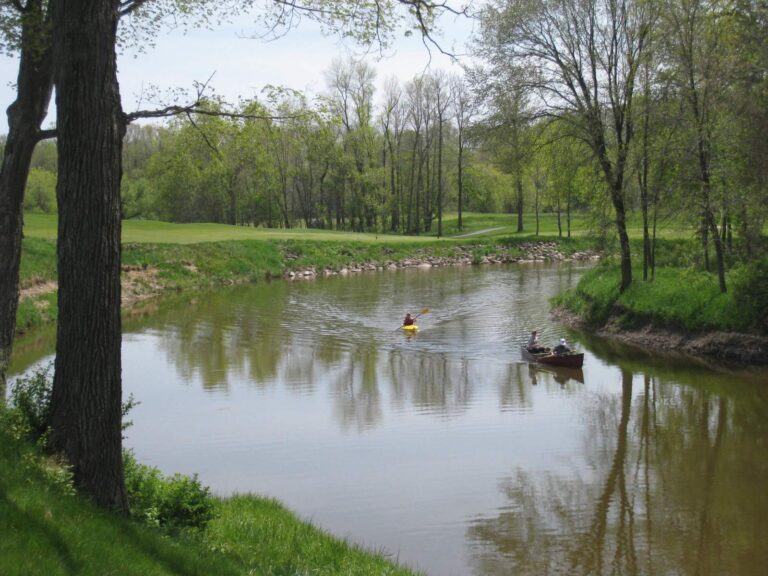
Photo: Dan Perry, CC BY 2.0
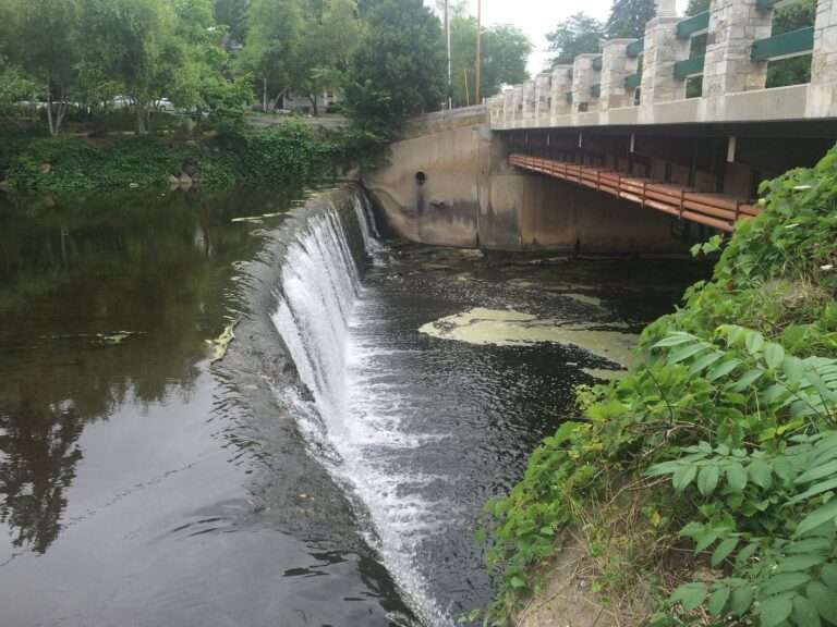
Photo: Aaron Volkening, CC BY 2.0
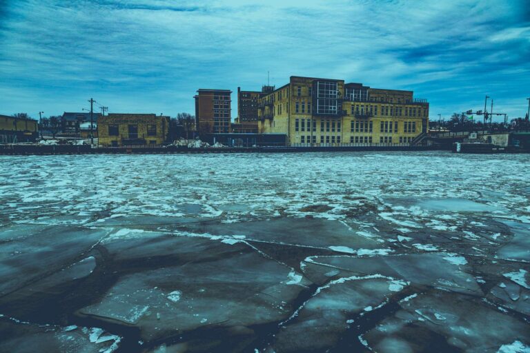
Photo: Tony Webster, CC BY-SA 2.0
Lake Michigan questions from Wisconsin anglers
Which Wisconsin license and stamp cover Lake Michigan?
Trout and salmon on Lake Michigan, Green Bay or Lake Superior take a Wisconsin fishing license plus the $10 Great Lakes trout and salmon stamp (annual license $20 resident, $55 nonresident), or the $14 two-day Great Lakes license.
How many harbors and landings are on the Wisconsin side of Lake Michigan?
32 boat access sites and 29 harbors and bays are listed on this page.
Do I need a paper license on Lake Michigan?
Yes. The guide says anglers must carry a paper copy of their license and stamps on the Great Lakes.
Where are the tributary mouths on Lake Michigan?
49 river mouths are listed, including Marinette, Green Bay and Door County – North.
Can I hire a charter on Lake Michigan?
62 charter listings, mostly out of Sheboygan, Port Washington and Algoma.
Is motor trolling allowed on Lake Michigan?
Yes, with three hooks, baits or lures per person, according to the guide.
Where does the fishing report for Lake Michigan come from?
The WDNR outdoor report, quoted with its date on this page.
Can I check the water level on Lake Michigan?
Yes, the latest Corps of Engineers or NOAA reading is shown with its date.
How many trout and salmon can I keep on Lake Michigan?
5 in total with lake trout; minimum length 10 inches, Open all year
Plan a Wisconsin trip to Lake Michigan
Carry the Great Lakes stamp and a paper license, then pick a landing above.