Pennsylvania Trout Regulation Programs
Pennsylvania trout regulation programs: 1,066 regulated waters by region, from stocked trout waters to delayed harvest, trophy, slot and fly-only sections, with the 2026 and 2027 openers.
 For weighing a catchPiscifun Lip gripper with digital scale27% OFFSale $39.99
Photo of Kettle Creek: Nicholas, CC BY 2.0

Pennsylvania trout regulation programs and their rules
| Program | Season | Harvest | Tackle | Waters |
|---|---|---|---|---|
| All Tackle Trophy Trout | Open year-round, 24 hours | 1 trout, 18-inch minimum, 8 a.m. opening day through Labor Day; no harvest day after Labor Day to opening day | No tackle restrictions | 1 |
| Catch and Release All Tackle | Open year-round, 24 hours | No trout may be killed or possessed | No tackle restrictions | 8 |
| Catch and Release Artificial Lures Only | Open year-round, 24 hours | No trout may be killed or possessed | Artificial lures of metal, plastic, rubber or wood, or flies and streamers; spinning or fly gear; taking baitfish or fishbait prohibited | 17 |
| Catch and Release Fly-Fishing Only | Open year-round, 24 hours | No trout may be killed or possessed | Artificial flies and streamers only, fly rods, fly reels and fly line with monofilament leader; taking baitfish or fishbait prohibited | 34 |
| All Tackle Trout Slot Limit | Open year-round, 24 hours | 2 trout (combined) at least 7 but less than 12 inches, 8 a.m. opening day through Labor Day; no harvest day after Labor Day to opening day | No tackle restrictions | 1 |
| Artificial Lures Only Trout Slot Limit | Open year-round, 24 hours | 2 trout (combined) at least 7 but less than 12 inches, 8 a.m. opening day through Labor Day; no harvest day after Labor Day to opening day | Artificial lures of metal, plastic, rubber or wood, or flies and streamers; taking baitfish or fishbait prohibited | 3 |
| Delayed Harvest Artificial Lures Only | Open year-round, 24 hours | 3 trout (combined), 9-inch minimum, June 15 through Labor Day; 0 from the day after Labor Day until June 15 | Artificial lures or flies and streamers only; natural bait, fish eggs, bait paste or any edible substance prohibited | 68 |
| Trophy Trout Artificial Lures Only | Open year-round, 24 hours | 1 trout, 18-inch minimum, 8 a.m. opening day through Labor Day; no harvest day after Labor Day to opening day | Artificial lures or flies and streamers only; taking baitfish or fishbait prohibited | 10 |
| Stocked Trout Waters | Closed to all fishing Feb. 16 to 8 a.m. opening day (April 4, 2026); open to trout harvest during the extended season | Commonwealth inland trout limits | No spearing at any time | 853 |
| Stocked Trout Waters Open to Year-Round Fishing | Open Feb. 16 to opening day but no trout may be taken or possessed then; inland sizes and limits opening day through Sept. 7; extended season limits Jan. 1 – Feb. 15 and Sept. 8 – Dec. 31 | Commonwealth inland trout limits | 71 |
2026 Pennsylvania Fishing Summary (PA Fish and Boat Commission; in effect or proposed as of October 1, 2025, PDF revised February 27, 2026), page 24. Retrieved October 23, 2026.
Pennsylvania trout opening day and Mentored Youth Day
Regular trout season opens April 4, 2026 at 8 a.m. in 2026; the 2027 opener is April 3, 2027 (Dates subject to change by regulation (p.41).)
Mentored Youth Trout Day (statewide): March 28, 2026, 8:00 a.m. to 7:30 p.m. Youth under 16 need a Mentored Youth Permit (free) or Voluntary Youth Fishing License ($2.97) and must be with a licensed adult who also holds a trout permit; youth may keep 2 trout (combined), 7-inch minimum; adults may not keep trout; waters = all Stocked Trout Waters statewide; special regulation areas excluded.
Stream sections that are both Class A Wild Trout Waters and Stocked Trout Waters are closed Feb. 16 until 8 a.m. opening day; see Miscellaneous Special Regulations pp.16-17.
Approximately 10,000 large trout (2-3 years old, 14-20 inches) are stocked in spring among Keystone Select waters managed under Delayed Harvest Artificial Lures Only and one water under Miscellaneous Special Regulations; 16 of the 24 stream sections also get a fall stocking.
2026 Pennsylvania Fishing Summary (PA Fish and Boat Commission; in effect or proposed as of October 1, 2025, PDF revised February 27, 2026), page 10, 21, 24. Retrieved October 23, 2026.
Pennsylvania regulated trout waters by region
| Region | Counties |
|---|---|
| Southeast | Berks, Bucks, Chester, Delaware, Lancaster, Lehigh, Montgomery, Northampton, Philadelphia, Schuylkill |
| Southcentral | Adams, Bedford, Blair, Cumberland, Dauphin, Franklin, Fulton, Huntingdon, Juniata, Lebanon, Mifflin, Perry, York |
| Southwest | Allegheny, Armstrong, Beaver, Butler, Cambria, Fayette, Greene, Indiana, Somerset, Washington, Westmoreland |
| Northwest | Butler, Clarion, Crawford, Erie, Forest, Lawrence, Mercer, Venango, Warren |
| Northcentral | Cameron, Centre, Clearfield, Clinton, Elk, Jefferson, Lycoming, McKean, Montour, Northumberland, Potter, Snyder, Tioga, Union |
| Northeast | Bradford, Carbon, Columbia, Lackawanna, Luzerne, Monroe, Pike, Sullivan, Susquehanna, Wayne, Wyoming |
Pennsylvania special regulation trout sections
| Water | County | Program | Section |
|---|---|---|---|
| Youghiogheny River | Fayette/Somerset | All Tackle Trophy Trout | 9.18 miles; from the confluence with Ramcat Run downstream to the Route 381 bridge at Ohiopyle |
| Penns Creek | Centre | All Tackle Trout Slot Limit | 6.98 miles; from the confluence with Elk Creek downstream to the Catch and Release area located 600 meters downstream of Swift Run |
| Monocacy Creek | Northampton | Artificial Lures Only Trout Slot Limit | 2.22 miles; from Illick’s Mill Dam upstream to and including the Gertrude Fox Conservation Area |
| Saucon Creek | Northampton | Artificial Lures Only Trout Slot Limit | 2.12 miles; from the upstream boundary of the city of Bethlehem property downstream to the SR 0412 bridge |
| Codorus Creek | York | Artificial Lures Only Trout Slot Limit | 2.00 miles; from the West Branch Codorus Creek downstream to 0.40 mile downstream from Thoman Drive |
| Little Juniata River | Blair/Huntingdon | Catch and Release All Tackle | 13.70 miles from the railroad bridge at the east, downstream, border of Ironville downstream to mouth |
| West Branch Susquehanna River | Cambria/Indiana | Catch and Release All Tackle | 26.10 miles; from outflow of AMD treatment plant near Watkins downstream to confluence of Cush Creek near Dowler Junction |
| Spring Creek | Centre | Catch and Release All Tackle | 16.24 miles; from the Boalsburg Road bridge, SR 3010, at Oak Hall upstream of Hanson Quarry, formerly HRI/Neidig Bros. Quarry, downstream to |
| Valley Creek | Chester/Montgomery | Catch and Release All Tackle | at Valley Forge and tributaries including Little Valley Creek; be aware that Valley Forge National Historic Park has imposed special bait re |
| West Branch Susquehanna River | Clearfield | Catch and Release All Tackle | 26.10 miles; from outflow of AMD treatment plant near Watkins downstream to confluence of Cush Creek near Dowler Junction |
| Clarion River | Elk | Catch and Release All Tackle | 8.49 miles; from the confluence of the East and West branches downstream to the Main St. bridge, SR 948, in Ridgway |
| Pine Creek | Lycoming | Catch and Release All Tackle | 2.88 miles; from the confluence with Slate Run downstream to the confluence with Bonnell Run at DCNR Clark Farm Access Area |
| Upper Kettle Creek basin | Potter/Tioga | Catch and Release All Tackle | 28.30 miles; Kettle Creek from the headwaters downstream to the confluence with Long Run and all tributaries including Long Run upstream to |
| Hunts Run | Cameron | Catch and Release Artificial Lures Only | 4.72 miles; from confluence with McNuff Branch downstream to the mouth |
| Hickory Run | Carbon | Catch and Release Artificial Lures Only | 3.12 miles; from the outlet of Saylorsville Dam downstream to the mouth |
| Fishing Creek | Clinton | Catch and Release Artificial Lures Only | 5.27 miles; from the private lane bridge at the Tylersville State Fish Hatchery downstream to Fleming's Bridge, SR 2004, at the Lamar Fish H |
| Rauchtown Creek | Clinton | Catch and Release Artificial Lures Only | 1.14 miles; from the confluence of Rockey Run and Krape Run downstream to the SR 0880 crossing upstream of the Ravensburg St. Park Picnic Ar |
| Young Womans Creek | Clinton | Catch and Release Artificial Lures Only | 5.70 miles; from the Beechwood Trail downstream to a point 0.70 mile upstream of the confluence with the Left Branch Young Womans Creek |
| Yellow Breeches Creek | Cumberland | Catch and Release Artificial Lures Only | 1.17 miles; 0.17 miles of the Unnamed Tributary to Yellow Breeches Creek, from the outfall of Children’s Lake to the confluence with Yellow |
| Spruce Creek | Huntingdon | Catch and Release Artificial Lures Only | 0.49 mile; Penn State Experimental Fisheries Area, about 0.60 mile above the village of Spruce Creek |
| Spruce Creek | Huntingdon | Catch and Release Artificial Lures Only | 0.15 mile; PFBC property at Indian Caverns near Franklinsville |
| Roaring Brook | Lackawanna | Catch and Release Artificial Lures Only | 3.70 miles; from Hollisterville Dam downstream to Elmhurst Reservoir |
| Grays Run | Lycoming | Catch and Release Artificial Lures Only | 2.38 miles; from the Grays Run Hunting Club property line downstream to the concrete bridge on T-842, Grays Run Road, at the old CCC camp |
| Penns Creek | Mifflin/Union | Catch and Release Artificial Lures Only | 7.48 miles; from approximately 600 meters downstream of Swift Run downstream to the downstream extent of the island near the end of Jolly Gr |
| Penns Creek | Mifflin/Union | Catch and Release Artificial Lures Only | 7.48 miles; from approximately 600 meters downstream of Swift Run downstream to the downstream extent of the island near the end of Jolly Gr |
| Bushkill Creek | Northampton | Catch and Release Artificial Lures Only | 1.19 miles; from 0.10 mile upstream of Edgewood Avenue bridge, former Binney-Smith Dam, downstream to the 13th Street Bridge |
| Toms Creek | Pike | Catch and Release Artificial Lures Only | 2.10 miles; from the Delaware Water Gap National Recreation Area boundary downstream to the mouth |
| Cross Fork | Potter | Catch and Release Artificial Lures Only | 5.03 miles; Rhulo Hollow to Weed property located 0.20 mile downstream of the T-416 bridge |
| Cherry Run | Union | Catch and Release Artificial Lures Only | 2.70 miles; from the mouth upstream a distance of 2.70 miles |
| West Branch Caldwell Creek | Warren | Catch and Release Artificial Lures Only | 2.75 miles; West Branch bridge upstream to Three Bridge Run |
| Conewago Creek | Adams | Catch and Release Fly-Fishing Only | 1.20 miles; from 0.10 mile downstream of T-340, Russell Tavern Rd., downstream to SR 34 |
| Yellow Creek | Bedford | Catch and Release Fly-Fishing Only | 0.93 mile from mouth of Maple Run, Jacks Run, upstream to cable near Red Bank Hill |
| Driftwood Branch | Cameron | Catch and Release Fly-Fishing Only | |
| Sinnemahoning Creek | Cameron | Catch and Release Fly-Fishing Only | 1.55 miles; from the Shippen Township Building downstream to 330 yards upstream of the SR 0120 bridge near Emporium |
| Spring Creek | Centre | Catch and Release Fly-Fishing Only | Fisherman’s Paradise)(1.26 miles; from a point adjacent to the Stackhouse School Pistol Range downstream to the lower Bellefonte Hatchery gr |
| French Creek | Chester | Catch and Release Fly-Fishing Only | 0.93 mile; from the dam at Camp Sleepy Hollow downstream to Hollow Road |
| Big Spring Creek | Cumberland | Catch and Release Fly-Fishing Only | 1.52 miles; from 100 feet below the source, Big Spring, downstream to the Nealy Road bridge |
| Green Spring Creek | Cumberland | Catch and Release Fly-Fishing Only | 1.20 miles; from mouth upstream to near confluence with Bulls Head Branch |
| Letort Spring Run | Cumberland | Catch and Release Fly-Fishing Only | 1.71 miles; from 300 yards upstream of bridge on T-481, Bonnybrook Road, downstream to the Reading Railroad bridge at the southern edge of L |
| Clark Creek | Dauphin | Catch and Release Fly-Fishing Only | 2.07 miles; PGC rifle range parking area on SR 325 downstream to PGC access road at the Iron Furnace |
| Ridley Creek | Delaware | Catch and Release Fly-Fishing Only | 0.60 mile; from the falls in Ridley Creek State Park downstream to the mouth of Dismal Run |
| West Branch Clarion River | Elk | Catch and Release Fly-Fishing Only | 0.68 mile; from intersection of SR 219 and SR 4003 upstream to the former Texas Gulf Sulphur property line 0.60 mile upstream of SR 4003 bri |
| Dunbar Creek | Fayette | Catch and Release Fly-Fishing Only | 4.22 miles; from the confluence of Glade Run downstream to the stone quarry along Furnace Hill Road, SR 1055 |
| East Branch Antietam Creek | Franklin | Catch and Release Fly-Fishing Only | 0.88 mile; from SR 16 downstream to T-365, Welty Rd. |
| Falling Spring Branch | Franklin | Catch and Release Fly-Fishing Only | 2.53 miles; from the first private lane located 672 feet upstream of Briar Lane bridge downstream to a wire fence crossing the Thomas L. Gei |
| Little Mahoning Creek | Indiana | Catch and Release Fly-Fishing Only | 3.60 miles; from Oberlin Road bridge abutments upstream of SR 1041 bridge upstream to Cesna Run |
| North Fork Redbank Creek | Jefferson | Catch and Release Fly-Fishing Only | 1.93 miles; from SR 322 in Brookville upstream 1.90 miles, except a 110-yard section from the Brookville Water Authority Dam downstream to t |
| Donegal Creek | Lancaster | Catch and Release Fly-Fishing Only | 2.21 miles; from 275 yards below SR 772 downstream to T-334 |
| West Branch Octoraro Creek | Lancaster | Catch and Release Fly-Fishing Only | 2.01 miles; From 30 yards downstream of SR 0472 downstream to 230 yards upstream of the second unnamed tributary downstream of SR 2010, Puse |
| Slippery Rock Creek | Lawrence | Catch and Release Fly-Fishing Only | 0.51 mile; from Heinz Camp property downstream to lower McConnells Mill State Park property line |
| Little Lehigh Creek | Lehigh | Catch and Release Fly-Fishing Only | 1.54 miles; from the downstream face of the bridge on T-508, Wild Cherry Lane, downstream to the upstream face of the bridge on T-510, Millr |
| Little Lehigh Creek | Lehigh | Catch and Release Fly-Fishing Only | 0.82 mile; from the upstream face of Fish Hatchery Road bridge downstream to near the Oxford Drive bridge |
| Slate Run | Lycoming/Tioga | Catch and Release Fly-Fishing Only | 7.13 miles; from the confluence of the Cushman and Francis branches downstream to the mouth |
| Marvin Creek | McKean | Catch and Release Fly-Fishing Only | 0.90 mile; from the vicinity of the high voltage line 3.00 miles south of Smethport downstream for a distance of 0.90 mile |
| Bush Kill | Monroe | Catch and Release Fly-Fishing Only | 6.16 miles; on the Resica Falls Scout Reservation property except 200 yards on each side of the falls |
| Kettle Creek | Potter | Catch and Release Fly-Fishing Only | 1.70 miles; from a sign located 500 feet downstream of the SR 0144 bridge to a sign located 1.70 miles upstream of the lower boundary |
| Clear Shade Creek | Somerset | Catch and Release Fly-Fishing Only | 1.00 mile; from the cable at Windber Water Dam upstream 1.00 mile |
| Francis Branch Tributary to Slate Run | Tioga | Catch and Release Fly-Fishing Only | 1.74 miles; from mouth upstream to Kramer Hollow |
| White Deer Creek | Union | Catch and Release Fly-Fishing Only | 3.45 miles; from Cooper Mill Road upstream to Union/ Centre County Line |
| Little Sandy Creek | Venango | Catch and Release Fly-Fishing Only | 1.40 miles; from the old bridge at Polk Center Pump House downstream to the bridge on Savannah Road, SR 3024 |
| Caldwell Creek | Warren | Catch and Release Fly-Fishing Only | 1.49 miles; from Selkirk highway bridge downstream to approximately 0.50 mile upstream of the Dotyville bridge |
| Dyberry Creek | Wayne | Catch and Release Fly-Fishing Only | 0.87 mile; from 300 meters, 0.19 mile, downstream from the third bridge on Dug Rd., SR 4009, upstream of the mouth, downstream to the second |
| Bowman Creek | Wyoming | Catch and Release Fly-Fishing Only | 0.83 mile; from SR 0292 downstream to Marsh Creek |
| Muddy Creek | York | Catch and Release Fly-Fishing Only | 1.60 miles; from 300 yards downstream of Bruce Road bridge, T-628, in Bruce downstream to 300 yards upstream of Bridgeton Road, SR 2032, bri |
| Bull Creek | Allegheny | Delayed Harvest Artificial Lures Only | 1.01 miles; from the first bridge on Thompson Road, above the Hemphill Road and Thompson Road intersection, downstream to the Thompson Road |
| Deer Creek | Allegheny | Delayed Harvest Artificial Lures Only | 1.90 miles; from the SR 0910 bridge at Martin Road intersection downstream to the lower boundary of Rose Ridge Golf Course |
| Pine Creek | Allegheny | Delayed Harvest Artificial Lures Only | 1.43 miles; from the railroad bridge near the Bryant Drive and Duncan Ave. intersection downstream to 150 yards downstream of the Mt. Royal |
| Buffalo Creek | Armstrong/Butler | Delayed Harvest Artificial Lures Only | 3.70 miles; from Little Buffalo Run downstream to 0.60 mile above Craigsville Road bridge |
| Tulpehocken Creek | Berks | Delayed Harvest Artificial Lures Only | 3.79 miles; from the first deflector below Blue Marsh Dam downstream to the T-921 covered bridge |
| Towanda Creek | Bradford | Delayed Harvest Artificial Lures Only | 1.60 miles; from SR 3001 downstream to Con’s Road, T-350 |
| Chest Creek | Cambria | Delayed Harvest Artificial Lures Only | 2.50 miles; Ridge Avenue downstream to Thomas Mills Road |
| Mud Run | Carbon | Delayed Harvest Artificial Lures Only | 2.52 miles; in Hickory Run State Park |
| Black Moshannon Creek | Centre | Delayed Harvest Artificial Lures Only | 1.30 miles; from Dry Hollow downstream to 0.30 mile downstream of the Huckleberry Road bridge |
| East Branch Brandywine Creek | Chester | Delayed Harvest Artificial Lures Only | 1.22 miles; from SR 4019, Dorlan’s Mill Road, downstream to SR 4004, Dowlin Forge Road |
| Middle Branch White Clay Creek | Chester | Delayed Harvest Artificial Lures Only | 1.60 miles; from SR 3009, Good Hope Road, downstream to the confluence with the East Branch |
| Pickering Creek | Chester | Delayed Harvest Artificial Lures Only | 1.50 miles; from SR 1019, Charlestown Road, downstream to 330 yards upstream of the railroad bridge |
| Piney Creek | Clarion | Delayed Harvest Artificial Lures Only | 1.20 miles; SR 2016 bridge downstream to 0.20 mile upstream of the SR 0066 bridge |
| Little Clearfield Creek | Clearfield | Delayed Harvest Artificial Lures Only | 1.14 miles; from 0.40 mile downstream of the T-584 bridge downstream to 0.20 mile upstream of the SR 2023, Turkey Hill, bridge |
| Sandy Lick Creek | Clearfield | Delayed Harvest Artificial Lures Only | 1.50 miles; from the mouth of Laborde Branch downstream to the SR 219 bridge |
| Caldwell Creek | Crawford | Delayed Harvest Artificial Lures Only | West Branch Caldwell Creek to mouth |
| Conneaut Creek | Crawford | Delayed Harvest Artificial Lures Only | Dicksonburg Road bridge, Dicksonburg, to Pennside Road |
| East Branch Oil Creek | Crawford | Delayed Harvest Artificial Lures Only | Clear Lake Dam to mouth |
| Fivemile Creek | Crawford | Delayed Harvest Artificial Lures Only | T-922 bridge to mouth |
| Little Sugar Creek | Crawford | Delayed Harvest Artificial Lures Only | SR 2009 bridge to mouth |
| McLaughlin Creek | Crawford | Delayed Harvest Artificial Lures Only | T-890 bridge to mouth |
| Muddy Creek | Crawford | Delayed Harvest Artificial Lures Only | Dewey Road bridge to Teepleville Road bridge |
| North Deer Creek | Crawford | Delayed Harvest Artificial Lures Only | Headwaters to mouth |
| Oil Creek | Crawford | Delayed Harvest Artificial Lures Only | Mosey Run to SR 8 bridge at Rynd Farm |
| Pine Creek | Crawford | Delayed Harvest Artificial Lures Only | Seldom Seen Road bridge to mouth |
| Sugar Creek | Crawford | Delayed Harvest Artificial Lures Only | Center Road bridge to Wright Road bridge |
| Thompson Creek | Crawford | Delayed Harvest Artificial Lures Only | 100 meters upstream bridge SR 2031 to mouth |
| Woodcock Creek | Crawford | Delayed Harvest Artificial Lures Only | SR 2036 bridge to mouth |
| Manada Creek | Dauphin | Delayed Harvest Artificial Lures Only | 1.73 miles; from unnamed tributary at river mile 11.50 downstream to Furnace Road, T-616 |
| Wiconisco Creek | Dauphin | Delayed Harvest Artificial Lures Only | 0.74 mile: from the western edge of the Ned Smith Center for Nature and Art walking bridge downstream to the power line crossing located 1.7 |
| Big Mill Creek | Elk | Delayed Harvest Artificial Lures Only | 1.50 miles; from the confluence of Rocky Run downstream to 0.30 mile downstream of the Allegheny National Forest, Forest Road 135 bridge |
| East Branch Clarion River | Elk | Delayed Harvest Artificial Lures Only | 1.18 miles; from 110 yards downstream of the outflow from the East Branch Clarion River Dam to the State Gameland boundary 1.15 miles downst |
| Cascade Creek | Erie | Delayed Harvest Artificial Lures Only | 12th Street bridge to mouth |
| Conneauttee Creek | Erie | Delayed Harvest Artificial Lures Only | Edinboro Lake to Route 99 |
| Crooked Creek | Erie | Delayed Harvest Artificial Lures Only | Gloskey Road bridge to Railroad bridge North SR 5 |
| East Basin Pond | Erie | Delayed Harvest Artificial Lures Only | Waterworks Ponds, Presque Isle State Park |
| Elk Creek | Erie | Delayed Harvest Artificial Lures Only | 200 meters upstream I-79 NB bridge to 500 meters downstream SR 98 bridge and 500 meters upstream Halls Run to mouth |
| Meadow Run | Fayette | Delayed Harvest Artificial Lures Only | 2.23 miles; from Dinner Bell Road downstream to mouth |
| East Hickory Creek | Forest | Delayed Harvest Artificial Lures Only | 1.74 miles; from the Queen Creek bridge downstream to the Otter Creek bridge |
| Falling Spring Branch | Franklin | Delayed Harvest Artificial Lures Only | 1.02 miles; from Walker Road downstream to Fifth Avenue |
| Big Cove Creek – | Fulton | Delayed Harvest Artificial Lures Only | 0.93 mile; from 200 yards downstream of the SR 0928 bridge downstream to the lower Buchanan State Forest boundary |
| East Licking Creek | Juniata/Mifflin | Delayed Harvest Artificial Lures Only | 4.00 miles; from the Texas Eastern gas pipeline crossing downstream to the upstream boundary of the Karl B. Guss State Forest Picnic Area |
| South Branch | Lackawanna/Wyoming | Delayed Harvest Artificial Lures Only | |
| Tunkhannock Creek | Lackawanna/Wyoming | Delayed Harvest Artificial Lures Only | 0.98 mile; from SR 6 downstream through Keystone College campus |
| Neshannock Creek | Lawrence | Delayed Harvest Artificial Lures Only | 2.70 miles; from the base of the Mill Dam in Volant downstream to the covered bridge on T-476 |
| Quittapahilla Creek | Lebanon | Delayed Harvest Artificial Lures Only | 1.10 miles; from Spruce Street bridge on T-398 downstream to the SR 0934 bridge |
| Little Pine Creek | Lycoming | Delayed Harvest Artificial Lures Only | 4.08 miles; Little Pine Creek Road bridge located 1.00 mile upstream Otter Run downstream to inflow of Little Pine Lake |
| Loyalsock Creek | Lycoming | Delayed Harvest Artificial Lures Only | 3.81 miles; 1.00 mile upstream Sullivan County Line downstream to unnamed tributary located 0.90 mile upstream of Plunketts Creek |
| Lycoming Creek – | Lycoming | Delayed Harvest Artificial Lures Only | 2.65 miles; 0.50 mile upstream Daugherty Run downstream to 0.10 mile downstream of the SR 0015 bridge, Old Route 15, near Haleeka |
| Muncy Creek | Lycoming | Delayed Harvest Artificial Lures Only | 1.06 miles; 0.30 mile upstream T-650 bridge downstream to Big Run and 0.91 mile; 0.44 mile downstream of the SR 220 bridge in Picture Rocks |
| Kinzua Creek | McKean | Delayed Harvest Artificial Lures Only | 4.79 miles; from Guffey Road bridge, Rocky Road, downstream to Allegheny National Forest boundary near Westline |
| West Branch Tunungwant Creek | McKean | Delayed Harvest Artificial Lures Only | 1.24 miles; from T-499 bridge downstream to pipeline crossing near confluence of Gates Hollow |
| Cool Spring Creek | Mercer | Delayed Harvest Artificial Lures Only | 1.20 miles; from SR 2014 bridge upstream to the abandoned railroad grade |
| Honey Creek | Mifflin | Delayed Harvest Artificial Lures Only | 1.80 miles; from the upper Bald Eagle State Forest boundary downstream 1.75 miles |
| Allegheny River | Potter | Delayed Harvest Artificial Lures Only | 2.70 miles; from Pond Road 0.30 mile downstream of Colesburg downstream to ford 0.30 mile downstream of Prosser Hollow bridge |
| First Fork Sinnemahoning Creek | Potter | Delayed Harvest Artificial Lures Only | 3.93 miles; Route 872 bridge at Schoolhouse Run downstream to Berge Run |
| Bear Creek | Schuylkill | Delayed Harvest Artificial Lures Only | 1.74 miles; from a cable 800 yards above T-662 downstream to the downstream side of the bridge on T-676 |
| Little Schuylkill River | Schuylkill | Delayed Harvest Artificial Lures Only | 1.70 miles; from SR 895 in New Ringgold downstream to the T-848 bridge near Rauschs |
| Middle Creek | Snyder | Delayed Harvest Artificial Lures Only | 2.00 miles; 0.30 mile upstream of Pine Swamp Road downstream to 0.60 mile upstream Covered Bridge Road |
| Laurel Hill Creek | Somerset | Delayed Harvest Artificial Lures Only | 2.33 miles; from 200 yards downstream of Jimtown Road bridge downstream to the Laurel Hill State Park Road bridge upstream of Laurel Hill La |
| Laurel Hill Creek | Somerset | Delayed Harvest Artificial Lures Only | 1.27 miles; from the footbridge on State Game Lands #111 Road in Humbert downstream to Paddytown Hollow Run |
| Pine Creek | Tioga | Delayed Harvest Artificial Lures Only | 3.35 miles; Marsh Creek downstream to Bear Run |
| Oil Creek | Venango | Delayed Harvest Artificial Lures Only | 1.62 miles; from bridge at Petroleum Center downstream to railroad bridge at Columbia Farm |
| Oil Creek | Venango | Delayed Harvest Artificial Lures Only | 1.00 mile; from the two green posts near the Drake Well Museum downstream to Oil Creek State Park hiking trail bridge |
| Dutch Fork | Washington | Delayed Harvest Artificial Lures Only | 1.59 miles; from the first SR 0070 bridge upstream of the Columbia Gas Compressor Station downstream to the Dutch Fork Lake backwaters |
| Pike Run | Washington | Delayed Harvest Artificial Lures Only | 1.10 miles; from the confluence with the unnamed tributary upstream of South Ridge Road, SR 2079, bridge downstream to the powerline crossin |
| Indian Creek | Westmoreland | Delayed Harvest Artificial Lures Only | 1.60 miles; from Hunters Lane bridge downstream to the SR 0381 bridge |
| Loyalhanna Creek | Westmoreland | Delayed Harvest Artificial Lures Only | 1.55 miles; from SR 711 downstream to SR 2045, Two Mile Run Road |
| Lick Run | Centre | Trophy Trout Artificial Lures Only | 2.49 miles; from the headwaters to the mouth |
| Lackawanna River | Lackawanna | Trophy Trout Artificial Lures Only | 4.24 miles; from the Gilmartin Street bridge in Archbald downstream to the Lackawanna Avenue bridge, SR 0347, in Olyphant. Excepted is a mid |
| Harveys Creek | Luzerne | Trophy Trout Artificial Lures Only | 1.70 miles; from Jackson Road, T-812, downstream to Pavlick Road, T-497 |
| Nescopeck Creek | Luzerne | Trophy Trout Artificial Lures Only | 2.24 miles; from the upstream boundary of State Game Lands #187 downstream to a cable across the stream |
| Cedar Run | Lycoming/Tioga | Trophy Trout Artificial Lures Only | 7.33 miles; from the confluence with Buck Run downstream to the mouth |
| East Branch Tunungwant Creek | McKean | Trophy Trout Artificial Lures Only | 3.04 miles; from the confluence with Pigeon Run downstream to the Main Street bridge in Lewis Run |
| McMichael Creek | Monroe | Trophy Trout Artificial Lures Only | 2.29 miles; 0.13 kilometer downstream from the Turkey Hill Road, T-416, bridge downstream to Glenbrook Rd., SR 2004, bridge |
| Tobyhanna Creek | Monroe | Trophy Trout Artificial Lures Only | 1.00 mile; from the confluence of Still Swamp Run, downstream to the PPL service bridge |
| Salt Lick Creek | Susquehanna | Trophy Trout Artificial Lures Only | 1.42 miles; from 90 yards downstream from Beaver Creek downstream to boundary of State Game Lands #35 |
| West Branch Wallenpaupack Creek | Wayne | Trophy Trout Artificial Lures Only | 1.74 miles; from 0.60 mile downstream from the Jones Creek confluence downstream to the Callapoose Rd., SR 3009, bridge |
2026 Pennsylvania Fishing Summary (PA Fish and Boat Commission; in effect or proposed as of October 1, 2025, PDF revised February 27, 2026), page 25 to 36. Retrieved October 23, 2026.
Pictured water for Pennsylvania Trout Regulation Programs
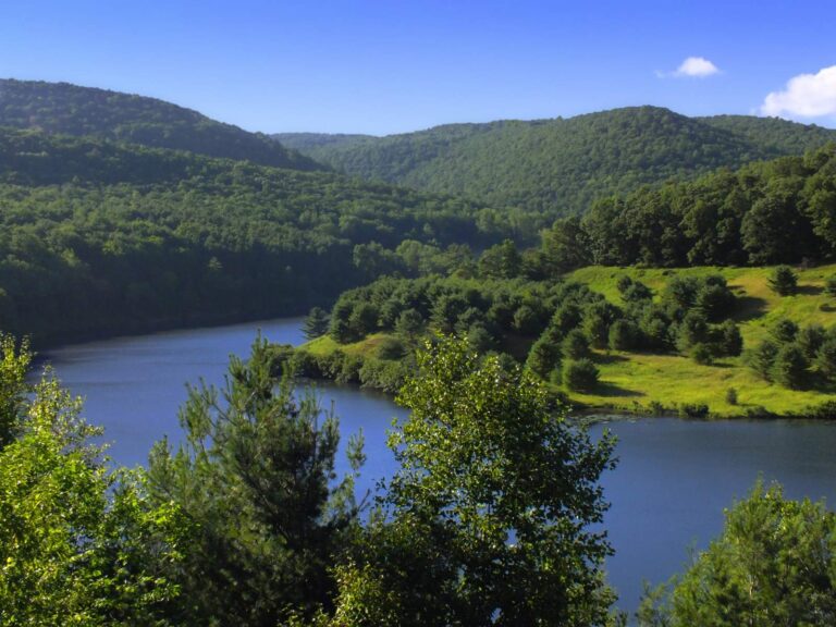
Photo: Nicholas A. Tonelli, CC BY 2.0

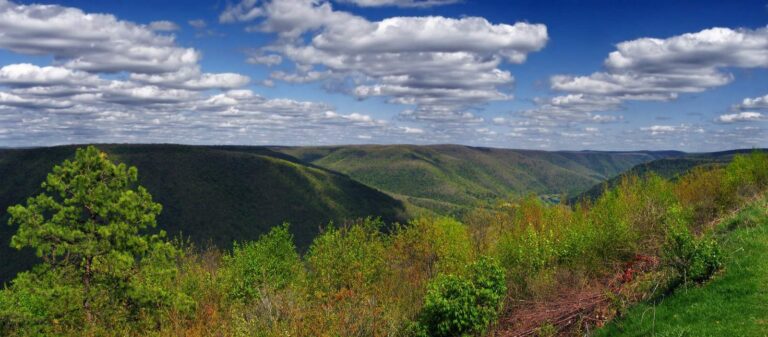
Photo: Nicholas A. Tonelli, CC BY 2.0

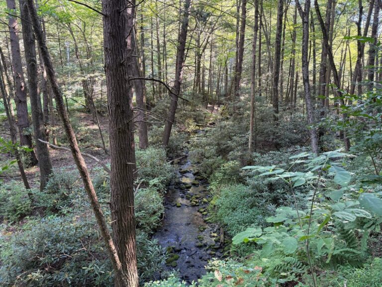
Photo: Famartin, CC BY-SA 4.0

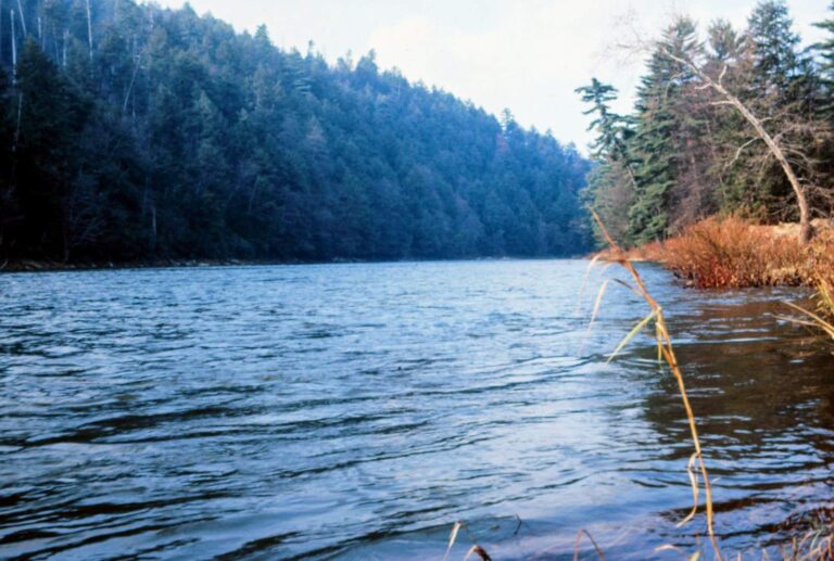
Photo: Chris Light, CC BY-SA 4.0

Questions on Pennsylvania’s Trout Regulation programs
When does trout season open in Pennsylvania in 2026?
April 4, 2026 at 8 a.m. statewide.
When is opening day for trout in 2027?
April 3, 2027, subject to change by regulation.
What is Mentored Youth Trout Day?
March 28, 2026, the Saturday a week before opening day, when youth with a mentor fish stocked waters early; Youth under 16 need a Mentored Youth Permit (free) or Voluntary Youth Fishing License ($2.97) and must be with a license
How many regulated trout waters does Pennsylvania list?
1,066 entries across the six PFBC regions in the 2026 Summary.
What is a Delayed Harvest Artificial Lures Only section?
3 trout (combined), 9-inch minimum, June 15 through Labor Day; 0 from the day after Labor Day until June 15; artificial lures or flies and streamers only; natural bait, fish eggs, bait paste or any e.
Where are the fly-fishing only sections?
34 Catch and Release Fly-Fishing Only sections are listed above by county.
What are Keystone Select waters?
Delayed harvest sections that get large trout of 14 to 20 inches in spring, about 10,000 fish in all.
Do I need a trout permit on these waters?
Yes; every program in the table requires the trout permit ($14.97) along with the license.
Regulation pages next to Pennsylvania Trout Regulation Programs
- Pennsylvania Lake Erie Fishing RulesLake Erie, Presque Isle Bay and tributary limits
- Pennsylvania Delaware River Fishing Rulesthe Delaware River and estuary table, circle hooks and border licenses
- Pennsylvania Special Regulation WatersBig Bass, panfish, brood stock and catch and release lakes, county waters
- Pennsylvania license and regulationsfees, openers and inland limits