Lake Erie Steelhead Streams, Pennsylvania
Erie County tributaries, PFBC access areas, public fishing easements and the tributary rules.
 Pick for steelheadPiscifun Viper X spinning reel50% OFFSale $39.99
Photo of Erie Harbor and Piers: George Neat, CC BY-SA 4.0

Pennsylvania steelhead streams flowing into Lake Erie
18 named streams run from Erie County into Lake Erie, and the PFBC manages them for steelhead under the Lake Erie tributary rules. Along them the PFBC lists 87 angler access areas with frontage and parking notes and 93 public fishing easements on private ground, so most of the fishing is on foot.
Every angler here needs the Lake Erie permit or the combination permit on top of the license. Nursery waters are closed by regulation, though their mouths on the lake can be fished.
| Stream | Miles | Main access | Rule | Access areas | Easements |
|---|---|---|---|---|---|
| Conneaut Creek | 40.3 | Conneaut Creek @ Griffy Road | Lake Erie and Tributaries Regulations | 14 | 13 |
| Elk Creek, Erie County | 32.5 | Elk Creek Access | Lake Erie and Tributaries Regulations | 32 | 35 |
| Walnut Creek | 22 | Walnut Creek Access | Lake Erie and Tributaries Regulations | 7 | 8 |
| Sixmile Creek | 14 | Sixmile Creek @ Route 5 | Lake Erie and Tributaries Regulations | 0 | 0 |
| Crooked Creek, Erie County | 11.9 | Crooked Creek @ Abels Road Bridge | Lake Erie and Tributaries Regulations | 8 | 7 |
| Sixteenmile Creek | 10.9 | Sixteenmile Creek @ Halli Reid Park | Lake Erie and Tributaries Regulations | 1 | 0 |
| Fourmile Creek | 9.5 | Fourmile Creek @ Lawrence Park Golf Course | Lake Erie and Tributaries Regulations | 4 | 4 |
| Twelvemile Creek | 8.4 | Twelvemile Creek @ Route 5 | Lake Erie and Tributaries Regulations | 2 | 2 |
| Trout Run near Avonia, Erie County | 7.4 | Trout Run Mouth | Nursery Waters – Closed to fishing by regulation | 1 | 1 |
| Sevenmile Creek | 7.1 | Sevenmile Creek @ Route 5 | Lake Erie and Tributaries Regulations | 1 | 1 |
| Raccoon Creek, Erie County | 7.1 | Raccoon Creek @ Raccoon Park | Lake Erie and Tributaries Regulations | 3 | 3 |
| Eightmile Creek | 7 | Eightmile Creek @ Shades Beach Park | Lake Erie and Tributaries Regulations | 0 | 0 |
| Turkey Creek | 5.2 | Turkey Creek @ Childs Road | Lake Erie and Tributaries Regulations | 1 | 1 |
| Twentymile Creek | 4.1 | Twentymile Creek @ Angler Parking Area | Lake Erie and Tributaries Regulations | 5 | 6 |
| Cascade Creek | 3.7 | Cascade Creek @ Public Parking Lot Niagara Pier | Lake Erie and Tributaries Regulations | 2 | 2 |
| Orchard Beach Creek | 3.2 | Orchard Beach Creek Mouth | Nursery Waters – Closed to fishing by regulation | 0 | 0 |
| Godfrey Run | 1.1 | Godfrey Run Mouth @ Fairplain Road | Nursery Waters – Closed to fishing by regulation | 1 | 1 |
| Crooked Creek, Erie County | 0.5 | Crooked Creek Mouth | Nursery Waters – Closed to fishing by regulation | 8 | 7 |
PFBC Erie_Steelhead layers (streams, angler parking and access, easements), retrieved October 23, 2026.
 For the steelhead herePiscifun AlumiX spinning reel46% OFFSale $64.99
PFBC steelhead access areas by Erie stream
Cascade Creek
- Parking Lot at Frontier Park1610 feet along both banks; Fishing access available within Frontier Park on both sides. Ample parking available off of Sixth Street, follow walking path to Cascade Creek.
- Parking Lot at Cascade-0.0002100 feet along both banks; Fishing available from parking lot to mouth on both sides. Ample parking available. Owned by Erie Western PA Port Authority. Park south of administration office for condominiums. To access creek,walk over the wooden brid
Conneaut Creek
- Parking available at Conneaut-29.0834,960 feet along both banks; Fishing easement provided by landowner. Limited parking available along Tower Road. Fishing access boundary is marked. Please stay between stream and marked boundary.
- Parking available at Conneaut-31.6881,600 feet along the west bank; Fishing easement provided by Conneautville Borough. Limited parking available at the township building off of Mulberry Road. Fishing access boundary is not marked. Please stay along stream until boundary is marked.
- Parking available at Conneaut-29.0954,960 feet along both banks; Fishing easement provided by landowner. Limited parking available along Tower Road. Fishing access boundary is marked. Please stay between stream and marked boundary.
- Parking off of Jerusaem road6,460 feet along both banks; Fishing easement provided by landowner. Parking available off Jerusalem. Access via the waterway. Fishing access boundary is not marked. Please stay along the stream until boundary is marked.
- Parking off of Jerusaem roadFishing easement provided by landowner. Parking available off Beaver Road on borough of Springboro property. Access via the waterway. Fishing access boundary is not marked. Please stay along the stream until boundary
- Parking off of Griffey road1,165 feet along north bank; Fishing access available on property owned by PFBC. Limited parking available off of Griffey road.
- Parking off of Beaver Road540 linear feet along west side; Fishing easement provided by landowner. Parking available off Beaver Road on borough of Springboro property. Access via the waterway. Fishing access boundary is not marked. Please stay along the stream until boundary
- Parking at Fisher Road3,960 feet along west bank; Fishing easement provided by landowner. Limited parking avaiable off of Fisher road.
- Parking off of Beaver Road185 linear feet along east side; Fishing easement provided by landowner. Parking available off Beaver Road on borough of Springboro property. Access via the waterway. Fishing access boundary is not marked. Please stay along the stream until boundary
- Parking off of Beaver Road1,985 linear feet along east side; Fishing easement provided by landowner. Parking available off Beaver Road on borough of Springboro property. Access via the waterway. Fishing access boundary is not marked. Please stay along the stream until boundary
- Parking off of Beaver Road790 linear feet along east side; Fishing easement provided by landowner. Parking available off Beaver Road on borough of Springboro property. Access via the waterway. Fishing access boundary is not marked. Please stay along the stream until boundary
- Parking at Fisher Road2,170 linear feet along the west bank; Fishing easement provided by landowner. Limited parking avaiable off of Fisher road.
- Parking at Fisher Road1,050 feet along the east bank; Fishing easement provided by landowner. Limited parking avaiable off of Fisher road.
- Parking at Fisher Road1,050 feet along the east bank; Fishing easement provided by landowner. Limited parking avaiable off of Fisher road.
Crooked Creek
- Crooked-1.680 @ Route 51600 feet along both banks; Fishing easement provided by landowner. No parking available on the property, access via the waterway. Fishing access boundary is marked. Please stay between stream and marked boundary.
- Crooked-1.680 @ Route 53000 feet along both banks; Fishing easement provided by landowner. Limited parking available along Route 5, access via the waterway. Fishing access boundary is marked. Please stay between stream and marked boundary.
- Parking area at Crooked 3.0582725 feet along west bank; Fishing easement provided by landowner. No parking available on property, access via the waterway. Fishing access boundary is marked. Please stay between stream and marked boundary.
- Parking area at Crooked 3.0582725 feet along east bank; Fishing easement provided by landowner. Limited parking available along Lucas Road, access via the marked trail from Lucas Road to the stream. Fishing access boundary is marked. Please stay between stream and marked b
- Parking area at Crooked 3.058460 feet along both banks; Fishing easement provided by landowner. No parking available on property, access via the waterway. Fishing access boundary is marked. Please stay between stream and marked boundary.
- Parking at Holliday Road1,675 feet along both banks.; Fishing easement provided by landowner. Limited parking available off of Holliday road. Access via the waterway. Fishing access boundary is not marked. Please stay between stream and marked boundary.
- Parking at Crooked 2.888 lt,rt650 feet along east bank 650 feet along west bank; Fishing access available on PFBC property. Parking available on the property at the intersection of Lucas road and Happy Valley road.
- Crooked 1.0641,675 feet along both banks.; Fishing easement provided by landowner. Limited parking available off of Holliday road. Access via the waterway. Fishing access boundary is not marked. Please stay between stream and marked boundary.
East Br. Conneaut Creek
- Conneaut-0.4073075 feet along both banks; Fishing access available on property owned by Albion Borough (Albion Borough Park). Parking available off of Lisek Circle. Fishing access boundary is marked. Please stay between stream and marked boundary.
Elk Creek
- Parking Lot at Elk-0.0404025 feet along east bank; Fishing access available from parking lot to mouth primarily on east side. Ample parking available. Owned by the PFBC, boat launch also available.
- Parking Lot at Elk-0.1683300 feet along west bank; Fishing access available from mouth upstream 3300 feet primarily on west side. Ample parking available off of Rt. 5. Owned by DCNR (Erie Bluffs State Park), boat launch also available.
- Parking lot at Elk-2.609300 feet along northeast bank; Fishing access available from Elk Park Road downstream 300 feet. Ample parking available. Owned by Girard Township. Fishing access boundary is marked. Please stay between stream and marked boundary.
- Parking Lot at Elk-3.8413270 feet along north bank, 2370 along south bank; Fishing access available on property owned by Girard Borough. Ample parking available off access road in the Park.
- Parking Lot at Elk-15.7282600 feet along north bank; Fishing access available on property owned by Fairview Township (Struchen Flats Park). Ample parking available off of Platz Road.
- Parking Lot at Elk-17.8841860 ft along east bank, 560 ft along west bank; Fishing access available from West Road bridge downstream on property owned by McKean Township (Sterrettania Access). Ample parking available off of West Road.
- Parking Lot at Elk-20.079900 ft along north bank, 450 ft along south bank; Fishing access available from Rick Road downstream 900 feet. Ample parking available along Rick Road. Owned by the PFBC.
- Parking Lot at Elk-22.1911080 feet along north bank; Fishing access available on property owned by McKean Borough (McKean Community Park). Parking available off of Rt. 99/Edinboro Road.
- Parking lot at Elk-2.6091550 feet along northeast bank; Fishing easement donated by Mercyhurst College. Fishing access available from Elk Park Road upstream 1550 feet along northeast bank. Ample parking available at Girard Township parking lot on Elk Park Road, access via th
- Parking lot at Elk-2.6091050 feet along both banks; Fishing easement provided by landowner. Fishing access available from railroad trestle upstream 1050 feet along both banks. Ample parking available at Girard Township parking lot on Elk Park Road, access via the waterw
- Parking Lot @ Elk-3.8411190 feet along west bank, 915 along east bank; Fishing access available on easement provided by landowner. Ample parking available at Girard Borough Park, access via the waterway. Fishing access boundary is marked. Please stay between stream and marked boundary.
- Parking Lot @ Girard American Legion1250 feet along northeast bank; Fishing easement provided by landowner. Parking available at the Girard American Legion, access the waterway. Fishing access boundary is marked. Please stay between stream and marked boundary.
- Driveway by barn @ Elk-19.0462700 feet along north bank, 2200 along south bank; Fishing access available on property acquired by the Lake Erie Region Conservancy. Ample parking available off of West Road. Follow path from parking area to the stream. Fishing access boundary is not marked. Please s
- Parking Lot @ Girard American Legion850 feet along both banks; Fishing easement provided by landowner. Parking available at the Girard American Legion, access the waterway. Fishing access boundary is marked. Please stay between stream and marked boundary.
- Parking area at Elk 21.174280 ft along south bank, 320 ft along north bank; Fishing easement provided by landowner. Limited parking available along West Road, access via the waterway. Fishing access boundary is marked. Please stay between stream and marked boundary.
- Parking area at Elk 4.9254800 ft along north bank, 3080 ft along south bank; Fishing easement provided by landowner. Ample parking available at the Girard American Legion off of Noble Road, access via the waterway. Fishing access boundary is marked. Please stay between stream and marked bounda
- Elk-17.3661700 feet along northeast bank; Fishing access available on property acquired by the Lake Erie Region Conservancy. Parking available along Peffer Road. Fishing access boundary is not marked. Please stay along stream until boundary is marked.
- Parking Area at Elk – 2.0213,600 feet along both banks; Fishing access available on property owned by the Western Pennsylvania Conservancy. Parking available on property off of North Creek Road. Follow trail from parking area to the stream. Please do not use the old access r
- Parking Area at Elk – 15.723,700 feet along both banks; Fishing easement provided by landowner. Ample parking on North side of stream at Struchen Flats Park, access via the waterway. Fishing access boundary is marked. Please stay between stream and marked boundary.
- Parking Area at Elk 2.6092,600 feet along both banks; Fishing easement provided by landowner. Ample parking available at Girard Township parking lot on Elk Park Road, access via the waterway. Fishing access boundary is marked. Please stay between stream and marked boundar
- Parking Area at Elk – 3.8411,895 feet along both banks; Fishing access available on property owned by the Borough of Girard. Ample parking available at Girard Borough Park, access via the waterway.
- Parking area at Elk-20.7521,600 feet along both banks; Fishing access available on PFBC property. Parking off of Skinner Road is very limited. Please do not block the turn around at the end of Skinner Road.
- Parking lot at Elk-20.079410 feet along both banks; Fishing easement provided by landowner. Parking available at PFBC's Rick Road access. Access via the waterway. Fishing access boundary is not marked. Please stay along stream until boundary is marked.
- Parking lot at Elk-15.7281,720 feet along both banks; Fishing easement provided by landowner. Parking available at Fairview Township's Struchen Flats property. Access via the waterway. Fishing access boundary is not marked. Please stay along stream until boundary is mark
- Parking at Folly's End Campground250 feet along west bank; Fishing easement provided by landowner. Parking avaiable at Folly's End Campground. Access via the waterway.
- Parking at Struechen Flats575 feet along east bank 600 feet along west bank; Fishing easement provided by landowner. Parking avaiable at Fairview Township's Struechen Flats property.
- Parking at Folly's End Campground760 feet along west bank; Fishing easement provided by landowner. Parking avaiable at Folly's End Campground. Access via the waterway.
- Parking at Girard Borough Park470 ft along North bank 685 ft along South bank; Fishing easement provided by landowner. Parking available off of access road in Girard Borough Park
- Parking area at Elk 20.0791,900 feet along both banks; Fishing easement provided by landowner. Parking available at Elk 20.079. Access via the waterway. Fishing access boundary is not marked. Please stay along stream until boundary is marked.
- Parking at Elk 7.536 rt2,325 feet along south bank; Fishing easement provided by landowner. Parking available off of Beckman Road on Lake Erie Region Conservancy Property. Park in eastern end of field by Beckman Road. Follow old logging road along eastern side of field
- Parking at Elk 7.536 rt6,325 feet along north bank; Fishing access available on property owned by the PFBC. Parking available off of Beckman Road on PFBC Property. Park in eastern end of field by Beckman Road. Follow old logging road along eastern side of field down to
- Parking area at Elk 21.174280 ft along south bank, 320 ft along north bank; Fishing easement provided by landowner. Limited parking available along West Road, access via the waterway. Fishing access boundary is marked. Please stay between stream and marked boundary.
Fourmile Creek
- Parking around Napier Park.2,075 along east bank; Fishing access available on property owned by Lawrence Park Township (Napier Park). Limited parking available in and around the Park. Fishing access primarily on the east side of the stream.
- Parking at Fourmile 1.5131230 feet along both banks; Fishing access available on property owned by the Lake Erie Region Conservancy. Limited parking available off of Water Street. Access primarily along west side of the stream.
- Parking in Wesleyville Borough Park5.560 feet along both banks; Fishing easement available on property owned by the Borough of Wesleyville. Limited parking available in the Wesleyville Borough Park.
- Parking around Napier Park.1,480 feet along east bank; Fishing access available on property owned by Lawrence Park Township (Napier Park). Limited parking available in and around the Park. Fishing access primarily on the east side of the stream.
Godfrey Run
- Godfrey-0.000145 feet along lake shore; Godfrey Run subject to nursery waters regulations – closed to fishing. Fishing available at lake shore, near mouth. Limited parking along Godfrey Road, walk-in access from road to mouth. Owned by the PFBC.
Presque Isle Bay
- PI-1 @ Route 832Over 4 miles from Ferry Docks to North Pier; Fishing access available at the Waterworks and Ferry Docks, the East and West piers, the Monument and the North pier. Ample parking available. Owned by the PA Dept. of Conservation and Natural Resources (DCNR).
- Parking area at Liberty Park265 linear feet along Presque Isle Bay; Shoreline fishing access available in Presque Isle Bay at Liberty Park at the Edward "Mathews" Mead fishing platform. Property owned by the Erie-Western PA Port Authority. Ample parking available at Liberty Park off of
- Parking Area at Holland Street Pier1,300 feet along Presque Isle Bay; Shoreline fishing access available in Presque Isle Bay at the Holland Street Fishing Pier. Property owned by the Erie-Western PA Port Authority. Ample parking available at Holland Street off of the Bayfront connector.
Raccoon Creek
- Parking Lot at Raccoon-0.0007230 feet along both banks; Fishing access available from mouth upstream on property owned by Springfield Township (Raccoon Creek Park). Ample parking available off of Old Lake Rd.
- Parking Area at Raccoon-1.5261775 feet along both banks; Fishing access available on property owned by the PA Game Commission (SGL#314). Limited parking available off of Elm Rd. Walk-in access to the creek.
- Raccoon-2.4122020 feet along both banks; Fishing access available on property owned by the PA Game Commission (SGL#314). Limited parking available off of Elm Rd. Walk-in access to the creek.
Sevenmile Creek
- Parking off of Route 52,150 ft along east bank 2,810 ft along west bank; Fishing easement provided by landowner. Limited parking available off of Route 5.
Sixteenmile Creek
- Parking Lot at Sixteen-0.000930 feet along southwest bank; Fishing access available near the mouth on the west bank ONLY. Ample parking available at "Halli Reed Park." Owned by Northeast Borough.
Trout Run
- Parking area at Trout-0.000600 feet along lake shore; Trout Run subject to nursery waters regulations – closed to fishing. Fishing available at lake shore near mouth. Ample parking available. Owned by Fairview Twp. Fishing access boundary is marked. Please stay betwee
Turkey Creek
- Turkey-0.00011330 feet along both banks; Fishing access available on property owned by the PA Game Commission (SGL#314). Limited roadside parking available along Childs Road. Alternate parking available along State Line Road.
Twelvemile Creek
- Parking Lot Twelve-0.0001750 feet along both banks; Fishing access available from Route 5 to the mouth on both sides. Ample parking available off of Shorewood Road. Owned by Harborcreek Township.
- Parking at Twelve 0.000 lt,rt490 feet along both banks; Fishing available on property owned by the PFBC. Ample parking available off of Shorewood Drive on Harborcreek township property.
Twentymile Creek
- Parking Lot at Twenty-0.0002700 feet along southwest bank; Fishing access available from Route 5 to the mouth on the west bank ONLY. Ample parking available. Owned by Northeast Township.
- Parking area atTwenty 2.3674350 feet along east bank; Fishing easement provided by landowner. Limited parking available along Gay Road on property owned by North East Township, access via the waterway. Fishing access boundary is marked. Please stay between stream and mar
- Parking area atTwenty 2.3671900 feet along east bank; Fishing access available on property owned by North East Township. Limited parking available along Gay Road. Follow old road from parking area to stream. Fishing access boundary is not marked. Please stay along stream
- Twentymile 0.111
- Twentymile 0.111
Walnut Creek
- Parking Lot at Walnut Creek Access2370 ft along west bank, 1990 ft along east bank; Fishing available from Manchester Road bridge to mouth on both sides, unless otherwise posted. Ample parking available. Owned by the PFBC, boat launch also available. On the south west side of the Manchester Bridge the
- Walnut-2.049 Public Fishing900 feet along both banks; Fishing access available on PFBC property. Parking off of Dutch Road is very limited – please do not park along railroad tracks. Walking access is difficult.
- Parking Lot off Route 832 at Walnut-6.4481885 ft along south bank, 1000 ft along north bank; Fishing access available on Mill Creek Township School District property (Asbury Woods). Parking available off of Rt. 832/ Sterrettania Road. Follow path from parking lot north to the walking bridge over the creek. Fi
- Parking area at Walnut-9.7912600 feet both banks; Fishing access available from Zimmerly Rd upstream 2600 feet. Ample parking available. Owned by Mill Creek Township (Veteran's Park). Fishing access boundary is marked. Please stay between the stream and marked bounda
- Walnut-1.055 @ Route 5560 feet along both banks; Fishing easement provided by landowner. Limited parking available along Rt 5, access via the waterway. Fishing access boundary is marked. Please stay between stream and marked boundary.
- Parking at Walnut-13.0511800 feet along both sides; Fishing Access available on property owned by Millcreek Township (Zimmerly Park). Limited parking available in the park. ADA accessible parking area, access trail and fishing platform on the property.
- Parking at Walnut 0.000 lt,rt360 feet along east bank; Fishing easement provided by landowner. No parking on the property. Parking available at Walnut 0.000 lt,rt. Walk in access only. Do not trespass on neighboring properties.
West Br. Conneaut Creek
- Parking Area at Conneaut-5.0188950 feet along both banks; Fishing access available on property owned by the PA Game Commission (SGL# 101). Limited roadside parking available off of Grirrey Road.
Public fishing easements along the Pennsylvania Erie streams
- West80 easements
- East12 easements
- unlisted1 easements
Easements are leased or bought rights for public fishing on private land; stay on the stream corridor and respect posted ground next to it.
PFBC notes on the Pennsylvania steelhead streams
- Eightmile CreekVery limited steelhead fishing available here and what there is depends on water levels. Shore fishing is available. Access this area via Shades Beach via State Route 5. Property is owned by Harborcreek Township and is open dusk to dawn. No restroom facilities.
- Orchard Beach CreekOrchard Beech Creek is a nursery water.
- Fourmile CreekFishing access is limited to north of the bridge at Lawrence Park Golf Course. Fishing access is available only by walk-in on the west side of the stream. Shore fishing available. No restroom facilities.
- Godfrey RunGodfrey Run is a nursery water and fishing in the creek is prohibited. However, fishing at the mouth of Godfrey for steelhead and walleye is popular when lake conditions are favorable. The mouth of Godfrey can be accessed from Fairplain Road (Township Road 4031), which loops around south of Route 5.
- Raccoon Creek, Erie CountyRaccoon Creek is a small stream that holds some steelhead. Its mouth is located west of the town of North Springfield, just west of Elmwood Home Road (Township Road 324). Raccoon is not an approved trout stream and it is not stocked with "regular" trout for the trout season. However, there is evidence of natural reproduction of trout in this creek. Occasionally the PFBC puts spawned-out steelhead
- Sevenmile CreekWalk in fishing only. Parking is available on State Route 5. Fishing access is available on either side of the stream courtesy of the Benedictine Sisters who own the property on both sides. Shore fishing available. No restroom facilities.
- Sixmile CreekPosted Property: No Fishing.
- Sixteenmile CreekFishing is available from the sewage treatment plant north to the lake. Shore fishing is available. This is a Northeast Township. Park and has adequate parking. The concession facility is closed during steelhead season. No restroom facilities.
- Trout Run near Avonia, Erie CountyTrout Run is a nursery water and fishing in the creek is prohibited. The mouth of Trout Run is the most popular place for shore fishing in the lake for steelhead and walleye. The Fish and Boat Commission maintains a nursery upstream on Trout Run, where it raises and milks steelhead. Thousands of steelhead return to Trout Run every year. This provides excellent fishing for steelhead when the fish s
- Twelvemile CreekFishing is available from State Route 5 and north to the lake. Shore fishing available. This is a good steelhead fishery. Property is owned by Harborcreek Township and has ample parking. No restroom facilities.
- Walnut CreekWalnut Creek is the second largest and second most popular creek for steelhead fishing. Walnut begins south of the Millcreek Mall (which is just east of the Kearsarge exit, Exit 41, of Interstate 79). It flows northwest through Millcreek Township, north through Fairview Township and enters Lake Erie east of the town of Fairview.
- Twentymile CreekThis area is the largest steelhead fishery on the east side of Erie with fishing access to the New York state line. It has some pockets of posted property, especially south of the State Route 5 Bridge and south of the railroad tubes south of State Route 20. Good shore fishing at the lake. Restroom facilities are available at the angler parking area on the west side of the steam north of State Rout
- Elk Creek, Erie CountyElk Creek is the largest and most popular of the Erie County tributary streams. It enters Lake Erie about one-half mile west of State Route 18 in Girard Township. Elk starts south of the Town of McKean. It flows under Interstate 79 at the McKean exit (Exit 39), under West Road (State Road 3020) in the Village of Sterrettania, under State Route 98 at Folly's End Campground south of the Town of Fair
- Crooked Creek, Erie CountyCrooked Creek is the third largest of the western creeks and holds a good population of steelhead. Its mouth is located east of Holiday Road (Township Road 342) and Virginia's Beach, and north of Camp Fitch. Exiting Interstate 90 at the East Springfield exit (Exit 2; Route 215) and traveling north on Route 215 will take you to the lower reaches of Crooked Creek. Turning east from Route 215 onto ei
- Cascade CreekCascade Creek is a small stream that runs through the City of Erie. It is tubed through part of the City. Cascade Creek empties into Presque Isle Bay just west of the Niagara Pier condominiums. Cascade Creek is stocked with trout during the regular trout season. It is stocked from its mouth, through Frontier Park, to just south of West 8th Street.
- Conneaut CreekConneaut Creek is the stream furthest to the west in Erie County. The mouth of this creek is at Conneaut Harbor in Conneaut, Ohio. It is stocked with steelhead by both Ohio and Pennsylvania fish authorities and by PFBC Cooperative Nurseries. Much of this creek is located in Ohio. It enters Erie County south of Interstate 90 and a good distance south of the Lake, and winds through rural lands to be
- Turkey CreekTurkey Creek is located in northwestern Erie County and flows into Ohio.
- Crooked Creek, Erie CountyThe portion of Crooked Creek from the Lake Erie shoreline upstream to Abels Road is a nursery water.
Keystone lakes and creeks seen from Lake Erie Steelhead Streams, Pennsylvania
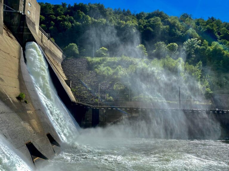
Photo: Andre Carrotflower, CC BY-SA 4.0

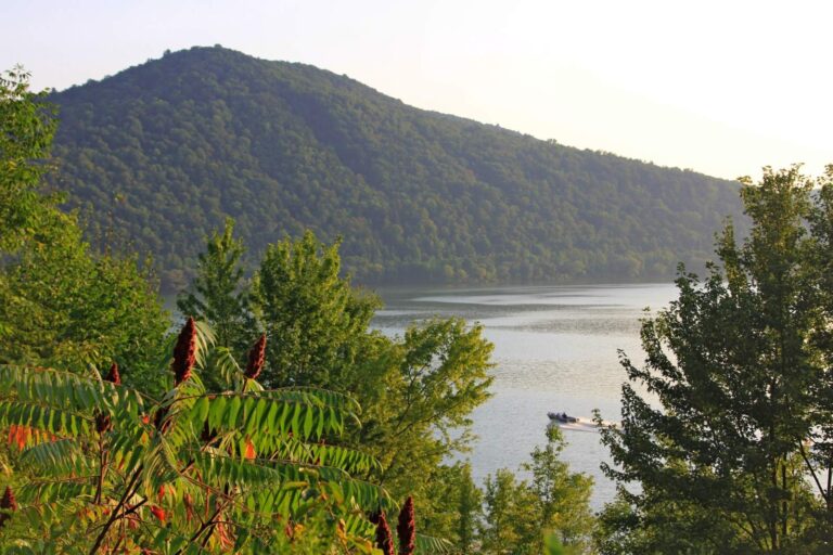
Photo: diego_cue, CC BY-SA 3.0

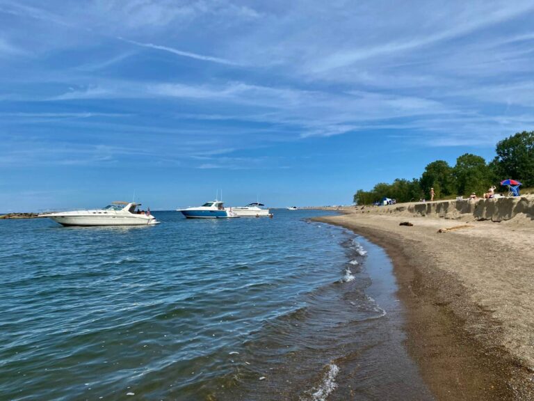
Photo: Andre Carrotflower, CC BY-SA 4.0

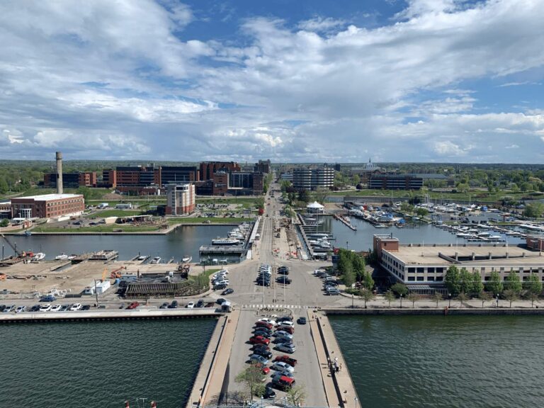
Photo: Cards84664, CC BY-SA 4.0

Pennsylvania steelhead stream questions
How many Pennsylvania streams flow into Lake Erie for steelhead?
18 named tributaries in the PFBC Erie steelhead layer.
Which Erie steelhead stream is longest?
Conneaut Creek, about 40.3 miles in Pennsylvania.
Which stream has the most PFBC access areas?
Elk Creek, with 32.
What permit do I need on the Erie tributaries?
Lake Erie, Presque Isle Bay and their tributaries take a Pennsylvania fishing license plus a Lake Erie permit ($9.97), or a combination trout and Lake Erie permit ($20.97); the resident license is $27.97.
What is a public fishing easement?
A PFBC agreement or purchase that opens private stream frontage to anglers; 93 are listed here.
Can I fish a nursery water like Godfrey Run?
No; nursery waters are closed by regulation, though their mouths on the lake are fished.
When is steelhead season on the tributaries?
Closed to fishing or possessing trout from 12:01 a.m. April 3 until 8 a.m. April 4 (32 hours), no daily limit.
Can I take bait fish from these streams inland?
No; VHS-susceptible fish may not leave the Lake Erie watershed.