Fishing in Pulaski County, Missouri
Courthouse in Waynesville. MDC manages its fish from the MDC Ozark Region.
- 0docks and jetties
- 4ramps
- 6river pages
 Pick for crappiePiscifun Carbon X ultralight spinning reel28% OFFSale $57.99
Photo of Gasconade River: Jason Chung, CC BY 2.0
Pulaski County, read for its lakes and creeks
Waynesville is the seat of Pulaski County, which held 53,955 residents at the 2020 Census. Its area splits into 547 square miles of land and 4.4 of water by Census figures. Fisheries staff from the MDC Ozark Region work these waters.
MDC and the Corps map 4 public ramps in all, and 0 carry the accessible mark. Cold-water fishing centres on Roubidoux Creek and Stone Mill Spring.
Census 2020 population and 2023 Gazetteer areas; MDC Managed Public Waterbody outlines, boat ramp/access, dock, jetty and fish attractor layers; USACE ramp layers; retrieved October 2026.
Every MDC ramp in Pulaski County on the map
MDC boat ramp/access and dock layers, USACE ramps, MDC lake label points and MDC stream access areas. Checked October 2026.
Lakes in Pulaski County with their own guides
These lake pages just outside Pulaski County are the shortest drives from Waynesville.
| Lake | From Waynesville | Acres | Ramps | Motor note | Fish MDC names |
|---|---|---|---|---|---|
| Rinquelin Trail Lake | 19 miles north | 26 | 1 | ||
| Schuman Park Lake | 26 miles east | 5 | 0 | ||
| Osage Beach City Park Lake | 31 miles northwest | 5 | 0 | ||
| Towell Lake | 31 miles northeast | 97 | 1 | largemouth bass, crappie, redear sunfish | |
| Scioto Lake | 35 miles east | 5 | 0 | ||
| Shawnee Lake | 40 miles east | 16 | 1 |
MDC Managed Public Waterbody outlines (GIS acres), MDC 2026 Fishing Prospects species and boating notes; retrieved October 2026.
 For the crappie herePiscifun Carbon XT ultralight spinning reel25% OFFSale $59.99
Species counts for lakes near Pulaski County
Around Waynesville, out to 50 miles, channel catfish appears on the most lake pages.
Species named in MDC 2026 Fishing Prospects text, the MDC state record list and MDC trout program waters, counted per lake page within 50 miles; not a full survey.
Lesser MDC water around Pulaski County
These 5 Pulaski County waters appear on the MDC outline layer without a page.
| Water | Acres | Attractors | Nearest place |
|---|---|---|---|
| T A 250 Lake | 19 | 0 | Fort Leonard Wood |
| Penn's Pond | 10 | 0 | Fort Leonard Wood |
| Indiana Ave Pond | 2 | 0 | Fort Leonard Wood |
| Decker's Ridge Pond | 1 | 0 | Fort Leonard Wood |
| Breeden Spring Pond | 0 | 0 | Fort Leonard Wood |
MDC Managed Public Waterbody outlines and fish attractor layer, retrieved October 2026.
Streams and float water of Pulaski County
- Roubidoux CreekWhite Ribbon trout area, 57 mi in Missouri
- Stone Mill Spring BranchWhite Ribbon trout area
- Gasconade Riversmallmouth management water, 19 MDC ramps, 14 access areas, 262 mi in Missouri
- Big Piney Riversmallmouth and goggle-eye management water, 6 MDC ramps, 7 access areas, 111 mi in Missouri
- Maries River1 access area, 65 mi in Missouri
- Tavern Creek5 access areas, 55 mi in Missouri
Streamflow stations of Pulaski County
| USGS gauge | Latest reading | Time (ET) |
|---|---|---|
| Big Piney Below Fort Leonard Wood, Mo | 151 cfs, 1.69 ft gage height | Nov 11 7:00 pm |
| Big Piney River Near Big Piney, Mo | 140 cfs, 2.24 ft gage height | Nov 11 7:00 pm |
| Roubidoux Creek At Polla Rd Bl Ft. Leonard Wood | 0 cfs, -0.35 ft gage height | Nov 11 6:30 pm |
US Geological Survey provisional data, retrieved Nov 11, 2026 7:33 pm ET. Provisional readings can be revised.
MDC stream access areas and boat ramps, MDC trout and smallmouth management layers, USGS NHD lengths and USGS gauges; retrieved October 2026.
Rainbow and brown trout water of Pulaski County
Keeping trout takes a Missouri trout permit on top of the fishing permit: $12 for residents and $24 for nonresidents 16 and older.
Trout area segments in Pulaski County
| Area | Water and segment | Length | Daily | Lures |
|---|---|---|---|---|
| White Ribbon | Roubidoux Creek: Downstream from Roubidoux Spring — 3.1 miles | Rainbows: none; Browns: at least 15" | 4 | All |
| White Ribbon | Stone Mill Spring: Entire spring branch — 0.3 mile | Rainbows: none; Browns: at least 15" (Feb. 28–Oct. 31, 2026); Catch-and-release (Nov. 1, 2026–Feb. 26, 2027) | 4 (Feb. 28–Oct. 31, 2026); 0 (Nov. 1, 2026–Feb. 26, 2027) | All (Feb. 28–Oct. 31, 2026, or as posted); Artificial lures and flies only (Nov. 1, 2026–Feb. 26, 2027, or as posted) |
- Roubidoux Creek (Downstream from Roubidoux Spring — 3.1 miles)Rainbow Trout (periodic; some also receive brown trout), All receive periodic stockings of rainbow trout, and some also receive brown trout. (White Ribbon Trout Area)
- Stone Mill Spring (Entire spring branch — 0.3 mile)Rainbow Trout (periodic; some also receive brown trout), All receive periodic stockings of rainbow trout, and some also receive brown trout. (White Ribbon Trout Area)
MDC trout program statements (2026 regulations booklet, MDC news releases and area pages); MDC publishes no per-water stocking table; trout areas and trout parks as printed in the 2026 regulations booklet pp. 24 to 27.
Ramps, jetties and docks inside Pulaski County
- Mitschele Access on Gasconade RiverGasconade River, boat ramp, parking
- Riddle Bridge Access on Gasconade RiverGasconade River, boat ramp, parking, privy nearby
- Ross Access on Big Piney RiverBig Piney River, boat ramp, parking
- Schlicht Springs Access on Gasconade RiverGasconade River, boat ramp, parking, privy nearby
MDC boat ramp/access, fishing dock, jetty and cleaning station layers; USACE Little Rock District ramp layers; retrieved October 2026.
The 2026 booklet rows that cover Pulaski County
Statewide limits govern Pulaski County water; the special-regulation bullets after them override.
| Species | Limit | Season |
|---|---|---|
| Black bass (largemouth, smallmouth, spotted/Kentucky) | 6 a day | All year |
| Black bass (largemouth, smallmouth, spotted/Kentucky) (Ozark streams) | 6 a day; 12" minimum | May 23, 2026–Feb. 28, 2027 |
| Channel catfish | 10 a day | All year |
| Blue catfish | 5 a day | All year |
| Flathead catfish | 5 a day | All year |
| Crappie (black and white) | 30 a day | All year |
| Goggle-eye (Ozark, rock, and shadow bass) and warmouth | 15 a day; 7" minimum | All year |
| Muskellunge | 1 (daily limit is 1 muskellunge or 1 northern pike); 36" minimum | All year |
| Northern pike | 1 (daily limit is 1 muskellunge or 1 northern pike) | All year |
| Paddlefish (spoonbill) | 2 a day; 32" minimum (eye to fork of tail) | March 15–April 30 |
| Pickerel (chain and grass) | 6 a day | All year |
| Shovelnose sturgeon | 10 a day; 30" maximum (snout to fork of tail) | All year |
| Trout (rainbow and brown) | 4 a day; Rainbow: none; Brown: 15" minimum in streams | All year |
| Walleye and sauger | 4 a day; 15" minimum | All year |
| White, yellow, and striped bass and their hybrids | 15 a day; No more than 4 longer than 18" | All year |
Booklet bullets that name Pulaski County water (3)
| Water | Where | Rule |
|---|---|---|
| Gasconade River | From Highway Y in Pulaski County to Highway D in Phelps County | Smallmouth bass — 15" minimum length limit. The daily limit of 6 black bass may include only 1 smallmouth bass. |
| Gasconade River | From the U.S. Highway 50 bridge to its confluence with the Missouri River | Nongame fish may be taken by bow and possessed at any hour of the day. |
| Roubidoux Creek | In Pulaski County | The use of porous-soled waders is prohibited. See Page 24. |
Limits and seasons as printed in A Summary of Missouri Fishing Regulations 2026 (MDC, effective March 1, 2026), page 20 (booklet PDF); retrieved October 27, 2026. Rules as printed in A Summary of Missouri Fishing Regulations 2026 (MDC, effective March 1, 2026) (booklet PDF, Special Regulations on Large Lakes and on Rivers and Streams); checked against the current Wildlife Code October 27, 2026.
Missouri record fish tied to Pulaski County
Closest record-fish waters to Pulaski County, within 70 miles, follow.
| Species | Weight | Method | Water | Date | Source |
|---|---|---|---|---|---|
| River Redhorse | 10 lbs. 3 oz. | pole and line | Osage Fork Gasconade River | May 16, 2026 | MDC news release |
| Hybrid Striped Bass | 9 lbs. 1 oz. | jug line | Lake of the Ozarks | Oct. 31, 2016 | MDC record list |
| Hybrid Striped Bass | 21 lbs. 11 oz. | pole and line | Lake of the Ozarks | May 19, 2019 | MDC record list |
| Striped Bass | 39 lbs. 8 oz. | jug line | Lake of the Ozarks | Oct. 11, 2002 | MDC record list |
MDC State Record Fish list (first page of 135 records readable) and MDC news releases, retrieved October 2026.
Pulaski County bait shops and fishing guides
Bait counters and marinas inside Pulaski County
- Bass Wishes Tackle Cobait and tackle shop, Richland
Yellow Pages and chain store listings, guide listings (county of business); retrieved October 2026.
Not far from Pulaski County
Overnight bases across Pulaski County
- Fort Leonard Woodpop. 15,959
- Waynesvillepop. 5,406
- St. Robertpop. 5,192
- Richlandpop. 1,734
- Dixonpop. 1,232
Short drives from Pulaski County by county
- Phelps County23 miles east
- Laclede County24 miles southwest
- Maries County28 miles northeast
- Miller County30 miles northwest
A Piscifun kit to carry to Pulaski County


Piscifun and Amazon links are affiliate links; the site earns a commission on qualifying purchases.
Hollows, bluffs and lakes by Pulaski County, in photos
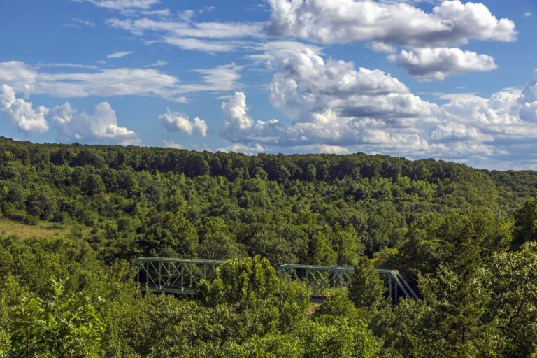
Photo: Richard Ricciardi, CC BY 2.0
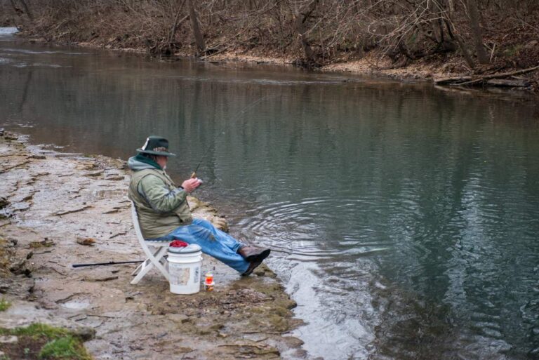
Photo: mostateparks, Public domain


Photo: Richard Ricciardi, CC BY 2.0

Photo: Kbh3rd, CC BY-SA 3.0

A fishing day in Pulaski County, sorted out
Which ramps in Pulaski County are on the MDC list?
4 public ramps; MDC marks 0 accessible.
Which Pulaski County impoundment spreads widest on the MDC map?
No lake page sits inside; Rinquelin Trail Lake, 19 miles away, is the closest.
Which fish do MDC reports name near Pulaski County?
Channel catfish lead the count of lake pages within 50 miles that MDC reports name, followed by crappie, largemouth bass and redear sunfish.
What shops in Pulaski County carry fishing gear?
Bass Wishes Tackle Co is one of 1 shop and marinas here.
Does Pulaski County have resident fishing guides?
No guide lists an address here; the statewide guides page has the rest.
In which Show-Me town does Pulaski County keep its offices?
Waynesville is the seat.
Do Pulaski County trout waters need an extra MDC permit?
A Show-Me State fishing permit runs $14 resident or $57 nonresident, with a $9 option for one day. Possessing trout takes a separate trout permit, $12 for residents.
Which county pages sit beside Pulaski County on the map?
Neighbours by distance: Phelps County, Laclede County and Maries County.
Which MDC region covers Pulaski County?
MDC places it in the MDC Ozark Region.
Which Pulaski County lakes break from statewide limits?
The 2026 booklet prints 3 special-regulation bullets naming this area, starting with Gasconade River; the table above shows each.
Which Pulaski County waters hold stocked trout?
Roubidoux Creek and Stone Mill Spring; MDC trout rules for each are on the linked pages.
Float or fish the streams of Pulaski County
Read the special rules before keeping fish.