New York Trout Streams
DEC trout categories, special sections, wild and stocked reaches and Public Fishing Rights by county.
 Pick for troutPiscifun Carbon X ultralight spinning reel28% OFFSale $57.99
Photo of Esopus Creek: Daniel Case, CC BY-SA 4.0

New York trout streams by DEC category
DEC trout reach data covers 469 stream reaches, about 1,739 miles, on 252 rivers and creeks; 47 carry wild reaches and 218 stocked reaches, with 827,035 trout planned or stocked in those reaches. DEC holds Public Fishing Rights easements on 420 streams.
250 of these streams have a page here, listed by county below; the rest appear on their county page.
DEC trout stream reach and Public Fishing Rights layers, retrieved October 24, 2026.
 For the trout herePiscifun Carbon XT ultralight spinning reel25% OFFSale $59.99
New York inland trout stream categories and limits
| Category | Season | Limit | Size | Notes |
|---|---|---|---|---|
| Wild and Stocked | Apr 1 – Oct 15 | 5, no more than 2 longer than 12" | none | Oct 16 – Mar 31 catch and release, artificial lures only |
| Stocked-Extended and Wild Quality | Apr 1 – Oct 15 | 3, no more than 1 longer than 12" | none | Oct 16 – Mar 31 catch and release, artificial lures only |
| Wild-Premier | Apr 1 – Oct 15 | 1 | Any size | Oct 16 – Mar 31 catch and release, artificial lures only |
| Catch and Release | All year | 0 (catch and release only) | none | Artificial lures only |
DEC inland trout stream regulations page (NYS Department of Environmental Conservation), read October 24, 2026; figures checked twice on October 25, 2026.
New York trout sections with their own category
| Water | Region | Category | Section |
|---|---|---|---|
| Amawalk Outlet (Muscoot River) | 3 | Wild Quality | Muscoot Reservoir upstream to Amawalk Reservoir |
| Beaver Kill | 3 | Stocked-Extended | Downstream end of Beaver Kill Campground upstream to 0.5 mi above covered bridge |
| Cedar Pond Brook | 3 | Wild Quality | Pyngyp Rd/Rt 210 intersection upstream to Cedar Flats Rd/Rt 210 intersection |
| East Branch Croton River | 3 | Stocked-Extended | Confluence with West Branch Croton upstream to Diverting Reservoir Dam |
| East Branch Croton River | 3 | Stocked-Extended | Diverting Reservoir upstream to East Branch Reservoir Dam |
| Esopus Creek | 3 | Wild Quality | Ashokan Reservoir upstream to confluence with Lost Clove Creek |
| Mongaup Creek | 3 | Wild Quality | Willowemoc Creek confluence upstream to tributary south of Catskill Fish Hatchery |
| Neversink River | 3 | Stocked-Extended | Guymard Tpke crossing upstream to Sullivan/Orange Co. line |
| Neversink River | 3 | Catch and Release | Neversink River Unique Area, Sullivan/Orange line upstream to Mercer Brook confluence (privately owned portions excluded) |
| Neversink River | 3 | Stocked-Extended | 1.0 mi downstream of Bridgeville Rd upstream to Wynkoop Brook |
| North Branch Callicoon Creek | 3 | Stocked-Extended | Callicoon Creek confluence upstream to Gossweyler Pond |
| North Branch Callicoon Creek | 3 | Wild Quality | Gossweyler Pond upstream to first Lower Weissman Rd bridge |
| Ramapo River | 3 | Stocked-Extended | Downstream end of H. Pierson Mapes Flat Rock County Park upstream to Arden Valley Rd |
| Rochester Creek | 3 | Wild Quality | Rondout Creek confluence upstream to Mettacahonts Creek confluence |
| Rondout Creek | 3 | Wild Quality | Sundown Creek confluence upstream to upstream-most crossing of County Rt 42 |
| Wappinger Creek | 3 | Stocked-Extended | 500 yd above New Hackensack Rd upstream to 250 yd above Titus/Rochdale Rd junction |
| Wappinger Creek | 3 | Wild Quality | 0.75 mi below Jameson Hill Rd bridge (Clinton Corners) upstream to Hunns Lake Creek (Stanfordville) |
| West Branch Beer Kill | 3 | Wild Quality | Beer Kill confluence upstream to Windsor Lake |
| West Branch Croton River | 3 | Catch and Release | East Branch Croton confluence upstream to Croton Falls Reservoir Dam |
| West Branch Croton River | 3 | Wild Quality | Croton Falls Reservoir upstream to West Branch Reservoir Dam |
| Willowemoc Creek | 3 | Stocked-Extended | Beaver Kill confluence upstream to second Rt 17 Quickway bridge east of Roscoe |
| Willowemoc Creek | 3 | Catch and Release | Second Rt 17 Quickway bridge east of Roscoe upstream 3.5 mi to 1200 ft above Elm Hollow Brook confluence |
| Willowemoc Creek | 3 | Stocked-Extended | 1200 ft above Elm Hollow Brook confluence upstream to Parkston Rd Bridge |
| Willowemoc Creek | 3 | Stocked-Extended | Downstream end of Willowemoc Wild Forest upstream to Fir Brook confluence |
| Batavia Kill | 4 | Wild Quality | East Branch Delaware confluence upstream to source |
| Beaver Kill | 4 | Catch and Release | 1.6 mi below Iron Bridge at Horton upstream to 1 mi above Iron Bridge at Horton |
| Beaver Kill | 4 | Closed to angling July 1 – Aug 31 (thermal stress) | Iron Bridge at Horton downstream to first Rt 17 overpass |
| Beaver Kill | 4 | Stocked-Extended | 1 mi above Iron Bridge at Horton upstream to old railroad trestle 2.5 mi below Sullivan Co. line |
| Beaver Kill | 4 | Catch and Release | Sullivan Co. line downstream of Roscoe downstream 2.5 mi to old railroad trestle |
| Beaver Kill | 4 | Stocked-Extended | Delaware/Sullivan Co. line downstream of Roscoe upstream to Rt 206 Bridge |
| Bushkill | 4 | Wild Quality | Dry Brook confluence upstream to Emory Brook and Vly Creek confluence |
| Bushnellsville Creek | 4 | Wild Quality | Greene/Ulster Co. line upstream to source |
| Catskill Creek | 4 | Stocked-Extended | Basic Creek confluence (Freehold) upstream to Fox Creek confluence (Preston Hollow) |
| Delaware River | 4 | Wild-Premier | Bridge in Lordville upstream to West and East Branch confluence |
| East Branch Delaware River | 4 | Wild-Premier | West Branch Delaware confluence upstream to Rt 206/30 bridge in Downsville |
| East Brook | 4 | Wild Quality | West Branch Delaware confluence upstream to source |
| East Creek (Kinderhook Creek) | 4 | Wild Quality | Kinderhook Creek confluence south of Rt 43 (Stephentown) upstream to State Line |
| Emory Brook | 4 | Wild Quality | Bush Kill confluence upstream to source |
| Kinderhook Creek | 4 | Stocked-Extended | I-90 upstream to East Creek confluence south of Rt 43 (Stephentown) |
| Little Hoosic River | 4 | Wild Quality | Hoosic River confluence upstream to source |
| Panther Creek | 4 | Wild Quality | Rt 4 in West Fulton upstream to source |
| Russell Brook | 4 | Wild Quality | Beaver Kill confluence upstream to source |
| West Branch Delaware River | 4 | Wild-Premier | NY/PA border upstream to 2 mi below Rt 17 bridge at Deposit |
| West Branch Delaware River | 4 | Catch and Release | Rt 17 bridge at Deposit downstream 2 mi |
| West Branch Delaware River | 4 | Wild-Premier | Rt 17 bridge at Deposit upstream to Stilesville Weir |
| West Branch Delaware River | 4 | Stocked-Extended | East Brook (Walton) upstream 35.5 mi to Town Brook (Hobart) |
| Batten Kill | 5 | Stocked-Extended | Whittaker Brook confluence upstream to Rexleigh Bridge |
| Batten Kill | 5 | Stocked-Extended | County Rt 61 Bridge (Shushan) upstream to County Rt 64 Bridge |
| Batten Kill | 5 | Wild Quality | County Rt 64 Bridge upstream to covered bridge in Eagleville |
| Batten Kill | 5 | Catch and Release | Covered bridge at Eagleville upstream to Vermont state line |
| Camden Creek | 5 | Wild Quality | Battenkill confluence upstream about 1,600 ft to upstream end of PFR |
| Chateaugay River | 5 | Stocked-Extended | End of posted PFR 1 mi from US/Canada border upstream to 1.0 mi above Marble River confluence |
| Chateaugay River | 5 | Stocked-Extended | Chasm Dam impoundment upstream to High Falls Dam |
| Hudson River | 5 | Stocked-Extended | Raymond Brook confluence upstream to Thirteenth Brook confluence |
| Kayaderosseras Creek | 5 | Stocked-Extended | Galway Rd upstream to 0.5 mi above N. Creek Rd/Squashville Rd crossing |
| Mettawee River | 5 | Stocked-Extended | Lower Turnpike Bridge (North Granville) upstream to Vermont line |
| North Branch Great Chazy River | 5 | Stocked-Extended | Great Chazy River confluence upstream to Graves Brook confluence |
| North Branch Great Chazy River | 5 | Stocked-Extended | Graves Brook confluence upstream to Lake Roxanne Rd (Ellenburg Depot) |
| Salmon River (Franklin Co.) | 5 | Stocked-Extended | Rt 37 Bridge (Westville Center) upstream to Flatrock Rd Bridge |
| Salmon River (Franklin Co.) | 5 | Catch and Release | Flatrock Rd Bridge upstream to 200 yd below Cargin Rd Bridge |
| Salmon River (Franklin Co.) | 5 | Stocked-Extended | 200 yd below Cargin Rd Bridge upstream to Lamica Lake Dam |
| Saranac River | 5 | Catch and Release | Millstone Monument (Sand Rd/NYS Rt 22B, Morrisonville) upstream to Kent Falls Dam |
| Saranac River | 5 | Stocked-Extended | 1500 ft east of Pup Hill Rd bridge upstream to boundary 100 yd above North Branch Saranac confluence |
| Saranac River | 5 | Catch and Release | Boundary 100 yd above North Branch Saranac confluence upstream 1.4 mi to Stord Brook |
| Schroon River | 5 | Stocked-Extended | Bolton Landing-Riverbank Rd upstream to Starbuckville Dam |
| True Brook | 5 | Wild Quality | Saranac River confluence upstream to Smithkill Brook (0.8 mi west of Number 37 Rd) |
| West Branch Ausable River | 5 | Stocked-Extended | East Branch Ausable confluence upstream to Rt 86 bridge at The Flume |
| West Branch Ausable River | 5 | Catch and Release | Rt 86 bridge at The Flume upstream to Whiteface Ski Center bridge |
| West Branch Ausable River | 5 | Stocked-Extended | Whiteface Ski Center bridge upstream to DEC sign 2.2 mi below Monument Falls |
| West Branch Ausable River | 5 | Catch and Release | DEC sign 2.2 mi below Monument Falls upstream to Holcomb Pond Outlet confluence |
| Crystal Creek | 6 | Wild Quality | Black River confluence upstream to Crystal Pond Dam |
| Crystal Creek | 6 | Wild Quality | Crystal Pond upstream to Erie Canal Rd |
| Fish Creek | 6 | Wild Quality | Black River confluence upstream to 1.5 mi above North South Rd |
| Mohawk River | 6 | Stocked-Extended | Delta Dam downstream to first Barge Canal confluence |
| South Branch Grass River | 6 | Catch and Release | 0.5 mi below Rt 3 upstream to Grass River Flow |
| West Canada Creek | 6 | Stocked-Extended | Bridge Street (Middleville) to Comstock Bridge below Cincinnati Creek mouth |
| West Canada Creek | 6 | Catch and Release | Comstock Bridge upstream to Trenton Falls Dam |
| Butternut Creek | 7 | Stocked-Extended | Kinne Rd upstream to Jamesville Reservoir |
| Butternut Creek | 7 | Stocked-Extended | Jamesville Reservoir upstream to Rt 80 |
| Chittenango Creek | 7 | Stocked-Extended | Russell St (Chittenango) upstream to mile marker 1237 south of the village line |
| Chittenango Creek | 7 | Catch and Release | Mile marker 1237 upstream to Fenner/Sullivan town line (mile marker 1219) |
| Chittenango Creek | 7 | Stocked-Extended | Fenner/Sullivan town line (mile marker 1219) upstream to Rt 20 in Cazenovia |
| Genegantslet Creek | 7 | Catch and Release | First Rt 220 bridge north of Smithville Flats upstream to mouth of Five Streams |
| Limestone Creek | 7 | Stocked-Extended | Erie Canal upstream to Rt 80 |
| Ninemile Creek | 7 | Catch and Release | Onondaga Lake upstream to Amboy Dam |
| Ninemile Creek | 7 | Stocked-Extended | Amboy Dam upstream to dam at Rt 174/Glover Rd junction |
| Old Chenango Canal | 7 | Wild-Premier | Oriskany Creek upstream to Rt 20 bridge |
| Oquaga Creek | 7 | Catch and Release | New Rt 17 bridge west of Deposit upstream 3 mi to old Rt 17 bridge east of McClure |
| Oriskany Creek | 7 | Wild-Premier | Rt 12B Bridge (Oriskany Falls) upstream to Old Chenango Canal |
| Skaneateles Creek | 7 | Catch and Release | Jordan Rd Bridge (Jordan) upstream 10.2 mi to Old Seneca Tpke bridge north of Skaneateles |
| Cayuta Creek | 8 | Stocked-Extended | 0.3 mi above Wyncoop Creek Rd upstream to 0.5 mi above State Rt 13 |
| Cohocton River | 8 | Stocked-Extended | Veterans Ave Bridge (Bath) upstream to County Rt 39A (Atlanta) |
| Cohocton River | 8 | Wild Quality | County Rt 39A (Atlanta) upstream to source |
| Mill Creek | 8 | Wild Quality | Canaseraga Creek confluence to County Rt 90 (Patchinville) |
| Neil Creek | 8 | Wild Quality | Cohocton River confluence upstream to end of PFR section 1500 ft above Mattoon Rd |
| Oatka Creek | 8 | Wild Quality | Bowerman Rd upstream to Union St |
| Oatka Creek | 8 | Catch and Release | Union St upstream 1.7 mi to Wheatland Center Rd |
| Oatka Creek | 8 | Wild Quality | Wheatland Center Rd upstream to Spring Creek confluence |
| Oatka Creek | 8 | Stocked-Extended | Monroe Co. line upstream to Circular Hill Rd |
| Spring Creek | 8 | Wild Quality | Oatka Creek confluence upstream to source |
| Cattaraugus Creek | 9 | Stocked-Extended | Elton Creek confluence upstream to 1.0 mi above Java Lake Rd |
| Clear Creek (Chautauqua Co.) | 9 | Wild-Premier | Conewango Creek confluence upstream to bridge at Cockaigne Ski Area |
| Clear Creek (Erie/Wyoming) | 9 | Wild-Premier | Cattaraugus Creek confluence upstream to NYS Rt 98 crossing near Phillipi Rd |
| East Koy Creek | 9 | Stocked-Extended | Wyoming Co. line upstream to Green Bay Rd |
| Elm Creek | 9 | Wild Quality | Little Conewango Creek confluence upstream to NYS Rt 394 |
| Elton Creek | 9 | Wild Quality | NYS Rt 16 upstream to former bridge on Swanson Hill Rd |
| Fenton Brook (Mud Creek) | 9 | Wild Quality | Conewango Creek upstream to County Rt 6 below Fancher Hill Rd |
| Flynn (Spring) Brook | 9 | Wild Quality | Cattaraugus Creek confluence upstream to Youngers Rd |
| Genesee River | 9 | Stocked-Extended | Belmont Dam (Belmont) upstream to 1.0 mi above County Rt 29 near York's Corners |
| Genesee River | 9 | Catch and Release | 1.0 mi above County Rt 29 (York's Corners) upstream to NYS Rt 19 bridge in Shongo |
| Genesee River | 9 | Stocked-Extended | NYS Rt 19 bridge (Shongo) upstream to State Line |
| Goose Creek | 9 | Stocked-Extended | 0.5 mi below County Rt 35 upstream to Wall St |
| Hosmer (Sardinia) Brook | 9 | Wild Quality | Cattaraugus Creek confluence upstream to Genesee Rd |
| Ischua Creek | 9 | Stocked-Extended | Coal Chutes Rd upstream to Franklinville/Farmersville town line |
| Lime Lake Outlet | 9 | Wild-Premier | Elton Creek confluence upstream to Lime Lake |
| Mansfield Creek | 9 | Wild Quality | 0.5 mi above western-most County Rt 13 (Maples Rd) crossing upstream to Hinman Hollow Rd crossing near Poverty Hill Rd |
| McKinstry Creek | 9 | Wild Quality | Lime Lake Outlet confluence upstream to source |
| North Branch Wiscoy Creek | 9 | Wild Quality | Wiscoy Creek confluence upstream to NYS Rt 362 |
| The Ram | 9 | Wild Quality | Elm Creek confluence upstream to NYS Rt 394 |
| Trout Brook | 9 | Wild Quality | Wiscoy Creek confluence upstream to 0.1 mi above Hillside Rd |
| Wiscoy Creek | 9 | Wild-Premier | Genesee River confluence upstream to Flynn Rd |
New York trout stream pages, county by county
Albany County
- Basic Creek2.9 trout miles, 780 stocked, Public Fishing Rights
- Lisha Kill1.7 trout miles, 560 stocked, Public Fishing Rights
- Vly Creek1.1 trout miles, 250 stocked, Public Fishing Rights
Allegany County
- Black Creek, Allegany County4.1 trout miles, 630 stocked, Public Fishing Rights
- California Hollow Brook1.9 trout miles, 420 stocked, Public Fishing Rights
- Canacadea Creek3.3 trout miles, 700 stocked, Public Fishing Rights
- Canaseraga Creek3.7 trout miles, 1,020 stocked, Public Fishing Rights
- Canisteo River1.8 trout miles, 730 stocked, Public Fishing Rights
- Cryder Creek6.2 trout miles, 1,010 stocked, Public Fishing Rights
- Dodge Creek8 trout miles, 1,200 stocked, Public Fishing Rights
- Dyke Creek1.6 trout miles, 540 stocked, Public Fishing Rights
- Little Genesee Creek5.4 trout miles, 1,030 stocked, Public Fishing Rights
- Root Creek1.6 trout miles, 250 stocked, Public Fishing Rights
Broome County
- Dudley Creek2.2 trout miles, 360 stocked
- East Branch Nanticoke Creek0.5 trout miles, 190 stocked, Public Fishing Rights
- Nanticoke Creek6.3 trout miles, 3,460 stocked, Public Fishing Rights
- Oquaga Creek10.4 trout miles, 3,270 stocked, Public Fishing Rights
Cattaraugus County
- Bone Run1.4 trout miles, 290 stocked, Public Fishing Rights
- Clear Creek, Cattaraugus County7.2 trout miles, wild reaches, Public Fishing Rights
- Elm Creek1.7 trout miles, wild reaches, Public Fishing Rights
- Elton Creek12 trout miles, wild reaches, 4,170 stocked, Public Fishing Rights
- Fivemile Creek1.9 trout miles, 450 stocked
- Forks Creek3.1 trout miles, 360 stocked
- Great Valley Creek1.3 trout miles, 720 stocked, Public Fishing Rights
- Ischua Creek13.1 trout miles, 4,297 stocked, Public Fishing Rights
- Lime Lake Outlet5.4 trout miles, wild reaches, Public Fishing Rights
- Little Conewango Creek9 trout miles, 1,680 stocked, Public Fishing Rights
- Mansfield Creek8.9 trout miles, wild reaches, 430 stocked, Public Fishing Rights
- McKinstry Creek5.2 trout miles, wild reaches, Public Fishing Rights
- Mud Creek8.4 trout miles, wild reaches
- Quaker Run6.3 trout miles, 1,670 stocked, Public Fishing Rights
- Red House Brook8.7 trout miles, 1,770 stocked, Public Fishing Rights
- South Branch Cattaraugus Creek4.6 trout miles, 1,130 stocked, Public Fishing Rights
Cayuga County
- Fall Creek12.8 trout miles, 4,010 stocked, Public Fishing Rights
- North Brook4.3 trout miles, 1,010 stocked, Public Fishing Rights
- Owasco Outlet1.2 trout miles, 830 stocked, Public Fishing Rights
Chautauqua County
- Canadaway Creek2.3 trout miles, 360 stocked, Public Fishing Rights
- Cassadaga Creek1.5 trout miles, 480 stocked, Public Fishing Rights
- Clear Creek, Chautauqua County10.2 trout miles, wild reaches, Public Fishing Rights
- Goose Creek7.3 trout miles, 2,300 stocked, Public Fishing Rights
- Mill Creek, Chautauqua County1.6 trout miles, 540 stocked, Public Fishing Rights
Chemung County
- Post Creek2 trout miles, 570 stocked, Public Fishing Rights
- Sing Sing Creek1.7 trout miles, 360 stocked, Public Fishing Rights
Chenango County
- Genegantslet Creek8.8 trout miles, 3,290 stocked, Public Fishing Rights
Clinton County
- North Branch Great Chazy River12 trout miles, 6,100 stocked, Public Fishing Rights
- Salmon River, Clinton County3.6 trout miles, 350 stocked, Public Fishing Rights
- Saranac River16.7 trout miles, 13,630 stocked, Public Fishing Rights
- True Brook4.8 trout miles, wild reaches, Public Fishing Rights
Columbia County
- Roeliff Jansen Kill14.4 trout miles, 7,510 stocked, Public Fishing Rights
Cortland County
- East Branch Owego Creek, Cortland County4.5 trout miles, 1,190 stocked, Public Fishing Rights
- East Branch Tioughnioga River7.6 trout miles, 5,000 stocked, Public Fishing Rights
- Virgil Creek1.3 trout miles, 440 stocked, Public Fishing Rights
- West Branch Tioughnioga River4.3 trout miles, 2,220 stocked, Public Fishing Rights
Delaware County
- Batavia Kill, Delaware County31.1 trout miles, wild reaches, 6,100 stocked, Public Fishing Rights
- Beaver Kill18.9 trout miles, 24,600 stocked, Public Fishing Rights
- Bush Kill, Delaware County4.7 trout miles, wild reaches, Public Fishing Rights
- Delaware River9.3 trout miles, wild reaches, Public Fishing Rights
- East Branch Delaware River36.3 trout miles, wild reaches, 1,740 stocked, Public Fishing Rights
- East Brook11.6 trout miles, wild reaches, Public Fishing Rights
- Emory Brook6 trout miles, wild reaches, Public Fishing Rights
- Little Delaware River0.8 trout miles, 260 stocked, Public Fishing Rights
- Ouleout Creek4.7 trout miles, 2,380 stocked
- Russell Brook5 trout miles, wild reaches, Public Fishing Rights
Dutchess County
- Crum Elbow Creek7.1 trout miles, 1,540 stocked, Public Fishing Rights
- East Branch Croton River5 trout miles, 7,460 stocked, Public Fishing Rights
- Fishkill Creek11.3 trout miles, 6,190 stocked, Public Fishing Rights
- Sprout Creek8 trout miles, 2,900 stocked, Public Fishing Rights
- Swamp River1.8 trout miles, 600 stocked, Public Fishing Rights
- Tenmile River3.7 trout miles, 2,700 stocked, Public Fishing Rights
- Wappinger Creek14 trout miles, wild reaches, 14,240 stocked, Public Fishing Rights
- Webatuck Creek7.4 trout miles, 1,890 stocked, Public Fishing Rights
Erie County
- Cayuga Creek1.6 trout miles, 2,220 stocked, Public Fishing Rights
- East Branch Cazenovia Creek2.6 trout miles, 1,230 stocked, Public Fishing Rights
- Eighteenmile Creek1 trout miles, 440 stocked, Public Fishing Rights
- Hosmer Brook2.5 trout miles, wild reaches, Public Fishing Rights
- Little Buffalo Creek2.2 trout miles, 870 stocked
Essex County
- Boquet River15 trout miles, 7,710 stocked, Public Fishing Rights
- Boreas River3.1 trout miles, 1,980 stocked, Public Fishing Rights
- East Branch Ausable River20 trout miles, 17,800 stocked, Public Fishing Rights
- La Chute0.9 trout miles, 1,200 stocked
- Schroon River13 trout miles, 15,470 stocked, Public Fishing Rights
- South Meadow Brook1.4 trout miles, 540 stocked, Public Fishing Rights
- West Branch Ausable River34.1 trout miles, 29,217 stocked, Public Fishing Rights
Franklin County
- Chateaugay River11 trout miles, 7,010 stocked, Public Fishing Rights
- Deer River, Franklin County9.4 trout miles, 2,720 stocked, Public Fishing Rights
- Little Salmon River3.8 trout miles, 1,970 stocked, Public Fishing Rights
- North Branch Saranac River7.5 trout miles, 5,540 stocked, Public Fishing Rights
- Saint Regis River5.8 trout miles, 6,950 stocked, Public Fishing Rights
- Salmon River, Franklin County21.2 trout miles, 26,550 stocked, Public Fishing Rights
- Trout River1.4 trout miles, 570 stocked
- Twobridge Brook9.8 trout miles, 1,040 stocked, Public Fishing Rights
Fulton County
- Cayadutta Creek3.6 trout miles, 1,170 stocked, Public Fishing Rights
- Middle Sprite Creek1 trout miles, 320 stocked, Public Fishing Rights
Genesee County
- Little Tonawanda Creek3.6 trout miles, 360 stocked, Public Fishing Rights
Greene County
- Bushnellsville Creek2.6 trout miles, wild reaches, Public Fishing Rights
- East Kill5.3 trout miles, 2,690 stocked, Public Fishing Rights
- Schoharie Creek, Greene County19.7 trout miles, 14,140 stocked, Public Fishing Rights
- West Kill, Greene County3.1 trout miles, 520 stocked, Public Fishing Rights
Hamilton County
- Cedar River1.6 trout miles, 1,010 stocked, Public Fishing Rights
- East Canada Creek10 trout miles, 4,180 stocked, Public Fishing Rights
- Indian River, Hamilton County1.7 trout miles, 2,740 stocked, Public Fishing Rights
- Jessup River3.2 trout miles, 1,740 stocked, Public Fishing Rights
- Mill Creek, Hamilton County2.8 trout miles, 580 stocked, Public Fishing Rights
- Raquette River1.8 trout miles, 2,140 stocked, Public Fishing Rights
- Sacandaga River6.2 trout miles, 4,480 stocked, Public Fishing Rights
- South Branch West Canada Creek3.7 trout miles, 2,760 stocked, Public Fishing Rights
- West Branch Sacandaga River1.3 trout miles, 1,220 stocked, Public Fishing Rights
Herkimer County
- Black River19.2 trout miles, 21,340 stocked, Public Fishing Rights
- Oswegatchie River4.9 trout miles, 3,320 stocked, Public Fishing Rights
- Otsquago Creek3.3 trout miles, 520 stocked
- Spruce Creek2.6 trout miles, 820 stocked, Public Fishing Rights
- Sunday Creek2.8 trout miles, 740 stocked, Public Fishing Rights
- Unadilla River0.9 trout miles, 270 stocked, Public Fishing Rights
- West Branch Oswegatchie River4.7 trout miles, 2,720 stocked, Public Fishing Rights
- West Canada Creek28.8 trout miles, 35,980 stocked, Public Fishing Rights
Jefferson County
- Black Creek, Jefferson County16.9 trout miles, 4,670 stocked, Public Fishing Rights
- Felts Mills Creek2.4 trout miles, 720 stocked, Public Fishing Rights
- Jacobs Creek2.8 trout miles, 460 stocked, Public Fishing Rights
- North Branch Sandy Creek1 trout miles, 350 stocked
- Sandy Creek, Jefferson County3.4 trout miles, 1,360 stocked, Public Fishing Rights
- South Sandy Creek near Lorraine, Jefferson County2.8 trout miles, 510 stocked, Public Fishing Rights
- Townsend Creek2.2 trout miles, 350 stocked, Public Fishing Rights
- West Branch Black Creek3.1 trout miles, 780 stocked, Public Fishing Rights
Lewis County
- Alder Creek4.1 trout miles, 1,480 stocked, Public Fishing Rights
- Crystal Creek10.3 trout miles, wild reaches, Public Fishing Rights
- East Branch Fish Creek8.2 trout miles, 4,910 stocked, Public Fishing Rights
- Fish Creek, Lewis County6.3 trout miles, wild reaches, Public Fishing Rights
- Indian River, Lewis County1.9 trout miles, 440 stocked, Public Fishing Rights
- Moose River1.5 trout miles, 1,680 stocked, Public Fishing Rights
- Otter Creek1.7 trout miles, 870 stocked, Public Fishing Rights
- Point Rock Creek8.1 trout miles, 1,510 stocked, Public Fishing Rights
- Salmon River, Lewis County2.3 trout miles, 1,070 stocked, Public Fishing Rights
- West Branch Deer River1.8 trout miles, 700 stocked, Public Fishing Rights
Livingston County
- Genesee River25.8 trout miles, 30,120 stocked, Public Fishing Rights
- Spring Creek1.6 trout miles, wild reaches, Public Fishing Rights
- Sugar Creek, Livingston County0.6 trout miles, 460 stocked
Madison County
- Beaver Creek, Madison County1.6 trout miles, 450 stocked, Public Fishing Rights
- Chenango River3.1 trout miles, 1,290 stocked, Public Fishing Rights
- Chittenango Creek16.6 trout miles, 14,770 stocked, Public Fishing Rights
- Oneida Creek4.5 trout miles, 780 stocked, Public Fishing Rights
- Oriskany Creek12.2 trout miles, wild reaches, 3,510 stocked, Public Fishing Rights
- Otselic River22.3 trout miles, 9,120 stocked, Public Fishing Rights
- Payne Brook1.4 trout miles, 390 stocked
Monroe County
- Oatka Creek, Monroe County11.4 trout miles, wild reaches, 10,490 stocked, Public Fishing Rights
Oneida County
- Lansing Kill3 trout miles, 960 stocked, Public Fishing Rights
- Mohawk River10.7 trout miles, 9,640 stocked, Public Fishing Rights
- Ninemile Creek, Oneida County6.2 trout miles, 3,620 stocked, Public Fishing Rights
- Sangerfield River0.9 trout miles, 450 stocked, Public Fishing Rights
- Sauquoit Creek5.1 trout miles, 1,260 stocked, Public Fishing Rights
- Sconondoa Creek2.1 trout miles, 560 stocked, Public Fishing Rights
Onondaga County
- Butternut Creek, Onondaga County22.1 trout miles, 7,498 stocked, Public Fishing Rights
- Carpenters Brook1.8 trout miles, 775 stocked, Public Fishing Rights
- Fabius Brook3 trout miles, 2,250 stocked, Public Fishing Rights
- Geddes Brook2 trout miles, 800 stocked, Public Fishing Rights
- Limestone Creek22.6 trout miles, 7,695 stocked, Public Fishing Rights
- Ninemile Creek, Onondaga County18.8 trout miles, 10,645 stocked, Public Fishing Rights
- Skaneateles Creek22.3 trout miles, 538 stocked, Public Fishing Rights
Ontario County
- Canandaigua Outlet6.3 trout miles, 3,900 stocked, Public Fishing Rights
Orange County
- Moodna Creek3.9 trout miles, 2,590 stocked, Public Fishing Rights
- Ramapo River11.3 trout miles, 8,080 stocked, Public Fishing Rights
- Rutgers Creek0.8 trout miles, 360 stocked
- Shawangunk Kill0.8 trout miles, 360 stocked, Public Fishing Rights
Oswego County
- Mad River, Oswego County1.1 trout miles, 400 stocked, Public Fishing Rights
- North Branch Salmon River9 trout miles, 3,030 stocked, Public Fishing Rights
- West Branch Fish Creek19.8 trout miles, 8,880 stocked, Public Fishing Rights
Otsego County
- Canajoharie Creek2.1 trout miles, 650 stocked
- Elk Creek6.1 trout miles, 1,340 stocked, Public Fishing Rights
- Otego Creek9.7 trout miles, 2,390 stocked, Public Fishing Rights
- Schenevus Creek6.4 trout miles, 3,250 stocked, Public Fishing Rights
- Wharton Creek12.5 trout miles, 4,280 stocked, Public Fishing Rights
Putnam County
- Muscoot River3.1 trout miles, 550 stocked, Public Fishing Rights
- Peekskill Hollow Creek0.6 trout miles, 360 stocked
- West Branch Croton River5.1 trout miles, wild reaches, 2,900 stocked, Public Fishing Rights
Rensselaer County
- East Creek2.6 trout miles, wild reaches, Public Fishing Rights
- Kinderhook Creek19.9 trout miles, 20,200 stocked, Public Fishing Rights
- Little Hoosic River19.9 trout miles, wild reaches, Public Fishing Rights
- Poesten Kill5.6 trout miles, 2,190 stocked, Public Fishing Rights
- Walloomsac River5.6 trout miles, 4,910 stocked, Public Fishing Rights
Rockland County
- Cedar Pond Brook0.8 trout miles, wild reaches
- Mahwah River3.3 trout miles, 640 stocked, Public Fishing Rights
- Minisceongo Creek2.9 trout miles, 580 stocked, Public Fishing Rights
- Pascack Brook0.5 trout miles, 360 stocked, Public Fishing Rights
- Stony Brook, Rockland County1.6 trout miles, 460 stocked, Public Fishing Rights
Saratoga County
- Geyser Brook2.4 trout miles, 520 stocked, Public Fishing Rights
- Glowegee Creek2.2 trout miles, 740 stocked, Public Fishing Rights
- Hudson River16.1 trout miles, 17,740 stocked, Public Fishing Rights
- Kayaderosseras Creek15 trout miles, 8,320 stocked, Public Fishing Rights
- Snook Kill9.2 trout miles, 1,760 stocked, Public Fishing Rights
Schoharie County
- Catskill Creek13.2 trout miles, 8,440 stocked, Public Fishing Rights
- Charlotte Creek, Schoharie County3.7 trout miles, 1,280 stocked, Public Fishing Rights
- Panther Creek5.8 trout miles, wild reaches, Public Fishing Rights
- West Branch Delaware River55.6 trout miles, wild reaches, 18,040 stocked, Public Fishing Rights
- West Kill, Schoharie County4.2 trout miles, 810 stocked, Public Fishing Rights
Schuyler County
- Cayuta Creek12.8 trout miles, 14,920 stocked, Public Fishing Rights
- Meads Creek2.9 trout miles, 1,020 stocked, Public Fishing Rights
Seneca County
- Canoga Creek0.3 trout miles, 330 stocked, Public Fishing Rights
St. Lawrence County
- Bog River1 trout miles, 660 stocked
- Grass River1.3 trout miles, 1,440 stocked, Public Fishing Rights
- Hopkinton Brook1.5 trout miles, 410 stocked, Public Fishing Rights
- Little River, St. Lawrence County3.3 trout miles, 2,750 stocked, Public Fishing Rights
- Plumb Brook6.1 trout miles, 2,570 stocked, Public Fishing Rights
- South Branch Grass River8 trout miles, 2,530 stocked, Public Fishing Rights
- Trout Brook, St. Lawrence County1.2 trout miles, 350 stocked
- West Branch St. Regis River2.8 trout miles, 2,760 stocked, Public Fishing Rights
Steuben County
- Bennetts Creek1.2 trout miles, 260 stocked, Public Fishing Rights
- Cohocton River37.8 trout miles, wild reaches, 14,760 stocked, Public Fishing Rights
- Mill Creek, Steuben County8.8 trout miles, wild reaches, Public Fishing Rights
- Neil Creek7 trout miles, wild reaches, Public Fishing Rights
Sullivan County
- Callicoon Creek1.2 trout miles, 440 stocked, Public Fishing Rights
- East Branch Callicoon Creek5 trout miles, 1,290 stocked, Public Fishing Rights
- Halfway Brook1 trout miles, 360 stocked
- Little Beaver Kill4.8 trout miles, 860 stocked, Public Fishing Rights
- Mongaup Creek4.2 trout miles, wild reaches, Public Fishing Rights
- Mongaup River0.7 trout miles, 690 stocked
- Neversink River38.1 trout miles, 14,560 stocked, Public Fishing Rights
- North Branch Callicoon Creek9.6 trout miles, wild reaches, 1,720 stocked, Public Fishing Rights
- Sandburg Creek1.2 trout miles, 570 stocked, Public Fishing Rights
Tioga County
- Catatonk Creek0.9 trout miles, 590 stocked
- East Branch Owego Creek, Tioga County0.7 trout miles, 620 stocked
- Owego Creek4.2 trout miles, 3,530 stocked, Public Fishing Rights
Tompkins County
- Enfield Creek2.1 trout miles, 580 stocked, Public Fishing Rights
- West Branch Owego Creek7.4 trout miles, 2,200 stocked, Public Fishing Rights
Ulster County
- Beer Kill1.8 trout miles, 670 stocked, Public Fishing Rights
- Black Creek, Ulster County2 trout miles, 490 stocked, Public Fishing Rights
- Esopus Creek18.5 trout miles, wild reaches, Public Fishing Rights
- Plattekill Creek1.5 trout miles, 870 stocked, Public Fishing Rights
- Rochester Creek6.8 trout miles, wild reaches
- Rondout Creek14.5 trout miles, wild reaches, 6,330 stocked, Public Fishing Rights
- Saw Kill5.9 trout miles, 2,390 stocked, Public Fishing Rights
- Vernooy Kill0.8 trout miles, 260 stocked
- West Branch Beer Kill4.2 trout miles, wild reaches, Public Fishing Rights
- Willowemoc Creek19.4 trout miles, 17,000 stocked, Public Fishing Rights
Warren County
- Glen Brook1 trout miles, 430 stocked, Public Fishing Rights
- Mill Creek, Warren County5.8 trout miles, 1,695 stocked, Public Fishing Rights
- North Creek2.5 trout miles, 825 stocked, Public Fishing Rights
Washington County
- Batten Kill17.5 trout miles, wild reaches, 19,330 stocked, Public Fishing Rights
- Camden Creek0.3 trout miles, wild reaches, Public Fishing Rights
- Indian River, Washington County3.2 trout miles, 380 stocked, Public Fishing Rights
- Mettawee River9.8 trout miles, 9,400 stocked, Public Fishing Rights
Westchester County
- Croton River1 trout miles, 1,140 stocked, Public Fishing Rights
- Pocantico River1.9 trout miles, 640 stocked, Public Fishing Rights
- Titicus River0.6 trout miles, 420 stocked, Public Fishing Rights
Wyoming County
- Cattaraugus Creek16.4 trout miles, 13,430 stocked, Public Fishing Rights
- East Koy Creek13.5 trout miles, 13,040 stocked, Public Fishing Rights
- North Branch Wiscoy Creek3.5 trout miles, wild reaches, Public Fishing Rights
- Spring Brook3.6 trout miles, wild reaches, Public Fishing Rights
- Tonawanda Creek, Wyoming County2.9 trout miles, 740 stocked
- Trout Brook, Wyoming County2.9 trout miles, wild reaches, Public Fishing Rights
- Wiscoy Creek22.5 trout miles, wild reaches, Public Fishing Rights
Yates County
- Keuka Lake Outlet6.5 trout miles, 1,600 stocked
New York shorelines a short drive from Trout streams
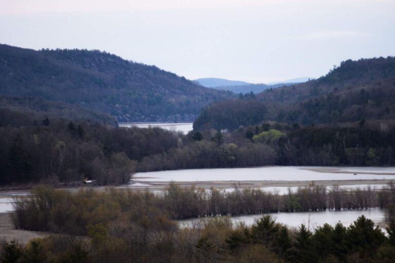
Photo: Tyler A. McNeil, CC BY-SA 4.0

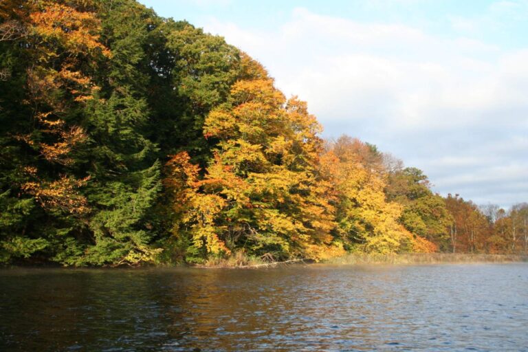
Photo: Ron Shawley, CC BY 3.0

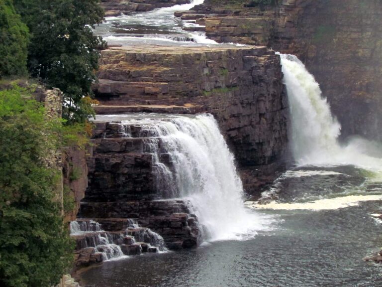
Photo: bobistraveling, CC BY 2.0


Photo: Andre Carrotflower, CC BY-SA 4.0

New York trout stream questions
How many trout stream sections have special rules in New York?
121 sections across DEC regions, in 5 categories.
What are the New York trout stream categories?
Wild and Stocked, Stocked-Extended and Wild Quality, Wild-Premier and Catch and Release.
How many trout may I keep from a Wild and Stocked stream?
5, no more than 2 longer than 12", Apr 1 – Oct 15.
What is a Wild-Premier stream?
A DEC category with a 1 limit, any size, from Apr 1 – Oct 15.
Can I fish New York trout streams in winter?
Yes, from October 16 to March 31 as catch and release with artificial lures on the statewide streams.
What are Public Fishing Rights?
Permanent easements DEC buys along private stream banks so anglers can walk and fish them; 420 streams carry them.
Which New York creek or river receives the biggest trout stocking?
West Canada Creek, 35,980 fish in its stocked reaches.
Does a New York trout angler buy any extra stamp?
Trout and salmon need no stamp in New York; the DEC freshwater license ($25.00 resident, $50.00 nonresident, $5.00 for residents 70 and older) covers them.