Lake Ontario Fishing
New York access, DEC limits and charters on Lake Ontario.
 Pick for brown troutPiscifun Carbon X ultralight spinning reel28% OFFSale $57.99
Photo: Dillan Payne, CC BY-SA 4.0
Introducing Lake Ontario
On the New York side, Lake Ontario borders Niagara County and 6 other counties; it is a Great Lake. Species with DEC seasons or limits here include brown trout, rainbow trout, coho salmon, chinook salmon, lake trout, atlantic salmon, brook trout, northern pike and black bass.
For the entire lake, US and Canadian waters together, the EPA lists 7,340 square miles, a mean depth of 283 feet, a maximum of 802 feet and 712 miles of shore. Counted here: 47 launches, 1 pier, 0 more shore sites, 4 named harbors and 15 tributaries with pages.
EPA Physical Features of the Great Lakes (whole lake, all jurisdictions); USGS GNIS, DEC launch, fishing access and marine access layers, retrieved October 24, 2026.
 For the brown trout herePiscifun Carbon XT ultralight spinning reel25% OFFSale $59.99
Access sites along Lake Ontario
Ramps and hand launches serving Lake Ontario
- Chaumont Boat Launchhard surface ramp, 100 parking spaces; managed by Oprhp
- Fair Haven Beachboat launch
- Fort Niagara Launchboat launch
- Genesee River/Lake Ontario access, Monroe Countyhard surface ramp, 40 parking spaces; managed by Municipal
- Golden Hill Launchboat launch
- Hamlin Beachboat launch
- Irondequoit Bay Marine Parkboat launch
- Lake Ontario (Black River Bay at Lloyds Landing) access, Jefferson Countyunpaved trailer launch, 20 parking spaces; managed by DEC
- Lake Ontario (Black River Bay at Muskellunge Creek) access, Jefferson Countyunpaved trailer launch, 24 parking spaces; managed by DEC
- Lake Ontario (Black River Bay at Perch River) access, Jefferson Countyunpaved trailer launch, 5 parking spaces; managed by DEC
- Lake Ontario (Chaumont Bay) access, Jefferson Countyunpaved trailer launch, 20 parking spaces; managed by Oprhp
- Lake Ontario (East Bay) access, Wayne County (north)hand launch, 8 parking spaces; managed by DEC
- Lake Ontario (East Bay) access, Wayne County (south)unpaved trailer launch, 5 parking spaces; managed by DEC
- Lake Ontario (Henderson Harbor) access, Jefferson Countyhard surface ramp, 80 parking spaces; managed by Municipal
- Lake Ontario (Mud Bay) access, Jefferson Countyunpaved trailer launch, 30 parking spaces; managed by DEC
- Lake Ontario (Port Bay) access, Wayne County (north)hard surface ramp, 35 parking spaces; managed by DEC
- Lake Ontario (Port Bay) access, Wayne County (south)hard surface ramp, 28 parking spaces; managed by DEC
- Lake Ontario (Sackets Harbor) access, Jefferson Countyhard surface ramp, 9 parking spaces; managed by Municipal
- Lake Ontario (Sodus Bay) access, Wayne Countyhard surface ramp, 20 parking spaces; managed by Municipal
- Lake Ontario (Three Mile Bay) access, Jefferson Countyhard surface ramp, 14 parking spaces; managed by DEC
- Lake Ontario access, Cayuga Countyhard surface ramp, 150 parking spaces; managed by Oprhp
- Lake Ontario access, Jefferson County (east)hard surface ramp, 35 parking spaces; managed by Oprhp
- Lake Ontario access, Jefferson County (west)hard surface ramp, 40 parking spaces; managed by DEC
- Lake Ontario access, Monroe Countyhand launch, 3 parking spaces; managed by Oprhp
- Lake Ontario access, Niagara Countyhand launch; managed by Oprhp
- Lake Ontario access, Niagara County (east)hard surface ramp, 55 parking spaces; managed by Oprhp
- Lake Ontario access, Niagara County (west)hard surface ramp, 50 parking spaces; managed by Oprhp
- Lake Ontario access, Wayne Countyhard surface ramp, 30 parking spaces; managed by US Coast Guard
- Lake Ontario/Braddock Bay access, Monroe Countyhand launch, 10 parking spaces; managed by DEC
- Lake Ontario/Eighteenmile Creek access, Niagara Countyhard surface ramp, 100 parking spaces; managed by Municipal
- Lake Ontario/Irondequoit Bay access, Monroe County (north)hard surface ramp, 28 parking spaces; managed by Oprhp
- Lake Ontario/Irondequoit Bay access, Monroe County (south)hand launch, 6 parking spaces; managed by Municipal
- Lake Ontario/Oak Orchard Creek access, Orleans Countyhard surface ramp, 121 parking spaces; managed by Oprhp
- Lake Ontario/Oak Orchard Creek access, Orleans Countyhard surface ramp, 42 parking spaces; managed by Oprhp
- Lake Ontario/Oswego River access, Oswego Countyhard surface ramp, 100 parking spaces; managed by Municipal
- Lake Ontario/Sandy Creek access, Monroe Countyhard surface ramp, 50 parking spaces; managed by DEC
- Lake Ontario/Slater Creek access, Monroe Countyhand launch, 25 parking spaces; managed by DEC/Municipal
- Lake Ontario/Twelvemile Creek access, Niagara Countyhand launch, 20 parking spaces; managed by Oprhp
- Mexico Point Marine Parkhard surface ramp, 134 parking spaces; managed by Oprhp
- Niagara River (lower)/Lake Ontario access, Niagara Countyhard surface ramp, 44 parking spaces; managed by Oprhp
- North Sandy Pond/Lake Ontario access, Oswego Countyhard surface ramp, 25 parking spaces; managed by DEC
- Oak Orchard Marine Parkboat launch
- Salmon River/Lake Ontario access, Oswego Countyunpaved trailer launch, 120 parking spaces; managed by Oprhp
- Selkirk Shores Launchboat launch
- Stony Creek Boat Launchhard surface ramp, 84 parking spaces; managed by Oprhp
- Westcott Beachboat launch
- Wilson-Tuscarora Launchboat launch
Piers and docks on Lake Ontario
DEC boat launch, fishing access and marine access layers, NYS Parks launches, USGS GNIS, retrieved October 24, 2026.
Where streams and harbors meet Lake Ontario
- Basin HarborJefferson County, harbor (gnis bay)
- Dels Boat BasinJefferson County, harbor (gnis bay)
- Henderson HarborJefferson County, harbor (gnis bay)
- Sackets HarborJefferson County, harbor (gnis bay)
Bays on the New York side of Lake Ontario
- Big Massaug CoveMonroe County
- Black River BayJefferson County
- Blind Creek CoveOswego County
- Blind Sodus BayWayne County
- Boomer CoveJefferson County
- Braddock BayMonroe County
- Briscoe CoveWayne County
- Carrying PlaceJefferson County
- Chaumont BayJefferson County
- Connellys CoveWayne County
- Duck BayJefferson County
- East BayWayne County
- Fuller BayJefferson County
- Gravely BayJefferson County
- Guffin BayJefferson County
- Helds CoveMonroe County
- Henderson BayJefferson County
- Ides CoveMonroe County
- Irondequoit BayMonroe County
- Little Sodus BayCayuga County
- Long BayJefferson County
- Maxwell BayWayne County
- Meadow CoveCayuga County
- Mexico BayOswego County
- Mud BayJefferson County
- Muskellunge BayJefferson County
- Port BayWayne County
- Ray BayJefferson County
- Reeds BayJefferson County
- Renshaw BayOswego County
- Sawmill BayJefferson County
- Sawmill CoveWayne County
- Sawyer BayJefferson County
- Sherwin BayJefferson County
- Snowshoe BayJefferson County
- Sodus BayWayne County
- Three Mile BayJefferson County
- Toad HoleJefferson County
- Tuscarora BayNiagara County
- Whites BayJefferson County
- Wilson BayJefferson County
Streams that run into Lake Ontario
- Black Riverbrown trout, steelhead, coho salmon, chinook salmon, smallmouth bass, sunfish, yellow perch, northern pike, chain pickerel, walleye, carp, channel catfish
- Eighteen Mile Creek, Niagara Countybrown trout, steelhead, atlantic salmon, chinook salmon, coho salmon, smallmouth bass, largemouth bass, sunfish, yellow perch, crappie, northern pike, carp, channel catfish
- Genesee Riverbrown trout, steelhead, coho salmon, chinook salmon, walleye, carp
- Irondequoit Creekbrown trout, chinook salmon, coho salmon, steelhead
- Johnson Creekbrown trout, chinook salmon, coho salmon, steelhead
- Lindsey Creeksteelhead, chinook salmon
- Marsh Creekbrown trout, chinook salmon, coho salmon, steelhead
- Oak Orchard Creekatlantic salmon, brown trout, chinook salmon, coho salmon, steelhead
- Oswego Riverbrown trout, steelhead, chinook salmon, coho salmon, smallmouth bass, yellow perch, crappie, walleye, carp, channel catfish
- Salmon River, Lewis Countybrown trout, steelhead, chinook salmon, coho salmon, atlantic salmon, smallmouth bass
- Sandy Creek, Monroe Countybrown trout, chinook salmon, coho salmon, steelhead
- Skinner Creeksteelhead, chinook salmon
- South Sandy Creek near Lorraine, Jefferson Countybrown trout, steelhead, coho salmon, chinook salmon, smallmouth bass
- South Sandy Creek near Ellisburg, Jefferson Countybrown trout, steelhead, coho salmon, chinook salmon, smallmouth bass
- Stoney Creekbrown trout, steelhead, coho salmon, chinook salmon, smallmouth bass, northern pike
USGS GNIS names, DEC Great Lakes tributary listing, retrieved October 24, 2026.
The Lake Ontario water level station
NOAA CO-OPS Great Lakes water levels reading for Cape Vincent (IGLD85), recorded October 24, 2026; retrieved October 24, 2026. Values are provisional.
NOAA CO-OPS Great Lakes water levels reading for Oswego (IGLD85), recorded October 24, 2026; retrieved October 24, 2026. Values are provisional.
NOAA CO-OPS Great Lakes water levels reading for Rochester (IGLD85), recorded October 24, 2026; retrieved October 24, 2026. Values are provisional.
NOAA CO-OPS Great Lakes water levels reading for Olcott (IGLD85), recorded October 24, 2026; retrieved October 24, 2026. Values are provisional.
The NOAA stations listed for Lake Ontario report hourly; times and datums are shown with each.
Carrying fish home from Lake Ontario
| Species | Daily limit and size | Season |
|---|---|---|
| Brown Trout, Rainbow Trout (incl. Steelhead), Coho Salmon, Chinook Sal | 3 in combination; no more than 2 rainbow trout (steelhead) in the lake; no more than 1 rainbow trout (steelhead) and 1 brown trout in tributaries; minimum 15"; rainbow tr | All year |
| Lake Trout | 2; except only 1 may be 25" to 30" | Dec 1 – Sep 30 |
| Atlantic Salmon | 1; minimum 25" | All year |
| Brook Trout | 5 | Apr 1 – Oct 15 |
| Northern Pike | 5; minimum 22" | May 1 – Mar 15 |
| Northern Pike | 3; minimum 22" | May 1 – Mar 15 |
| Black Bass | 5; minimum 12" | Jun 15 – Nov 30 (statewide season) |
| Walleye | 3; minimum 18" | May 1 – Mar 15 |
| Muskellunge, Tiger Muskellunge | 1; minimum 54" | Jun 15 – Dec 15 |
| Lake Sturgeon, American Eel | No harvest | Closed |
| Yellow Perch | 50 | All year |
DEC lists Lake Ontario under Lake Ontario and St. Lawrence River, separate from the statewide table.
The New York side of the Great Lakes and their tributaries is covered by the ordinary DEC freshwater license, with no extra stamp: $25.00 a year for residents, $50.00 for nonresidents, or $5.00 and $10.00 for one day.
2026 DEC freshwater fishing regulations (statewide table effective April 1, 2026), retrieved October 24, 2026, figures checked against the DEC pages October 25, 2026. All New York limits.
DEC stocking in Lake Ontario
Lake Ontario appears 99 times in recent DEC stocking files.
| Year | Species | Type | Entries | Fish | Size |
|---|---|---|---|---|---|
| 2026 | Brown Trout | planned spring 2026 | 13 | 471,710 | 8 inches |
| 2025 | Brown Trout | stocked | 17 | 499,250 | 6.1 in, 6.9 in, 7.6 in |
| 2025 | Lake Trout | stocked | 1 | 31,812 | 7.2 in |
| 2025 | Landlocked Salmon | stocked | 1 | 20,630 | 6.5 in |
| 2024 | Brown Trout | stocked | 22 | 480,111 | 7.3 in, 7.6 in, 7.7 in |
| 2024 | Lake Trout | stocked | 8 | 308,378 | 6.5 in, 6.7 in, 6.8 in |
| 2024 | Landlocked Salmon | stocked | 2 | 50,000 | 6.3 in, 7.2 in |
| 2023 | Brown Trout | stocked | 25 | 443,313 | 7.7 in, 7.8 in, 7.9 in |
| 2023 | Lake Trout | stocked | 8 | 322,578 | 6.1 in, 6.2 in, 6.3 in |
| 2023 | Landlocked Salmon | stocked | 2 | 38,890 | 6.5 in, 7 in |
DEC Fish Stocking Lists (Actual), 2023 to 2025, and DEC Current Season Spring Trout Stocking, 2026 (data.ny.gov), retrieved October 24, 2026.
State records landed in Lake Ontario
| Species | Weight | Angler | Year |
|---|---|---|---|
| Salmon, Coho | 33 lb. 7 oz. | Stephen Sheets Jr. | 1998 |
| Trout, Brown | 33 lb. 2 oz. | Tony Brown | 1997 |
| Trout, Rainbow | 31 lb. 3 oz. | Robert Wilson | 2004 |
| Salmon, Atlantic | 24 lb. 15 oz. | Mike Dandino | 1997 |
| Burbot | 16 lb. 12 oz. | Terrance Colwell | 1991 |
DEC current state record fish table, retrieved October 24, 2026.
DEC-licensed guides for Lake Ontario
- Cold Steel Sportfishingcharter, Altmar
- Lots A Limits Charters/Guide Scharter, Henderson Harbor
- Broad Horizons Guide and Charter Servicecharter, Oswego
- Little O Charterscharter, Pulaski
- Rainbow Connection Charterscharter, Sodus
Where boaters gas up and buy bait for Lake Ontario
- Fairpoint Marinamarina, Cayuga, 25 miles
- Screwy Louies Sport Shopsporting goods store, Fair Haven, 27 miles
- Dick's Sporting Goods, 1062 Ridge Roadsporting goods store, Webster, 29 miles
- Mayer's Marinamarina, Webster, 30 miles
- Wrights Landingmarina, Oswego, 31 miles
- S&R Bait and Tacklebait and tackle shop, Monroe, 31 miles
- Coast Guard Basinmarina, Oswego, 31 miles
- Southpoint Marinamarina, Rochester, 33 miles
- Braddock Bay Marinamarina, Monroe, 34 miles
- Port of Palmyramarina, Wayne, 34 miles
- B & T Sport Shop of Fulton, Ny, Inc.sporting goods store, Fulton, 39 miles
- Kimmel's Catfish Creek Fishing Camps Inc.bait and tackle shop, New Haven, 40 miles
DEC licensed guide list (business name and county), OpenStreetMap and DEC license agent shop listings, retrieved October 24, 2026.
Derbies and events on Lake Ontario
Further big water past Lake Ontario
- Lake ErieGreat Lake
- St. Lawrence Riverconnecting river
- Niagara Riverconnecting river
- Black Rivertributary
- Eighteen Mile Creek, Niagara Countytributary
- Genesee Rivertributary
- Irondequoit Creektributary
Reels and pliers from Piscifun for Lake Ontario trips


Piscifun and Amazon links are affiliate links; the site earns a commission on qualifying purchases.
Photographs of the species found at Lake Ontario
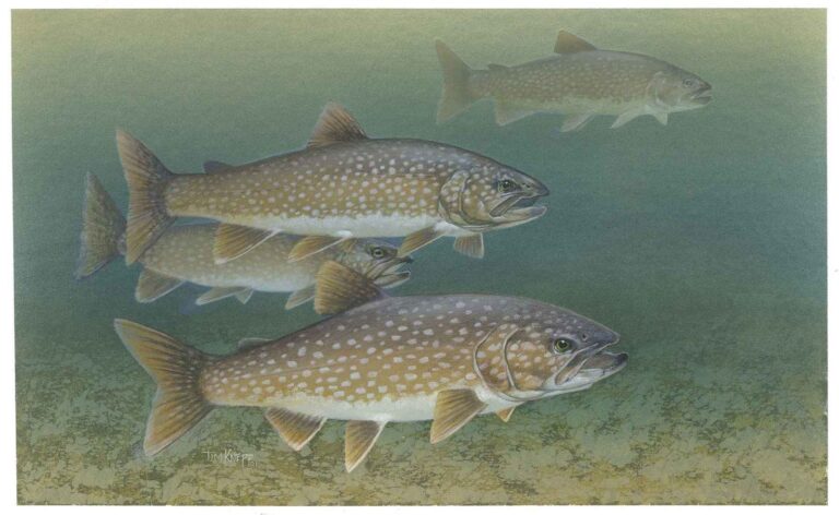
Photo: Knepp Timothy, U.S. Fish and Wildlife Service, Public domain

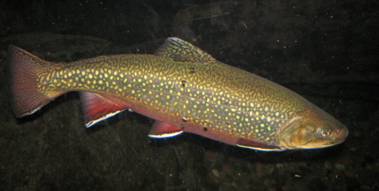
Photo: James St. John, CC BY 2.0

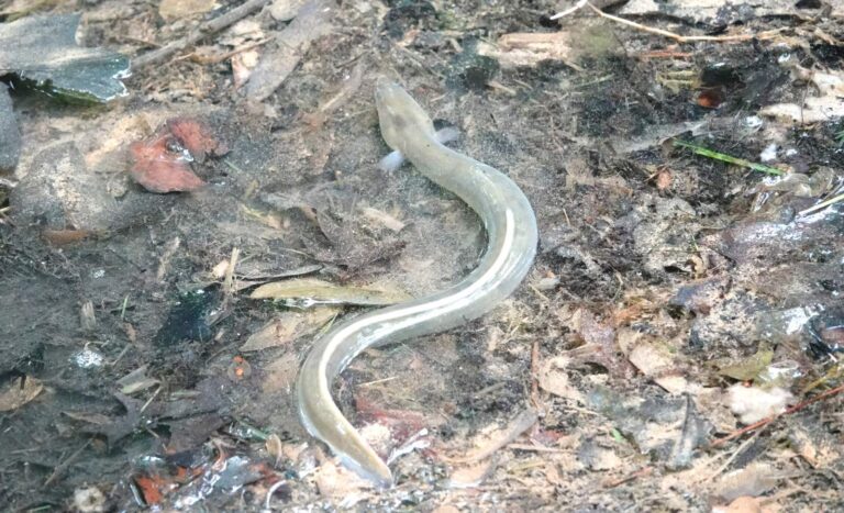
Photo: hug_78, CC BY 2.0

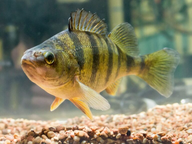
Photo: Robert Colletta, Public domain

Lake Ontario in a handful of answers
Is a license or registry needed for Lake Ontario?
The New York side of the Great Lakes and their tributaries is covered by the ordinary DEC freshwater license, with no extra stamp: $25.00 a year for residents, $50.00 for nonresidents, or $5.00 and $10.00 for one day.
At which spots do boats slide into Lake Ontario?
47 launches are listed on this page, among them Lake Ontario access, Cayuga County, Chaumont Boat Launch and Lake Ontario (Henderson Harbor) access, Jefferson County.
Which species does DEC regulate on Lake Ontario?
Brown trout, rainbow trout, coho salmon, chinook salmon, lake trout, atlantic salmon, brook trout, northern pike, black bass and walleye.
Does Lake Ontario have piers open to anglers?
1 pier and 0 other shore sites are listed, such as Muskellunge Fishing Pier.
Can I hire a captain for Lake Ontario?
5 businesss from the DEC licensed guide list are shown, for example Cold Steel Sportfishing.
Is there a water level gauge for Lake Ontario?
4 NOAA stations print their latest reading in the water level band.
Where does Lake Ontario touch New York?
Niagara County, Orleans County, Monroe County, Wayne County, Cayuga County, Oswego County and Jefferson County.
How many walleye may I keep from Lake Ontario?
3; minimum 18"; May 1 – Mar 15.
How many black bass may I keep from Lake Ontario?
5; minimum 12"; Jun 15 – Nov 30 (statewide season).
What are the EPA size figures for Lake Ontario?
The EPA gives the full lake 7,340 square miles of surface and a 712-mile shoreline.
Do trout run up streams from Lake Ontario?
15 tributary pages, including Black River, Eighteen Mile Creek and Genesee River.
Give Lake Ontario a whole weekend
Choose an access site, then check the limits.