Hugh M. Gillis Lake Fishing
A 113-acre Georgia Public Fishing Area lake in Laurens County, part of Hugh M. Gillis PFA.
 Pick for largemouth bassPiscifun Chaos Pro CNC baitcasting reel25% OFFSale $97.99
Photo, nearby stand in for Hugh M. Gillis Lake: Michael Rivera, CC BY-SA 4.0
Hugh M. Gillis Lake by the figures
Inside Laurens County, Hugh M. Gillis Lake holds about 113 acres of fishable water. You may see it listed as KFE Pond 1 and Lake Hugh M. Gillis as well. The closest Census town is Adrian, roughly 8 miles from the water. This water is one of the lakes at Hugh M. Gillis PFA.
WRD access points here list largemouth bass, channel catfish, black crappie, bluegill, redear sunfish and warmouth. The shoreline has 2 public boat ramps. Fishing without a boat works from 2 pier or bank fishing sites.
 For the largemouth bass herePiscifun AlinoX 300 low profile baitcaster34% OFFSale $104.99
Fish of Hugh M. Gillis Lake
The Hugh M. Gillis Lake species list joins WRD access flags with forecast and record entries.
Fish the guide names at Hugh M. Gillis PFA: Largemouth bass, Bluegill, Redear sunfish, Channel catfish, Black crappie, Brown bullhead. Live fish (minnows) are allowed for bait.
WRD Water Access Points species flags, WRD fishing forecast and WRD record lists; checked October 2026.
Public launches at Hugh M. Gillis Lake
- Hugh M. Gillis PFA, Lower Boat Ramp2 lanes, dock, restroom, Georgia DNR Wildlife Resources Division
- Hugh M. Gillis PFA, Upper Boat Ramp1 lane, dock, Georgia DNR Wildlife Resources Division
Shore access along Hugh M. Gillis Lake
- Hugh M. Gillis PFA, Upperfishing pier, Georgia DNR Wildlife Resources Division
- Hugh M. Gillis PFA, Lowerfishing pier, Georgia DNR Wildlife Resources Division
Launch sites close to Hugh M. Gillis Lake
- Buckeye Park Lake #2Buckeye Park Lake, 9 miles west
- Buckeye Park Lake #1Buckeye Park Lake, 9 miles west
- Buckeye Park Lake #3Buckeye Park Lake, 9 miles west
- Buckeye LandingOconee River, 10 miles west
- River Bend WMA North Boat RampTroup Lake, 10 miles southwest
- Blackshear Ferry LandingOconee River, 11 miles west
WRD Water Access Points layer and CRD coastal ramps, checked October 2026.
Regulations covering Hugh M. Gillis Lake
PFA limits printed for Hugh M. Gillis PFA: Largemouth bass between 16 and 24 inches must be released immediately. Bass up to 16 inches and over 24 inches can be kept (limit 5 per person).
| Species | Daily limit | Season |
|---|---|---|
| Largemouth bass | 5; minimum length 14 inches unless otherwise posted | Open all year (PFA hours 24 hours a day unless posted) |
| Bream or sunfish (any one species or a combination) | 15 | Open all year |
| Channel catfish | 5 | Open all year |
| Grass carp | Must be released immediately | Open all year |
Public Fishing Areas ask for a Georgia fishing license ($15 resident, $50 nonresident) or a Lands Pass for anglers 16 and older, as posted at each area.
2026-2027 Georgia Hunting and Fishing Regulations, effective July 1, 2026 to June 30, 2027; checked October 2026.
Close-by lakes lined up with Hugh M. Gillis Lake
Drive under a mile to reach KFE Pond 2, the nearest; Watson Pond is the biggest close by.
| Lake | Distance | Acres | Ramps | Type | Species listed |
|---|---|---|---|---|---|
| Hugh M. Gillis Lake | 113 | 2 | Public Fishing Area lake | 7 | |
| KFE Pond 2 | under a mile south | 1 | 0 | Public Fishing Area lake | 0 |
| Watson Pond | 35 miles east | 412 | 2 | pond | 9 |
| Little Ocmulgee Lake | 35 miles south | 224 | 1 | lake | 10 |
| Steve Bell Lake | 37 miles southwest | 101 | 1 | Public Fishing Area lake | 8 |
| Hamburg Lake | 44 miles north | 225 | 1 | reservoir | 6 |
WRD waterbodies, reservoirs and Water Access Points layers.
Spots by Hugh M. Gillis Lake
Lakes that pair well with Hugh M. Gillis Lake
- KFE Pond 2under a mile south
- Watson Pond35 miles east
- Little Ocmulgee Lake35 miles south
- Steve Bell Lake37 miles southwest
- Hamburg Lake44 miles north
Rivers to pair with Hugh M. Gillis Lake
- Little Ohoopee River19 miles
- Ohoopee River23 miles
Gear and bait a short hop from Hugh M. Gillis Lake
- Sweat's Bait & Tacklebait and tackle shop, Wrightsville, 10 miles
- Dublin Hunting and Fishing Supplybait and tackle shop, Dublin, 11 miles
- 4-J Gun Smithbait and tackle shop, Tarrytown, 20 miles
Nearby towns for a Hugh M. Gillis Lake trip
- Adrian8 miles
- East Dublin9 miles
- Wrightsville11 miles
Hugh M. Gillis Lake, county by county
- Laurens Countyseat: Dublin
A Piscifun reel lineup for Hugh M. Gillis Lake


Piscifun and Amazon links are affiliate links; the site earns a commission on qualifying purchases.
Know what you hooked at Hugh M. Gillis Lake
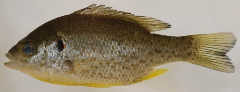
Photo: Smithsonian Environmental Research Center, CC BY 2.0

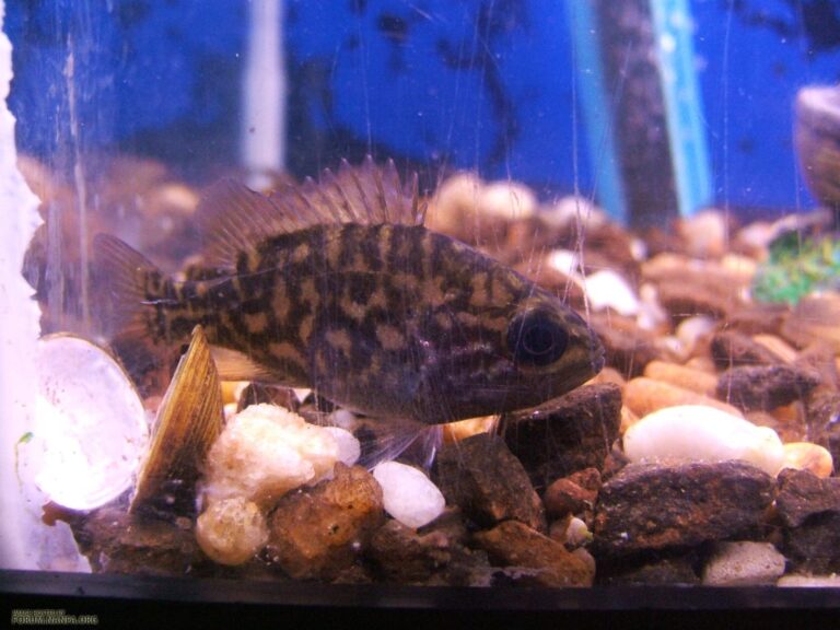
Photo: Stevo2011, CC BY-SA 4.0

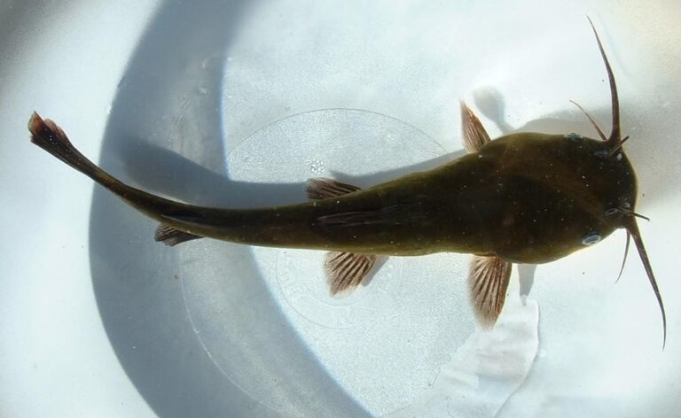
Photo: Unknown author, CC BY-SA 3.0

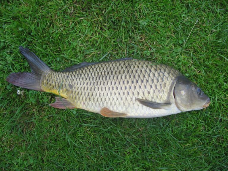
Photo: Dezidor, CC BY-SA 3.0

Things to know before you fish Hugh M. Gillis Lake
What part of Georgia holds Hugh M. Gillis Lake?
Georgia maps place it in Laurens County, about 8 miles from Adrian.
How big is Hugh M. Gillis Lake?
Close to 113 acres of water.
Is there a public boat ramp on Hugh M. Gillis Lake?
WRD maps 2 public ramps; Hugh M. Gillis PFA, Lower Boat Ramp is a good start.
Which species turn up in Hugh M. Gillis Lake?
largemouth bass, channel catfish, black crappie, bluegill, redear sunfish, warmouth and brown bullhead, per WRD records.
Which rules cover Hugh M. Gillis Lake?
Largemouth bass between 16 and 24 inches must be released immediately. Bass up to 16 inches and over 24 inches can be kept (limit 5 per person).
Which Georgia license do I carry at Hugh M. Gillis Lake?
Public Fishing Areas ask for a Georgia fishing license ($15 resident, $50 nonresident) or a Lands Pass for anglers 16 and older, as posted at each area.
Where are crickets and shiners sold near Hugh M. Gillis Lake?
Drive 10 miles to Sweat's Bait & Tackle.
What other Georgia lakes sit close to Hugh M. Gillis Lake?
Try KFE Pond 2, under a mile away.
A weekend at Hugh M. Gillis Lake starts here
Licenses come from Go Outdoors Georgia; limits are on the next page.