Fishing near Lee's Summit, Missouri
Jackson County, population 101,108.
- 3 milesto nearest lake
- 8ramps nearby
 Pick for troutPiscifun Carbon X ultralight spinning reel28% OFFSale $57.99
Photo: Glenn Kinyon, CC BY-SA 3.0
A fishing day that starts in Lee's Summit
In the 2020 count, Lee's Summit registered 101,108 people as a city within Jackson County. The closest lake page is Prairie Lee Lake, about 3 miles to the northeast. The shortest tow is 3 miles to Prairie Lee Lake (Jackson County).
November trout go into Plover Lake, roughly 4 miles out. Shore anglers can try Fishing jetties at Plover Lake, James A. Reed Memorial Wildlife Area, 4 miles out.
Census 2020 population and Gazetteer point for Lee's Summit; distances are straight lines.
 For the trout herePiscifun Carbon XT ultralight spinning reel25% OFFSale $59.99
Impoundments ranked by distance from Lee's Summit
| Lake | Distance | Acres | Ramps | Motor note | Fish MDC names |
|---|---|---|---|---|---|
| Prairie Lee Lake | 3 miles northeast | 143 | 1 | ||
| Plover Lake | 4 miles southeast | 14 | 0 | rainbow trout | |
| Jackrabbit Lake | 4 miles southeast | 28 | 0 | ||
| Catclaw Lake | 4 miles southeast | 40 | 0 | ||
| Coot Lake | 4 miles southeast | 21 | 0 | rainbow trout | |
| Lake Nell, James A. Reed Memorial Wildlife Area | 4 miles southeast | 26 | 0 |
MDC Managed Public Waterbody outlines, MDC 2026 Fishing Prospects species and boating notes; retrieved October 2026.
MDC-accessed rivers and creeks by Lee's Summit
- Blue River11 miles, 1 MDC ramp, 1 access area, 34 mi in Missouri
Live USGS river numbers by Lee's Summit
| USGS gauge | Latest reading | Time (ET) |
|---|---|---|
| Little Blue R. At Lees Summit Rd In Independence | 21 cfs, 3.69 ft gage height | Oct 28 7:15 pm |
| Adair Creek At Independence, Mo | 4 cfs, 6.74 ft gage height | Oct 28 6:30 pm |
| Crackerneck Creek At Selsa Rd. In Independence, Mo | 2 cfs, 3.87 ft gage height | Oct 1 12:45 am Not updated since Oct 1, 2008. |
US Geological Survey provisional data, retrieved Oct 28, 2026 7:34 pm ET. Provisional readings can be revised.
MDC stream access areas and trout and smallmouth layers; USGS NHD lengths and USGS gauges. Retrieved October 2026.
Mapping the ramps near Lee's Summit
- Prairie Lee Lake (Jackson County)Prairie Lee Lake, 3 miles
- Lake Jacomo (Jackson County) (south ramp)Lake Jacomo, 4 miles
- Lake Jacomo (Jackson County) (north ramp)Lake Jacomo, 5 miles
- Lake Jacomo (Jackson County) (north ramp)Lake Jacomo, 5 miles
- Blue Springs Lake (Jackson County) (west ramp)Blue Springs Lake, 6 miles
- Blue Springs Lake (Jackson County) (west ramp)Blue Springs Lake, 7 miles
- Blue Springs Lake (Jackson County) (east ramp)Blue Springs Lake, 7 miles
- Lone Jack Lake Conservation AreaLone Jack Lake, 10 miles
Docks and jetties near Lee's Summit
- Fishing jetties at Plover Lake, James A. Reed Memorial Wildlife Area4 miles
- Fishing docks and jetties at Jackrabbit Lake, James A. Reed Memorial Wildlife Area4 miles
- Fishing docks and jetties at Catclaw Lake, James A. Reed Memorial Wildlife Area4 miles
- Fishing docks and jetties at Coot Lake, James A. Reed Memorial Wildlife Area4 miles
- Fishing jetties at Lake Nell, James A. Reed Memorial Wildlife Area, James A. Reed Memorial Wildlife Area4 miles
- Fishing jetties at Cottontail Lake, James A. Reed Memorial Wildlife Area4 miles
MDC boat ramp/access and dock layers, USACE ramp layers; retrieved October 2026.
Where Lee's Summit anglers go for stocked rainbows
| Water | Program | Distance |
|---|---|---|
| Plover Lake | winter trout lake, stocked in November | 4 miles |
| Honker Pond | winter trout lake, stocked in November | 4 miles |
| Coot Lake | winter trout lake, stocked in November | 4 miles |
Keeping trout takes a Missouri trout permit on top of the fishing permit: $12 for residents and $24 for nonresidents 16 and older.
MDC trout program statements (2026 regulations booklet, MDC news releases and area pages); MDC publishes no per-water stocking table; trout parks, trout areas and winter trout lakes as printed in the 2026 regulations booklet.
Supplies and guides by Lee's Summit
The nearest shops to Lee's Summit
- Dick's Sporting Goods Lees Summitsporting goods store, Lees Summit, 1 mile
- Fishing Tackle Junctionbait and tackle shop, Lees Summit, 2 miles
- Longview Lake Marinamarina, Kansas City, 5 miles
- 40 Woods Bait & Tacklebait and tackle shop, Blue Springs, 7 miles
- Rainbow Fly Shopfly shop, Independence, 8 miles
- Bass Pro Shops Independencesporting goods store, Independence, 8 miles
- Dick's Sporting Goods Independencesporting goods store, Independence, 9 miles
- Academy Sports + Outdoors Beltonsporting goods store, Belton, 10 miles
Yellow Pages and chain store listings, guide listings; retrieved October 2026.
Creel and length rules for Lee's Summit anglers
Residents pay $14 and nonresidents $57 for a year of fishing in Missouri, and a daily permit is $9. Anglers who keep a trout also carry a trout permit ($12 resident).
| Species | Limit | Season |
|---|---|---|
| Black bass (largemouth, smallmouth, spotted/Kentucky) | 6 a day | All year |
| Black bass (largemouth, smallmouth, spotted/Kentucky) (Ozark streams) | 6 a day; 12" minimum | May 23, 2026–Feb. 28, 2027 |
| Channel catfish | 10 a day | All year |
| Blue catfish | 5 a day | All year |
| Flathead catfish | 5 a day | All year |
| Crappie (black and white) | 30 a day | All year |
| Goggle-eye (Ozark, rock, and shadow bass) and warmouth | 15 a day; 7" minimum | All year |
| Muskellunge | 1 (daily limit is 1 muskellunge or 1 northern pike); 36" minimum | All year |
| Northern pike | 1 (daily limit is 1 muskellunge or 1 northern pike) | All year |
| Paddlefish (spoonbill) | 2 a day; 32" minimum (eye to fork of tail) | March 15–April 30 |
| Pickerel (chain and grass) | 6 a day | All year |
| Shovelnose sturgeon | 10 a day; 30" maximum (snout to fork of tail) | All year |
| Trout (rainbow and brown) | 4 a day; Rainbow: none; Brown: 15" minimum in streams | All year |
| Walleye and sauger | 4 a day; 15" minimum | All year |
| White, yellow, and striped bass and their hybrids | 15 a day; No more than 4 longer than 18" | All year |
Limits and seasons as printed in A Summary of Missouri Fishing Regulations 2026 (MDC, effective March 1, 2026), page 20 (booklet PDF); retrieved October 27, 2026. Lake and river pages print any special-regulation bullet.
Within a few miles of Lee's Summit
More town pages close to Lee's Summit
- Greenwood6 miles
- Raytown6 miles
- Lake Lotawana7 miles
- Lake Winnebago7 miles
- Grandview8 miles
The county guide that takes in Lee's Summit
- Jackson Countyseat: Independence
Line and reels from Piscifun ahead of Lee's Summit


Piscifun and Amazon links are affiliate links; the site earns a commission on qualifying purchases.
Photographs of fishing water by Lee's Summit
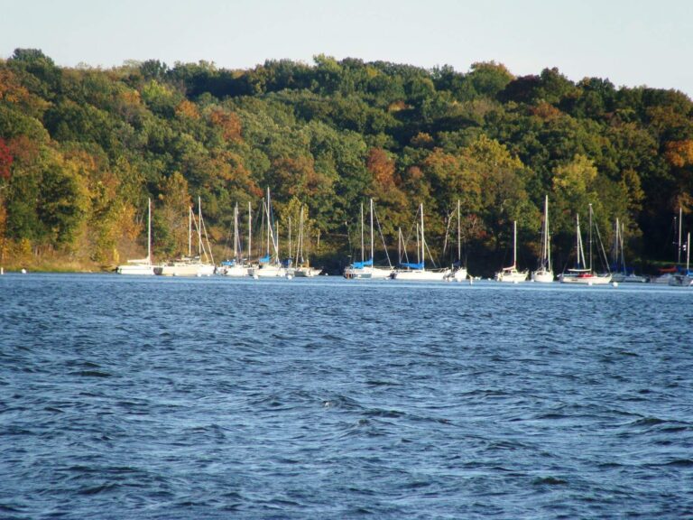
Photo: Nightryder84, CC BY-SA 3.0


Photo: Nightryder84, CC BY-SA 3.0

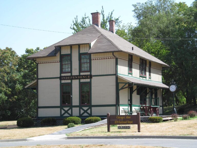
Photo: Doug Kerr, CC BY-SA 2.0

Photo: David Brossard, CC BY-SA 2.0
Lee's Summit as a fishing base, explained
How many miles separate Lee's Summit from a paged MDC lake?
Prairie Lee Lake, 3 miles northeast.
Where is the closest boat ramp to Lee's Summit?
Closest: Prairie Lee Lake (Jackson County), 3 miles.
Which MDC jetty or dock is closest to Lee's Summit?
Fishing jetties at Plover Lake, James A. Reed Memorial Wildlife Area, about 4 miles.
Who sells minnows and crawlers around Lee's Summit?
Dick's Sporting Goods Lees Summit, 1 mile away.
In which Missouri county does Lee's Summit lie?
Jackson County covers it.
What do out-of-state visitors pay MDC to fish around Lee's Summit?
Expect $57 for a nonresident year or $9 a day.
Which impoundment close to Lee's Summit holds the most acres?
Prairie Lee Lake, 143 acres, 3 miles away.
Which town pages sit close to Lee's Summit?
Greenwood (6 miles), Raytown (6 miles) and Lake Lotawana (7 miles) lie closest.
Is there trout fishing close to Lee's Summit?
Plover Lake, a winter trout lake, about 4 miles away.
Wet a line in Show-Me water by Lee's Summit
Open a ramp for parking and directions.