Thomas Hill Reservoir Fishing
A 4,013-acre Missouri reservoir in Randolph County and Macon County.
 Pick for white crappiePiscifun Carbon X ultralight spinning reel28% OFFSale $57.99
Photo of Long Branch Lake: mostateparks, Public domain
Where Thomas Hill Reservoir sits and how big it is
The MDC outline gives Thomas Hill Reservoir a surface of 4,013 acres, spread over Randolph County and Macon County. The shortest run to a town is Prairie Hill, near 8 miles. Biologists of the MDC Northeast Region look after it. MDC lists it as part of Thomas Hill Reservoir Conservation Area.
You can launch at 4 mapped ramps. Shore anglers can use 4 docks and jetties. Anglers can target 30 mapped attractor points. The booklet prints 3 special regulations for it.
MDC Managed Public Waterbody outlines (GIS acres, region, managing area) on gisblue.mdc.mo.gov, Census 2023 places, retrieved October 27, 2026. MDC office phone: 660-785-2420.
This season at Thomas Hill Reservoir, per MDC
In its 2026 prospects, MDC reports on Thomas Hill Reservoir as follows:
Thomas Hill Reservoir (4,950 acres) is in Macon and Randolph counties and provides water for cooling Associated Electric Cooperative, Incorporated’s coal-fired generators. The warm water discharge results in a unique, year-round fishery. White crappie are one of the most sought-after species at Thomas Hill Reservoir, and it is predicted that fishing will be good in 2026. The results of a fall 2025 survey indicated a moderate abundance of adult fish with nearly 40 percent of the white crappies captured measuring nine inches or longer. Hybrid striped bass are popular with wintertime anglers due to the hybrids' attraction to the warm water discharge and their fierce fight.
Flathead catfish and channel catfish round out the angling choices at this reservoir. Most channel catfish caught are small due to overpopulation, so anglers are encouraged to take home their daily limit of 10. There is the potential to catch a large flathead catfish (greater than 36 inches) using trotlines, bank lines, and jugs using live bait near old river channels. In early 2009, a barrier-free fishing dock was placed in the warm-water arm (Brush Creek), just northeast of the boat ramp.
From Highway 63 at Excello, turn west on Highway T and travel six miles to College Mound. Turn north on Highway C then immediately turn west on Highway T for two and three-tenths miles to Glider Avenue. Follow Glider Avenue for three-tenths of a mile and turn west towards the boat ramp and fishing jetty.
MDC, 2026 Missouri Fishing Prospects (report), quoted; retrieved October 27, 2026.
 For the white crappie herePiscifun Carbon XT ultralight spinning reel25% OFFSale $59.99
Species reported at Thomas Hill Reservoir
Tap a fish to open its Missouri species page; each one is named for Thomas Hill Reservoir by MDC.
MDC 2026 Fishing Prospects text, MDC State Record Fish list and MDC trout program statements, retrieved October 27, 2026.
MDC fish attractors in Thomas Hill Reservoir
MDC maps 30 attractor points in Thomas Hill Reservoir, placed in 2021.
| Material | Points | Years placed |
|---|---|---|
| Cedar-Hardwood | 30 | 2021 |
MDC Fishing Interactive Map, fish attractors layer (material and year placed as mapped), retrieved October 27, 2026.
Ramps and docks on Thomas Hill Reservoir
- Thomas Hill Reservoir Conservation Area (north ramp)boat ramp, parking, privy nearby; Missouri Department of Conservation
- Thomas Hill Reservoir Conservation Area (south ramp)boat ramp, parking, privy nearby; Missouri Department of Conservation
- Thomas Hill Reservoir Conservation Area (west ramp)boat ramp, parking, privy nearby; Missouri Department of Conservation
- Thomas Hill Reservoir Conservation Areaboat ramp, parking; Missouri Department of Conservation
Fishing docks MDC maps at Thomas Hill Reservoir
- Thomas Hill Reservoir Conservation Areafishing dock, accessible
- Thomas Hill Reservoir Conservation Areafishing dock, accessible
- Thomas Hill Reservoir Conservation Areafishing dock, accessible
- Thomas Hill Reservoir Conservation Areafishing jetty
MDC boat ramp/access, dock and jetty layers; USACE Little Rock District ramps and USACE recreation areas; retrieved October 27, 2026.
Bag and length rules at Thomas Hill Reservoir
| Species | Daily limit and length | Season |
|---|---|---|
| Black bass (largemouth, smallmouth, spotted/Kentucky) | 6 a day | All year |
| Channel catfish | 10 a day | All year |
| Blue catfish | 5 a day | All year |
| Flathead catfish | 5 a day | All year |
| Crappie (black and white) | 30 a day | All year |
| Goggle-eye (Ozark, rock, and shadow bass) and warmouth | 15 a day; 7" minimum | All year |
| Muskellunge | 1 (daily limit is 1 muskellunge or 1 northern pike); 36" minimum | All year |
| Northern pike | 1 (daily limit is 1 muskellunge or 1 northern pike) | All year |
| Paddlefish (spoonbill) | 2 a day; 32" minimum (eye to fork of tail) | March 15–April 30 |
| Pickerel (chain and grass) | 6 a day | All year |
| Shovelnose sturgeon | 10 a day; 30" maximum (snout to fork of tail) | All year |
| Trout (rainbow and brown) | 4 a day; Rainbow: none; Brown: 15" minimum in streams | All year |
| Walleye and sauger | 4 a day; 15" minimum | All year |
| White, yellow, and striped bass and their hybrids | 15 a day; No more than 4 longer than 18" | All year |
At Thomas Hill Reservoir the statewide limits apply, with any listed exception taking priority.
Rules that change at Thomas Hill Reservoir
| Water as printed | Where | Rule |
|---|---|---|
| Thomas Hill Reservoir | Whole water | Black bass — 15" minimum length limit |
| Thomas Hill Reservoir | Whole water | Crappie — 15 fish daily limit |
| Thomas Hill Reservoir | Whole water | Hybrid striped bass — 20" minimum length limit; daily limit of 4 |
Rules as printed in A Summary of Missouri Fishing Regulations 2026 (MDC, effective March 1, 2026) (booklet PDF, Special Regulations on Large Lakes and on Rivers and Streams); checked against the current Wildlife Code October 27, 2026.
Limits and seasons as printed in A Summary of Missouri Fishing Regulations 2026 (MDC, effective March 1, 2026), page 20 (booklet PDF); retrieved October 27, 2026.
MDC lakes near Thomas Hill Reservoir, put side by side
For more room to roam, Long Branch Lake offers 2,750 acres.
| Lake | Distance | Acres | Ramps | Attractors | Species named |
|---|---|---|---|---|---|
| Thomas Hill Reservoir | 4,013 | 4 | 30 | 6 | |
| Blees Lake | 12 miles northeast | 10 | 0 | 0 | 0 |
| Sugar Creek Lake | 12 miles southeast | 308 | 1 | 0 | 0 |
| Macon City Lake | 13 miles northeast | 189 | 1 | 6 | 0 |
| Long Branch Lake | 15 miles northeast | 2,750 | 0 | 14 | 9 |
| Rothwell Park Lake | 16 miles southeast | 25 | 1 | 0 | 0 |
MDC waterbody outlines, ramp and attractor layers, 2026 prospects; retrieved October 27, 2026.
What else lies close to Thomas Hill Reservoir
Lakes to try after Thomas Hill Reservoir
- Blees Lake12 miles northeast
- Sugar Creek Lake12 miles southeast
- Macon City Lake13 miles northeast
- Long Branch Lake15 miles northeast
- Rothwell Park Lake16 miles southeast
Shops anglers stop at before Thomas Hill Reservoir
- Tong Branch Marina Storemarina, Macon, 14 miles
- Sunderland Bait & Tacklebait and tackle shop, Moberly, 14 miles
- Ardent Outdoors Incbait and tackle shop, Macon, 14 miles
Where to sleep before fishing Thomas Hill Reservoir
- Huntsville13 miles
- Macon13 miles
- Salisbury16 miles
Counties sharing Thomas Hill Reservoir
- Randolph Countyseat: Huntsville
- Macon Countyseat: Macon
Line and reels from Piscifun ahead of Thomas Hill Reservoir


Piscifun and Amazon links are affiliate links; the site earns a commission on qualifying purchases.
Photographs of fishing water by Thomas Hill Reservoir

Photo: mostateparks, Public domain
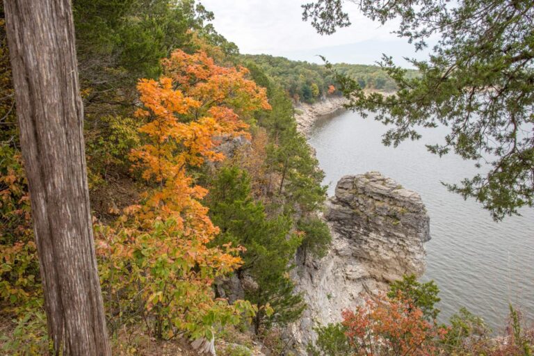
Photo: mostateparks, Public domain


Photo: Heath Cajandig, CC BY 2.0
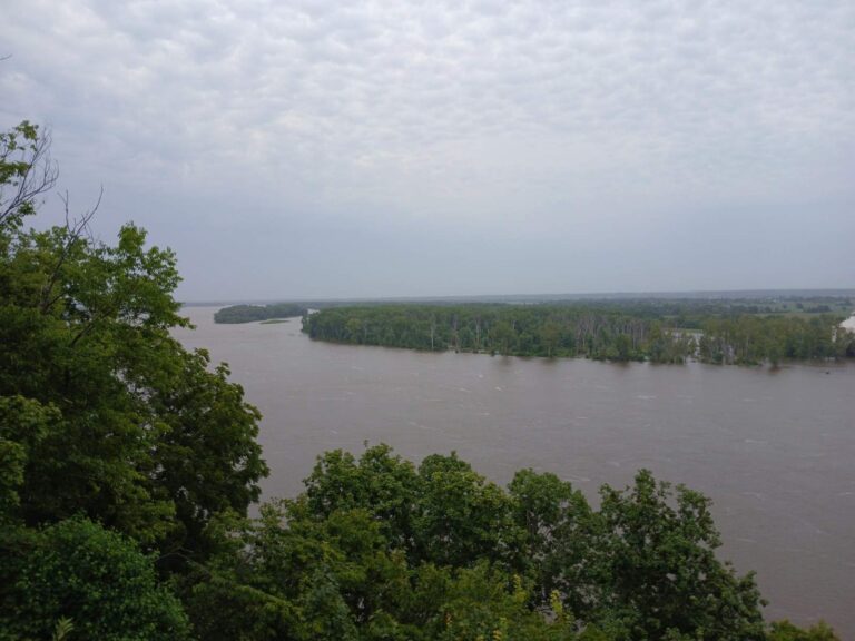
Photo: Ser Amantio di Nicolao, CC0 1.0

Before a trip to Thomas Hill Reservoir, the common questions
Where in the Show-Me State is Thomas Hill Reservoir?
The outline sits in Randolph County and Macon County, the MDC Northeast Region, about 8 miles from Prairie Hill.
How many acres is Thomas Hill Reservoir by MDC mapping?
The outline measures 4,013 acres.
Where is the nearest ramp to Thomas Hill Reservoir?
Yes, 4 mapped ramps, such as Thomas Hill Reservoir Conservation Area (north ramp).
Which gamefish are named for Thomas Hill Reservoir?
MDC names hybrid striped bass, largemouth bass, crappie, channel catfish, flathead catfish and white crappie.
Is there a length limit at Thomas Hill Reservoir?
Black bass (largemouth, smallmouth, spotted/Kentucky): 6 a day; All year. Extra rules for it appear in the limits section.
Can a visitor from another state fish Missouri's Thomas Hill Reservoir?
Missouri anglers 16 through 64 carry a fishing permit: $14 a year for residents, $57 for nonresidents, or $9 for a daily permit.
Is there a horsepower limit on Thomas Hill Reservoir?
No motor limit is on file; signs on site decide.
Where does a Missouri angler buy bait near Thomas Hill Reservoir?
Closest listed: Tong Branch Marina Store, 14 miles.
What is the 2026 outlook for Thomas Hill Reservoir?
Thomas Hill Reservoir (4,950 acres) is in Macon and Randolph counties and provides water for cooling Associated Electric Cooperative, Incorporated’s coal-fired generators. The warm water discharge results in a unique, year-round fishery. White crappie are one of the most sought-after species at (MDC 2026 Fishing Prospects)
Has MDC added fish cover to Thomas Hill Reservoir?
Yes: 30 attractor points on the MDC layer.
Give a Missouri weekend to Thomas Hill Reservoir
Buy the Missouri permit online before the trip.