Table Rock Lake Fishing
A 49,720-acre Missouri reservoir in Stone County, Barry County and Taney County, 95% of it in Missouri.
 Pick for black bassPiscifun Chaos Pro CNC baitcasting reel25% OFFSale $97.99
Photo: Vawgahan, CC0 1.0
Sizing up Table Rock Lake
In Stone County, Barry County and Taney County, Table Rock Lake measures 49,720 acres on the conservation department map. About 95% of the mapped surface is in Missouri; the rest is in Arkansas. Coney Island is the nearest town, some 4 miles off. MDC manages it within the MDC Southwest Region.
Boaters have 33 mapped ramps to choose from. MDC habitat work left 1,231 attractor points here. The Army Corps lists 21 recreation areas on its shores. MDC gives it 6 special regulations in the regulations summary.
MDC Managed Public Waterbody outlines (GIS acres, region, managing area) on gisblue.mdc.mo.gov, Census 2023 places, retrieved October 27, 2026. MDC office phone: 417-334-3324.
The MDC 2026 outlook for Table Rock Lake
Here is how MDC biologists sized up Table Rock Lake for 2026:
Fishing for black bass should be excellent in 2026. Largemouth bass are plentiful throughout the lake as a result of the high lake levels in past years. Fall 2025 electrofishing surveys revealed good numbers of largemouth bass in the 15”-18” range. These surveys also revealed an abundance of spotted bass in the 11”-14” range, with just three percent of the spotted bass captured in the fall 2025 surveys exceeding 15”. Due to the high abundance and slow growth rates of spotted bass in Table Rock Lake, the minimum length limit is planned to be reduced to 12” in 2026. Anglers are encouraged to harvest spotted bass to help reduce overcrowding and improve growth.
Crappie fishing should be fair in 2026. Fall 2025 netting surveys in the James River Arm revealed fair numbers of black and white crappie in the 7”-9” that should reach the legal-size limit of 10” in the fall of 2026. Forty percent of the black crappie captured in the fall 2025 netting surveys were greater than 10” and 10% were greater than 12”. Thirty-six percent of white crappie captured in the fall 2025 netting surveys were greater than 10” and 3% were greater than 12”. Crappie fishing will be best in the James, Kings, and Long Creek arms where crappie densities are higher.
White bass fishing will be fair in 2026. The best opportunity to catch white bass will be when the fish congregate far up in tributary streams to spawn in March. Anglers willing to troll or fish jigging spoons can also catch white bass during the summer months. Gravel flats 25’ to 50’ deep are the best areas to troll or spoon for white bass. Trolling can also be effective in February and early March when these fish begin to move up the river arms. As water temperatures warm, the white bass will move further up the river into shallower water but will congregate in deeper holes in the channel up the river arms of the lake before moving up.
MDC, 2026 Missouri Fishing Prospects (report), quoted; retrieved October 27, 2026.
 For the black bass herePiscifun AlinoX 300 low profile baitcaster34% OFFSale $104.99
Gamefish at Table Rock Lake
Every chip below has an MDC source tying it to Table Rock Lake.
MDC 2026 Fishing Prospects text, MDC State Record Fish list and MDC trout program statements, retrieved October 27, 2026.
Structure placed in Table Rock Lake
The MDC attractor layer shows 1,231 points at Table Rock Lake, placed between 2004 and 2026.
For speed the map plots one point in 7.
| Material | Points | Years placed |
|---|---|---|
| Cedars | 422 | 2012 to 2026 |
| Cedar-Hardwood | 366 | 2015 to 2024 |
| Rocks | 189 | 2008 to 2011 |
| Hardwood | 128 | 2018 to 2026 |
| Stump | 97 | 2004 to 2012 |
| StumpRocks | 29 | 2008 to 2010 |
MDC Fishing Interactive Map, fish attractors layer (material and year placed as mapped), retrieved October 27, 2026.
Every mapped access at Table Rock Lake
- Aunts Creek ramp on Table Rock Lakeconcrete ramp, Corps ramp; US Army Corps of Engineers, Little Rock District
- Aunts Creek ramp on Table Rock Lakeconcrete ramp, Corps ramp; US Army Corps of Engineers, Little Rock District
- Baxter ramp on Table Rock Lakeconcrete ramp, Corps ramp; US Army Corps of Engineers, Little Rock District
- Baxter ramp on Table Rock Lakeconcrete ramp, Corps ramp; US Army Corps of Engineers, Little Rock District
- Big Bay ramp on Table Rock Lakeconcrete ramp, Corps ramp; US Army Corps of Engineers, Little Rock District
- Big Indian ramp on Table Rock Lakeconcrete ramp, Corps ramp; US Army Corps of Engineers, Little Rock District
- Big M ramp on Table Rock Lakeconcrete ramp, Corps ramp; US Army Corps of Engineers, Little Rock District
- Campbell Point ramp on Table Rock Lakeconcrete ramp, Corps ramp; US Army Corps of Engineers, Little Rock District
- Cape Fair ramp on Table Rock Lakeconcrete ramp, Corps ramp; US Army Corps of Engineers, Little Rock District
- Cape Fair ramp on Table Rock Lakeconcrete ramp, Corps ramp; US Army Corps of Engineers, Little Rock District
- Coombs Ferry ramp on Table Rock Lakeconcrete ramp, Corps ramp; US Army Corps of Engineers, Little Rock District
- Cow Creek ramp on Table Rock Lakeconcrete ramp, Corps ramp; US Army Corps of Engineers, Little Rock District
- Cow Creek ramp on Table Rock Lakeconcrete ramp, Corps ramp; US Army Corps of Engineers, Little Rock District
- Eagle Rock ramp on Table Rock Lakeconcrete ramp, Corps ramp; US Army Corps of Engineers, Little Rock District
- Eagle Rock ramp on Table Rock Lakeconcrete ramp, Corps ramp; US Army Corps of Engineers, Little Rock District
- Indian Point ramp on Table Rock Lakeconcrete ramp, Corps ramp; US Army Corps of Engineers, Little Rock District
- Joe Bald ramp on Table Rock Lakeconcrete ramp, Corps ramp; US Army Corps of Engineers, Little Rock District
- Kings River ramp on Table Rock Lakeconcrete ramp, Corps ramp; US Army Corps of Engineers, Little Rock District
- Long Creek ramp on Table Rock Lakeconcrete ramp, Corps ramp; US Army Corps of Engineers, Little Rock District
- Mill Creek ramp on Table Rock Lakeconcrete ramp, Corps ramp; US Army Corps of Engineers, Little Rock District
- Moonshine ramp on Table Rock Lakeconcrete ramp, Corps ramp; US Army Corps of Engineers, Little Rock District
- Old Hwy 86 ramp on Table Rock Lakeconcrete ramp, Corps ramp; US Army Corps of Engineers, Little Rock District
- Port of Kimberling ramp on Table Rock Lakeconcrete ramp, Corps ramp; US Army Corps of Engineers, Little Rock District
- Port of Kimberling ramp on Table Rock Lakeconcrete ramp, Corps ramp; US Army Corps of Engineers, Little Rock District
- Port of Kimberling ramp on Table Rock Lake (east ramp)concrete ramp, Corps ramp; US Army Corps of Engineers, Little Rock District
- Port of Kimberling ramp on Table Rock Lake (west ramp)concrete ramp, Corps ramp; US Army Corps of Engineers, Little Rock District
- State Park ramp on Table Rock Lakeconcrete ramp, Corps ramp; US Army Corps of Engineers, Little Rock District
- The Harbor ramp on Table Rock Lakeconcrete ramp, Corps ramp; US Army Corps of Engineers, Little Rock District
- The Harbor ramp on Table Rock Lakeconcrete ramp, Corps ramp; US Army Corps of Engineers, Little Rock District
- The Harbor ramp on Table Rock Lakegravel ramp, Corps ramp; US Army Corps of Engineers, Little Rock District
- Viney Creek ramp on Table Rock Lake (north ramp)concrete ramp, Corps ramp; US Army Corps of Engineers, Little Rock District
- Viney Creek ramp on Table Rock Lake (south ramp)concrete ramp, Corps ramp; US Army Corps of Engineers, Little Rock District
- Viola ramp on Table Rock Lakeconcrete ramp, Corps ramp; US Army Corps of Engineers, Little Rock District
Corps parks on Table Rock Lake
Aunts Creek, Baxter, Big Bay, Big Indian, Big M, Campbell Point, Cape Fair, Coombs Ferry, Eagle Rock, Indian Point, Joe Bald, Kimberling Park, Kings River, Long Creek, Mill Creek, Moonshine Beach, Old Hwy 86, Table Rock State Park, Viney Creek, Viola and White River Landing.
Accesses a quick trailer haul from Table Rock Lake
- Shepherd of the Hills Fish Hatchery access on Lake TaneycomoLake Taneycomo, 10 miles east
MDC boat ramp/access, dock and jetty layers; USACE Little Rock District ramps and USACE recreation areas; retrieved October 27, 2026.
How full Table Rock Lake is running
USACE Little Rock District, Table Rock Dam; reading for October 27, 2026, retrieved October 27, 2026. Provisional; Corps water control page.
Check the caption for when the Table Rock Lake reading was taken.
Daily limits on Table Rock Lake
| Species | Daily limit and length | Season |
|---|---|---|
| Black bass (largemouth, smallmouth, spotted/Kentucky) | 6 a day | All year |
| Channel catfish | 10 a day | All year |
| Blue catfish | 5 a day | All year |
| Flathead catfish | 5 a day | All year |
| Crappie (black and white) | 30 a day | All year |
| Goggle-eye (Ozark, rock, and shadow bass) and warmouth | 15 a day; 7" minimum | All year |
| Muskellunge | 1 (daily limit is 1 muskellunge or 1 northern pike); 36" minimum | All year |
| Northern pike | 1 (daily limit is 1 muskellunge or 1 northern pike) | All year |
| Paddlefish (spoonbill) | 2 a day; 32" minimum (eye to fork of tail) | March 15–April 30 |
| Pickerel (chain and grass) | 6 a day | All year |
| Shovelnose sturgeon | 10 a day; 30" maximum (snout to fork of tail) | All year |
| Trout (rainbow and brown) | 4 a day; Rainbow: none; Brown: 15" minimum in streams | All year |
| Walleye and sauger | 4 a day; 15" minimum | All year |
| White, yellow, and striped bass and their hybrids | 15 a day; No more than 4 longer than 18" | All year |
The statewide rows set the baseline at Table Rock Lake.
Where Table Rock Lake differs from statewide limits
| Water as printed | Where | Rule |
|---|---|---|
| Table Rock Lake | Lakewide | Black bass — 15" minimum length limit. Changes to spotted bass length limits for Table Rock Lake were pending at the time of this booklet’s publication. Please check current regulations in Chapter 6 at sos.mo.gov/adrules/csr/ current/3csr/3csr.asp. |
| Table Rock Lake | Lakewide | Catfish (blue, channel, and flathead) — Daily limit of 10 fish, combined total of these species |
| Table Rock Lake | Lakewide | Crappie — 10" minimum length limit; 15 fish daily limit |
| Table Rock Lake | Lakewide | Walleye and sauger — 18" minimum length limit |
| Table Rock Lake | Lakewide | No person shall continue to snag, snare, or grab for any species after taking a daily limit of 2 paddlefish. |
| Table Rock Lake | On the lake and its tributaries | Paddlefish — 34" minimum body length, measured from eye to fork of tail |
Rules as printed in A Summary of Missouri Fishing Regulations 2026 (MDC, effective March 1, 2026) (booklet PDF, Special Regulations on Large Lakes and on Rivers and Streams); checked against the current Wildlife Code October 27, 2026.
Missouri and Arkansas sell a $10 White River Border Lakes Permit that lets a holder of either state's permit fish Bull Shoals, Norfork and Table Rock across the line.
Limits and seasons as printed in A Summary of Missouri Fishing Regulations 2026 (MDC, effective March 1, 2026), page 20 (booklet PDF); retrieved October 27, 2026.
Record catches at Table Rock Lake
| Species | Division | Weight | Angler | Date | Source |
|---|---|---|---|---|---|
| Bass: Spotted | Pole and line | 7 lbs. 8 oz. | Gene Arnaud, Branson, MO | 04/06/1966 | MDC record list |
| Bass: Smallmouth | Alternative Method: Jug line | 4 lbs. 4 oz. | Paul V. Elder, House Springs, MO | 09/18/2002 | MDC record list |
| Bass: Yellow | Pole and line | 2 lbs. 7 oz. | Danny Naugle, Cassville, MO | 05/13/2026 | MDC record list |
MDC State Record Fish list and MDC news releases (rows marked as such), retrieved October 27, 2026. All Missouri records.
Tournaments on Table Rock Lake
One page holds the Table Rock Lake schedule and its results.
Table Rock Lake next to five nearby lakes
By MDC acreage, Bull Shoals Lake tops the neighbours at 44,944 acres.
| Lake | Distance | Acres | Ramps | Attractors | Species named |
|---|---|---|---|---|---|
| Table Rock Lake | 49,720 | 33 | 1,231 | 14 | |
| Lake Taneycomo | 17 miles east | 2,131 | 3 | 0 | 10 |
| Bull Shoals Lake | 41 miles east | 44,944 | 9 | 724 | 0 |
| Valley Water Mill Lake | 48 miles north | 14 | 0 | 0 | 6 |
| Fellows Lake | 51 miles north | 800 | 1 | 98 | 11 |
| Kellogg Lake | 61 miles northwest | 24 | 1 | 0 | 0 |
MDC waterbody outlines, ramp and attractor layers, 2026 prospects; retrieved October 27, 2026.
Next stops near Table Rock Lake
Other still water near Table Rock Lake
- Lake Taneycomo17 miles east
- Bull Shoals Lake41 miles east
- Valley Water Mill Lake48 miles north
- Fellows Lake51 miles north
- Kellogg Lake61 miles northwest
Bait counters that serve Table Rock Lake
- Baxter Boat Dockmarina, Lampe, 2 miles
- Ozarks Bait & Tacklebait and tackle shop, Kimberling City, 4 miles
- Campbell Point Marinamarina, Shell Knob, 4 miles
- MarineMax Incmarina, Kimberling City, 4 miles
- What's Up Dock Marinamarina, Kimberling City, 4 miles
- Nordic Way Tube Fliesbait and tackle shop, Reeds Spring, 4 miles
Paid guides around Table Rock Lake
- Hook's Table Rock Fishingcharter, Table Rock Lake, Reeds Spring, (417) 338-2277
- Table Rock Guide Servicecharter, Table Rock Lake, Kimberling City, (417) 335-1867
- Table Rock Lake Guide Servicefishing guide, Table Rock Lake, Branson, (417) 434-2823
Show-Me towns a drive from Table Rock Lake
- Kimberling City5 miles
- Branson10 miles
- Reeds Spring11 miles
The Missouri counties Table Rock Lake reaches into
- Stone Countyseat: Galena
- Barry Countyseat: Cassville
- Taney Countyseat: Forsyth
Piscifun tackle a Missouri angler might take to Table Rock Lake


Piscifun and Amazon links are affiliate links; the site earns a commission on qualifying purchases.
Hollows, bluffs and lakes by Table Rock Lake, in photos
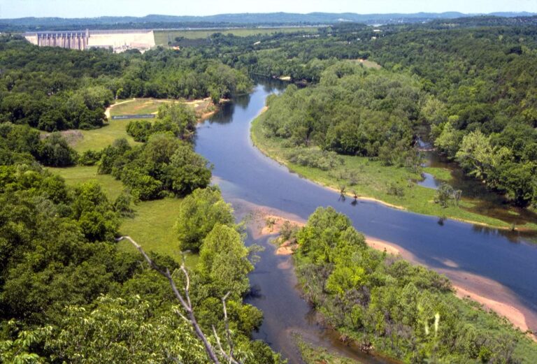
Photo: Tequask, CC BY-SA 4.0


Photo: Semipaw, CC BY 3.0

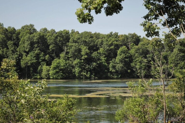
Photo: ThinkHat, CC BY 4.0

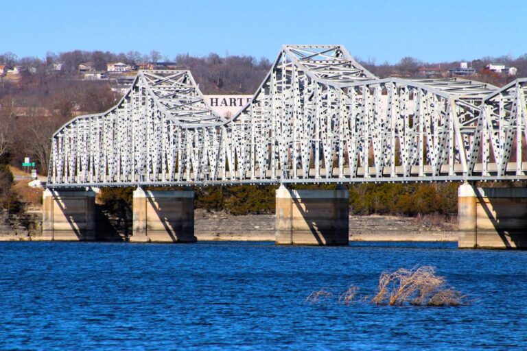
Photo: Avalon1101, CC0 1.0

Things Show-Me visitors wonder about Table Rock Lake
Which MDC region covers Table Rock Lake?
You will find it in Stone County, Barry County and Taney County, the MDC Southwest Region, about 4 miles from Coney Island.
What surface area does MDC give Table Rock Lake?
Some 49,720 acres, about 95% of it in Missouri.
Where does a Show-Me boater launch on Table Rock Lake?
33 mapped ramps, including Aunts Creek ramp on Table Rock Lake.
What fish does MDC report at Table Rock Lake?
Listed: largemouth bass, smallmouth bass, spotted bass, white bass, crappie, bluegill and redear sunfish.
Does Table Rock Lake have special fishing rules?
Black bass (largemouth, smallmouth, spotted/Kentucky): 6 a day; All year. A water-specific rule changes part of that; see the limits section.
Is a trout permit needed at Table Rock Lake?
Missouri and Arkansas sell a $10 White River Border Lakes Permit that lets a holder of either state's permit fish Bull Shoals, Norfork and Table Rock across the line.
Does MDC allow gas motors on Table Rock Lake?
Posted rules at the access apply; none is on file here.
Who sells minnows and crawdads near Table Rock Lake?
Drive about 2 miles to Baxter Boat Dock.
What does MDC expect at Table Rock Lake in 2026?
Fishing for black bass should be excellent in 2026. Largemouth bass are plentiful throughout the lake as a result of the high lake levels in past years. Fall 2025 electrofishing surveys revealed good numbers of largemouth bass in the 15”-18” range. These surveys also revealed an abundance of (MDC 2026 Fishing Prospects)
How full is Table Rock Lake?
USACE Little Rock District reports it; the figure is above.
Did a state record come out of Table Rock Lake?
Bass: Spotted, 7 lbs. 8 oz., by Gene Arnaud (04/06/1966).
Does Table Rock Lake have fish attractors?
MDC lists 1,231 points of placed cover.
Pick a date for Table Rock Lake
Check the daily limit before a fish goes in the livewell.