North Carolina Mountain Trout Waters
Every Public Mountain Trout Waters stream by class and county, with heritage waters and classed lakes.
Photo of Elk River near Banner Elk, Avery County: Beau B, CC BY 2.0

Public Mountain Trout Waters in North Carolina
NCWRC designates 1,735 stream segments in 1,635 named streams as Public Mountain Trout Waters, split into Hatchery Supported, Delayed Harvest, Wild Trout, Catch and Release and Special Regulation classes. Each class has its own creel, size, bait and season rules, marked by sign colors on the bank.
This page lists the 255 streams with their own page, county by county, plus the 1,380 smaller Wild Trout streams that appear on county pages, the 21 classed lakes, and the 23 Mountain Heritage Trout Waters.
Miles of stream in each trout class
| Class | Segments | Miles |
|---|---|---|
| Wild Trout | 1,485 | 2,106.9 |
| Hatchery Supported | 152 | 806.8 |
| Catch and Release, flies and lures | 62 | 124.1 |
| Delayed Harvest | 35 | 77.8 |
| Special Regulation | 1 | 9.9 |
Trout stream pages by county
Alleghany County
- (Big) Glade CreekHatchery Supported, 8.2 mi
- Big Pine Creek, Alleghany CountyHatchery Supported, 2.9 mi
- Bledsoe CreekHatchery Supported, 5.9 mi
- Brush CreekHatchery Supported, 15.5 mi
- Little River, Alleghany CountyHatchery Supported, 49.1 mi
- Meadow Fork, Alleghany CountyHatchery Supported, 4 mi
- Pine Swamp CreekHatchery Supported, 4.8 mi
- Piney ForkHatchery Supported, 3.6 mi
- Prathers CreekHatchery Supported, 11.1 mi
- Stone Mountain CreekDelayed Harvest and Wild Trout, 3.5 mi
Ashe County
- Beaver CreekHatchery Supported, 5.4 mi
- Big Horse Creek near Lansing, Ashe CountyCatch and Release, flies and lures, Delayed Harvest and Hatchery Supported, 14.8 mi
- Big Horse Creek near Lansing, Ashe County, 1.1 miWild Trout, 1.1 mi
- Big Laurel Creek near Lansing, Ashe CountyHatchery Supported, 8 mi
- Big Laurel Creek near Lansing, Ashe County, 1.2 miWild Trout, 1.2 mi
- Buffalo Creek near Jefferson, Ashe CountyHatchery Supported, 2.7 mi
- Buffalo Creek near West Jefferson, Ashe CountyWild Trout, 0.1 mi
- Cranberry CreekHatchery Supported, 11.7 mi
- Helton CreekDelayed Harvest, 8.9 mi
- Nathans CreekHatchery Supported, 3.2 mi
- North Fork New RiverHatchery Supported and Wild Trout, 71.1 mi
- Old Fields CreekHatchery Supported, 4.3 mi
- Peak CreekHatchery Supported, 3.4 mi
- Roan CreekHatchery Supported, 7.1 mi
- South Fork New RiverDelayed Harvest and Hatchery Supported, 89.2 mi
- Three Top CreekHatchery Supported, 8.6 mi
Avery County
- Andrews CreekCatch and Release, flies and lures, 2.5 mi
- Bee BranchCatch and Release, flies and lures, 0.5 mi
- Buckeye Creek, Avery CountyHatchery Supported, 0.3 mi
- Bucks Timber CreekCatch and Release, flies and lures, 2.7 mi
- Cary Flat BranchCatch and Release, flies and lures and Wild Trout, 1.1 mi
- Elk River near Banner Elk, Avery CountyCatch and Release, flies and lures, 0.6 mi
- Elk River near Elk Park, Avery CountyHatchery Supported, 1.4 mi
- Flat Land BranchCatch and Release, flies and lures, 0.8 mi
- Laurel Mountain BranchCatch and Release, flies and lures and Wild Trout, 1 mi
- Linn Cove BranchCatch and Release, flies and lures, 0.6 mi
- Linville River, Avery CountyHatchery Supported, 8.4 mi
- Little Laurel CreekCatch and Release, flies and lures, 0.8 mi
- Little Lost Cove CreekCatch and Release, flies and lures, 1.4 mi
- Little Wilson CreekCatch and Release, flies and lures, 2 mi
- Lost Cove CreekCatch and Release, flies and lures, 7.3 mi
- Mill Timber CreekHatchery Supported, 4.3 mi
- North Toe RiverDelayed Harvest and Hatchery Supported, 104.7 mi
- Sassafras CreekCatch and Release, flies and lures, 1.7 mi
- Squirrel CreekHatchery Supported, 4.2 mi
- Stack Rock CreekCatch and Release, flies and lures, 3.2 mi
- Turkey BranchCatch and Release, flies and lures, 1.1 mi
Buncombe County
- Bearwallow BranchCatch and Release, flies and lures, 0.6 mi
- Bent CreekHatchery Supported and Wild Trout, 5.2 mi
- Cane Creek, Buncombe CountyHatchery Supported, 11 mi
- Carter CreekCatch and Release, flies and lures, 2.3 mi
- Dillingham CreekHatchery Supported, 5.1 mi
- Ivy CreekHatchery Supported, 6.7 mi
- Peach Orchard CreekCatch and Release, flies and lures, 1.9 mi
- Reems CreekHatchery Supported, 9.3 mi
- Stony CreekHatchery Supported, 0.7 mi
- Swannanoa RiverHatchery Supported, 19.4 mi
- Waterfall CreekCatch and Release, flies and lures, 1.7 mi
Burke County
- Carroll CreekHatchery Supported, 2.5 mi
- Catawba RiverDelayed Harvest, Hatchery Supported, Special Regulation and Wild Trout, 169 mi
- He CreekCatch and Release, flies and lures, 2.1 mi
- Henry ForkCatch and Release, flies and lures, 6 mi
- Jacob ForkDelayed Harvest and Wild Trout, 7.4 mi
- Linville River near Crossnore, Burke CountyWild Trout, 14.5 mi
- Linville River near Glen Alpine, Burke CountyHatchery Supported, 1.2 mi
- Little River, Burke CountyWild Trout, 5.3 mi
Caldwell County
- Boone Fork PondHatchery Supported, 0.1 mi
- Buffalo Creek, Caldwell CountyHatchery Supported and Wild Trout, 6.4 mi
- Crusher BranchCatch and Release, flies and lures and Wild Trout, 1 mi
- Joes CreekHatchery Supported and Wild Trout, 3.3 mi
- Johns RiverWild Trout, 40.9 mi
- Wilson CreekCatch and Release, flies and lures, Delayed Harvest and Hatchery Supported, 39.4 mi
Cherokee County
- Davis CreekHatchery Supported, 3.3 mi
- Hyatt CreekHatchery Supported and Wild Trout, 5.2 mi
- Junaluska Creek near Andrews, Cherokee CountyHatchery Supported, 5.5 mi
- Junaluska Creek near Andrews, Cherokee County, 0.6 miWild Trout, 0.6 mi
- Shuler CreekHatchery Supported and Wild Trout, 11 mi
- Slickrock BranchHatchery Supported and Wild Trout, 1 mi
- Tellico RiverWild Trout, 5.8 mi
- Valley River near Murphy, Cherokee CountyHatchery Supported, 25.1 mi
- Valley River near Robbinsville, Cherokee CountyWild Trout, 0.5 mi
Clay County
- Buck CreekHatchery Supported and Wild Trout, 12.5 mi
- Coleman RiverWild Trout, 0.7 mi
- Fires CreekDelayed Harvest, Hatchery Supported and Wild Trout, 13.4 mi
- Mill Creek, Clay CountyWild Trout, 5.3 mi
- Tallulah RiverWild Trout, 3.1 mi
- Tusquitee Creek near Hayesville, Clay CountyHatchery Supported, 6.3 mi
- Tusquitee Creek near Hayesville, Clay County, 0.7 miWild Trout, 0.7 mi
Graham County
- (Big) Snowbird CreekDelayed Harvest and Hatchery Supported, 11.6 mi
- Panther Creek near Andrews, Graham CountyWild Trout, 1.7 mi
- Panther Creek near Bryson City, Graham CountyHatchery Supported, 2.4 mi
- Santeetlah CreekHatchery Supported and Wild Trout, 14.2 mi
- Stecoah CreekHatchery Supported and Wild Trout, 7.5 mi
- Tulula Creek near Robbinsville, Graham CountyHatchery Supported, 7.7 mi
- Tulula Creek near Robbinsville, Graham County, 1.1 miWild Trout, 1.1 mi
- West Buffalo CreekHatchery Supported, 5 mi
- Yellow Creek near Fontana Dam, Graham CountyHatchery Supported, 1.8 mi
- Yellow Creek near Fontana Dam, Graham County, 0.8 miWild Trout, 0.8 mi
Haywood County
- Buckeye Creek, Haywood CountyWild Trout, 1.5 mi
- East Fork Pigeon RiverWild Trout, 5.1 mi
- Jonathans CreekHatchery Supported, 15.4 mi
- Little East Fork Pigeon River near Waynesville, Haywood CountyWild Trout, 3.5 mi
- Little East Fork Pigeon River near Waynesville, Haywood County, 0.4 miWild Trout, 0.4 mi
- Middle Prong West Fork Pigeon RiverWild Trout, 3.8 mi
- Pigeon RiverHatchery Supported, 2.8 mi
- Richland Creek, Haywood CountyHatchery Supported, 2.3 mi
- Right Hand Prong West Fork Pigeon RiverWild Trout, 2.8 mi
- West Fork Pigeon River near Waynesville, Haywood CountyDelayed Harvest, Hatchery Supported and Wild Trout, 9.8 mi
- West Fork Pigeon River near Waynesville, Haywood County, 0.5 miWild Trout, 0.5 mi
Henderson County
- (Big) Hungry RiverHatchery Supported, 3.3 mi
- Cane Creek, Henderson CountyHatchery Supported, 1.8 mi
- Clear CreekHatchery Supported, 8 mi
- Mill Creek, Henderson CountyWild Trout, 0.3 mi
- North Fork Mills RiverDelayed Harvest and Wild Trout, 4 mi
Jackson County
- Chattooga RiverWild Trout, 6.9 mi
- Cullowhee CreekHatchery Supported, 3.4 mi
- Dark Ridge CreekHatchery Supported, 1.7 mi
- East Fork Chattooga RiverWild Trout, 0.9 mi
- Flat CreekCatch and Release, flies and lures, 5.4 mi
- Frolictown CreekCatch and Release, flies and lures, 1.1 mi
- Goldspring BranchCatch and Release, flies and lures, 0.8 mi
- Greenland CreekCatch and Release, flies and lures, 4.1 mi
- Greens Creek, Jackson CountyHatchery Supported and Wild Trout, 8.4 mi
- Honeycamp BranchCatch and Release, flies and lures, 0.8 mi
- Little Green CreekCatch and Release, flies and lures, 1.1 mi
- Panthertown CreekCatch and Release, flies and lures, 2.8 mi
- Savannah CreekHatchery Supported, 9.6 mi
- Scott CreekHatchery Supported, 11.5 mi
- Tuckasegee RiverCatch and Release, flies and lures, Delayed Harvest, Hatchery Supported and Wild Trout, 94.7 mi
- Whitewater RiverWild Trout, 5.7 mi
- Wolf Creek LakeHatchery Supported, 0 mi
Macon County
- Buckeye Creek, Macon CountyWild Trout, 1.4 mi
- Burningtown Creek near Franklin, Macon CountyHatchery Supported, 8.7 mi
- Burningtown Creek near Franklin, Macon County, 1.7 miWild Trout, 1.7 mi
- Cane Creek, Macon CountyWild Trout, 1.2 mi
- Cartoogechaye CreekHatchery Supported, 8.2 mi
- Cullasaja RiverHatchery Supported and Wild Trout, 12.7 mi
- Nantahala RiverDelayed Harvest, Hatchery Supported and Wild Trout, 65.3 mi
Madison County
- Big Laurel Creek near Hot Springs, Madison CountyDelayed Harvest, 1.2 mi
- Big Laurel Creek near Mars Hill, Madison CountyHatchery Supported, 13.6 mi
- Big Pine Creek, Madison CountyHatchery Supported, 7.7 mi
- Blood RiverWild Trout, 1.3 mi
- Little Ivy CreekHatchery Supported, 4.6 mi
- Meadow Fork, Madison CountyHatchery Supported, 6.3 mi
- Puncheon ForkHatchery Supported, 3.7 mi
- Roaring ForkHatchery Supported and Wild Trout, 8.2 mi
- Shelton Laurel CreekDelayed Harvest and Hatchery Supported, 15.3 mi
- Shut-In CreekHatchery Supported, 4 mi
- Spillcorn CreekHatchery Supported, 3.6 mi
- Spring Creek near Hot Springs, Madison CountyHatchery Supported, 8.2 mi
- Spring Creek near Hot Springs, Madison County, 1.7 miDelayed Harvest, 1.7 mi
- West Fork Shut-In CreekHatchery Supported and Wild Trout, 2.5 mi
McDowell County
- Armstrong Creek near Spruce Pine, McDowell CountyWild Trout, 2.5 mi
- Armstrong Creek near Spruce Pine, McDowell County, 1.6 miHatchery Supported, 1.6 mi
- Cane Creek, McDowell CountyWild Trout, 0.2 mi
- Chute BranchCatch and Release, flies and lures, 1 mi
- Curtis CreekDelayed Harvest and Wild Trout, 7.7 mi
- Horse BranchCatch and Release, flies and lures, 1.2 mi
- Laurel Log BranchCatch and Release, flies and lures, 0.8 mi
- Left Prong Newberry CreekCatch and Release, flies and lures, 1.1 mi
- Little Buck CreekHatchery Supported and Wild Trout, 2.6 mi
- Mill Creek, McDowell CountyDelayed Harvest and Wild Trout, 3.1 mi
- Newberry CreekCatch and Release, flies and lures, 2.2 mi
- North Fork Catawba RiverHatchery Supported, 10.4 mi
Mitchell County
- Big Rock CreekHatchery Supported and Wild Trout, 6.9 mi
- Cane Creek, Mitchell CountyDelayed Harvest and Hatchery Supported, 1.8 mi
- East Fork Grassy CreekHatchery Supported, 2.3 mi
- Grassy CreekHatchery Supported, 2.5 mi
- Spring Creek, Mitchell CountyWild Trout, 0.6 mi
Polk County
- Green RiverDelayed Harvest, Hatchery Supported and Wild Trout, 71.3 mi
- North Pacolet RiverHatchery Supported, 7.2 mi
Rutherford County
- (Rocky) Broad RiverHatchery Supported, 3.8 mi
- Little First Broad RiverWild Trout, 0.6 mi
Stokes County
- Dan RiverHatchery Supported, 105.9 mi
Surry County
- Ararat RiverDelayed Harvest and Hatchery Supported, 37 mi
- Big Elkin CreekHatchery Supported, 0.4 mi
- Fisher River (Cooper Creek)Hatchery Supported, 15.9 mi
- Little Fisher RiverHatchery Supported, 8.2 mi
- Lovills CreekHatchery Supported, 3.5 mi
- Mitchell RiverDelayed Harvest, 2.6 mi
- Pauls CreekHatchery Supported, 3.1 mi
Swain County
- Alarka CreekHatchery Supported and Wild Trout, 15.7 mi
- Connelly CreekHatchery Supported and Wild Trout, 7 mi
- Deep CreekHatchery Supported, 1.9 mi
Transylvania County
- Caney Bottom CreekCatch and Release, flies and lures, 1.7 mi
- Coontree CreekCatch and Release, flies and lures, 1.3 mi
- Cove Creek, Transylvania CountyCatch and Release, flies and lures, 3 mi
- Daniel Ridge CreekCatch and Release, flies and lures, 1.8 mi
- Davidson RiverCatch and Release, flies and lures, Hatchery Supported and Wild Trout, 11 mi
- East Fork French Broad River near Rosman, Transylvania CountyWild Trout, 2.7 mi
- East Fork French Broad River near Rosman, Transylvania County, 2 miDelayed Harvest, 2 mi
- French Broad RiverHatchery Supported and Wild Trout, 129.4 mi
- Horsepasture RiverWild Trout, 4.1 mi
- Lanning BranchCatch and Release, flies and lures, 0.7 mi
- Laurel ForkCatch and Release, flies and lures, 2.2 mi
- Little River, Transylvania CountyDelayed Harvest and Wild Trout, 22.2 mi
- Long BranchCatch and Release, flies and lures, 2.2 mi
- Middle Fork French Broad RiverHatchery Supported, 3.1 mi
- North Fork French Broad RiverWild Trout, 8 mi
- Richland Creek, Transylvania CountyWild Trout, 0.9 mi
- Right Fork Davidson RiverCatch and Release, flies and lures, 1.7 mi
- Rockhouse CreekCatch and Release, flies and lures, 1.9 mi
- Searcy CreekCatch and Release, flies and lures, 1 mi
- Shuck Ridge CreekCatch and Release, flies and lures, 1.8 mi
- Shut-in BranchCatch and Release, flies and lures, 1.4 mi
- South Fork Mills RiverWild Trout, 21.3 mi
- Stillwater BranchCatch and Release, flies and lures, 0.5 mi
- Thompson RiverWild Trout, 4.7 mi
- Toxaway RiverWild Trout, 5.9 mi
- West Fork French Broad River near Rosman, Transylvania CountyHatchery Supported, 5 mi
- West Fork French Broad River near Rosman, Transylvania County, 3.7 miWild Trout, 3.7 mi
Watauga County
- Beaverdam CreekHatchery Supported, 3.7 mi
- Beech CreekHatchery Supported, 7.3 mi
- Cove Creek, Watauga CountyHatchery Supported, 7.6 mi
- Dutch CreekHatchery Supported and Wild Trout, 5.8 mi
- Elk Creek, Watauga CountyDelayed Harvest and Hatchery Supported, 10.1 mi
- Laurel Creek near Beech Mountain, Watauga CountyHatchery Supported, 2.3 mi
- Laurel Creek near Blowing Rock, Watauga CountyCatch and Release, flies and lures, 3.4 mi
- Meat Camp CreekHatchery Supported, 4.1 mi
- Middle Fork South Fork New RiverHatchery Supported, 6.4 mi
- Norris ForkHatchery Supported, 4.3 mi
- Pond CreekCatch and Release, flies and lures, 1.6 mi
- Stony ForkHatchery Supported, 0.8 mi
- Watauga River near Beech Mountain, Watauga CountyDelayed Harvest, 0.9 mi
- Watauga River near Seven Devils, Watauga CountyDelayed Harvest, 0.8 mi
Wilkes County
- Basin CreekHatchery Supported, 1 mi
- Cub CreekHatchery Supported, 1.1 mi
- Darnell CreekHatchery Supported, 3.9 mi
- East Prong Roaring RiverDelayed Harvest and Hatchery Supported, 5.7 mi
- Elk Creek, Wilkes CountyDelayed Harvest, 1 mi
- Fall CreekHatchery Supported, 4.1 mi
- Harris CreekCatch and Release, flies and lures and Wild Trout, 2.3 mi
- Middle Fork Reddies RiverHatchery Supported, 4.9 mi
- Middle Prong Roaring RiverHatchery Supported, 5.7 mi
- North Fork Reddies RiverHatchery Supported, 10.4 mi
- Pike CreekHatchery Supported, 2.9 mi
- Reddies RiverDelayed Harvest, 0.9 mi
- Roten CreekHatchery Supported, 1.4 mi
- South Fork Reddies RiverHatchery Supported, 3.4 mi
- South Prong Lewis ForkHatchery Supported, 6.1 mi
- West Prong Roaring RiverWild Trout, 0.9 mi
- Yadkin RiverHatchery Supported, 198.1 mi
Yancey County
- Bald Mountain CreekHatchery Supported, 8.1 mi
- Big CreekWild Trout, 15.7 mi
- Cane River near Burnsville, Yancey CountyHatchery Supported, 5.6 mi
- Cane River near Burnsville, Yancey County, 0.6 miDelayed Harvest, 0.6 mi
- Grassy Knob BranchCatch and Release, flies and lures, 1.2 mi
- Hemphill CreekCatch and Release, flies and lures, 0.8 mi
- Left Prong South Toe RiverCatch and Release, flies and lures, 1 mi
- Middle Fork Upper CreekCatch and Release, flies and lures, 1.3 mi
- Price CreekHatchery Supported, 1.9 mi
- Right Prong South Toe RiverCatch and Release, flies and lures, 2.3 mi
- South Fork Upper CreekCatch and Release, flies and lures, 1.9 mi
- South Toe RiverCatch and Release, flies and lures, Hatchery Supported and Wild Trout, 47.5 mi
- Upper CreekCatch and Release, flies and lures, 0.8 mi
NCWRC PMTW_Streams_2026 layer.
Wild Trout streams listed on county pages
| County | Wild Trout streams |
|---|---|
| Alleghany County | 3 |
| Ashe County | 5 |
| Avery County | 25 |
| Buncombe County | 32 |
| Burke County | 39 |
| Caldwell County | 73 |
| Cherokee County | 157 |
| Clay County | 100 |
| Cleveland County | 2 |
| Graham County | 174 |
| Haywood County | 68 |
| Henderson County | 27 |
| Jackson County | 61 |
| Macon County | 201 |
| Madison County | 63 |
| McDowell County | 69 |
| Mitchell County | 31 |
| Polk County | 10 |
| Rutherford County | 15 |
| Swain County | 31 |
| Transylvania County | 126 |
| Watauga County | 3 |
| Wilkes County | 15 |
| Yancey County | 50 |
Mountain Heritage Trout Waters
| Water | County | Town | Class |
|---|---|---|---|
| Big Horse Creek (S.R. 1324 bridge to North Fork New River) | Ashe | Lansing | Delayed Harvest |
| South Fork New River (upstream end of Todd Island to S.R. 1351 bridge) | Ashe | Todd | Delayed Harvest |
| North Toe River (Watauga St. bridge to Roby Shomaker Wetlands and Family Recreation Park) | Avery | Newland | Hatchery Supported |
| Swannanoa River (River Walk Park in Black Mountain to S.R. 2500 Bridge) | Buncombe | Black Mountain | Hatchery Supported |
| Jonathan Creek (upstream S.R. 1302 bridge to S.R. 1309 bridge) | Haywood | Maggie Valley | Hatchery Supported |
| Richland Creek (Russ Avenue bridge to U.S. 19 bridge) | Haywood | Waynesville | Hatchery Supported |
| Scott Creek (Hometown Place Road to Tuckasegee River) | Jackson | Dillsboro | Hatchery Supported |
| Tuckasegee River (Falls located 275 yards upstream of U.S. 23-441 bridge to Scott Creek) | Jackson | Dillsboro | Hatchery Supported |
| Tuckasegee River (Savannah Creek to falls located 275 yards upstream of U.S. 23-441 bridge) | Jackson | Dillsboro | Delayed Harvest |
| Scott Creek (Hospital Road to Hometown Place Road) | Jackson | Sylva | Hatchery Supported |
| Tuckasegee River (downstream N.C. 107 bridge to Savannah Creek) | Jackson | Webster | Delayed Harvest |
| Spring Creek (N.C. 209 bridge at Hot Springs city limits to iron bridge at end of Andrews Avenue) | Madison | Hot Springs | Delayed Harvest |
| Mill Creek (U.S. 70 bridge to the I-40 bridge) | McDowell | Old Fort | Delayed Harvest |
| Cane Creek (N.C. 226 bridge to S.R. 1189 bridge) | Mitchell | Bakersville | Delayed Harvest |
| North Toe River (U.S. 19E bridge to N.C. 226 bridge) | Mitchell | Spruce Pine | Delayed Harvest |
| Tuckasegee River (U.S. 19 bridge to Slope Street bridge) | Swain | Bryson City | Delayed Harvest |
| Buckeye Creek (Buckeye Creek Reservoir dam to Grassy Gap Creek) | Watauga | Beech Mountain | Hatchery Supported |
| Buckeye Creek Reservoir | Watauga | Beech Mountain | Hatchery Supported |
| Lake Coffey | Watauga | Beech Mountain | Delayed Harvest |
| Pond Creek (headwaters to Locust Ridge Road bridge, excluding the pond adjacent to Lake Coffey) | Watauga | Beech Mountain | Catch and Release, flies and lures |
| Reddies River (Town of North Wilkesboro water intake dam to confluence with Yadkin River) | Wilkes | North Wilkesboro | Delayed Harvest |
| Cub Creek (0.5 miles upstream of S.R. 2460 bridge to S.R. 101 bridge) | Wilkes | Wilkesboro | Hatchery Supported |
| South Toe River (property boundaries of the Yancey County Toe River Campground) | Yancey | Burnsville | Hatchery Supported |
Any license with trout privileges is valid on Mountain Heritage Trout Waters; a 3-day Mountain Heritage Trout Waters license is sold to residents and nonresidents (see license.json). Honorably separated Armed Forces veterans with documentation are exempt from license requirements on these waters.
Classed trout lakes and impoundments
- Apalachia LakeSpecial Regulation
- Balsam LakeHatchery Supported
- Bear Creek LakeHatchery Supported
- Bell Branch PondHatchery Supported
- Boone Fork PondHatchery Supported
- Boundary Line PondHatchery Supported
- Boyde Coffey LakeHatchery Supported
- Buckeye LakeHatchery Supported
- Calderwood LakeHatchery Supported
- Cedar Cliff LakeHatchery Supported
- Cheoah ReservoirHatchery Supported
- Cliffside LakeHatchery Supported
- Lake CoffeyDelayed Harvest
- Lake PowhatanHatchery Supported
- Max Patch PondHatchery Supported
- Pike Creek PondHatchery Supported
- Queens Creek LakeHatchery Supported
- Tanasee Creek LakeHatchery Supported
- Trout LakeDelayed Harvest
- Wildcat LakeHatchery Supported
- Wolf Creek LakeHatchery Supported
North Carolina waters, pictured
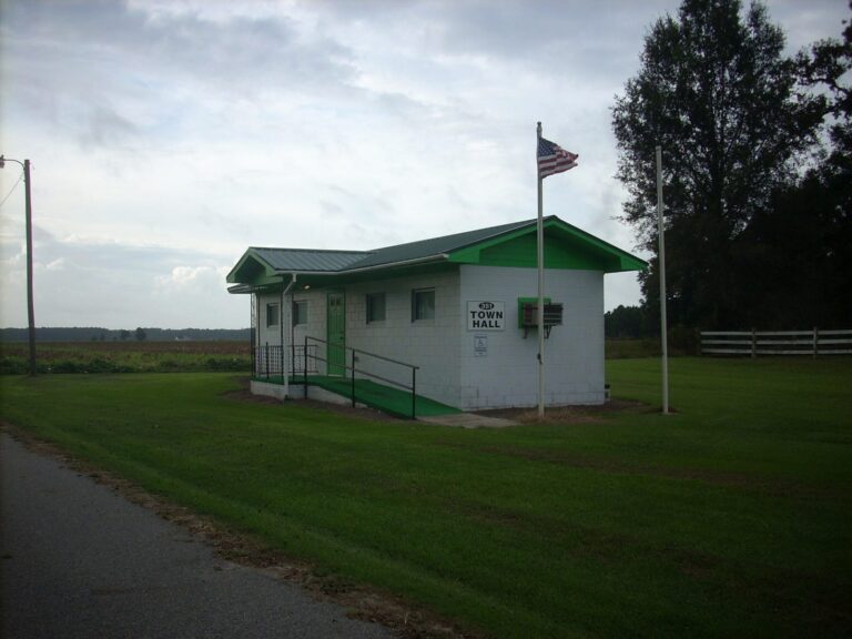
Photo: Gerry Dincher, CC BY-SA 2.0

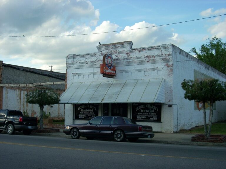
Photo: User:Dincher, CC BY-SA 3.0

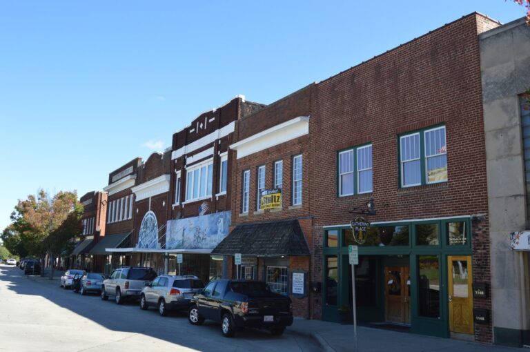
Photo: Nyttend, Public domain

Photo: Indy beetle, CC0 1.0

Mountain trout questions
How many trout streams does North Carolina have?
1,635 named streams carry a Public Mountain Trout Waters class.
Which class has the most miles?
Wild Trout, at about 2,107 miles.
Where are Delayed Harvest waters?
In the mountain counties; each stream page lists its reach and stocking weeks.
Do I need a trout stamp?
No; the inland license covers trout. A 3-day Mountain Heritage license covers only heritage waters.
When are trout stocked?
Hatchery Supported waters from spring through summer; NCWRC set fall 2026 Delayed Harvest stockings for November.
What are Mountain Heritage Trout Waters?
Town waters with their own 3-day license; 23 are listed.
Are game land streams wild trout water?
Yes; Public Mountain Trout Waters on game lands are Wild Trout Waters unless posted otherwise.
Can I keep trout year-round?
On Wild Trout Waters, yes, 4 a day; Hatchery Supported waters close March 1 to early April.